


Why visit Senftenberg
Townapedia lists 82 museums and landmarks, 27 parks and trails, 131 places to eat, 44 places to stay and 11 attractions in and around town.
Highlights include Tierpark Senftenberg, Landmarke Lausitzer Seenland "Rostiger Nagel", Festung Senftenberg and Schloss und Festung Senftenberg.
Weather in Senftenberg
Forecast from MET Norway (CC BY 4.0). Full forecast
About Senftenberg
Senftenberg (German, pronounced [ˈzɛnftn̩ˌbɛʁk] ) or Zły Komorow (Lower Sorbian, pronounced [ˈzwɨ ˈkɔmɔrɔw]) is a town in Lower Lusatia, Brandenburg, in eastern Germany, capital of the Oberspreewald-Lausitz district.
From the Wikipedia article Senftenberg (this version), under CC BY-SA 4.0.
Travel tips from other travellers: Senftenberg on Wikivoyage (CC BY-SA 4.0).
Things to do11

Tierpark Senftenberg
Zoo and aquarium · 1.2 km
Jan-Mar, Nov-Dec: Mo-Fr 09:00-15:30; Sa,Su 09:00-16:00;...

Landmarke Lausitzer Seenland "Rostiger Nagel"
Scenic view · 6.7 km
Von seiner Aussichtsplattform bietet sich ein Panorama über das Lausitzer Seenland, insbesondere über den Sedlitzer, Geierswalder und...





Museums and landmarks82

Festung Senftenberg
Monument and historic site · 1.0 km
Schloss und Festung Senftenberg / Kunstsammlung Lausitz
36 Steindamm, Senftenberg

Schloss und Festung Senftenberg
Museum · 1.0 km
Schlossstraße, Senftenberg
Tu-Fr 12:00-17:00, Sa,Su 10:30-17:30


Sühnekreuz
Monument and historic site · 0.7 km
In der Südostecke der Friedhofsmauer, Einmündung der August-Bebel-Straße - Ernst-Thälmann-Straße

Sühnekreuz
Monument and historic site · 1.2 km
Granitsäule mit eingemeisseltem Kreuz und der Jahreszahl 1766

Sühnekreuz
Monument and historic site · 8.2 km
In Hosena, östlich der Straße nach Hohenbocka, in einer kleinen Anlage vor einer Eiche.


Wegweiserstein
Monument and historic site · 7.3 km
Wegestein, an der Poststraße / Ruhlander Straße zwischen Schwarzheide und Schipkau in Schipkau.

Denkmal für die Gefallenen des Ersten Welkrieges
Monument and historic site · 8.2 km

Gedenkstätte für abgebaggerte Orte
Monument and historic site · 2.2 km
Gedenkstätte für die abgebaggerten Orte Anna-Mathilde, Birkenhain, Bückgen, Großräschen-Süd, Rauno, Reppist und Sauo
70 more on the map.
Parks, trails and playgrounds27



Erlebnisbad Senftenberg
Sports field and stadium · 1.9 km
32 Hörlitzer Straße, Senftenberg




15 more on the map.
Restaurants and cafes131
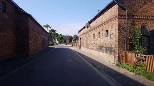
Café Scheune im Mühlenhof
Cafe · Coffee, Cake · 5.0 km
Das Team besteht ausschließlich aus Familie und Freunden. Dieses Gefühl von Zuhause gibt die Café-Scheune weiter und es spiegelt sich in...
12 Sedlitzer Bahnhofstraße, Senftenberg
Sa, Su 13:00-18:00
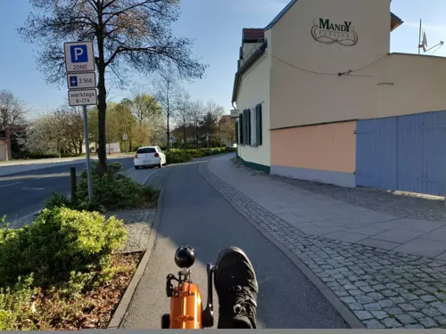
Die Drogerie
Restaurant · 0.6 km
Küvhenschluss 21:30
2 Jüttendorfer Anger, Senftenberg
Mo-Sa 09:00-23:00; Su 10:00-16:00
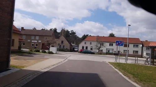
Dorfkrug 2.0
Restaurant · German · 5.1 km
4 Dorfplatz, Senftenberg
Mo-Th 17:00-21:00, Fr 17:00-22:00, Sa 11:00-22:00, Su 11:00-21:00
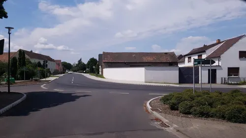
Mareens Landhotel und Steakhaus
Restaurant · Steak House · 8.4 km
1 Lindenstraße, Elsterheide
Mo,Tu off; We-Sa 17:00+; Su 11:00+
Restaurant "Seestern"
Restaurant · Italian · 4.7 km
1a Straße zur Südsee, Senftenberg
Mo-Su 10:00-22:00


Yakisoba Sushi
Restaurant · Sushi · 0.6 km
1 Steindamm, Senftenberg
Mo-Fr 10:30-14:00,16:00-19:00; Sa 16:00-19:00; Su,PH off


119 more on the map.
History
Senftenberg was first mentioned in a 1279 deed issued by Henry III the Illustrious of Wettin, then margrave of Lusatia. In 1319, the town became part of the Duchy of Jawor, the southwesternmost duchy of fragmented Piast-ruled Poland. In 1346 it passed to the Bohemia, then in 1350 to the Margraviate of Brandenburg. With Lower Lusatia, the settlement was re-acquired by the Kingdom of Bohemia under Charles IV of Luxembourg in 1368. The town was located on a trade route connecting Leipzig with Poland. Elector Frederick II of Saxony acquired Senftenberg in 1448, whereafter the area as a border stronghold of the House of Wettin was separated from Bohemian Lusatia, until in 1635 all Lusatian territories fell to Saxony by the Peace of Prague.
During the Great Northern War, in 1701, troops marched through the town towards Poland. In 1704, the defensive walls were strengthened against a possible Swedish attack. According to the 1815 Congress of Vienna, Lower Lusatia was annexed by Prussia and incorporated into the Province of Brandenburg. During World War II, the present-day district of Großkoschen (Kóšyna) was the location of a subcamp of the Gross-Rosen concentration camp, in which some 850 men, including Soviet citizens and Poles, were imprisoned. From 1952 to 1990, it was part of the Bezirk Cottbus of East Germany.
From the History section of Senftenberg on Wikipedia, under CC BY-SA 4.0.
Where to stay44
Churches and places of worship16
Shopping32
Gas and EV charging15
Schools, colleges and libraries23
Brandenburgische Technische Universität Cottbus-Senftenberg
School · 1.1 km
1 Universitätsplatz, Senftenberg
Brandenburg University of Technology Cottbus-Senftenberg
School · 1.1 km
Healthcare14
Medizinische Einrichtungsgesellschaft
Clinic and pharmacy
2 a Dr.-Dorothea-Erxleben-Straße, Senftenberg
Map of Senftenberg
250 places. The map loads OpenStreetMap tiles when you open it.
Getting there and nearby towns
Dresden Airport (DRS) is the nearest airport with scheduled flights listed in OpenStreetMap, 46 km away.
- Großräschen 7 km north, about 7 min by car
- Schipkau 7 km west, about 7 min by car
- Schwarzbach 10 km southwest, about 10 min by car
- Schwarzheide 11 km southwest, about 11 min by car
- Hohenbocka 10 km south, about 10 min by car
- Ruhland 12 km southwest, about 12 min by car
- Welzow 13 km northeast, about 13 min by car
- Sallgast 13 km northwest, about 13 min by car
- Dresden 56 km south, about 56 min by car
- Zossen 86 km northwest, about 1 h 30 min by car
Drive times are estimates from straight-line distance, not routes.
Local news
Headlines from INDB.
Reviews, tips and questions
Loading what members have shared...
Sources and licences
- GeoNames (CC BY 4.0): population, coordinates, regions and time zone
- Mapillary (see each image): photos
- OpenStreetMap contributors (ODbL 1.0): places, airports, map data
- Wikidata (CC0 1.0): elevation, founding date, time zone, website, landmarks and historic places
- Wikimedia Commons (see each image): photos
- Wikipedia (CC BY-SA 4.0): overview and history text
Photo credits
- Niederlausitz Senftenberg 07-2015 img7 Markt, A.Savin, CC BY-SA 3.0
- Straße der jugend senftenberg 2018-10-20 (28), Z thomas, CC BY-SA 4.0
- Straße der Jugend Senftenberg 2018-07-21 - 9, Z thomas, CC BY-SA 3.0
- Straße der Jugend Senftenberg 2018-07-21 - 6, Z thomas, CC BY-SA 3.0
- Straße der Jugend Senftenberg 2018-07-21 - 4, Z thomas, CC BY-SA 3.0
- Straße der Jugend Senftenberg 2018-07-21 - 10, Z thomas, CC BY-SA 3.0
- Straße der Jugend Senftenberg 2018-07-21 - 8, Z thomas, CC BY-SA 3.0
- Straße der Jugend Senftenberg 2018-07-21 - 7, Z thomas, CC BY-SA 3.0
- Breitscheidstraße Senftenberg 2018-07-21, Z thomas, CC BY-SA 3.0
- Bahnhofstraße senftenberg 2018-10-20 (26), Z thomas, CC BY-SA 4.0
- Breitscheidstraße senftenberg 2018-10-20 (29), Z thomas, CC BY-SA 4.0
- Bahnhofstraße Senftenberg 2018-07-21 - 16, Z thomas, CC BY-SA 3.0
- Bahnhofstraße Senftenberg 2018-07-21 - 19, Z thomas, CC BY-SA 3.0
- Bahnhofstraße Senftenberg 2018-07-21 - 6, Z thomas, CC BY-SA 3.0
- Straße der Jugend Senftenberg 2018-07-21 - 5, Z thomas, CC BY-SA 3.0
- Bahnhofstraße Senftenberg 2018-07-21 - 7, Z thomas, CC BY-SA 3.0
- Straße der jugend senftenberg 2018-10-20 (29), Z thomas, CC BY-SA 4.0
- Bahnhofstraße Senftenberg 2018-07-21 - 17, Z thomas, CC BY-SA 3.0
- Bahnhofstraße Senftenberg 2018-07-21 - 4, Z thomas, CC BY-SA 3.0
- Bahnhofstraße Senftenberg 2018-07-21 - 29, Z thomas, CC BY-SA 3.0
- Bahnhofstraße Senftenberg 2018-07-21 - 20, Z thomas, CC BY-SA 3.0
- 19.01.94 Senftenberg 155.006, Phil Richards, CC BY-SA 2.0
- Bahnhofstraße Senftenberg 2018-07-21 - 25, Z thomas, CC BY-SA 3.0
- Bahnhofstraße Senftenberg 2018-07-21 - 12, Z thomas, CC BY-SA 3.0
- Bahnhofstraße Senftenberg 2018-07-21 - 3, Z thomas, CC BY-SA 3.0
- Bahnhofstraße Senftenberg 2018-07-21 - 11, Z thomas, CC BY-SA 3.0
- Bahnhofstraße Senftenberg 2018-07-21 - 24, Z thomas, CC BY-SA 3.0
- Bahnhofstraße Senftenberg 2018-07-21 - 28, Z thomas, CC BY-SA 3.0
- Bahnhofstraße Senftenberg 2018-07-21 - 21, Z thomas, CC BY-SA 3.0
- Bahnhofstraße senftenberg 2018-10-20 (24), Z thomas, CC BY-SA 4.0
- Bahnmeistergasse senftenberg 2018-10-20 (85), Z thomas, CC BY-SA 4.0
- Bahnhofstraße Senftenberg 2018-07-21 - 15, Z thomas, CC BY-SA 3.0
- Bahnhofstraße Senftenberg 2018-07-21 - 26, Z thomas, CC BY-SA 3.0
- Bahnhofstraße senftenberg 2018-10-20 (25), Z thomas, CC BY-SA 4.0
- Bahnhofstraße Senftenberg 2018-07-21 - 14, Z thomas, CC BY-SA 3.0
- Bahnmeistergasse senftenberg 2018-09-29 (1), Z thomas, CC BY-SA 4.0
- Bahnhofstraße Senftenberg 2018-07-21 - 10, Z thomas, CC BY-SA 3.0
- Bahnhofstraße Senftenberg 2018-07-21 - 22, Z thomas, CC BY-SA 3.0
- Bahnhofstraße Senftenberg 2018-07-21 - 1, Z thomas, CC BY-SA 3.0
- Bahnmeistergasse senftenberg 2018-10-20 (86), Z thomas, CC BY-SA 4.0
- 2017 Audi DTM Team photo (33936369274), Mattias Ekström, CC BY 2.0
- Senftenberg schlosspark, Z thomas, CC BY 3.0
- Klettwitz seite1, Z thomas, CC BY 3.0
- Annahütte kirche, Z thomas, CC BY 3.0
- Senftenberg Neue Bühne 1, Photo: Andreas Praefcke, CC BY 3.0
- Bibliothek senftenberg 2018-09-29 (1), Z thomas, CC BY-SA 4.0
- Taetzschwitz kirche, Z thomas, CC BY 3.0
- Stadthafen Senftenberg 2019-06-22 -, Z thomas, CC BY 3.0
- Großräschener See (13), Biberbaer, CC BY-SA 4.0
- Ansichten und Tiere - Tierpark Senftenberg Mai 2017 (6), Frank Lehmann, CC BY-SA 4.0
- Grundschule steigerstraße Senftenberg 2020-02-15 9, Z thomas, CC BY-SA 4.0
- Senftenberg walterrathenauschule, Z thomas, CC BY 3.0
- Grossraeschen zieglerschule4, Z thomas, CC BY 3.0
- Senftenberg schwimmhalle, Z thomas, CC BY 3.0
- Leuchtturm-Geierswalde, Tnemtsoni, CC BY-SA 3.0
- Kronprinz ernst-thälmann-straße senftenberg 2018-04-08, Z thomas, CC BY-SA 4.0
- Hoerlitz barbarakirche, Z thomas, CC BY 3.0
- Hoerlitz heilandskirche, Z thomas, CC BY 3.0
- Rostigernagel, Z thomas, CC BY 3.0
- Senftenberg Festung von außen, Photo: Andreas Praefcke, CC BY 3.0
- Senftenberg Postmeilensäule, Radler59, CC BY-SA 3.0
- Festungsanlage Senftenberg (03-2), Norbert Kaiser, CC BY-SA 3.0
- Senftenberg Steinkreuz I, Radler59, CC BY-SA 3.0
- Senftenberg Steinkreuz II, Radler59, CC BY-SA 3.0
- Hosena Steinkreuz, Radler59, CC BY-SA 3.0
- Kommandantenhaus senftenberg 2019-06-22 (7), Z thomas, CC BY-SA 4.0
- Schipkau Wegestein, Radler59 ( talk ), CC BY-SA 4.0
- Lauta kriegerdenkmal, Z thomas, CC BY 3.0
- Niederlausitz Senftenberg 07-2015 img3 Peter-Paul-Kirche, A.Savin, CC BY-SA 3.0
- Kirche lauta-dorf, 16356isLOL, CC BY-SA 4.0
- Senftenberg selk, Z thomas, CC BY 3.0
- Sfb kathkirche seite, Z thomas, CC BY 3.0
- Marga Kirche 2016 N, Hans G. Oberlack, CC BY-SA 4.0
- Catholic church Großräschen 2016 SE, Hans G. Oberlack, CC BY-SA 4.0
- Regenbogenschule Senftenberg 2020-03-24 (95), Z thomas, CC BY-SA 4.0
- Großräschener See, Westansicht von der Aussichtsplattform Victoriahöhe, 01, Wilhelm Zimmerling PAR, CC BY-SA 4.0
- Snowtropolis senftenberg, LeonRascal, CC BY-SA 3.0
- Street-level photo, dsmm, CC BY-SA 4.0
- Street-level photo, dsmm, CC BY-SA 4.0
- Street-level photo, britiger, CC BY-SA 4.0
- Street-level photo, Birken_Liege, CC BY-SA 4.0
- Street-level photo, britiger, CC BY-SA 4.0
- Street-level photo, masterofnoroad, CC BY-SA 4.0
- Street-level photo, dsmm, CC BY-SA 4.0
- Street-level photo, dsmm, CC BY-SA 4.0
- Street-level photo, dsmm, CC BY-SA 4.0
- Street-level photo, jenki, CC BY-SA 4.0
- Street-level photo, dsmm, CC BY-SA 4.0
- Street-level photo, sp8962de, CC BY-SA 4.0
- Street-level photo, britiger, CC BY-SA 4.0
- Street-level photo, dsmm, CC BY-SA 4.0
- Street-level photo, dsmm, CC BY-SA 4.0
- Street-level photo, dsmm, CC BY-SA 4.0
- Street-level photo, dsmm, CC BY-SA 4.0
- Street-level photo, dsmm, CC BY-SA 4.0
- Street-level photo, dsmm, CC BY-SA 4.0
- Street-level photo, britiger, CC BY-SA 4.0
- Street-level photo, bejotel, CC BY-SA 4.0
- Street-level photo, sp8962de, CC BY-SA 4.0
- Street-level photo, dsmm, CC BY-SA 4.0
- Street-level photo, autobahn42, CC BY-SA 4.0
- Street-level photo, yiro, CC BY-SA 4.0


Page built November 8, 2026. Spotted a mistake? Tell us or suggest a place.