


Why visit Treuchtlingen
Townapedia lists 56 museums and landmarks, 20 parks and trails, 71 places to eat, 16 places to stay and 37 attractions in and around town.
Highlights include Central Filmtheater, Bubenheimer Berg, Steinkreuz bei Pappenheim (1) and Steinkreuz bei Pappenheim (2).
Weather in Treuchtlingen
Forecast from MET Norway (CC BY 4.0). Full forecast
About Treuchtlingen
Treuchtlingen (German pronunciation: [ˈtʁɔʏçtlɪŋən] ) is a town in the Weißenburg-Gunzenhausen district, in Bavaria, Germany. It has a population of around 12,000.
From the Wikipedia article Treuchtlingen (this version), under CC BY-SA 4.0.
Things to do37


25 more on the map.
Museums and landmarks56



Karlsgrabenausstellung
Museum · 3.2 km
7 Karlsgrabenstraße, Treuchtlingen
We-Su 14:00-17:00; Mo,Tu off


Stadtschloss Treuchtlingen
Monument and historic site
Wussten Sie schon, dass 1594 im Stadtschloss Treuchtlingen der Reitergeneral Gottfried Heinrich von Pappenheim geboren wurde? Diesem...
3 Heinrich-Aurnhammer-Straße, Treuchtlingen
Mo-Fr 09:00-12:00, 13:00-17:00; Sa 09:00-13:00


Weißenburg Roman Fort
Monument and historic site · 9.3 km
Was built in about 90
44 more on the map.
Parks, trails and playgrounds20

Altmühltherme
Sports field and stadium · 0.6 km
Sa,Su,Mo,PH 09:00-20:00; Tu,We,Th 09:00-21:00; Fr 09:00-22:00





8 more on the map.
Restaurants and cafes71

Hotel & Gasthof Zum Goldenen Lamm im Altmühltal
Restaurant · Regional · 3.6 km
16 Marktstraße, Treuchtlingen
May-Oct: 11:30-13:30,17:30-21:00; Nov-Apr: Mo,Tu 16:00+; Nov-Apr:...
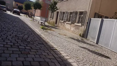
Goldenes LamLam Asia Restaurant
Restaurant · Asian, Sushi
11 Kirchenstraße, Treuchtlingen
Tu-Su,PH 11:00-15:00,17:00-22:00
Hotel-Gasthof zur Sonne
Restaurant · Regional · 5.3 km
20 Deisingerstraße, Pappenheim
11:30-14:00,17:30-21:30; Tu off
Lindenwirt
Restaurant · Friture, Local, Noodles, Regional, Sausage · 5.4 km
11 Schützenstraße, Pappenheim
Tu,Th 11:30-14:00,17:00-22:00; We 17:00+; Fr-Su,PH 11:00-22:00
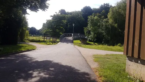
Stadthalle Restaurant
Restaurant · German, Greek
14 Jahnstraße, Treuchtlingen
Tu-Su 11:00-23:00; Mo 12:00-12:00
Gasthof Rose
Restaurant · 7.0 km
4 Rosengasse, Langenaltheim
Mo,Tu 16:00-22:00; Fr-Su,PH 11:00-14:00,16:00-22:00; We,Th off
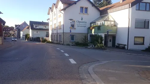


Rockenstube
Restaurant · German · 6.9 km
3 Flurstraße, Weißenburg in Bayern
Tu-We 17:00+; Th-Su 11:00+
59 more on the map.
History
The spot where the town is situated was first settled by Celts, Romans and Franks. The town proper was founded in 793, during the reign of Charlemagne, and it was first mentioned in 899, as Drutelinga. In the 12th century the castle was erected. In 1495 Treuchtlingen was burnt down. In 1869 the train station was opened.
On 23 February 1945 at 11:00 clock an air raid on the station Treuchtlingen (Operation Clarion) took place, in which the Fronturlauberzug SF 2046 just stopped. The passengers of the train fled into the platform underpass, which received a direct hit.300 people died in the platform underpass, a total of nearly 600 people were killed and another 900 injured in the station and the surrounding area. Most of the bomb victims are buried in the memorial site of Kriegsgräberfürsorge on the Nagelberg. In the underpass, which tunneled the tracks elsewhere since a station renovation in 2004, a marble plaque commemorates the victims. In a second attack on April 11, 1945, no people were killed, but among other things, a steam locomotive type Bayerische G 3/4 H destroyed. Part of the wreck was found in the course of the reconstruction and is now in the Bavarian Railway Museum in Nördlingen.
From the History section of Treuchtlingen on Wikipedia, under CC BY-SA 4.0.
Where to stay16
Pension FeWo Elsa Tschernach
Motel and hotel · 0.7 km
5 Siedlungsstraße, Treuchtlingen
Churches and places of worship40
Shopping15
Gas and EV charging7
Schools, colleges and libraries11
Healthcare5
Map of Treuchtlingen
250 places. The map loads OpenStreetMap tiles when you open it.
Getting there and nearby towns
Ingolstadt Manching Airport (IGS) is the nearest airport with scheduled flights listed in OpenStreetMap, 53 km away.
- Weißenburg in Bayern 10 km northeast, about 10 min by car
- Bopfingen 42 km west, about 42 min by car
- Ingolstadt 43 km southeast, about 43 min by car
- Wendelstein 48 km north, about 48 min by car
- Zirndorf 54 km north, about 54 min by car
- Nuremberg 57 km north, about 57 min by car
- Ellwangen 57 km west, about 57 min by car
- Fürth 58 km north, about 58 min by car
- Aalen 61 km west, about 1 h by car
- Augsburg 65 km south, about 1 h by car
Drive times are estimates from straight-line distance, not routes.
Local news
Headlines from INDB.
Reviews, tips and questions
Loading what members have shared...
Sources and licences
- GeoNames (CC BY 4.0): population, coordinates, regions and time zone
- Mapillary (see each image): photos
- OpenStreetMap contributors (ODbL 1.0): places, airports, map data
- Wikidata (CC0 1.0): elevation, founding date, time zone, website, landmarks and historic places
- Wikimedia Commons (see each image): photos
- Wikipedia (CC BY-SA 4.0): overview and history text
Photo credits
- Hauptstraße 2 (Treuchtlingen), Kd6=dra, CC0
- Treuchtlingen, Alte Burgstr 14, Flügelrad, 1, Renardo la vulpo, CC BY-SA 4.0
- Marktbrunnen (Treuchtlingen) 160, Kd6=dra, CC0
- Hauptstraße 28 (Treuchtlingen), Kd6=dra, CC0
- Hauptstraße 26 (Treuchtlingen), Kd6=dra, CC0
- Kirchenstraße 2 (Treuchtlingen), Kd6=dra, CC0
- Treuchtlingen WUG 029, DALIBRI, CC BY-SA 4.0
- Treuchtlingen WUG 006, DALIBRI, CC BY-SA 4.0
- Treuchtlingen WUG 028, DALIBRI, CC BY-SA 4.0
- Treuchtlingen WUG 007, DALIBRI, CC BY-SA 4.0
- Treuchtlingen WUG 008, DALIBRI, CC BY-SA 4.0
- Treuchtlingen WUG 027, DALIBRI, CC BY-SA 4.0
- Treuchtlingen WUG 009, DALIBRI, CC BY-SA 4.0
- Marktbrunnen (Treuchtlingen) 045, Kd6=dra, CC0
- Treuchtlingen WUG 011, DALIBRI, CC BY-SA 4.0
- Treuchtlingen WUG 010, DALIBRI, CC BY-SA 4.0
- Treuchtlingen WUG 012, DALIBRI, CC BY-SA 4.0
- Treuchtlingen WUG 014, DALIBRI, CC BY-SA 4.0
- Treuchtlingen WUG 013, DALIBRI, CC BY-SA 4.0
- Treuchtlingen WUG 026, DALIBRI, CC BY-SA 4.0
- Treuchtlingen WUG 018, DALIBRI, CC BY-SA 4.0
- Treuchtlingen WUG 016, DALIBRI, CC BY-SA 4.0
- Treuchtlingen WUG 017, DALIBRI, CC BY-SA 4.0
- Treuchtlingen WUG 015, DALIBRI, CC BY-SA 4.0
- Am Schulhof 4 (Treuchtlingen) 185, Kd6=dra, CC0
- St Lambertus - Treuchtlingen 001, DALIBRI, CC BY-SA 4.0
- Markgrafenkirche Treuchtlingen 037, DALIBRI, CC BY-SA 4.0
- Markgrafenkirche Treuchtlingen 044, DALIBRI, CC BY-SA 4.0
- Treuchtlingen, Lambertikirche v SW, 3, Renardo la vulpo, CC BY-SA 4.0
- Treuchtlingen, Markgrafenkirche v NW, 2, Renardo la vulpo, CC BY-SA 4.0
- Markgrafenkirche Treuchtlingen 050, DALIBRI, CC BY-SA 4.0
- Markgrafenkirche Treuchtlingen 052, DALIBRI, CC BY-SA 4.0
- Markgrafenkirche Treuchtlingen 053, DALIBRI, CC BY-SA 4.0
- Markgrafenkirche Treuchtlingen 051, DALIBRI, CC BY-SA 4.0
- Markgrafenkirche Treuchtlingen 054, DALIBRI, CC BY-SA 4.0
- Markgrafenkirche Treuchtlingen 043, DALIBRI, CC BY-SA 4.0
- Markgrafenkirche Treuchtlingen 036, DALIBRI, CC BY-SA 4.0
- Markgrafenkirche Treuchtlingen 035, DALIBRI, CC BY-SA 4.0
- Treuchtlingen WUG 005, DALIBRI, CC BY-SA 4.0
- Markgrafenkirche Treuchtlingen 041, DALIBRI, CC BY-SA 4.0
- Weißenburg Rekonstruktionsversuch, Unknown author Unknown author, Public domain
- Altmuehltherme TreuchtlingenJPG, mef.ellingen, CC BY-SA 3.0
- Treuchtlingen - Fossa Carolina - Karlsgraben, Franzfoto, CC BY-SA 3.0
- Schloss Möhren Vakantie in een kasteel, Marijke van Klaveren, CC0
- Treuchtlingen - Schnellzuglok 01220, Baujahr 1937, Franzfoto, CC BY-SA 3.0
- St Johannes - Dietfurt WUG 002, DALIBRI, CC BY-SA 4.0
- Treuchtlingen, Graben, Evang.-Luth. Filialkirche St. Kunigunde, 001, Tilman2007, CC BY-SA 3.0
- Pappenheim-Osterdorf, Kirche St. Erhard von Nordwesten, N8eule78, CC BY-SA 4.0
- Berolzheim (17), PeterBraun74, CC BY-SA 3.0
- St Nikolaus Dettenheim, Mef.ellingen, CC BY-SA 3.0
- St Johannes - Emetzheim 041, DALIBRI, CC BY-SA 4.0
- Sankt Margaretha Holzingen, Bahnfisch, CC BY-SA 4.0
- St. Magnus - Kattenhochstatt WUG 003, DALIBRI, CC BY-SA 4.0
- 2018 Steinkreuze Pappenheim 04, Derzno, CC BY 4.0
- 2018 Steinkreuze Pappenheim 05, Derzno, CC BY 4.0
- 2018 Steinkreuze Pappenheim 06, Derzno, CC BY 4.0
- Städtische Galerie Pappenheim, Stefan Karl, CC BY-SA 4.0
- Burg von Pappenheim, BKLuis, CC BY-SA 3.0
- Treuchtlingen Schloß, Cholo Aleman, CC BY-SA 3.0
- Marktberolzheim.buchleite, Andreas Dollinger, CC BY 2.5
- Schambachried mit Gunthildiskapelle, Doemountain, CC BY-SA 4.0
- Treuchtlingen Bubenheim Heilig-Kreuz-Kirche, De nue pw, CC BY-SA 4.0
- Pappenheim, Graf-Carl-Straße 7, Ev. Pfarrkirche, Ansicht von der Burg-20160811-005, Tilman2007, CC BY-SA 4.0
- Bubenheimer Berg, Stoaklauber, CC BY-SA 4.0
- Street-level photo, changchun1, CC BY-SA 4.0
- Street-level photo, changchun1, CC BY-SA 4.0
- Street-level photo, changchun1, CC BY-SA 4.0
- Street-level photo, changchun1, CC BY-SA 4.0
- Street-level photo, changchun1, CC BY-SA 4.0
- Street-level photo, changchun1, CC BY-SA 4.0
- Street-level photo, msdess, CC BY-SA 4.0
- Street-level photo, bernd_niemann, CC BY-SA 4.0
- Street-level photo, bernd_niemann, CC BY-SA 4.0
- Street-level photo, changchun1, CC BY-SA 4.0
- Street-level photo, msdess, CC BY-SA 4.0
- Street-level photo, santon, CC BY-SA 4.0
- Street-level photo, changchun1, CC BY-SA 4.0
- Street-level photo, changchun1, CC BY-SA 4.0
- Street-level photo, bernd_niemann, CC BY-SA 4.0
- Street-level photo, changchun1, CC BY-SA 4.0


Page built November 8, 2026. Spotted a mistake? Tell us or suggest a place.