


Why visit Waldkirchen
Townapedia lists 27 museums and landmarks, 15 parks and trails, 33 places to eat, 14 places to stay and 17 attractions in and around town.
Highlights include Kino, Oberfrauenwald, Emerenz Meier Haus and Wolfstein Castle.
Weather in Waldkirchen
Forecast from MET Norway (CC BY 4.0). Full forecast
About Waldkirchen
Waldkirchen is the biggest town in the district of Freyung-Grafenau in Germany.
From the Wikipedia article Waldkirchen (this version), under CC BY-SA 4.0.
Things to do17




5 more on the map.
Museums and landmarks27


Wolfstein Castle
Monument and historic site · 9.9 km
Castle in Germany
Am Goldenen Steig
Museum
22 Büchl, Waldkirchen
"Mai-Okt. Sa, Su 14.00-17.00; Palmso., Weißer So. u. 25. Dez.-6....



Motorradmuseum Rosenberger
Monument and historic site · 5.2 km
Privat geführtes Motorradmuseum, bitte zuvor telefonisch einen Termin ausmachen.
1
Frischecker Madonna
Monument and historic site · 1.7 km
Betstock (Marterl) aus Granit - Gedenkstätte an die ehemalige Wallfahrtskapelle
Frischecker Madonna
Monument and historic site · 0.7 km
Granitplastik von Franz Biber, um 1910
Kriegerdenkmal
Monument and historic site
Granitplasik von 1953 zum Gedächtnis der Gefallenen des 1. und 2. Weltkrieges
15 more on the map.
Parks, trails and playgrounds15





3 more on the map.
Restaurants and cafes33

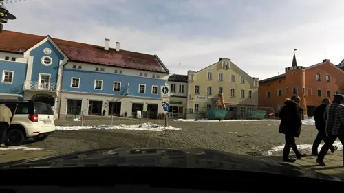
Restaurant Johanns
Restaurant · Regional, Italian, Ice Cream
24 Marktplatz, Waldkirchen
Mo-Sa 12:00-14:30, 18:00-23:55
Gasthaus Meindl
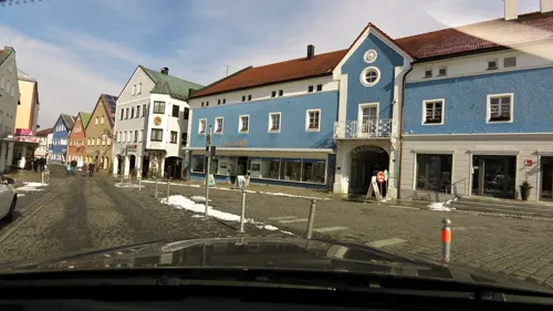
Restaurant · Regional
14 Marktplatz, Waldkirchen
Mo-Fr 08:00-18:00; Sa 08:00-15:00; PH off


Wirtshaus zur Emerenz
Restaurant · 0.9 km
9 Dorfplatz, Waldkirchen
We-Su 11:00-00:00
Zum Sepp
Restaurant · 3.0 km
2 Frauenwaldstraße, Waldkirchen
Mo-Sa 08:00-14:00, 17:00-22:00; Su 08:00-22:00


Eden das indische Paradies
Restaurant
1 Jahnstraße, Waldkirchen
Tu 12:00-14:00,17:00-21:00; Th-Su 11:00-14:00,17:00-21:00
Haller-Alm
Restaurant · 2.1 km
42 Graben, Waldkirchen
May 01-May 31: Tu-Su 11:30-18:00; Jun 01-Oct 03: Mo-Th...
Irodion
Restaurant · Greek
12 Marktplatz, Waldkirchen
Mo off; Tu-Sa 17:30-23:00; Su 11:30-14:00,17:30-23:00
21 more on the map.
History
Mentioned for the first time in 1203, it soon became an important trading place along the "Goldener Steig" (Golden Path), a salt-trading route between Bavaria and Bohemia in the late Middle Ages. In the 13th century the Bishop of Passau gave Waldkirchen the title of a "Markt" (market).
After several raids by Bohemian soldiers during the 15th century the city built a "Ringmauer", a big stonewall, to surround it, which is still to be seen in many places of the city.
Belonging to the Bishop of Passau's territory for more than 600 years, the city became part of the Kingdom of Bavaria in 1806 and in 1871 of the German Empire.
Waldkirchen burned down six times between 1492 and 1945. The last fire was on April 26, 1945, when the 16th Company of Regiment Grossdeutschland, SS Panzer Grenadier Division "Das Reich" arrived from St. Pölten, Austria. Each squad of ten men was armed with one light machine gun, one machine pistol, two Panzerfaust and rifles. Eight civilians were killed in combat with the 11th Armored Division, and 48 houses and city's historical church were destroyed. In the course of the action 120 families also lost shelter. The devastated city was rebuilt during the 1950s and was chartered in 1972.
From the History section of Waldkirchen on Wikipedia, under CC BY-SA 4.0.
Where to stay14
Roomingston Waldkirchen City
Motel and hotel · 1.4 km
48 Hauzenberger Straße, Waldkirchen
Roomington Waldkirchen Karoli
Motel and hotel · 1.1 km
26 VdK-Heim-Straße, Waldkirchen
Churches and places of worship41
Maria Verkündigung
Church · Roman Catholic · 6.2 km
11 Rannariedler Straße, Jandelsbrunn
Königreichssaal der Zeugen Jehovas
Church · Jehovahs Witness · 1.1 km
27a Hauzenberger Straße, Waldkirchen
Shopping12
Gas and EV charging4
Schools, colleges and libraries10
Staatliches berufliches Schulzentrum Waldkirchen
School
8 Freyunger Straße, Waldkirchen
Healthcare4
Map of Waldkirchen
177 places. The map loads OpenStreetMap tiles when you open it.
Getting there and nearby towns
Flugplatz Straubing-Wallmühle (RBM) is the nearest airport with scheduled flights listed in OpenStreetMap, 82 km away.
- Röhrnbach 6 km west, about 6 min by car
- Jandelsbrunn 7 km east, about 7 min by car
- Grainet 8 km northeast, about 8 min by car
- Hauzenberg 9 km south, about 9 min by car
- Büchlberg 9 km southwest, about 9 min by car
- Freyung 9 km northwest, about 9 min by car
- Hinterschmiding 10 km north, about 10 min by car
- Sonnen 10 km southeast, about 10 min by car
- Neureichenau 11 km east, about 11 min by car
- Zwiesel 41 km northwest, about 41 min by car
Drive times are estimates from straight-line distance, not routes.
Local news
Headlines from INDB.
Reviews, tips and questions
Loading what members have shared...
Sources and licences
- GeoNames (CC BY 4.0): population, coordinates, regions and time zone
- Mapillary (see each image): photos
- OpenStreetMap contributors (ODbL 1.0): places, airports, map data
- Wikidata (CC0 1.0): elevation, founding date, time zone, website, landmarks and historic places
- Wikimedia Commons (see each image): photos
- Wikipedia (CC BY-SA 4.0): overview and history text
Photo credits
- Waldkirchen Marktplatz 1, Aconcagua, CC BY-SA 3.0
- Waldkirchen Marktplatz 2, Aconcagua, CC BY-SA 3.0
- Ladestation Pedelec, E-Bike, Kleingeräte (Waldkirchen), APneunzehn74, CC0
- Turnhalle in Waldkirchen, High Contrast, CC BY 3.0 de
- Katholische Pfarrkirche St. Peter und Paul in Waldkirchen 011, Georg Karl Ell, CC BY 4.0
- Katholische Pfarrkirche St. Peter und Paul in Waldkirchen 015, Georg Karl Ell, CC BY 4.0
- Katholische Pfarrkirche St. Peter und Paul in Waldkirchen 08, Georg Karl Ell, CC BY 4.0
- Katholische Pfarrkirche St. Peter und Paul in Waldkirchen 01, Georg Karl Ell, CC BY 4.0
- Katholische Pfarrkirche St. Peter und Paul in Waldkirchen 03, Georg Karl Ell, CC BY 4.0
- Katholische Pfarrkirche St. Peter und Paul in Waldkirchen 04, Georg Karl Ell, CC BY 4.0
- Katholische Pfarrkirche St. Peter und Paul in Waldkirchen 02, Georg Karl Ell, CC BY 4.0
- Katholische Pfarrkirche St. Peter und Paul in Waldkirchen 010, Georg Karl Ell, CC BY 4.0
- Katholische Pfarrkirche St. Peter und Paul in Waldkirchen 09, Georg Karl Ell, CC BY 4.0
- Katholische Pfarrkirche St. Peter und Paul in Waldkirchen 05, Georg Karl Ell, CC BY 4.0
- Katholische Pfarrkirche St. Peter und Paul in Waldkirchen 06, Georg Karl Ell, CC BY 4.0
- Katholische Pfarrkirche St. Peter und Paul in Waldkirchen 014, Georg Karl Ell, CC BY 4.0
- Katholische Pfarrkirche St. Peter und Paul in Waldkirchen 012, Georg Karl Ell, CC BY 4.0
- Katholische Pfarrkirche St. Peter und Paul in Waldkirchen 016, Georg Karl Ell, CC BY 4.0
- Katholische Pfarrkirche St. Peter und Paul in Waldkirchen 07, Georg Karl Ell, CC BY 4.0
- Katholische Pfarrkirche St. Peter und Paul in Waldkirchen 013, Georg Karl Ell, CC BY 4.0
- Waldkirchen Ölbergkapelle 04, Georg Karl Ell, CC BY 4.0
- Waldkirchen Ölbergkapelle 01, Georg Karl Ell, CC BY 4.0
- Waldkirchen Ölbergkapelle 02, Georg Karl Ell, CC BY 4.0
- Waldkirchen Ölbergkapelle 03, Georg Karl Ell, CC BY 4.0
- Waldkirchen Rathaus, Aconcagua, CC BY-SA 3.0
- Waldkirchen Orgel Eisenbarth, Regerman, CC BY-SA 4.0
- Schloss Wolfstein, Konrad Lackerbeck, CC BY 3.0
- Freyung, FRG - Stadtpfarrkirche v O 02, Flodur63, CC BY-SA 4.0
- Burgruine Kaltenstein GO-4, Gras-Ober, CC BY-SA 3.0
- Karlsbach mit Pfarrkirche, Konrad Lackerbeck, CC BY 3.0
- Pfarrkirche Röhrnbach, Konrad Lackerbeck, CC BY 3.0
- D-2-72-151-55 Vorderansicht, Caredig7, CC BY-SA 3.0 de
- Grabenkapelle Waldkirchen 2, Edelmauswaldgeist, CC0
- Brunnenfigur, Waldkirchen, High Contrast, CC BY 3.0 de
- Waldkirchen Karolikapelle, Aconcagua, CC BY-SA 3.0
- Kirche Böhmzwiesel, Konrad Lackerbeck, CC0
- Waldkirchen-Schiefweg-Dorfplatz-9, Elcom.stadler, CC BY-SA 3.0
- Naturschutzgebiet Saußbachklamm Waldkirchen Dr. Fritz Haselbeck, Dr. Fritz Haselbeck, CC BY-SA 4.0
- Evangelische Erlöserkirche in Waldkirchen, High Contrast, CC BY 3.0 de
- Aussichtsturm Oberfrauenwald, Konrad Lackerbeck, CC BY 3.0
- Waldkirchen Kanal Saußbachleite, Gras-Ober, CC BY-SA 3.0
- Alpenkette am Steinberg, Tobias Marold, CC BY-SA 3.0
- Street-level photo, czmrtn, CC BY-SA 4.0
- Street-level photo, czmrtn, CC BY-SA 4.0
- Street-level photo, czmrtn, CC BY-SA 4.0
- Street-level photo, czmrtn, CC BY-SA 4.0
- Street-level photo, czmrtn, CC BY-SA 4.0
- Street-level photo, peppone84, CC BY-SA 4.0


Page built November 8, 2026. Spotted a mistake? Tell us or suggest a place.