


Why visit Wandlitz
Townapedia lists 60 museums and landmarks, 25 parks and trails, 103 places to eat, 23 places to stay and 20 attractions in and around town.
Highlights include Klosterfelder Senfmühle, BARNIM PANORAMA Naturparkzentrum Agrarmuseum Wandlitz, Landhaus Bogensee and Strandbad Rahmer See.
Weather in Wandlitz
Forecast from MET Norway (CC BY 4.0). Full forecast
About Wandlitz
Wandlitz (German pronunciation: [ˈvandlɪts] ) is a village, a borough (Ortsteil) and an independent municipality in the Landkreis (district) of Barnim, in Brandenburg, Germany. It is situated 25 km north of Berlin, and 15 km east of Oranienburg. The municipality was established in 2004 by merger of the nine villages Basdorf, Klosterfelde, Lanke, Prenden, Schönerlinde, Schönwalde, Stolzenhagen, Wandlitz and Zerpenschleuse.
From the Wikipedia article Wandlitz (this version), under CC BY-SA 4.0.
Things to do20
Klosterfelder Senfmühle
Farm and orchard · 6.7 km
34 Zerpenschleuser Straße, Wandlitz
Mo-Th 09:00-15:00; Fr 09:00-14:00

Schuttberg
Scenic view · 1.9 km
Die höchste Erhebung liegt bei 78,1 m NHN und somit ca. 10 m über Geländeoberkante.

8 more on the map.
Museums and landmarks60

BARNIM PANORAMA Naturparkzentrum Agrarmuseum Wandlitz
Museum · 1.1 km
9 Breitscheidstraße, Wandlitz
Sa-Th,PH 10:00-18:00

Landhaus Bogensee
Monument and historic site · 5.8 km
Former country house of Reichspropaganda Minister Joseph Goebbels


Alter Speicher
Museum · 8.9 km
Kornspeicher und Wasserturm in Hobrechtsfelde. Ausstellung zu Rieselfeldern und Stadtgut. Eintritt gegen freiwillige Spende 1-2€.

Object 17/5001 Primary control center for the East German National Defence Council
Monument and historic site · 7.1 km
Teil des Bunker-Komplexes 5000

Objekt 17/5001 Hauptführungsstelle des Nationalen Verteidigungsrats der DDR
Monument and historic site · 6.8 km
Dauerhaft versiegelter ehem. NVR-Kommandobunker in Privatbesitz (e.V.). Der ehem. Zugangstunnel ist dauerhaft versiegelt (Betonplombe),...



Heidekrautbahn Museum
Museum · 3.7 km
2a An der Wildbahn, Wandlitz


Reste des Senders Zehlendorf
Monument and historic site · 7.0 km
Technical_monument
48 more on the map.
Parks, trails and playgrounds25










13 more on the map.
Restaurants and cafes103
Altes Forsthaus
Restaurant · German · 9.9 km
19 Bahnhofstraße, Mühlenbecker Land
We-Sa 11:30-22:00; Su 11:30-20:00; Mo-Tu off

Bellevue
Restaurant · German, Hungarian, Regional · 7.3 km
17 Lanker Dorfstraße, Wandlitz
We-Mo 12:00-18:00
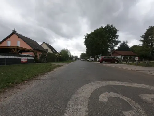
Café Feldheim
Restaurant · German · 9.2 km
1 Triftweg, Mühlenbecker Land
Mo-Fr 17:00+; Sa,Su,PH 12:00+
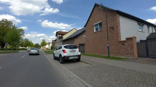
Heaven's Cake
Cafe · Cake, Coffee Shop, Ice Cream, Breakfast · 5.5 km
60 Klosterfelder Hauptstraße
We-Su 08:00-18:00
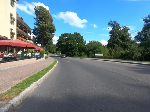
Hotel & Restaurant am Liepnitzsee
Restaurant · German · 5.1 km
12 Wandlitzer Straße, Wandlitz
PH,Mo-Su 12:00-18:00
Pegasos
Restaurant · Greek · 9.8 km
20 Bahnhofstraße, Mühlenbecker Land
Tu-Fr 16:00-23:00; Sa-Su 12:00-23:00; PH 12:00-23:00


91 more on the map.
History
Wandlitz was first mentioned as Slavic Vandlice in a 1242 deed, when the Margraves of Brandenburg John I and Otto III sold it to the Lehnin Abbey. The word means men who live at the water. Situated on the Barnim plateau among woods and lakes it became a popular recreation area especially in the 20th century. Since 1901 the Heidekrautbahn railway line links Wandlitz with Berlin.
From 1815 to 1945, Wandlitz was part of the Prussian Province of Brandenburg, from 1945 to 1952 of the State of Brandenburg, from 1952 to 1990 of the East German Bezirk Frankfurt and since 1990 again of Brandenburg.
Shortly after World War II, the village was home to an orphanage of children from Berlin. The orphanage, run by nuns, later became a holiday spot for visiting high-ranking Communist party members. The children of the small orphanage were frowned upon as second-class citizens by villagers, and often went hungry.
The name Wandlitz is also often used as a synonym for the nearby "Waldsiedlung" (Forest Settlement) compound, where the highest East German functionaries lived removed from the general population. However, this settlement is actually located on the territory of the town Bernau.
From the History section of Wandlitz on Wikipedia, under CC BY-SA 4.0.
Where to stay23
Churches and places of worship24
Dorfkirche Zehlendorf
Church · Protestant · 6.7 km
53A Alte Dorfstraße, Oranienburg
Dorfkirche Wensickendorf
Church · Protestant · 5.7 km
7 Zehlendorfer Chaussee, Oranienburg
Shopping32
Gas and EV charging8
Schools, colleges and libraries23
Healthcare8
Ahorn-Apotheke Klosterfelde
Clinic and pharmacy · 5.6 km
48 Klosterfelder Hauptstraße, Wandlitz
Map of Wandlitz
250 places. The map loads OpenStreetMap tiles when you open it.
Getting there and nearby towns
Berlin Brandenburg Airport "Willy Brandt" (BER) is the nearest airport with scheduled flights listed in OpenStreetMap, 42 km away.
- Bernau bei Berlin 11 km southeast, about 11 min by car
- Rüdnitz 11 km east, about 11 min by car
- Biesenthal 13 km east, about 13 min by car
- Oranienburg 14 km west, about 14 min by car
- Hohen Neuendorf 14 km southwest, about 14 min by car
- Berlin 24 km south, about 24 min by car
- Zehdenick 28 km north, about 28 min by car
- Zeuthen 45 km south, about 45 min by car
- Potsdam 46 km southwest, about 46 min by car
- Zossen 58 km south, about 58 min by car
Drive times are estimates from straight-line distance, not routes.
Local news
Headlines from INDB.
Reviews, tips and questions
Loading what members have shared...
Sources and licences
- GeoNames (CC BY 4.0): population, coordinates, regions and time zone
- Mapillary (see each image): photos
- OpenStreetMap contributors (ODbL 1.0): places, airports, map data
- Wikidata (CC0 1.0): elevation, founding date, time zone, website, landmarks and historic places
- Wikimedia Commons (see each image): photos
- Wikipedia (CC BY-SA 4.0): overview and history text
Photo credits
- 20241109 xl 0741-Wandlitz, Molgreen, CC BY-SA 4.0
- Bombardier Talent am Bahnhof Wandlitz 20160315 10, Sebastian Rittau, CC BY 4.0
- Bombardier Talent am Bahnhof Wandlitz 20160315 11, Sebastian Rittau, CC BY 4.0
- Am Bahnhof Wandlitz 20160315 5, Sebastian Rittau, CC BY 4.0
- Am Bahnhof Wandlitz 20160315 6, Sebastian Rittau, CC BY 4.0
- Gleisreste am Bahnhof Wandlitz 20160315 13, Sebastian Rittau, CC BY 4.0
- Am Bahnhof Wandlitz 20160315 4, Sebastian Rittau, CC BY 4.0
- Zaun am Bahnhof Wandlitz 20160315 9, Sebastian Rittau, CC BY 4.0
- Gleisreste am Bahnhof Wandlitz 20160315 12, Sebastian Rittau, CC BY 4.0
- Am Bahnhof Wandlitz 20160315 7, Sebastian Rittau, CC BY 4.0
- Weichensignal am Bahnhof Wandlitz 20160315 8, Sebastian Rittau, CC BY 4.0
- Bahnhof Wandlitz 2023 WNW, Hans G. Oberlack, CC BY-SA 4.0
- Antenne am Bahnhof Wandlitz 20160315 14, Sebastian Rittau, CC BY 4.0
- Bahnhof Wandlitz 20160315 3, Sebastian Rittau, CC BY 4.0
- Bahnhof Wandlitz 20160315 2, Sebastian Rittau, CC BY 4.0
- Bahnhof Wandlitz 20160315 1, Sebastian Rittau, CC BY 4.0
- Bahnhof Wandlitz 2023 NE, Hans G. Oberlack, CC BY-SA 4.0
- Bahnhof Wandlitz 2016-06-28 ama fec (4), Angela M. Arnold, Berlin (=44Pinguine), CC BY-SA 3.0
- Bahnübergang am Bahnhof Wandlitz 20160315 15, Sebastian Rittau, CC BY 4.0
- Bahnhof Wandlitz 20160315 18, Sebastian Rittau, CC BY 4.0
- Bahnübergang am Bahnhof Wandlitz 20160315 17, Sebastian Rittau, CC BY 4.0
- Strecke nach Wandlitzsee 20160315 16, Sebastian Rittau, CC BY 4.0
- 19-09-28-Wandlitz-DJI 0905, Daniela Kloth, GFDL 1.2
- 19-09-28-Wandlitz-100-0890, Daniela Kloth, GFDL 1.2
- 19-09-28-Wandlitz-0895-0898, Daniela Kloth, GFDL 1.2
- 2014-07-06 02 Agrarmuseum Wandlitz anagoria, Anagoria, CC BY 3.0
- Objekt 17 5001 toegangsdeur 02, Vincent de Groot - http://www.videgro.net, CC BY-SA 4.0
- Bernau bei Berlin ADGB Schule Wohntrakte vorne, User:Dabbelju, CC BY 2.5
- Dammsmühle2 (1994), Olaf Tausch, CC BY-SA 3.0
- Dorfkirche Ladeburg, Ulrich Waack, Public domain
- Prenden church, Doris Antony , Berlin, CC BY-SA 3.0
- ADGB Schule Bernau 5149, Sebastian Wallroth, CC BY 3.0
- Hellsee 09, Geoprofi Lars, CC BY-SA 4.0
- Schloss Lanke 06, Olaf Tausch, CC BY 3.0
- 08-07 Wandlitz St Konrad Kirche+Pfarre1, Angela Monika Arnold, Berlin, CC BY 3.0
- Schäferpfühle Ladeburg, Kds11, CC BY-SA 3.0
- Panke 08, Olaf Tausch, CC BY 3.0
- Dorfkirche Wandlitz 2017 NW, Hans G. Oberlack, CC BY-SA 4.0
- Museum in Basdorf 2017-10-22 ama fec (29), Angela M. Arnold, Berlin (=44Pinguine))), CC BY-SA 3.0
- Basdorf (Barnim) church 2016 SSE, Hans G. Oberlack, CC BY-SA 4.0
- Schönwalde Kirche (1994) 2, Olaf Tausch, CC BY-SA 3.0
- 2010-05-23 Kl'felde - AMA.B fec - 179 Kirche, Angela M. Arnold, Berlin, CC BY-SA 3.0
- Schönerlinde Kirche 03, Olaf Tausch, CC BY 3.0
- Bernau bei Berlin OT Schönow Dorfkirche (1), Kvikk, CC BY-SA 3.0
- Wandlitz Lanke church, Doris Antony , Berlin, CC BY-SA 3.0
- Kirche Zehlendorf (Oranienburg) 2, Jumbo1435, CC BY-SA 3.0
- Wandlitz Bogensee Landsitz Goebbels, Oberlausitzerin64, CC BY-SA 4.0
- Panketal Hobrechtsfelde Kornspeicher, Mazbln, CC BY-SA 3.0
- 5001-Dispatcher, BEG, CC BY-SA 3.0
- Baudenkmal Bundesschule Bernau Waldfrieden 12, Ladeburg LIVE, CC BY-SA 4.0
- 19-09-28-Wandlitz-0865-0873, Daniela Kloth, GFDL 1.2
- Bernau bei Berlin OT Ladeburg Dorfkirche, Kvikk, CC BY-SA 3.0
- Wandlitz evangelische Kirche, Oberlausitzerin64, CC BY-SA 4.0
- Wensickendorf church, Doris Antony , Berlin, CC BY-SA 3.0
- Street-level photo, kartonage, CC BY-SA 4.0
- Street-level photo, carlheinz, CC BY-SA 4.0
- Street-level photo, kartonage, CC BY-SA 4.0
- Street-level photo, carlheinz, CC BY-SA 4.0
- Street-level photo, carlheinz, CC BY-SA 4.0
- Street-level photo, carlheinz, CC BY-SA 4.0
- Street-level photo, kartonage, CC BY-SA 4.0
- Street-level photo, carlheinz, CC BY-SA 4.0
- Street-level photo, moenk, CC BY-SA 4.0
- Street-level photo, carlheinz, CC BY-SA 4.0
- Street-level photo, carlheinz, CC BY-SA 4.0
- Street-level photo, moenk, CC BY-SA 4.0
- Street-level photo, kartonage, CC BY-SA 4.0
- Street-level photo, carlheinz, CC BY-SA 4.0
- Street-level photo, carlheinz, CC BY-SA 4.0
- Street-level photo, Langfahrer, CC BY-SA 4.0
- Street-level photo, carlheinz, CC BY-SA 4.0
- Street-level photo, carlheinz, CC BY-SA 4.0
- Street-level photo, carlheinz, CC BY-SA 4.0
- Street-level photo, carlheinz, CC BY-SA 4.0
- Street-level photo, Langfahrer, CC BY-SA 4.0
- Street-level photo, carlheinz, CC BY-SA 4.0


Page built November 8, 2026. Spotted a mistake? Tell us or suggest a place.