


Weil am Rhein, Germany
Weil am Rhein is a town of 32,236 people in Baden-Wurttemberg, Germany.
Why visit Weil am Rhein
Townapedia lists 93 museums and landmarks, 76 parks and trails, 225 places to eat, 26 places to stay and 17 attractions in and around town.
Highlights include Burghof, Kinopalast, Museum Dorfstube and Vitra Design Museum, Frank Gehry (1989).
Weather in Weil am Rhein
Forecast from MET Norway (CC BY 4.0). Full forecast
About Weil am Rhein
Weil am Rhein (German pronunciation: [ˈvaɪl ʔam ˈʁaɪn], lit. 'Weil on the Rhine'; High Alemannic: Wiil am Rhii) is a German town and commune. It is on the east bank of the River Rhine, and extends to the tripoint of Switzerland, France, and Germany. It is the most southwesterly town in Germany and a suburb in the Trinational Eurodistrict of Basel. The town has around 30,000 inhabitants, and the Eurodistrict metropolitan area has about 830,000.
From the Wikipedia article Weil am Rhein (this version), under CC BY-SA 4.0.
Travel tips from other travellers: Weil am Rhein on Wikivoyage (CC BY-SA 4.0).
Things to do17

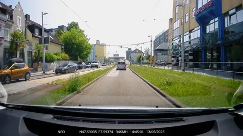
Kinopalast
Cinema and theater · 2.1 km
435 Hauptstraße, Weil am Rhein
"Depends on the weekly movie schedule"

Müller Obst- u Gemüsehof
Farm and orchard · 2.5 km
11 Große Gaß, Weil am Rhein
Mo,Tu,Th,Fr 08:00-12:30,14:30-18:00; We,Sa 08:00-12:30; Su,PH off
Weingut Riehen AG
Farm and orchard · 2.5 km
63 Rössligasse, Riehen
"Ab Hof nach Vereinbarung Weinhandlung Paul Ullrich AG Basel, Henz...
Wyyguet Rinklin
Farm and orchard · 2.0 km
1 Eglingerweg, Riehen
We, Fr 16:00-19:00 "oder nach Vereinbarung Hauslieferung"


Spittelmatthof
Farm and orchard · 2.1 km
31 Spittelmattweg, Riehen
24/7 closed "Zur Zeit kein Verkauf ab Hof"

Three Countries Bridge
Bridge · 2.3 km
Bridge in France, Switzerland, and Germany

Vitra Slide Tower
Monument and historic site · 1.1 km
Observation tower in Weil am Rhein

Wiesentalbrücke
Bridge · 5.8 km
Bridge in the town of Lörrach, Germany
Bäumlihof
Farm and orchard · 2.5 km
385 Aeussere Baselstrasse, Riehen
"Nach Vereinbarung"
Greiner Gemüsebau
Farm and orchard · 1.4 km
Gemüse der Saison Gemüsejungpflanzen Stiefmütterchen Beet-Balkonpflanzen
98 Lustgartenstraße, Weil am Rhein
Mo-Fr 09:00-12:00, 13:00-19:00; Sa 09:00-13:00
5 more on the map.
Museums and landmarks93

Vitra Design Museum, Frank Gehry (1989)
Museum · 0.9 km
2 Charles-Eames-Straße, Weil am Rhein
Mo-Su 10:00-18:00


Dreiländereck
Monument and historic site · 2.4 km
Monument marking the tripoint of France, Germany and Switzerland


Gedenkstätte für Flüchtlinge zur Zeit des 2. Weltkriegs
Museum · 2.6 km
44 Inzlingerstrasse, Riehen
Mo-Su 09:00-17:00


Basel Historical Museum
Museum · 4.9 km
Historical museum in Basel (Switzerland)
81 more on the map.
Parks, trails and playgrounds76

Gartenbad Eglisee
Sports field and stadium · 2.5 km
85 Egliseestrasse, Basel
May-Sep PH,Mo-Su 09:00-20:00






Merian Gardens
Park · 6.1 km
Botanical gardens in Münchenstein, Switzerland

Robi Allmend
Playground · 3.3 km
Staffed playground where kids can play without parental supervision. Parents generally not welcome.
We-Sa 14:00-18:00
64 more on the map.
Restaurants and cafes225
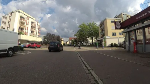
Bäckerei Konditorei Cafe Fritz
Cafe · Sandwich, Cake, Regional
Drive-in : SMS oder WhatsApp an 01746837712
7 Königsberger Straße, Weil am Rhein
Mo-Fr 06:00-18:00; Sa 06:00-17:00; Su,PH off

Al Hambra
Restaurant · Couscous, Barbecue, Chicken, Seafood, Soup, Arab, Lebanese, Mediterranean · 3.5 km
146 Basler Straße, Lörrach
11:00-14:30; 17:00-23:00; Mo off
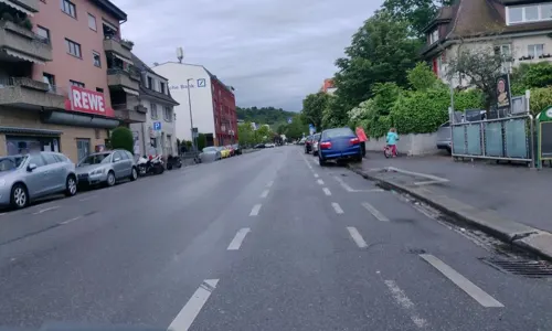
Alte Zunft
Restaurant · Regional · 0.7 km
5 Rathausplatz, Weil am Rhein
Tu-Fr 10:00-23:00; Sa 10:00-00:00
Axion-Delphi
Restaurant · Greek · 2.0 km
46 Freiburger Straße, Weil am Rhein
Fr-We,PH 11:30-14:30,17:30-22:30
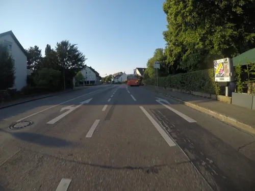
Café Gupi
Restaurant · Regional, Coffee Shop, Wine · 0.7 km
1 Römerstraße, Weil am Rhein
Th-Mo 15:00-22:00; Tu,We off

Café Inka
Cafe · Cake, Coffee Shop · 3.3 km
95 Dorfstraße, Weil am Rhein
We-Sa 12:00-18:00; Su 14:00-18:00; Mo,Tu off
Chläbi
Restaurant · Regional, German · 1.1 km
9 Eisenbahnstraße, Weil am Rhein
Tu 16:00+; We-Su 10:30-14:00, 17:00+
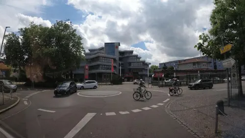
Eiscafé Da Tony
Ice cream
Genieße das süße Leben im Eiscafé Da Tony! Unsere handgemachten Eiscremes und erfrischenden Sorbets werden deine Geschmacksknospen...
274 Hauptstraße, Weil am Rhein
Su-Th 10:00-23:30
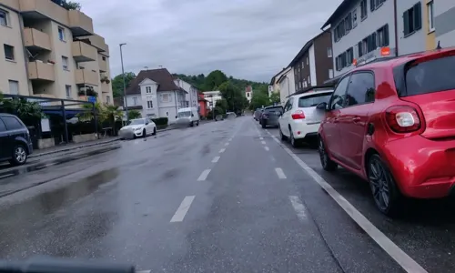


Hanoi Quan
Restaurant · Vietnamese
179 Hauptstraße, Weil am Rhein
Mo,We-Su 11:30-14:30,17:30-22:00; Tu off
213 more on the map.
History
The town is first documented in the year 786 as Willa, a name which is thought to be of Roman origin.
The duc de Villars crossed the Rhine here in October 1702 to fight the Battle of Friedlingen during the War of the Spanish Succession. Weil was severely damaged as a result of the conflict.
Agriculture dominated local industry until the 19th century, when the city began to grow, aided by its favourable transport connections. A railway marshalling yard linking Weil am Rhein to Basel was built in 1913. Swiss textile factories were established in the Friedlingen quarter. 1934 saw the construction of a harbour on the Rhine.
After the Second World War the population again grew rapidly due to the influx of refugees and stateless persons. Between 1971 and 1975 the communities of Ötlingen, Haltingen and Märkt were incorporated and Weil am Rhein became a substantial town.
Since 2014, line 8 of the Basel tram system has extended across the border from Switzerland to terminate in Weil am Rhein.
From the History section of Weil am Rhein on Wikipedia, under CC BY-SA 4.0.
Where to stay26
Churches and places of worship26
Sankt Gallus
Church · Protestant · 3.2 km
50 Dorfstraße, Weil am Rhein
St. Christophoruskirche
Church · Catholic · 2.3 km
25 Kleinhüningeranlage, Basel
Shopping72
Gas and EV charging16
Shell Migrol Basel Nord-Weil
Gas station · 1.3 km
BASEL NORD-WEIL A2/A5 Autobahntankstelle Basel-Weil, Weil am Rhein
Schools, colleges and libraries38
Baden-Wuerttemberg Cooperative State University Loerrach
School · 5.0 km
University of Applied Sciences Northwestern Switzerland
School · 6.7 km
Healthcare22
Map of Weil am Rhein
250 places. The map loads OpenStreetMap tiles when you open it.
Getting there and nearby towns
Lahr Airport (LHA) is the nearest airport with scheduled flights listed in OpenStreetMap, 87 km away.
- Tüllingen 2 km northeast, about 2 min by car
- Lörrach 4 km northeast, about 4 min by car
- Binzen 4 km north, about 4 min by car
- Salzert 5 km east, about 5 min by car
- Eimeldingen 5 km north, about 5 min by car
- Inzlingen 5 km east, about 5 min by car
- Rümmingen 6 km north, about 6 min by car
- Grenzach-Wyhlen 7 km southeast, about 7 min by car
- Brombach 7 km northeast, about 7 min by car
- Wehr 22 km east, about 22 min by car
Drive times are estimates from straight-line distance, not routes.
Local news
Headlines from INDB.
Reviews, tips and questions
Loading what members have shared...
Sources and licences
- GeoNames (CC BY 4.0): population, coordinates, regions and time zone
- Mapillary (see each image): photos
- OpenStreetMap contributors (ODbL 1.0): places, airports, map data
- Wikidata (CC0 1.0): elevation, founding date, time zone, website, landmarks and historic places
- Wikimedia Commons (see each image): photos
- Wikipedia (CC BY-SA 4.0): overview and history text
Photo credits
- Weil am Rhein - Kirche Alt-Weil2, Taxiarchos228, CC BY 3.0
- Maxistuhl Parigi von Aldo Rossi in Weil am Rhein, Andreas Schwarzkopf, CC BY-SA 3.0
- Maxistuhl Harfe von Jørgen Høvelskov in Weil am Rhein, Hauptstr. 291, 1963, Andreas Schwarzkopf, CC BY-SA 3.0
- Maxistuhl Zig Zag von Gerrit T. Rietveld, in Weil am Rhein, Hauptstr. 294, 1932-34, Andreas Schwarzkopf, CC BY-SA 3.0
- Maxistuhl Stapelstuhl von Robert Mallet-Stevens in Weil am Rhein, Hauptstr. 311, Andreas Schwarzkopf, CC BY-SA 3.0
- Maxistuhl First von Michele De Lucchi in Weil am Rhein, Rathausplatz 3, 1983 4, Andreas Schwarzkopf, CC BY-SA 3.0
- Maxistuhl First von Michele De Lucchi in Weil am Rhein, Rathausplatz 3, 1983 2, Andreas Schwarzkopf, CC BY-SA 3.0
- Weil am Rhein Naturschutzgebiet Kiesgrube Käppelin Bild 1, PantaRhei, CC BY-SA 4.0
- Weil am Rhein Hadid Pavillon Mattrain 1 Bild 6, PantaRhei, CC BY-SA 4.0
- Maxistuhl Verstellbarer Sessel von Herbert von Thaden, in Weil am Rhein, Pfädlistr. 4, Andreas Schwarzkopf, CC BY-SA 3.0
- Weil am Rhein Hadid Pavillon Mattrain 1 Bild 5, PantaRhei, CC BY-SA 4.0
- Maxistuhl Argyle Street High Back Chair von Charles Rennie Mackintosh in Weil am Rhein, Hauptstr, Andreas Schwarzkopf, CC BY-SA 3.0
- Weil am Rhein Hadid Pavillon Mattrain 1 Bild 4, PantaRhei, CC BY-SA 4.0
- Weil am Rhein Hadid Pavillon Mattrain 1 Bild 2, PantaRhei, CC BY-SA 4.0
- Maxistuhl Wingnut Chair von Jasper Morrison, in Weil am Rhein-Altweil, Lindenplatz, Andreas Schwarzkopf, CC BY-SA 3.0
- Gleisbauarbeiten Friedensbrücke, 1, Weil am Rhein, Kreis Lörrach, GeorgDerReisende, CC BY-SA 4.0
- Baustelle 2018 Bahnhof Weil am Rhein - 8947, Amada44, CC BY-SA 3.0
- Weil am Rhein Kunstraum Kieswerk Mattrain 5 Bild 1, PantaRhei, CC BY-SA 4.0
- Bau der Brücke für die Tramlinie 8 neben der Friedensbrücke über den Bahnhof von Weil am Rhein, Andreas Schwarzkopf, CC BY-SA 3.0
- Weil am Rhein Hadid Pavillon Mattrain 1 Bild 1, PantaRhei, CC BY-SA 4.0
- Weil am Rhein Kunstraum Kieswerk Mattrain 5 Bild 3, PantaRhei, CC BY-SA 4.0
- Bauarbeiten Tramschlaufe Weil am Rhein 7012, Amada44, CC BY-SA 3.0
- Weil am Rhein Castanea sativa Bild 4, PantaRhei, CC BY-SA 4.0
- Bauarbeiten Tramschlaufe Weil am Rhein 7013, Amada44, CC BY-SA 3.0
- Weil am Rhein Castanea sativa Bild 3, PantaRhei, CC BY-SA 4.0
- Weil am Rhein Kunstraum Kieswerk Mattrain 5 Bild 2, PantaRhei, CC BY-SA 4.0
- 1 Rheinbrücke in Basel, W. Bulach, CC BY-SA 4.0
- Weil am Rhein - Dreiländerbrücke10, Taxiarchos228, CC BY 3.0
- Tripoint Basel (ws), Wladyslaw Sojka, CC BY-SA 3.0
- Hess Haus zur Mücke 1837, Hieronymus Hess, Public domain
- Basel Barfüsserkirche Inneres 11-05-2008, Basmus, CC BY-SA 3.0
- Basel 032, TeamBurton 17:20, 5. Juni 2009 (CEST), Public domain
- Merian-Gärten Villa Merian 2, Zieglhar, CC BY-SA 4.0
- Elisabethenkirche Basel 2006 820, Norbert Aepli, Switzerland ( User:Noebu ), CC BY 2.5
- Biorentrum Basel, -- Wladyslaw Disk., CC BY-SA 3.0
- Hochschule für Technik FHNW, WebmasterHT, CC BY-SA 3.0
- Old University Basel, Gulliveig, Attribution
- Switzerland riehen fondation beyeler, Unknown author, CC BY-SA 3.0
- Burghof Loerrach, Wladyslaw Sojka, CC BY-SA 3.0
- St. Christophorus, Basel, katholisch bl.bs, CC BY-SA 4.0
- 1786 Ref. Kirche Kleinhüningen, Domi-schnitz64, CC BY-SA 3.0
- Riehen Dorfkirche, Wsieber, CC BY-SA 3.0
- Weil am Rhein - Friedenskirche, Taxiarchos228, CC BY-SA 3.0
- Aerial view - Lörrach-Stetten1, Taxiarchos228, CC BY 3.0
- Tierpark Lange Erlen, Wladyslaw Sojka, CC BY-SA 3.0
- Weil am Rhein - Johanneskirche, Taxiarchos228, CC BY 3.0
- Weil am Rhein - Pfarrkirche Guter Hirte2, Taxiarchos228, CC BY 3.0
- St. Michael, Basel, katholisch bl.bs, CC BY-SA 4.0
- Ötlingen - Galluskirche1, Taxiarchos228, CC BY 3.0
- Tüllingen - Ottilienkirche3, Taxiarchos228, CC BY 3.0
- Luftaufnahme Stücki Shopping Bauphase, Tivona Eta AG, CC BY-SA 3.0 de
- Vitra Haus (2010) jm03008, joergens.mi, CC BY-SA 3.0
- FES Lörrach Grundschule, Feuerswut, CC BY-SA 4.0
- Eglisee Basel, Bild 11, KusiD, CC BY-SA 4.0
- Naturbad Riehen, Eingangsgebäude 3, Andreas Schwarzkopf, CC BY-SA 3.0
- Duale Hochschule BW - Lörrach - Bibliothek, Wladyslaw, CC BY-SA 3.0
- Spittelmatthof Riehen, Wm1bl, CC BY-SA 3.0
- Vitra Slide Tower jm03450, joergens.mi, CC BY-SA 3.0
- Spielzeugmuseum Riehen, Sammlung, Laloom (Tinu Egli), CC BY-SA 4.0
- Dreiländermuseum Lörrach, -jkb-, CC BY-SA 3.0
- Street-level photo, johsin18, CC BY-SA 4.0
- Street-level photo, teddy73, CC BY-SA 4.0
- Street-level photo, kto, CC BY-SA 4.0
- Street-level photo, teddy73, CC BY-SA 4.0
- Street-level photo, teddy73, CC BY-SA 4.0
- Street-level photo, kto, CC BY-SA 4.0
- Street-level photo, teddy73, CC BY-SA 4.0
- Street-level photo, mfa, CC BY-SA 4.0
- Street-level photo, mfa, CC BY-SA 4.0
- Street-level photo, mfa, CC BY-SA 4.0
- Street-level photo, swalther, CC BY-SA 4.0
- Street-level photo, mfa, CC BY-SA 4.0
- Street-level photo, fundacja_geolife, CC BY-SA 4.0
- Street-level photo, mfa, CC BY-SA 4.0
- Street-level photo, TechniPorter, CC BY-SA 4.0
- Street-level photo, jhbz1, CC BY-SA 4.0
- Street-level photo, miguel_andrade, CC BY-SA 4.0
- Street-level photo, StefanS79, CC BY-SA 4.0
- Street-level photo, TechniPorter, CC BY-SA 4.0
- Street-level photo, teddy73, CC BY-SA 4.0
- Street-level photo, teddy73, CC BY-SA 4.0
- Street-level photo, johsin18, CC BY-SA 4.0


Page built November 8, 2026. Spotted a mistake? Tell us or suggest a place.