


Weinheim, Germany
Landtagswahlkreis Weinheim
Weinheim is a town of 43,325 people in Baden-Wurttemberg, Germany.
Why visit Weinheim
Townapedia lists 44 museums and landmarks, 20 parks and trails, 112 places to eat, 7 places to stay and 7 attractions in and around town.
Highlights include Modernes Theater, Geiersberg, Burgruine Windeck and Wachenburg.
Weather in Weinheim
Forecast from MET Norway (CC BY 4.0). Full forecast
About Weinheim
Weinheim is an electoral constituency (German: Wahlkreis) represented in the Landtag of Baden-Württemberg.
From the Wikipedia article Weinheim (electoral district) (this version), under CC BY-SA 4.0.
Things to do7




Museums and landmarks44

Burgruine Windeck
Monument and historic site · 0.8 km
2 Alter Burgweg, Weinheim
We-Fr 17:00-20:00; Sa-Su 11:00-20:00

Wachenburg
Monument and historic site · 1.3 km
We-Fr 16:00+; Sa 12:00+; Su 10:00+; PH 10:00+; Mo-Tu off


Rathaus von Lützelsachsen
Monument and historic site · 2.4 km
65 Sommergasse, Weinheim

Lützelsachsen Klosterhof
Monument and historic site · 2.4 km
Kulturdenkmal gemäß DSchG

Molitorsches Haus
Monument and historic site
Fachwerkhaus aus 1344, ältestes Haus zwischen Rhein Main und Tauber


32 more on the map.
Parks, trails and playgrounds20

Miramar
Sports field and stadium · 2.5 km
The thermal baths are still closed and will be under reconstruction until spring 2026.
100 Waidallee, Weinheim
Mo-Th 09:30-22:00; Fr 09:30-00:00; Sa 09:00-00:00; Su 09:00-22:00;...

Strandbad Waidsee
Sports field and stadium · 2.4 km
May 09:00-19:30; Jun-Aug 09:00-20:30; Sep 09:00-19:30

8 more on the map.
Restaurants and cafes112
Beim Alex
Restaurant · Greek · 1.7 km
40/2 Breslauer Straße, Weinheim
Mo-Fr 11:30-14:00, 17:00+;We off

Dynasty
Restaurant · Chinese · 2.0 km
4 Schlehdornweg, Weinheim
Mo-Fr 11:30-15:00,17:30-23:00; Sa,Su 11:30-23:00
Galileo
Restaurant · Pizza · 0.7 km
108 Grundelbachstraße, Weinheim
Mo-Su 11:00-14:00,17:00-23:00; We off
Gourmet Tempel
Restaurant · Asian · 0.7 km
7 Bergstraße, Weinheim
Mo-Fr 11:30-15:00,17:30-22:00; Sa-Su,PH 12:30-22:30
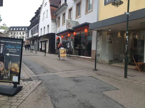
Hellas
Restaurant · Greek
49 Hauptstraße, Weinheim
Tu-Fr 11:30-14:30,17:30-23:00; Sa 17:00-23:00; Su 12:00-15:00,17:00-23:00
Knuspergockel im Eulenspiegel
Restaurant · Chicken · 0.6 km
21 Lindenstraße, Weinheim
We,Th 17:00-22:30, Fr,Sa 17:00-00:00


Lotus Restaurant
Restaurant · Asian, Sushi, Vietnamese · 0.6 km
23 Mannheimer Straße, Weinheim
Tu-Sa 11:00-15:00,17:00-22:30; Su 12:00-15:00,17:00-22:30
100 more on the map.
Where to stay7
Churches and places of worship12
Peterskirche
Church · Protestant · 0.8 km
114 Grundelbachstraße, Weinheim
Adventsgemeinde
Church · Seventh Day Adventist · 0.8 km
36 Friedrich-Vogler-Straße, Weinheim
Liebenzeller Gemeinde
Church · Protestant · 1.0 km
51 Nördliche Hauptstraße, Weinheim
Evangelisch-Freikirchliche Gemeinde (Baptisten)
Church · 1.6 km
2 Waidallee, Weinheim
Shopping43
Gas and EV charging29
Schools, colleges and libraries19
Healthcare12
Map of Weinheim
250 places. The map loads OpenStreetMap tiles when you open it.
Getting there and nearby towns
City-Airport Mannheim (MHG) is the nearest airport with scheduled flights listed in OpenStreetMap, 14 km away.
- Mannheim 16 km southwest, about 16 min by car
- Heidelberg 16 km south, about 16 min by car
- Ludwigshafen am Rhein 18 km southwest, about 18 min by car
- Wiesloch 28 km south, about 28 min by car
- Darmstadt 36 km north, about 36 min by car
- Mainz 56 km northwest, about 56 min by car
- Heilbronn 61 km southeast, about 1 h by car
- Offenbach 62 km north, about 1 h by car
- Frankfurt am Main 63 km north, about 1 h by car
- Karlsruhe 63 km south, about 1 h by car
Drive times are estimates from straight-line distance, not routes.
Local news
Headlines from INDB.
Reviews, tips and questions
Loading what members have shared...
Sources and licences
- GeoNames (CC BY 4.0): population, coordinates, regions and time zone
- Mapillary (see each image): photos
- OpenStreetMap contributors (ODbL 1.0): places, airports, map data
- Wikidata (CC0 1.0): elevation, founding date, time zone, website
- Wikimedia Commons (see each image): photos
- Wikipedia (CC BY-SA 4.0): overview and history text
Photo credits
- Weinheim Schlossturm 20120918, Rudolf Stricker, Attribution
- Blaustern Weinheim (DSC02538), Polibil, CC BY-SA 4.0
- Riesenlauch Weinheim (DSC02486), Polibil, CC BY-SA 4.0
- Alium Weinheim (DSC02487), Polibil, CC BY-SA 4.0
- Chinesische Pfingstrose Weinheim (DSC02489), Polibil, CC BY-SA 4.0
- Großer Fuchs Weinheim (DSC02519), Polibil, CC BY-SA 4.0
- Chinesische Pfingstrose Weinheim (DSC02494), Polibil, CC BY-SA 4.0
- Chinesische Pfingstrose Weinheim (DSC02497), Polibil, CC BY-SA 4.0
- Yulan-Magnolie Weinheim (DSC02499), Polibil, CC BY-SA 4.0
- Taglilien Knöterich Weinheim (DSC02460), Polibil, CC BY-SA 4.0
- Taglilien Knöterich Weinheim (DSC02456), Polibil, CC BY-SA 4.0
- Weinheim, Germany - panoramio (25), mroszewski, CC BY-SA 3.0
- Gestieltblättriges Schaublatt Weinheim (DSC02444), Polibil, CC BY-SA 4.0
- Bäume im Süden des Hermannshof Weinheim (DSC02443), Polibil, CC BY-SA 4.0
- UK SUBS live im Cafe Central Weinheim am 13.02.2020, Cryptorebel, CC BY-SA 4.0
- Roter Turm in Weinheim (3), Krzysztof Golik, CC BY-SA 4.0
- Roter Turm in Weinheim (1), Krzysztof Golik, CC BY-SA 4.0
- Roter Turm in Weinheim (2), Krzysztof Golik, CC BY-SA 4.0
- Weinheim, Castle - panoramio, poktomi, CC BY 3.0
- Weinheim Obertorstrasse 20120918, Rudolf Stricker, Attribution
- Weinheim Roter Turm 350 IMG 20230528 1143, Karlunun, CC BY-SA 4.0
- Weinheim Roter Turm 20120918, Rudolf Stricker, Attribution
- Weinheim Werner-Heisenberg-Gymnasium Neubau 20120909, Rudolf Stricker, Attribution
- Burg Windeck (Weinheim), Wollschaf, CC BY-SA 3.0
- Weinheim Peterskirche 20120918, Rudolf Stricker, Attribution
- Weinheim Dietrich-Bonhoeffer-Schule 20120909, Rudolf Stricker, Attribution
- Wachenburg, de:Benutzer:Wollschaf, CC BY-SA 3.0
- Weinheim Werner-Heisenberg-Gymnasium 20120909, Rudolf Stricker, Attribution
- Rathaus Lützelsachsen, Hugo4wiki, CC BY-SA 4.0
- Hirschkopfturm-1, Muck, CC BY-SA 4.0
- Weinheim - St.-Marien-Kirche, Radosław Drożdżewski (Zwiadowca21), CC BY-SA 3.0
- WeinheimSchloss2017-05-06-11-18-10, Rolf Kickuth, CC BY-SA 4.0
- Fliegen Ölweide Hermannshof (DSC02525), Polibil, CC BY-SA 4.0
- Fliegen Ölweide Hermannshof (DSC02526), Polibil, CC BY-SA 4.0
- Frosch Hermannshof (DSC02533), Polibil, CC BY-SA 4.0
- Glyzinen Hermannshof (DSC02483), Polibil, CC BY-SA 4.0
- Glyzinen Hermannshof2 (DSC02480), Polibil, CC BY-SA 4.0
- Karthäusernelke Hermannshof (DSC02464), Polibil, CC BY-SA 4.0
- Lupinen Hermannshof (DSC02511), Polibil, CC BY-SA 4.0
- Lupinen Hermannshof (DSC02512), Polibil, CC BY-SA 4.0
- Weinheim, Roter Turm - panoramio, poktomi, CC BY 3.0
- Panorama vom Hirschkopf, Jörg Braukmann, CC BY-SA 4.0
- Stolperstein Weinheim Arthur Auerbacher November 2022, TheCarnil2, CC BY-SA 4.0
- Street-level photo, robffm, CC BY-SA 4.0
- Street-level photo, ramap, CC BY-SA 4.0
- Street-level photo, Eraoniel, CC BY-SA 4.0
- Street-level photo, voschix, CC BY-SA 4.0
- Street-level photo, voschix, CC BY-SA 4.0
- Street-level photo, ramap, CC BY-SA 4.0
- Street-level photo, voschix, CC BY-SA 4.0
- Street-level photo, voschix, CC BY-SA 4.0
- Street-level photo, NorMan61, CC BY-SA 4.0
- Street-level photo, nvbwseifert, CC BY-SA 4.0
- Street-level photo, robffm, CC BY-SA 4.0
- Street-level photo, robffm, CC BY-SA 4.0
- Street-level photo, Eraoniel, CC BY-SA 4.0
- Street-level photo, ramap, CC BY-SA 4.0
- Street-level photo, wegavision, CC BY-SA 4.0
- Street-level photo, wegavision, CC BY-SA 4.0
- Street-level photo, ramap, CC BY-SA 4.0
- Street-level photo, wegavision, CC BY-SA 4.0
- Street-level photo, ramap, CC BY-SA 4.0
- Street-level photo, ramap, CC BY-SA 4.0
- Street-level photo, NorMan61, CC BY-SA 4.0
- Street-level photo, wegavision, CC BY-SA 4.0
- Street-level photo, voschix, CC BY-SA 4.0
- Street-level photo, NorMan61, CC BY-SA 4.0
- Street-level photo, veloroute_hamburg, CC BY-SA 4.0
- Street-level photo, wegavision, CC BY-SA 4.0


Page built November 8, 2026. Spotted a mistake? Tell us or suggest a place.