


Why visit Wertheim
Townapedia lists 208 museums and landmarks, 23 parks and trails, 128 places to eat, 30 places to stay and 47 attractions in and around town.
Highlights include Lebe Gesund, Roxy, Glasmuseum and Burg Wertheim.
Weather in Wertheim
Forecast from MET Norway (CC BY 4.0). Full forecast
About Wertheim
Wertheim (German pronunciation: [ˈveːɐ̯thaɪm] ; East Franconian: Wärde) is a town in southwestern Germany, in the state of Baden-Württemberg with a population of around 23,400. It is located on the confluence of the rivers Tauber and Main. Wertheim is best known for its landmark castle and medieval town centre.
From the Wikipedia article Wertheim am Main (this version), under CC BY-SA 4.0.
Travel tips from other travellers: Wertheim on Wikivoyage (CC BY-SA 4.0).
Things to do47

Lebe Gesund
Farm and orchard · 0.6 km
15 Marktplatz
Mo-We 10:00-16:00; Th-Fr 10:00-18:00; PH,Su closed; Sa 08:00-14:00




35 more on the map.
Museums and landmarks208

Glasmuseum
Museum · 0.7 km
24 Mühlenstraße, Wertheim
Tu-Fr 10:00-17:00; PH,Sa,Su 13:00-18:00; Dec 24,Dec 31 off


Schlösschen im Hofgarten
Monument and historic site · 1.7 km
30 Würzburger Straße

Kloster
Monument and historic site · 7.0 km
Cultural heritage monument D-6-77-182-10 (0) in Schollbrunn, Bavaria


Museum für ländliches Kulturgut
Museum · 5.8 km
Abteilung des Wertheimer GrafschaftsMuseums zeigt ländliches Kulturgut.


Toppels Haus - Verdrehte Welt
Monument and historic site · 5.8 km
6 Almosenberg, Wertheim
Mo-Su 10:00-19:00

196 more on the map.
Parks, trails and playgrounds23






WSV-Bettingen e.V.
Marina and boat launch · 4.6 km
Main-km 167 LU; Strom/Wasser, Dusche/WC, Slipanlage

Städtisches Freibad Wertheim-Bestenheid
Sports field and stadium · 2.4 km
25 An den Christwiesen, Wertheim

Bootsmarina Hock-Boote
Marina and boat launch · 7.5 km
Main-km 144 RU; Strom/Wasser am Steg, Dusche+WC am Campingplatz
11 more on the map.
Restaurants and cafes128
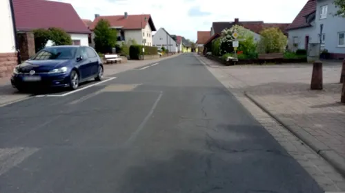

Hof-Café am Wassersteinchen
Cafe · Cake, Ice Cream, Tea, Juice, Regional · 7.0 km
Geöffnet Sonntags von Anfang April bis Ende September.
1 Wassersteinchen, Höhefeld
Su 14:00-18:00

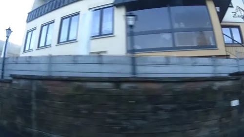
Zum Roß
Restaurant · German, Local · 1.8 km
7 Nassiger Straße
Mo-Sa 17:30-21:00; Su 11:30-13:45, 17:30-20:00
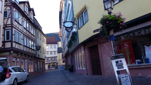

Biergarten Ankerplatz
Bar and pub · Cake, Rolls · 0.7 km
Fährgasse
Tu-Fr 15:00-22:00; Sa,Su 11:00-22:00
Chotto Dinner
Restaurant · Thai, Sushi, Vietnamese, Asian, Chinese
1 Lindenstraße, Wertheim
Mo Off; Tu-Fr 11:00-15:00, 17:00-22:00; Sa-Su 12:00-22:00
Da Barista
Cafe · Coffee Shop
12 Gerbergasse, Wertheim
Tu-Fr 09:00-17:00; Sa 09:30-18:00; Mo,Su,PH off
Die Burgermeisterei
Restaurant · Burger · 0.7 km
26 Mühlenstraße, Wertheim
Tu-Th,Su 17:00-21:30; Fr,Sa 17:00-22:30
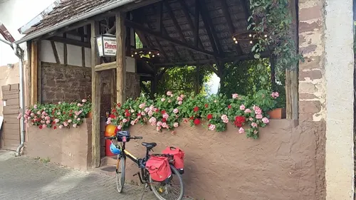
Gasthaus "Zum Löwen"
Restaurant · German · 8.2 km
1 Am Oberen Tor, Wertheim
Mo-Tu off; We-Su 11:30-14:00,17:30-21:00


Kalinski Wertheim
Restaurant · Sausage · 0.8 km
38 Eichelgasse
We-Fr 12:00-14:00, 17:00-21:30; Sa-Su 12:00-21:30
116 more on the map.
History
Wertheim was founded between the 7th and 8th century. However, the first settlement was a town called Kreuzwertheim on the right bank of the river Main. From the early 12th century onwards, a branch of the noble family of the Reginbodons called themselves after the town. After the family of the Counts of Wertheim had built a castle on the left bank of the river Main, a settlement developed at the foot of this dominating structure that was called Wertheim. It was mentioned for the first time in 779. In 1192, it was referred to as Suburbium castri Wertheim and in 1200 the town was referred to as an oppidum and in 1244 as a civitas.
Count Eberhard of Wertheim reigned from the year 1355 to 1373. In 1363 Emperor Charles IV granted him by degree the right to mint coins. The last Count of Wertheim was Michael III. He married Katharina, the oldest daughter of Ludwig of Stolberg. Michael died without producing a male heir and consequently the county passed to Ludwig of Stolberg. In 1574, after the death of Ludwig, the county passed on to his son-in-law Count Ludwig of Löwenstein.
From the History section of Wertheim am Main on Wikipedia, under CC BY-SA 4.0.
Where to stay30
Churches and places of worship54
Jakobskirche (Wehrkirche)
Church · Lutheran · 4.8 km
22 Wehrkirchstraße
katholische Kirche
Church · Catholic · 5.3 km
38 Röttbacher Straße, Kreuzwertheim
St. Margareta
Church · Roman Catholic · 8.1 km
51 Wertheimer Straße, Külsheim
Shopping32
Gas and EV charging20
Schools, colleges and libraries17
Grundschule Kreuzwertheim
School · 1.1 km
3 Philipp-Günzelmann-Weg, Kreuzwertheim
Healthcare9
Map of Wertheim
250 places. The map loads OpenStreetMap tiles when you open it.
Getting there and nearby towns
Verkehrslandeplatz Giebelstadt (GHF) is the nearest airport with scheduled flights listed in OpenStreetMap, 35 km away.
- Kreuzwertheim 1 km northeast, about 1 min by car
- Würzburg 32 km east, about 32 min by car
- Darmstadt 63 km west, about 1 h by car
- Offenbach 65 km northwest, about 1 h by car
- Frankfurt am Main 71 km northwest, about 1 h 15 min by car
- Heidelberg 71 km southwest, about 1 h 15 min by car
- Heilbronn 72 km south, about 1 h 15 min by car
- Wiesloch 78 km southwest, about 1 h 15 min by car
- Mannheim 81 km west, about 1 h 15 min by car
- Ludwigshafen am Rhein 83 km west, about 1 h 30 min by car
Drive times are estimates from straight-line distance, not routes.
Local news
Headlines from INDB.
Reviews, tips and questions
Loading what members have shared...
Sources and licences
- GeoNames (CC BY 4.0): population, coordinates, regions and time zone
- Mapillary (see each image): photos
- OpenStreetMap contributors (ODbL 1.0): places, airports, map data
- Wikidata (CC0 1.0): elevation, founding date, time zone, website, landmarks and historic places
- Wikimedia Commons (see each image): photos
- Wikipedia (CC BY-SA 4.0): overview and history text
Photo credits
- Wertheim Aerial fg217, Fritz Geller-Grimm supported by Rüdiger Wandke, CC BY-SA 3.0
- Gemeinschaftsschule Wertheim mit Grundschule, FrauPfenning, CC BY-SA 4.0
- WW1 memorial Wertheim 2, Granpar, CC BY 3.0
- WW1 memorial Wertheim 3, Granpar, CC BY 3.0
- WW1 memorial Wertheim 1, Granpar, CC BY 3.0
- Franco-Prussian war memorial Wertheim 2, Granpar, CC BY 3.0
- GMS Wertheim mit Grundschule, FrauPfenning, CC BY-SA 4.0
- Franco-Prussian war memorial Wertheim 3, Granpar, CC BY 3.0
- Franco-Prussian war memorial Wertheim 1, Granpar, CC BY 3.0
- Kriegsgräberfeld Friedhof Wertheim, Granpar, CC BY 3.0
- Kriegsgräberstätte Wertheim, Grabstein 3, Granpar, CC BY 3.0
- Kriegsgräberstätte Wertheim, Grabstein 1, Granpar, CC BY 3.0
- Kriegsgräberstätte Wertheim, Grabstein 2, Granpar, CC BY 3.0
- Kriegsgräberfeld Friedhof Wertheim--1, Granpar, CC BY 3.0
- Namenstafel Kriegerdenkmal WW2 Wertheim 2, Granpar, CC BY 3.0
- Namenstafel Kriegerdenkmal WW2 Wertheim 4, Granpar, CC BY 3.0
- Namenstafel Kriegerdenkmal WW2 Wertheim 6, Granpar, CC BY 3.0
- Namenstafel Kriegerdenkmal WW2 Wertheim 5, Granpar, CC BY 3.0
- Namenstafel Kriegerdenkmal WW2 Wertheim 1, Granpar, CC BY 3.0
- Namenstafel Kriegerdenkmal WW2 Wertheim 3, Granpar, CC BY 3.0
- Wertheim WW2 memorial + war graves, Granpar, CC BY 3.0
- St. Venantius, Wertheim, Nave 20160802 1, DXR, CC BY-SA 4.0
- St. Venantius, Wertheim, Nave 20160802 2, DXR, CC BY-SA 4.0
- St. Venantius, Wertheim, Nave Towards Organ 20160802 3, DXR, CC BY-SA 4.0
- St. Venantius, Wertheim, 360 Panorama view 20160802 4, DXR, CC BY-SA 4.0
- Sankt Venantius Wertheim, Dem Zwickelbert sei Frau, Public domain
- Sender Wertheim 03062015 1, Zonk43, CC BY-SA 3.0
- Stolperstein Wertheim - Bahnhofstraße 4 - Sophie Brückheimer, Stolpersteineuploader, CC0
- Stolperstein Wertheim - Bahnhofstraße 4 - Hilda Brückheimer, Stolpersteineuploader, CC0
- Stolperstein Wertheim - Bahnhofstraße 4 - Hedwig Brückheimer, Stolpersteineuploader, CC0
- Stolperstein Wertheim - Bahnhofstraße 4 - Selma Brückheimer, Stolpersteineuploader, CC0
- 628 in Minttürkis im Bahnhof Wertheim, Blickrichtung Aschaffenburg, HerrLevin, CC0
- 628 in Minttürkis im Bahnhof Wertheim, Blickrichtung Crailsheim, HerrLevin, CC0
- Wertheim Tauber, Tilman AB, Public domain
- Over the roofs of Wertheim. - panoramio, More pics than views…, CC BY 3.0
- Kartause Grünau with fish pond, Drow69, CC BY-SA 4.0
- Gartenstraße 11 Triefenstein, Homburg am Main 20180728 001, Tilman2007, CC BY-SA 4.0
- Burg Wertheim 0998, Agricolax, CC BY-SA 4.0
- GesamtansichtDBGL1010822 (4), Oktobersonne, CC BY-SA 4.0
- Glasmuseum Wertheim, User: GDelhey, CC BY-SA 3.0
- Museo-01 Grafschaftsmuseum Wertheim, Kalif Storch, CC BY 3.0
- Die Jakobskirche in Urphar diente im Mittelalter auch als Wehrkirche. 07, Holger Uwe Schmitt, CC BY-SA 4.0
- Spitzer Turm Wertheim Nahansicht, Felix König, CC BY 3.0
- 2011 Maintal 040 Bettingbergtunnel Osteingang, Steffen 962, CC0
- Michelrieth Michaelskirche 001, Tilman2007, CC BY-SA 3.0
- Kreuzwertheim Kreuzkirche 005, Tilman2007, CC BY-SA 3.0
- Blick vom NSG Leidenrain über die Mainschleife zum Himmelreich, H. Beierstettel, CC BY-SA 4.0
- Schlösschen im Hofgarten, Stefan Rudorfer, CC BY-SA 3.0
- 2022-02-01 Wertheim Village Geschäfte 8, Triplec85, CC BY-SA 4.0
- Berufliches Schulzentrum Wertheim, The.JaKu, CC BY-SA 3.0
- Comenius Realschule Wertheim, The.JaKu, CC BY-SA 3.0
- Wertheim, Mainplatz 8, Maintor-20161223-002, Tilman2007, CC BY-SA 4.0
- Schulgasse 1 Wertheim 20190324 001, Tilman2007, CC BY-SA 4.0
- Wertheim, Ev. Stadtpfarrkirche von Osten-20161101-002, Tilman2007, CC BY-SA 4.0
- Tauberfranken 2010 045, Klaus Graf, CC BY 3.0
- Kloster Bronnbach, Wirtschaftsgebäude, Museumsscheune (ehem. Fruchtscheune) und Gästehaus Bursariat, Xocolatl ( talk ) 09:50, 30 May 2013 (UTC), CC BY-SA 3.0
- Toppelshaus 001 (Wertheim), Hans-Jürgen Neubert, CC BY 4.0
- Wartturm (Wertheim)-01, Muck, CC BY-SA 4.0
- Naturschutzgebiet Grohberg 02, Bernd Flicker, CC BY-SA 3.0
- Bronnbach Gasthaus, Xocolatl ( talk ) 10:18, 30 May 2013 (UTC), CC BY-SA 3.0
- Bronnbach Bursariat, Xocolatl ( talk ) 09:48, 30 May 2013 (UTC), CC BY-SA 3.0
- Auferstehungskirche (Nassig) 07, Triplec85, CC BY-SA 4.0
- St. Margareta in Hundheim, Triplec85, CC0
- Friedenskirche Sonderriet Rückansicht 1, Triplec85, CC0
- BW-kloster-bronnbach-kirche-1, Bgabel, CC BY-SA 3.0
- HoherBergAltenbuchSpessart, Shawn Steinfeger, CC0
- Städtisches Freibad Wertheim-Bestenheid Eingangsbereich, The.JaKu, CC BY-SA 3.0
- Street-level photo, mlh2018, CC BY-SA 4.0
- Street-level photo, ramap, CC BY-SA 4.0
- Street-level photo, bernd_niemann, CC BY-SA 4.0
- Street-level photo, mjacke, CC BY-SA 4.0
- Street-level photo, mjacke, CC BY-SA 4.0
- Street-level photo, bernd_niemann, CC BY-SA 4.0
- Street-level photo, chuck, CC BY-SA 4.0
- Street-level photo, changchun1, CC BY-SA 4.0
- Street-level photo, Felix23, CC BY-SA 4.0
- Street-level photo, mlh2018, CC BY-SA 4.0
- Street-level photo, chuck, CC BY-SA 4.0
- Street-level photo, changchun1, CC BY-SA 4.0
- Street-level photo, ramap, CC BY-SA 4.0
- Street-level photo, ramap, CC BY-SA 4.0
- Street-level photo, gevau, CC BY-SA 4.0
- Street-level photo, changchun1, CC BY-SA 4.0
- Street-level photo, mjacke, CC BY-SA 4.0
- Street-level photo, mjacke, CC BY-SA 4.0
- Street-level photo, chuck, CC BY-SA 4.0
- Street-level photo, mlh2018, CC BY-SA 4.0
- Street-level photo, mlh2018, CC BY-SA 4.0


Page built November 8, 2026. Spotted a mistake? Tell us or suggest a place.