


Why visit Wolfratshausen
Townapedia lists 57 museums and landmarks, 10 parks and trails, 67 places to eat, 5 places to stay and 7 attractions in and around town.
Highlights include Kinocenter Wolfratshausen, Burlein-Hof, Erinnerungsort Badehaus and Museum Wolfratshausen.
Weather in Wolfratshausen
Forecast from MET Norway (CC BY 4.0). Full forecast
About Wolfratshausen
Wolfratshausen (German pronunciation: [vɔlfʁaːtsˈhaʊzn̩] ) is a town of the district of Bad Tölz-Wolfratshausen, located in Bavaria, Germany. The town had a population of 19,033 as of 31 December 2019.
From the Wikipedia article Wolfratshausen (this version), under CC BY-SA 4.0.
Travel tips from other travellers: Wolfratshausen on Wikivoyage (CC BY-SA 4.0).
Things to do7


Burlein-Hof
Farm and orchard · 3.0 km
17 Dorfstraße, Icking
Fr 09:00-12:30,13:30-17:00



Museums and landmarks57

Erinnerungsort Badehaus
Museum · 2.2 km
Place of remembrance of camp for displaced persons in Wolfratshausen, Bavaria, Germany
1 Kolpingplatz, Wolfratshausen
Fr 09:00-17:00; Sa,Su 13:00-17:00

Museum Wolfratshausen
Museum
10 Untermarkt, Wolfratshausen
Mo,Tu off; We,Fr,Sa 10:00-16:00; Th 10:00-17:00; Su 14:00-17:00;...


1. Stationskapelle (Kalvarienberg)
Monument and historic site · Catholic
Passionsszene: Abschied Christi von Maria

2. Stationskapelle (Kalvarienberg)
Monument and historic site · Catholic
Passionsszene: Christus am Ölberg

3. Stationskapelle (Kalvarienberg)
Monument and historic site · Catholic
Passionsszenen: Geißelung Christi

4. Stationskapelle (Kalvarienberg)
Monument and historic site · Catholic
Passionsszene: Dornenkrönung

5. Stationskapelle (Kalvarienberg)
Monument and historic site · Catholic
Passionsszene: Kreuztragung Christi

6. Stationskapelle (Kalvarienberg)
Monument and historic site · Catholic
Passionsszene: Beweinung Christi; Heiliges Grab
Berggasse
Monument and historic site
Schöne alte Gasse mit vielen alten historischen Häusern
45 more on the map.
Parks, trails and playgrounds10




Restaurants and cafes67


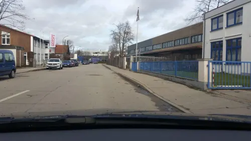
Bharat
Restaurant · Indian · 0.8 km
14 Hans-Urmiller-Ring, Wolfratshausen
Mo-Sa 11:30-14:00, 17:30-23:00; Su, PH 12:00-23:00

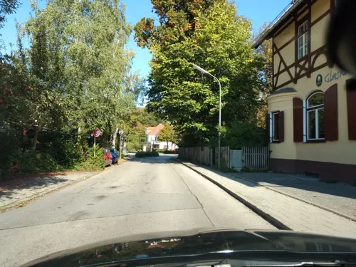
Joji – Asian Fusion & Sushi Bar
Restaurant · Asian
1 Geltinger Straße, Wolfratshausen
Mo-Su 11:30-14:30,17:30-22:30
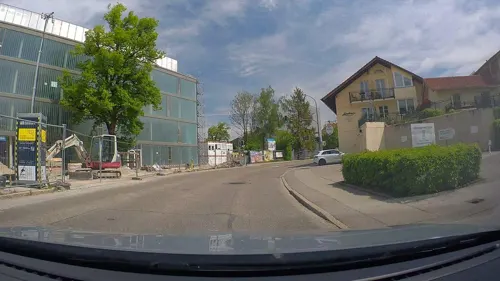
Restaurant Zum Bergkramerhof
Restaurant · Regional, German · 1.6 km
1 Bergkramerhof, Wolfratshausen
Mo-Su 10:00-21:30
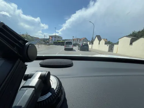


Sokrates
Restaurant · Greek · 1.0 km
2 Äußere Sauerlacher Straße, Wolfratshausen
Mo-Sa 11:00-15:00,17:00-24:00; Su 11:00-24:00

Wirtshaus Flößerei
Restaurant · Bavarian
1 Sebastiani Steg, Wolfratshausen
Mo-Fr 11:00-23:00; PH,Sa,Su 10:00-23:00
Zum Grillmeister
Restaurant · Pizza, Burger · 1.2 km
29 Kräuterstraße, Wolfratshausen
Tu-Su,PH 11:30-14:00,17:30-22:00; Mo off
55 more on the map.
History
The first mention of "Wolveradeshusun" appears in documents from the year 1003. About 100 years later, Otto II, the Graf of Deißen-Andechs, built a castle on a hill overlooking the valley. The castle was destroyed on 7 April 1734 when lightning struck the tower where gunpowder was stored. Stones from the ruins were transported to Munich where they were used to build the Residenz.
From 1280 the town was designated a market town. In 1286, Conrad Nantwein, a pilgrim from Northern Germany, was arrested and burned at the stake in Wolfratshausen. Pope Boniface VIII canonized Nantwein as St. Nantovinus in 1297.
By the 15th century, the Loisach and Isar rivers were used for water transport, especially logging. River travel continued and rafts operated between Wolfratshausen and Munich. Following the war, the labour camp was used as a displaced persons camp by the Allies. In 1957, Föhrenwald was transformed into a suburb of Wolfratshausen and renamed Waldram, to honour the Lord of Münsing who was one of the founders of the Benediktbeuern Abbey.
In July 1983, Croatian emigre businessman Stjepan Đureković was assassinated by UDBA agents in Wolfratshausen.
Wolfratshausen was formerly the seat of the district government, but this moved to Bad Tölz in 1972.
From the History section of Wolfratshausen on Wikipedia, under CC BY-SA 4.0.
Where to stay5
Hotel Märchenwald Garni
Motel and hotel · 1.3 km
37 Kräuterstraße, Wolfratshausen
Churches and places of worship16
Christliche Gemeinde Wolfratshausen
Church · Evangelical · 1.2 km
14 d Geltinger Straße, Wolfratshausen
St. Johannes der Täufer
Church · Roman Catholic · 1.3 km
6 Wolfratshauser Straße, Icking
St. Josef der Arbeiter
Church · Roman Catholic · 2.3 km
34 Steinstraße, Wolfratshausen
Shopping23
Gas and EV charging12
Schools, colleges and libraries10
Healthcare5
Map of Wolfratshausen
212 places. The map loads OpenStreetMap tiles when you open it.
Getting there and nearby towns
Sonderflughafen Oberpfaffenhofen (OBF) is the nearest airport with scheduled flights listed in OpenStreetMap, 21 km away.
- Icking 4 km north, about 4 min by car
- Münsing 4 km west, about 4 min by car
- Egling 6 km east, about 6 min by car
- Eurasburg 7 km south, about 7 min by car
- Geretsried 8 km southeast, about 8 min by car
- Schäftlarn 9 km north, about 9 min by car
- Tutzing 11 km west, about 11 min by car
- Munich 27 km northeast, about 27 min by car
- Augsburg 64 km northwest, about 1 h by car
- Wolnzach 78 km north, about 1 h 15 min by car
Drive times are estimates from straight-line distance, not routes.
Local news
Headlines from INDB.
Reviews, tips and questions
Loading what members have shared...
Sources and licences
- GeoNames (CC BY 4.0): population, coordinates, regions and time zone
- Mapillary (see each image): photos
- OpenStreetMap contributors (ODbL 1.0): places, airports, map data
- Wikidata (CC0 1.0): elevation, founding date, time zone, website
- Wikimedia Commons (see each image): photos
- Wikipedia (CC BY-SA 4.0): overview and history text
Photo credits
- Altstadt Wolfratshausen vom Loisach-Ostuferpark, Ricardalovesmonuments, CC BY-SA 4.0
- Stadtbücherei Wolfratshausen, Лорд Бъмбъри, CC BY-SA 3.0
- St. Andreas Wolfratshausen vom Loisach-Ostuferpark, Ricardalovesmonuments, CC BY-SA 4.0
- 2021-09-25 Wolfratshausen 50 Jahre Abitur Waldram 01, Burkhard Mücke, CC BY-SA 4.0
- 2021-09-25 Wolfratshausen 50 Jahre Abitur Waldram 04, Burkhard Mücke, CC BY-SA 4.0
- Sauerlacher Straße 10 Wolfratshausen 1, Ricardalovesmonuments, CC BY-SA 4.0
- Sauerlacher Straße 10 Wolfratshausen 2, Ricardalovesmonuments, CC BY-SA 4.0
- Wolfratshausen, Germany - panoramio, Foto Fitti, CC BY-SA 3.0
- Wegkreuz vor Am Wasen 3 Wolfratshausen, Ricardalovesmonuments, CC BY-SA 4.0
- Königsdorfer Straße 2 (Wolfratshausen) 2, Ricardalovesmonuments, CC BY-SA 4.0
- Königsdorfer Straße 2 (Wolfratshausen) 5, Ricardalovesmonuments, CC BY-SA 4.0
- Sauerlacher Straße 16 Wolfratshausen 2, Ricardalovesmonuments, CC BY-SA 4.0
- Königsdorfer Straße 2 (Wolfratshausen) 1, Ricardalovesmonuments, CC BY-SA 4.0
- Königsdorfer Straße 2 (Wolfratshausen) 1+2, File:Königsdorfer Straße 2 (Wolfratshausen) 1.jpg : Ricardalovesmonuments File:Königsdorfer Straße 2 (Wolfratshausen) 2.jpg : Ricardalovesmonuments derivative work: Georgfotoart, CC BY-SA 3.0
- Sauerlacher Straße 18 Wolfratshausen 2, Ricardalovesmonuments, CC BY-SA 4.0
- Wolfratshausen StAndreas Loisach Maypole 113, Jacquesverlaeken, CC BY-SA 4.0
- Wirtshaus Flößerei in Wolfratshausen - panoramio, Walter Berg, CC BY 3.0
- Winterwanderung, Wolfratshausen, 3 mit dem "Sporty Dancer" - panoramio, Walter Berg, CC BY 3.0
- 19.09.2010. Wolfratshausen - panoramio - Sandor Bordas, Sandor Bordas, CC BY-SA 3.0
- Josef-Bromberger-Weg 1 Wolfratshausen, Ricardalovesmonuments, CC BY-SA 4.0
- Sauerlacher Straße 18 Wolfratshausen 1, Ricardalovesmonuments, CC BY-SA 4.0
- Königsdorfer Straße 2 (Wolfratshausen) 3, Ricardalovesmonuments, CC BY-SA 4.0
- Königsdorfer Straße 2 (Wolfratshausen) 4, Ricardalovesmonuments, CC BY-SA 4.0
- Sauerlacher Straße 16 Wolfratshausen 1, Ricardalovesmonuments, CC BY-SA 4.0
- Winterwanderung, Wolfratshausen, 4 - panoramio, Walter Berg, CC BY 3.0
- Wolfrathshausen (i.e. Wolfratshausen), Upper Bavaria, Germany, Photochrom Print Collection, Public domain
- St. Michael (Wolfratshausen) 2, Ricardalovesmonuments, CC BY-SA 4.0
- St. Michael (Wolfratshausen) 4, Ricardalovesmonuments, CC BY-SA 4.0
- St. Michael (Wolfratshausen) 3, Ricardalovesmonuments, CC BY-SA 4.0
- St. Michael (Wolfratshausen) 1, Ricardalovesmonuments, CC BY-SA 4.0
- Districtkrankenhaus in Wolfratshausen, Лорд Бъмбъри, CC BY 4.0
- Am Loisachufer in Wolfratshausen - panoramio, Walter Berg, CC BY 3.0
- Kriegerdenkmal St. Michael (Wolfratshausen), Wikitarisch, CC BY 4.0
- Sebastianisteg in Wolfratshausen, 2023, Lantus, CC BY-SA 3.0
- Badehaus Mahnblume 2021, Justine Bittner, Fotografin aus Geretsried, CC BY-SA 4.0
- St. Georg Puppling-2, Gras-Ober, CC BY-SA 3.0
- Gelting St. Benedikt-GO-1, Gras-Ober, CC BY-SA 3.0
- Bahnhofstr. 2 St. Michael Wolfratshausen-1, Rufus46, CC BY-SA 3.0
- Hl. Dreifaltigkeit Wolfratshausen-1, Rufus46, CC BY-SA 3.0
- Frauenkapelle Wolfratshausen-1, Rufus46, CC BY-SA 3.0
- Obermarkt 2 Wolfratshausen 3, Edelmauswaldgeist, CC0
- Kirche St Nantwein Wolfratshausen, Gras-Ober ( talk ), CC BY-SA 3.0
- Kapelle Weidach Wolfratshausen-1, Rufus46, CC BY-SA 3.0
- St. Johannes Baptist (Dorfen, Icking), Ricardalovesmonuments, CC BY-SA 4.0
- Höhenrain, die Herz Jesu Kirche foto5 2012-08-17 13.02, Michielverbeek, CC BY-SA 3.0
- Kinocenter, Лорд Бъмбъри, CC BY-SA 3.0
- Museum Wolfratshausen, Stefan Karl, CC BY-SA 4.0
- Riemerschmidpark in January 2021, Yoashca, CC BY-SA 4.0
- Kalvarienberg WOR 2 - Erste Kapelle - 2021-07-23 - 135a, Martinus KE, CC BY-SA 4.0
- Kalvarienberg WOR 3 - Zweite Kapelle - 2021-07-23 - 115b, Martinus KE, CC BY-SA 4.0
- Kalvarienberg Kapellenhaeuschen Wolfratshausen-2, Rufus46, CC BY-SA 3.0
- Kalvarienberg Kapellenhaeuschen Wolfratshausen-1, Rufus46, CC BY-SA 3.0
- Kalvarienberg WOR 6 - Fünfte Kapelle - 2021-07-23 - 100b, Martinus KE, CC BY-SA 4.0
- Dreifaltigkeitskapelle Wolfratshausen 2, Ricardalovesmonuments, CC BY-SA 4.0
- Kalvarienberg WOR 1 - Frauenkapelle - 2008-03-23 - 271b, Martinus KE, CC BY-SA 4.0
- Die Dorfener Höhe - panoramio, Walter Berg, CC BY 3.0
- A rare lock-down pleasure live music at Kulturbühne Hinterhalt near Munich, Germany (51035077157), Ralf Steinberger from Milan, Berlin + Munich, Italy + Germany, CC BY 2.0
- Street-level photo, alpe374, CC BY-SA 4.0
- Street-level photo, schwartzks, CC BY-SA 4.0
- Street-level photo, schwartzks, CC BY-SA 4.0
- Street-level photo, alpe374, CC BY-SA 4.0
- Street-level photo, lin_wang, CC BY-SA 4.0
- Street-level photo, softbiker, CC BY-SA 4.0
- Street-level photo, poxonline, CC BY-SA 4.0
- Street-level photo, meskalin, CC BY-SA 4.0
- Street-level photo, schwartzks, CC BY-SA 4.0
- Street-level photo, schwartzks, CC BY-SA 4.0
- Street-level photo, schwartzks, CC BY-SA 4.0
- Street-level photo, poxonline, CC BY-SA 4.0
- Street-level photo, heilbron, CC BY-SA 4.0
- Street-level photo, heilbron, CC BY-SA 4.0
- Street-level photo, schwartzks, CC BY-SA 4.0
- Street-level photo, heilbron, CC BY-SA 4.0
- Street-level photo, schwartzks, CC BY-SA 4.0
- Street-level photo, lin_wang, CC BY-SA 4.0
- Street-level photo, schwartzks, CC BY-SA 4.0
- Street-level photo, alpe374, CC BY-SA 4.0
- Street-level photo, lin_wang, CC BY-SA 4.0


Page built November 8, 2026. Spotted a mistake? Tell us or suggest a place.