


Wuppertal, Germany
Wuppertal is a city of 360,797 people in North Rhine-Westphalia, Germany, founded in 1929.
Why visit Wuppertal
Townapedia lists 116 museums and landmarks, 24 parks and trails, 268 places to eat, 10 places to stay and 23 attractions in and around town.
Highlights include Elisenturm, Rex Filmtheater, Von der Heydt-Museum and Stadthalle.
Weather in Wuppertal
Forecast from MET Norway (CC BY 4.0). Full forecast
About Wuppertal
Wuppertal (German pronunciation: [ˈvʊpɐtaːl] ; lit. 'Wupper Dale') is a city in North Rhine-Westphalia, in western Germany, with a population of 355,000. Wuppertal is the seventh-largest city in North Rhine-Westphalia and 17th-largest in Germany. It was founded in 1929 by the merger of Elberfeld, Barmen, Ronsdorf, Cronenberg and Vohwinkel, and was initially called "Barmen-Elberfeld" before adopting its present name in 1930. It is the capital and largest city of the Bergisches Land.
From the Wikipedia article Wuppertal (this version), under CC BY-SA 4.0.
Travel tips from other travellers: Wuppertal on Wikivoyage (CC BY-SA 4.0).
Things to do23

Elisenturm
Scenic view · 1.0 km
Turm geöffnet bei schönem Wetter, Sonntags von Mai-Okt, 15-17 Uhr (Stand 10-2017)
1a Elisenhöhe, Wuppertal


CinemaxX Wuppertal
Cinema and theater
250 Bundesallee, Wuppertal
Mo-We 13:45-20:30; Th,Fr 13:45-23:15; Su 11:15-20:30; Sa 11:15-23:15

Kohlfurther Bridge
Bridge · 7.7 km
Bridge in Wuppertal – Kohlfurth / , Solingen – Kohlfurth


Opernhaus Wuppertal
Cinema and theater · 3.4 km
Opera house and theatre in Barmen, Wuppertal, Germany

Schauspielhaus Wuppertal
Cinema and theater · 0.6 km
Former municipal drama theatre in Elberfeld, Wuppertal, Germany

Teo Otto Theater
Cinema and theater · 8.7 km
Theatre in Remscheid, Germany

Thalia-Theater
Cinema and theater
Former theatre in Elberfeld, Wuppertal, Germany

Theater in Cronenberg
Cinema and theater · 5.7 km
Theatre in Cronenberg, Wuppertal, Germany

Wuppertal Schwebebahn
Monument and historic site · 2.6 km
Suspension railway in Wuppertal, Germany
11 more on the map.
Museums and landmarks116

Von der Heydt-Museum
Museum
Art museum in Wuppertal, Germany
8 Turmhof, Wuppertal
Mo off; Tu,We 11:00-18:00; Th 11:00-20:00; Fr-Su,PH 11:00-18:00


Palais Meckel
Monument and historic site · Roman Catholic · 0.6 km
15 Friedrich-Ebert-Straße, Wuppertal


Bahnhof Wuppertal-Mirke
Monument and historic site · 1.2 km
48 Mirker Straße, Wuppertal

Haus Daniel von der Heydt
Monument and historic site
13 Friedrich-Ebert-Straße, Wuppertal


Villa Frowein
Monument and historic site · 1.1 km
2 Briller Straße, Wuppertal



104 more on the map.
Parks, trails and playgrounds24






12 more on the map.
Restaurants and cafes268


Xafé Wuppertal - Ihr Cafe im Luisenviertel
Cafe · Cafe, Breakfast · 0.7 km
Wir sind ein Café & Brunch-Lokal in modernem Ambiente und bieten Dir eine große Auswahl an Frühstück, homemade Kuchen & Gebäck, belegten...
39 Friedrich-Ebert-Straße, Wuppertal
Mo-Fr 08:30-18:00; Sa 09:00-18:00; Su 10:00-18:00

Amalfi
Restaurant · Italian · 0.6 km
Laurentiusplatz, Wuppertal
Mo-Th 17:00-22:00; Fr,Sa 17:00-23:00; Su,PH off
Atelier
Restaurant · Regional, Sandwich
51 Hofaue, Wuppertal
Mo-We,Fr 16:00-22:00+; Su 10:00-14:00; Sa 10:00-22:00+; Th 12:00-22:00+
Backwerk
Bakery
24 Schwanenstraße, Wuppertal
Mo-Fr 05:45-18:00; Sa 08:00-17:00; Su,PH off; 2026 May 18-2026 Jun 09 off
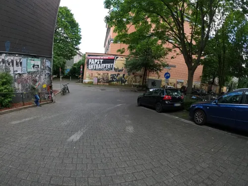
Bernhard - Soulfood & Drinks
Restaurant · Curry · 0.6 km
72 Luisenstraße, Wuppertal
Mo-Th 12:00-15:00; Fr,Sa 12:00-15:00,18:00-22:00; PH,Su off
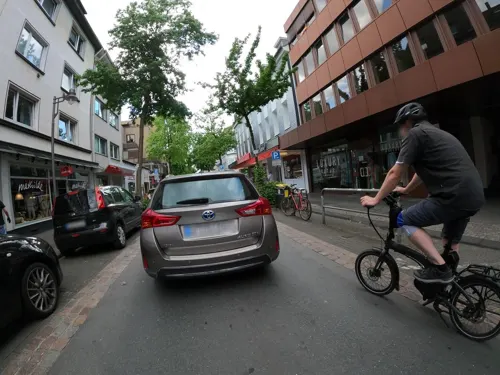
Bistro Kaufmann
Restaurant · German · 0.8 km
46 Friedrich-Ebert-Straße, Wuppertal
Mo-Fr 10:00-18:00; Sa 10:00-16:00; Su,PH off
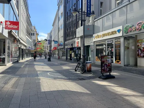
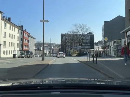


Delhi-Roma
Restaurant · Indian · 0.7 km
37 Friedrich-Ebert-Straße, Wuppertal
Tu-Fr 11:30-14:00,17:00-23:00; Sa 12:00-23:00; PH,Su 16:00-23:00
256 more on the map.
History
Wuppertal in its present borders was formed in 1929 by merging the industrial cities of Barmen and Elberfeld along with the communities of Vohwinkel, Ronsdorf, Cronenberg, Langerfeld and Beyenburg. The initial name Barmen-Elberfeld was changed in a 1930 referendum to Wuppertal ("Wupper Valley"). The new city was administered as part of Prussia's Rhine Province.
Uniquely for Germany, it is a "linear city", owing to the steep hillsides along the river Wupper. Its highest hill is the Lichtscheid, which is 351 m (1,152 ft) above sea level. The dominant urban centres Elberfeld (historic commercial centre) and Barmen (more industrial) have formed a continuous urbanized area since 1850. During the succeeding decades, "Wupper-Town" became the dominant industrial agglomeration of northwestern Germany. During the 20th century, this conurbation had been surpassed by Cologne, Düsseldorf and the Ruhr area, all with a more favourable topography.
From the History section of Wuppertal on Wikipedia, under CC BY-SA 4.0.
Where to stay10
Churches and places of worship33
Sankt Suitbertus
Church · Roman Catholic · 0.7 km
10 Kölner Straße, Wuppertal
St. Marien Kirche
Church · Roman Catholic · 0.7 km
1 Wortmannstraße, Wuppertal
Shopping62
Gas and EV charging4
Schools, colleges and libraries29
Healthcare16
Map of Wuppertal
250 places. The map loads OpenStreetMap tiles when you open it.
Getting there and nearby towns
Flughafen Essen-Mülheim (ESS) is the nearest airport with scheduled flights listed in OpenStreetMap, 22 km away.
- Wülfrath 8 km west, about 8 min by car
- Remscheid 9 km south, about 9 min by car
- Solingen 10 km southwest, about 10 min by car
- Gruiten 10 km southwest, about 10 min by car
- Schwelm 11 km east, about 11 min by car
- Velbert 11 km northwest, about 11 min by car
- Haan 12 km southwest, about 12 min by car
- Mettmann 12 km west, about 12 min by car
- Sprockhövel 12 km northeast, about 12 min by car
- Köln 38 km south, about 38 min by car
Drive times are estimates from straight-line distance, not routes.
Local news
Headlines from INDB.
Reviews, tips and questions
Loading what members have shared...
Sources and licences
- GeoNames (CC BY 4.0): population, coordinates, regions and time zone
- Mapillary (see each image): photos
- OpenStreetMap contributors (ODbL 1.0): places, airports, map data
- Wikidata (CC0 1.0): elevation, founding date, time zone, website, landmarks and historic places
- Wikimedia Commons (see each image): photos
- Wikipedia (CC BY-SA 4.0): overview and history text
Photo credits
- Wuppertal ansicht, JensD, CC BY-SA 3.0
- Wuppertal, Stadthalle in der Morgensonne 2017-07-13, Martinus KE, CC BY-SA 4.0
- Wuppertal Alte Freiheit 2018 031, Atamari, CC BY-SA 4.0
- Wuppertal Alte Freiheit 2018 030, Atamari, CC BY-SA 4.0
- Wuppertal City-Kirche Elberfeld 2013 049, Atamari, CC BY-SA 3.0
- Wuppertal City-Kirche Elberfeld 2013 048, Atamari, CC BY-SA 3.0
- Wuppertal City-Kirche Elberfeld 2013 047, Atamari, CC BY-SA 3.0
- Wuppertal - CityKirche Elberfeld am Kirchplatz - panoramio, Edgar El, CC BY 3.0
- Wuppertal Alte Freiheit 2018 032, Atamari, CC BY-SA 4.0
- Wuppertal Alter Markt 2018 005, Atamari, CC BY-SA 4.0
- Wuppertal Döppersberg 2018 139, Atamari, CC BY-SA 4.0
- Schwebebahnstation Hauptbahnhof Alte Freiheit 42103 Wuppertal Germany, Spudgun67, CC0
- Eugen Langen plaque Schwebebahnstation Hauptbahnhof Alte Freiheit 42103 Wuppertal Germany, Spudgun67, CC0
- Wuppertal City-Kirche Elberfeld 2013 032, Atamari, CC BY-SA 3.0
- Wuppertal City-Kirche Elberfeld 2013 027, Atamari, CC BY-SA 3.0
- Wuppertal City-Kirche Elberfeld 2013 038, Atamari, CC BY-SA 3.0
- Wuppertal City-Kirche Elberfeld 2013 029, Atamari, CC BY-SA 3.0
- Wuppertal City-Kirche Elberfeld 2013 051, Atamari, CC BY-SA 3.0
- Wuppertal City-Kirche Elberfeld 2013 037, Atamari, CC BY-SA 3.0
- Wuppertal City-Kirche Elberfeld 2013 044, Atamari, CC BY-SA 3.0
- Wuppertal City-Kirche Elberfeld 2013 033, Atamari, CC BY-SA 3.0
- Wuppertal City-Kirche Elberfeld 2013 053, Atamari, CC BY-SA 3.0
- Wuppertal City-Kirche Elberfeld 2013 052, Atamari, CC BY-SA 3.0
- Wuppertal City-Kirche Elberfeld 2013 037 (cropped), Atamari, CC BY-SA 3.0
- Wuppertal City-Kirche Elberfeld 2013 030, Atamari, CC BY-SA 3.0
- Wuppertal City-Kirche Elberfeld 2013 058, Atamari, CC BY-SA 3.0
- Wuppertal City-Kirche Elberfeld 2013 006, Atamari, CC BY-SA 3.0
- Wuppertal City-Kirche Elberfeld 2013 031, Atamari, CC BY-SA 3.0
- Wuppertal City-Kirche Elberfeld 2013 005, Atamari, CC BY-SA 3.0
- Wuppertal City-Kirche Elberfeld 2013 028, Atamari, CC BY-SA 3.0
- 2015.09.26.124322 Schwebebahn Wuppertal-Elberfeld, Hermann Luyken, CC0
- 2015.09.26.124323 Schwebebahn Wuppertal-Elberfeld, Hermann Luyken, CC0
- Wuppertal Alte Freiheit 2018 029, Atamari, CC BY-SA 4.0
- 2015.09.26.124315 Schwebebahn Wuppertal-Elberfeld, Hermann Luyken, CC0
- Wuppertal City-Kirche Elberfeld 2013 061, Atamari, CC BY-SA 3.0
- Wuppertal City-Kirche Elberfeld 2013 059, Atamari, CC BY-SA 3.0
- Wuppertal City-Kirche Elberfeld 2013 050, Atamari, CC BY-SA 3.0
- Kohlfurther Brücke 04 ies, Frank Vincentz, CC BY-SA 3.0
- Legobrücke Wuppertal 1, Morty, CC BY-SA 3.0
- Solingen -- Müngstener Brücke (10403938084), InterCityImpress, CC BY-SA 2.0
- Wuppertal Friedrich-Engels-Allee 2013 001, Atamari, CC BY-SA 3.0
- GER Wuppertal, Schauspielhaus 005, -wuppertaler, CC BY 4.0
- RS-Theo-Otto-Theater, Michael Kramer, CC BY-SA 3.0
- Wuppertal Thalia-Theater 1, The original uploader was Pitichinaccio at German Wikipedia . ( Original text: unbekannt/ de:Benutzer:Pitichinaccio ), Public domain
- Wuppertal Borner Str 0004, Atamari, CC BY-SA 3.0
- WikiCon 2019 by Einsamer Schütze 06, Ronny Ueckermann, CC BY-SA 4.0
- Wuppertal vdheydtmuseum, Fotograf: Daniel Jünger, CC BY-SA 3.0
- Empfangsgebäude Zoo Wuppertal, Norbert Sdunzik, CC BY-SA 3.0
- Uni Wuppertal (Atamari)-2, Atamari, CC BY-SA 2.5
- Wuppertal Hardt 0142, Atamari, CC BY-SA 3.0
- Wuppertal Platz am Kolk 0013, Atamari, CC BY-SA 3.0
- Alte Reformierte Kirche Elberfeld retouched, Ökologix, CC BY-SA 3.0 de
- Judfriedhof-engelnberg, A.Savin, CC BY-SA 3.0
- Wuppertal Islandufer 0010, Atamari, CC BY-SA 3.0
- Wuppertal Mirker Bahnhof 0032, Atamari, CC BY-SA 3.0
- Wuppertal Wolkenburg 0001, Atamari, CC BY-SA 3.0
- Wuppertal Islandufer 0102, Atamari, CC BY-SA 3.0
- Deweerthscher Garten2, Ticketautomat at German Wikipedia ( Original text: de:Benutzer:Ticketautomat ), Public domain
- Wuppertal Willy-Brandt-Platz 2007 018, Atamari, CC BY-SA 4.0
- Wuppertal Hardt 2014 015, Atamari, CC BY-SA 3.0
- Wuppertal Sankt Suitbertus, Pitichinaccio, Public domain
- Friedhofskirche Wuppertal, No machine-readable author provided. Thomas Wtal assumed (based on copyright claims)., CC BY-SA 2.5
- Wuppertal laurentiuskirche, Fotograf: Daniel Jünger, CC BY-SA 3.0
- Wuppertal Platz der Republik 0023, Atamari, CC BY-SA 3.0
- Wuppertal Laurentiusplatz 0006, Atamari, CC BY-SA 3.0
- Wuppertal Hardt 0185, Atamari, CC BY-SA 3.0
- Wuppertal Friedrich-Ebert-Str 0052, Atamari, CC BY-SA 3.0
- Wuppertal Elberfeld - Rex 01 ies, Frank Vincentz, CC BY-SA 3.0
- Villa Frowein (Wuppertal), Atamari, CC BY-SA 3.0
- Wuppertal - Sophienkirche 02 ies, Frank Vincentz, CC BY-SA 3.0
- Wuppertal Sankt Marien, Pitichinaccio, Public domain
- St. Anna Schule Wuppertal 7934, Banffy, CC BY-SA 3.0
- Kasinogarten mit Bellona Skulptur von Georg Kolbe, Norbert Sdunzik, CC BY-SA 3.0
- Wuppertal Stadthalle, Jty, CC BY 2.5
- GER Wuppertal Unibibliothek 004 2014, Der-wuppertaler, CC BY-SA 3.0
- Wuppertal - Wunderbau 05 ies, Frank Vincentz, CC BY-SA 3.0
- Serbisch-Orthodoxe Kirche Elberfeld 07, Opernkomponist, CC BY-SA 4.0
- Wuppertal Hofaue 2014 026, Atamari, CC BY-SA 4.0
- Wuppertal Döppersberg 2018 158, Atamari, CC BY-SA 4.0
- Klophaus-Park, Wuppertal 4, Morty, CC BY-SA 3.0
- Wuppertal Petri-Kirche, Pitichinaccio, Public domain
- GER Wuppertal Prinzenstraße 01, -wuppertaler, CC BY-SA 4.0
- Wuppertal Elberfeld 0002, Atamari, CC BY-SA 3.0
- Gerechtigkeitsbrunnen, Platz der Republik, Wuppertal, 2022, 1falt, CC BY-SA 4.0
- Street-level photo, bilderhobbit, CC BY-SA 4.0
- Street-level photo, VIA_KK, CC BY-SA 4.0
- Street-level photo, klaus100000, CC BY-SA 4.0
- Street-level photo, rausk, CC BY-SA 4.0
- Street-level photo, phitec, CC BY-SA 4.0
- Street-level photo, klaus100000, CC BY-SA 4.0
- Street-level photo, mfa, CC BY-SA 4.0
- Street-level photo, phitec, CC BY-SA 4.0
- Street-level photo, phitec, CC BY-SA 4.0
- Street-level photo, mac_do, CC BY-SA 4.0
- Street-level photo, mfa, CC BY-SA 4.0
- Street-level photo, phitec, CC BY-SA 4.0
- Street-level photo, endradon, CC BY-SA 4.0
- Street-level photo, phitec, CC BY-SA 4.0
- Street-level photo, phitec, CC BY-SA 4.0
- Street-level photo, phitec, CC BY-SA 4.0
- Street-level photo, phitec, CC BY-SA 4.0
- Street-level photo, bilderhobbit, CC BY-SA 4.0
- Street-level photo, phitec, CC BY-SA 4.0
- Street-level photo, ASRvw, CC BY-SA 4.0
- Street-level photo, phitec, CC BY-SA 4.0
- Street-level photo, phitec, CC BY-SA 4.0
- Street-level photo, ASRvw, CC BY-SA 4.0


Page built November 8, 2026. Spotted a mistake? Tell us or suggest a place.