


Why visit Zeitz
Townapedia lists 113 museums and landmarks, 36 parks and trails, 88 places to eat, 19 places to stay and 13 attractions in and around town.
Highlights include Hofladen Hühnerhof-Zimmermann, Landfleischerei Ingo Triebe, Brikettfabrik Herrmannschacht and Steinkreuz I.
Weather in Zeitz
Forecast from MET Norway (CC BY 4.0). Full forecast
About Zeitz
Zeitz (German pronunciation: [ˈtsaɪts] ; Upper Sorbian: Žič, pronounced [ˈʒitʃ]) is a town in the Burgenlandkreis district, in Saxony-Anhalt, Germany. It is situated on the river White Elster, in the triangle of the federal states Saxony-Anhalt, Thuringia, and Saxony.
From the Wikipedia article Zeitz (this version), under CC BY-SA 4.0.
Travel tips from other travellers: Zeitz on Wikivoyage (CC BY-SA 4.0).
Things to do13

Hofladen Hühnerhof-Zimmermann
Farm and orchard · 4.9 km
3 Bergweg, Zeitz
Th,Fr 15:00-18:00; Sa 09:00-12:00; Mo,Tu,We,Su,PH off
Landfleischerei Ingo Triebe
Farm and orchard · 2.4 km
37 Hainichener Dorfstraße, Elsteraue
Tu-Fr 08:00-18:00; Sa 08:00-11:00



Viadukt Maßnitz
Bridge · 3.8 km
Eisenbahnbrücke über die Weiße Elster bei Zangenberg (Zeitz)




1 more on the map.
Museums and landmarks113

Brikettfabrik Herrmannschacht
Museum · 1.7 km
Zugang nur mit Führung zu Beginn der Öffnungszeiten
99 Naumburger Straße, Zeitz
May-Oct: Tu-Fr 10:00-11:45,12:00-13:45; Sa 10:00-12:00; Su...

Steinkreuz I
Monument and historic site · 0.7 km
Steinkreuz, Badstubenvorstadt 12, im Garten des Albrecht`schen Palais von Zeitz

Julius-Pflug-Schule
Monument and historic site
Julius-Pflug-Schule Domherrenstraße 1 in Zeitz
1 Domherrenstraße, Zeitz

Postamt
Monument and historic site · 0.6 km
Postamt, Domherrenstraße 2, 3, 4 in Zeitz
2-4 Domherrenstraße, Zeitz

Schloss Moritzburg
Monument and historic site · 0.8 km
Schloss Moritzburg in Zeitz
Schloßstraße, Zeitz

Stadtmauerturm
Monument and historic site
Stadtmauerturm, Parzellenstraße 1 in Zeitz
1 Parzellenstraße, Zeitz

Brücke Haynsburg
Monument and historic site · 5.8 km
Brücke über die Weiße Elster zwischen Haynsburg und Sautzschen


Kulturhaus Alttröglitz
Monument and historic site · 4.6 km
26 Hauptstraße, Elsteraue

Kursächsische Postmeilensäule
Monument and historic site · 0.6 km
Kursächsische Halbmeilensäule Nr. 54. Umgesetzt von Tröglitz in den Rosengarten vor Schloss Moritzburg in Zeitz

Preußischer Viertelmeilenstein
Monument and historic site · 2.9 km
Preußischer Viertelmeilenstein an der B2 Höhe Kuhndorf

101 more on the map.
Parks, trails and playgrounds36



24 more on the map.
Restaurants and cafes88
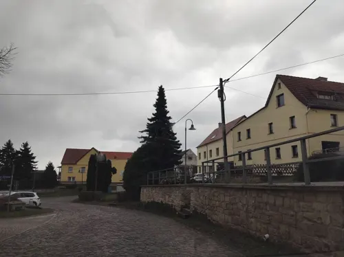
Gasthof zur Weintraube
Restaurant · German, Regional · 4.7 km
9 Borngasse, Kretzschau
Mo-Sa 11:00-14:00,17:00-22:00; Th 11:00-14:00; Su...
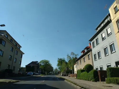
Zur Gulaschkanone
Restaurant · Regional · 1.7 km
Zur Gulaschkanone ist ein deutscher Imbiss mit Spezialitäten aus der Gulaschkanone
26 Weißenfelser Straße, Zeitz
Mo-Fr 07:30-20:00
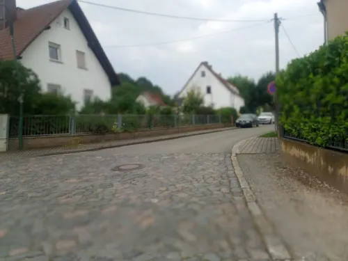

Kazoku Le - Sushi & Grill
Restaurant · Sushi
22 Altmarkt, Zeitz
Tu-Su,PH 11:00-15:00,17:00-22:00; Mo off
Landgasthof "Zur Kempe"
Restaurant · Regional, German · 6.7 km
30 Grüner Anger, Wetterzeube
We-Su,PH 11:00+; Mo,Tu off
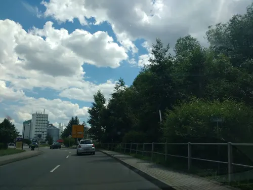
Peking
Restaurant · Chinese · 2.2 km
7 Leipziger Straße, Kretzschau
Mo,We-Su,PH 11:00-14:00,17:30-21:30; Tu off
Rustika
Restaurant · German
7 Judenstraße, Zeitz
Mo-Th 11:00-14:00,18:00-21:00; Fr 11:00-14:00,18:00-22:00; Sa...
Volkshaus Nonnewitz
Restaurant · Regional · 5.1 km
1 Hauptstraße, Zeitz
Fr-Su 17:00-22:00; Mo,Tu,We,Th off

Backhaus Hennig
Bakery · 0.9 km
29 Theodor-Arnold-Promenade, Zeitz
Mo-Fr 07:00-19:00; Sa 07:00-18:00; Su,PH off


Backhaus Hennig
Bakery · 2.4 km
1 Hainichener Dorfstraße, Zeitz
Mo-Fr 07:00-20:00; Sa 07:00-19:00; Su,PH off
Backhaus Hennig
Bakery · 3.1 km
4b Friedensplatz, Elsteraue
Mo-Fr 07:00-18:00; Sa 07:00-13:00; Su,PH off
76 more on the map.
History
First a Slavic pagan settlement later Christianized, Zeitz was first recorded under the Medieval Latin name Cici in the Synod of Ravenna in 967. The name "Zeitz" is believed to have Slavic origins, likely deriving from the Sorbian word "cica", meaning "water" or "stream," referring to the White Elster river that flows through the town. The suffix "-itz" is a common Slavic placename ending.
Between 965 and 982, it was the chief fortress of the March of Zeitz. Zeitz was a bishop's residence between 968 and 1028, when it was moved to Naumburg. Beginning at the end of the 13th century, the bishops again resided in their castle at Zeitz.
The city was captured by Swedish troops during the Thirty Years' War and was given to Electorate of Saxony in 1644. It was the centre of Saxe-Zeitz between 1657 and 1718, before returning to the Electorate (which became the Kingdom of Saxony in 1806).
In 1815, it was given to the Kingdom of Prussia, becoming district (kreis) centre of the Merseburg region (regierungsbezirk) of the Province of Saxony until 1944, when it became part of the Province of Halle-Merseburg. The Herrmannsschacht, built in 1889, is one of the oldest brown coal briquette factories in the world.
From the History section of Zeitz on Wikipedia, under CC BY-SA 4.0.
Where to stay19
Churches and places of worship33
St. Peter und Paul
Church · Roman Catholic · 0.6 km
1 Brückenweg, Zeitz
Shopping22
Gas and EV charging9
Schools, colleges and libraries21
Healthcare14
Map of Zeitz
250 places. The map loads OpenStreetMap tiles when you open it.
Getting there and nearby towns
Leipzig-Altenburg Airport (AOC) is the nearest airport with scheduled flights listed in OpenStreetMap, 27 km away.
- Gera 19 km south, about 19 min by car
- Leipzig 36 km northeast, about 36 min by car
- Jena 41 km west, about 41 min by car
- Penig 42 km east, about 42 min by car
- Zwickau 44 km southeast, about 44 min by car
- Mülsen 45 km southeast, about 45 min by car
- Lichtenstein 48 km southeast, about 48 min by car
- Halle (Saale) 49 km north, about 49 min by car
- Burgstädt 49 km east, about 49 min by car
- Wilkau-Haßlau 49 km southeast, about 49 min by car
Drive times are estimates from straight-line distance, not routes.
Local news
Headlines from INDB.
Reviews, tips and questions
Loading what members have shared...
Sources and licences
- GeoNames (CC BY 4.0): population, coordinates, regions and time zone
- Mapillary (see each image): photos
- OpenStreetMap contributors (ODbL 1.0): places, airports, map data
- Wikidata (CC0 1.0): elevation, founding date, time zone, website, landmarks and historic places
- Wikimedia Commons (see each image): photos
- Wikipedia (CC BY-SA 4.0): overview and history text
Photo credits
- Zeitz Schloss1, Mewes at German Wikipedia, Public domain
- Zeitz, das Capitol, Dguendel, CC BY 3.0
- ZeitzCapitol3, Jwaller, CC BY-SA 4.0
- ZeitzCapitol2, Jwaller, CC BY-SA 4.0
- ZeitzAltemälzerei, Jwaller, CC BY-SA 4.0
- Zeitz--Gasthof-Drei-Schwäne, Dguendel, CC BY-SA 3.0
- ZeitzKleefeldtafel, Jwaller, CC BY-SA 3.0
- ZeitzWendische3 2, Jwaller, CC BY-SA 4.0
- ZeitzCapitol1, Jwaller, CC BY-SA 4.0
- Zeitz3Schwäne, Jwaller, CC BY-SA 3.0
- ZeitzRoßmarkt11, Jwaller, CC BY-SA 4.0
- ZeitzWendische3 1, Jwaller, CC BY-SA 4.0
- ZeitzWendischeStrW, Jwaller, CC BY-SA 3.0
- Zeitz, die Apotheke am Roßmarkt, Dguendel, CC BY 3.0
- ZeitzRoßmarkt-längs, Jwaller, CC BY-SA 4.0
- Zeitz Monument Victims of fascism 80415, Jacquesverlaeken, CC BY-SA 4.0
- Zeitz Rathaus 80416, Jacquesverlaeken, CC BY-SA 4.0
- Fußgängerzone Zeitz, Michael Sander, CC BY-SA 3.0
- Zeitz, der Roßmarkt, Dguendel, CC BY 3.0
- Zeitz, die Judenstraße, Dguendel, CC BY 3.0
- Zeitz, die Wendische Straße, Dguendel, CC BY 3.0
- Zeitz, das Rathaus, Dguendel, CC BY-SA 4.0
- Zeitz Altmarkt 16 Gewandhaus, Radler59, CC BY-SA 4.0
- Zeitz, Häuserzeile am Altmarkt, Dguendel, CC BY 3.0
- Gewandhaus Zeitz, Dguendel, CC BY-SA 3.0
- Zeitz Haus Roßmarkt6, Cookroach, CC BY-SA 4.0
- ZeitzVoigtsstr26, Jwaller, CC BY-SA 4.0
- Altes Rathaus Zeitz, Michael Sander, CC BY-SA 3.0
- Zeitz, Fassade vom Haus Wendische Straße 15, Dguendel, CC BY 3.0
- Zeitz Voigtsplatz Brunnen Lindwurm, Radler59, CC BY-SA 4.0
- ZeitzAltmarktNW, Jwaller, CC BY-SA 4.0
- ZeitzVoigtsstr25, Jwaller, CC BY-SA 4.0
- Zeitz Voigtsstraße, Lindwurm-Brunnen, Catatine, CC0
- ZeitzAltmarktNO, Jwaller, CC BY-SA 4.0
- Zeitz Altmarkt 1 Rathaus, Radler59, CC BY-SA 4.0
- Zeitz, Rathaus und Brüderstraße, Dguendel, CC BY 3.0
- Dom Zeitz, Lucas Friese, CC BY-SA 3.0
- Schloss Moritzburg in Zeitz, Uwe Rieschel, CC BY-SA 4.0
- Zeitz Schloss3, Mewes at German Wikipedia, Public domain
- Zeitz, Judenstraße 3 und 4-001, Tilman2007, CC BY-SA 3.0
- Zeitz Steinkreuz I-01, Radler59, CC BY-SA 4.0
- AylsdorfKirche3, Jwaller, CC BY-SA 4.0
- Theißen (Zeitz), the village church, Dguendel, CC BY 3.0
- ZangenbergKirche2, Jwaller, CC BY-SA 4.0
- DöschwitzKirche, Jwaller, CC BY-SA 3.0
- HollsteitzKirche2, Jwaller, CC BY-SA 3.0
- KirchsteitzKirche3, Jwaller, CC BY-SA 3.0
- Kirche-Breitenbach, Tnemtsoni, CC BY-SA 3.0
- OssigKirche, Jwaller, CC BY-SA 3.0
- DraschwitzKirche1, Jwaller, CC BY-SA 3.0
- Zeitz Kursaechs Halbmeilensaeule-01, Radler59, CC BY-SA 4.0
- Loitsch Kirche, Jwaller, CC BY-SA 3.0
- ZeitzKathPfarrkircheAusschnitt, User:Jwaller, CC BY-SA 2.5
- Domherrenstraße 1 Zeitz 20180816 004, Tilman2007, CC BY-SA 4.0
- Domherrenstraße 1 Zeitz 20180816 003, Tilman2007, CC BY-SA 4.0
- ZeitzBaenschstr1, Jwaller, CC BY-SA 3.0
- Haynsburg Bruecke, Radler59, CC BY-SA 4.0
- Alttröglitz, Haupstraße 26 (Elsteraue) - Kulturhaus des ehemaligen Hydrierwerk Zeitz, Cookroach, CC BY-SA 4.0
- BurgEtzoldshain, Tnemtsoni, CC BY-SA 3.0
- Hügel am Igelberg im Park Hollsteitz, Cookroach, CC BY-SA 4.0
- Zeitz, Steinsgraben 16, Neues Theater 01, Catatine, CC0
- Zeitz, Brikettfabrik Herrmannschacht, Braunkohle-Stamm mit geringem Inkohlungsgrad, Dguendel, CC BY 4.0
- Zeitz Parzellenstrasse 1 Stadtmauerturm, Radler59, CC BY-SA 4.0
- Kuhndorf, Preußischer Viertelmeilenstein (1), Manfred Schröter, Berga, CC BY-SA 4.0
- Street-level photo, thetornado76, CC BY-SA 4.0
- Street-level photo, thetornado76, CC BY-SA 4.0
- Street-level photo, natura, CC BY-SA 4.0
- Street-level photo, thetornado76, CC BY-SA 4.0
- Street-level photo, thetornado76, CC BY-SA 4.0
- Street-level photo, thetornado76, CC BY-SA 4.0
- Street-level photo, thetornado76, CC BY-SA 4.0
- Street-level photo, natura, CC BY-SA 4.0
- Street-level photo, natura, CC BY-SA 4.0
- Street-level photo, natura, CC BY-SA 4.0
- Street-level photo, thetornado76, CC BY-SA 4.0
- Street-level photo, thetornado76, CC BY-SA 4.0
- Street-level photo, canislupus, CC BY-SA 4.0
- Street-level photo, canislupus, CC BY-SA 4.0
- Street-level photo, thetornado76, CC BY-SA 4.0
- Street-level photo, natura, CC BY-SA 4.0


Page built November 8, 2026. Spotted a mistake? Tell us or suggest a place.