


Why visit Zwickau
Townapedia lists 65 museums and landmarks, 36 parks and trails, 221 places to eat, 21 places to stay and 12 attractions in and around town.
Highlights include Theater Plauen-Zwickau, Filmpalast Astoria, August Horch Museum and Mining Museum Reinsdorf.
Weather in Zwickau
Forecast from MET Norway (CC BY 4.0). Full forecast
About Zwickau
Zwickau (German pronunciation: [ˈtsvɪkaʊ] ) is the fourth-largest city of Saxony, Germany, after Leipzig, Dresden and Chemnitz, with around 88,000 inhabitants.
From the Wikipedia article Zwickau (this version), under CC BY-SA 4.0.
Travel tips from other travellers: Zwickau on Wikivoyage (CC BY-SA 4.0).
Photos of Zwickau


Things to do12


Ballhaus Neue Welt
Cinema and theater · 1.5 km
182 Leipziger Straße, Zwickau


Museums and landmarks65

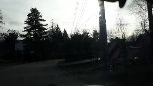
Mining Museum Reinsdorf
Museum · 3.9 km
9 Pöhlauer Straße, Reinsdorf
Apr Su[-1]-Oct Su[-1]: Su 14:00-17:00


Robert-Schumann-Haus
Museum · 1.2 km
5 Hauptmarkt, Zwickau
Tu-Fr 10:00-17:00; Sa,Su 13:00-17:00

Alter Gasometer
Monument and historic site · 1.0 km
3 Kleine Biergasse, Zwickau


Schloss Osterstein
Monument and historic site · 1.1 km
Das Schloss Osterstein ist das ehemalige kurfürstliche Stadtschloss von Zwickau.
1 Schlossgrabenweg, Zwickau


53 more on the map.
Parks, trails and playgrounds36



Indoorspielplatz Zwickelino
Playground · 1.7 km
43 Carl-Goerdeler-Straße, Zwickau
Mo-Fr 14:00-19:00, Sa,Su,PH 10:00-19:00


24 more on the map.
Restaurants and cafes221
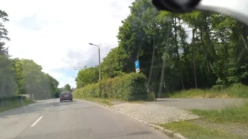
Asia Perle Restaurant
Restaurant · Vietnamese · 2.3 km
152 Werdauer Straße, Zwickau
Mo-Su 11:00-14:30,17:00-23:00
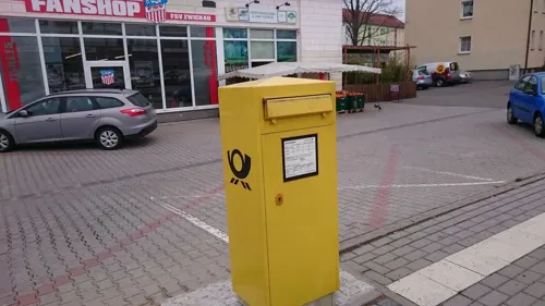
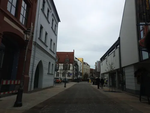
Brauhaus Esch
Restaurant · Regional · 1.2 km
14-16 Peter-Breuer-Straße, Zwickau
We-Fr 17:00-23:00, Sa 11:00-24:00, Su 11:00-23:00
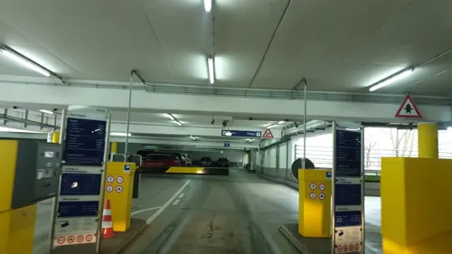
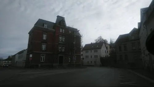
Danli
Restaurant · Vietnamese, Sushi · 3.8 km
5 Wilhelm-Stolle-Platz, Zwickau
Tu-Su 11:00-15:00; Tu-Su 17:00-21:30
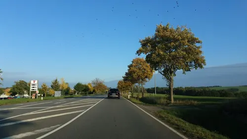
Espitas
Restaurant · Mexican · 2.4 km
25 A Äußere Dresdner Straße, Zwickau
Mo-Th 17:00-22:00; Fr,Sa 17:00-23:00; Su 10:00-22:00
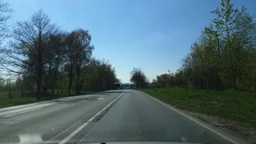
Espitas Chill 'Y'Beach
Restaurant · Mexican · 2.4 km
25 A Äußere Dresdner Straße, Zwickau
Mo-Th 17:00-22:00; Fr,Sa 17:00-23:00; Su 14:00-22:00
Espitas Strandhaus
Restaurant · Mexican · 2.4 km
25 A Äußere Dresdner Straße, Zwickau
Fr,Sa 17:00-20:00
Gasthof Schneppendorf
Restaurant · German · 3.9 km
51 Jüdenhainer Straße, Zwickau
Fr-Su 11:00-14:00, Tu-Su 17:00-21:00

August Horch Restaurant
Restaurant · Regional · 0.7 km
7 Audistraße, Zwickau
Tu-Su 09:30-17:00;"nach Vereinbarung"
Da Giuseppe
Restaurant · Italian · 0.8 km
20 Dr.-Friedrichs-Ring, Zwickau
Mo-Su 11:30-14:00,17:30-23:00; Tu off; We 17:30-23:00
209 more on the map.
History
The region around Zwickau was settled by Sorbs as early as the 7th century AD. The name Zwickau is probably a Germanization of the Sorbian toponym Šwikawa, which derives from Svarozič, the Slavic sun and fire god. In the 10th century, German settlers began arriving and the native Slavs were Germanized. A trading place known as terretorio Zcwickaw (in Medieval Latin) was mentioned in 1118. The settlement received a town charter in 1212, and hosted Franciscans and Cistercians during the 13th century. Zwickau was a free imperial city from 1290 to 1323, but was subsequently granted to the Margraviate of Meissen. Although regional mining began in 1316, extensive mining increased with the discovery of silver in the Schneeberg in 1470. Because of the silver ore deposits in the Erzgebirge, Zwickau developed in the 15th and 16th centuries and grew to be an important economic and cultural centre of Saxony.
Its nine churches include the Gothic church of St. Mary (1451–1536), with a spire 285 ft (87 m) high and a bell weighing 51 tons. The church contains an altar with wood carvings, eight paintings by Michael Wohlgemuth and a pietà in carved and painted wood by Peter Breuer.
Read more of the history
The late Gothic church of St. Catharine has an altar piece ascribed to Lucas Cranach the elder, and is remembered because Thomas Müntzer was once pastor there (1520–22). The city hall was begun in 1404 and rebuilt many times since. The municipal archives include documents dating back to the 13th century.
Early printed books from the Middle Ages, historical documents, letters and books are kept in the City Archives (e.g. Meister Singer volumes by Hans Sachs (1494–1576)), and in the School Library founded by scholars and by the city clerk Stephan Roth during the Reformation.
In 1520 Martin Luther dedicated his treatise "On the Freedom of the Christian Man" to his friend Hermann Muehlpfort, the Lord Mayor of Zwickau. The Anabaptist movement of 1525 began at Zwickau under the inspiration of the "Zwickau prophets". After Wittenberg, it became the first city in Europe to join the Lutheran Reformation. The late Gothic Gewandhaus (cloth merchants' hall), was built in 1522–24 and is now converted into a theatre. The city was seriously damaged during the Thirty Years' War.
In the Old Town the Cathedral and the Gewandhaus (cloth merchants' hall) originate in the 16th century and when Schneeberg silver was traded. In the 19th century the city's economy was driven by industrial coal mining and later by automobile manufacturing.
During World War II, in 1942, a Nazi show trial of the members of the Czarny Legion Polish underground resistance organization from Gostyń was held in Zwickau, after which 12 members were executed in Dresden, and several dozen were imprisoned in Nazi concentration camps, where 37 of them died. In May 1942, five Polish students of the Salesian Oratory in Poznań, known as the Poznań Five or five of the 108 Blessed Polish Martyrs of World War II, were imprisoned in Zwickau, before being executed in Dresden. A subcamp of the Flossenbürg concentration camp was located in Zwickau, whose prisoners were mostly Poles and Russians, but also Italians, French, Hungarians, Jews, Czechs, Germans and others.
On 17 April 1945, US troops entered the city. They withdrew on 30 June 1945 and handed Zwickau to the Soviet Red Army. Between 1944 and 2003, the city had a population of over 100,000.
A major employer is Volkswagen which assembles its ID.3, ID.4 and ID.5 models, as well as Audi and Cupra EV's in the Zwickau-Mosel vehicle plant.
Coal mining is mentioned as early as 1348. However, mining on an industrial scale first started in the early 19th century. The coal mines of Zwickau and the neighbouring Oelsnitz-Lugau coalfield contributed significantly to the industrialisation of the region and the city.
In 1885 Carl Wolf invented an improved gas-detecting safety mining-lamp. He held the first world patent for it. Together with his business partner Friemann he founded the "Friemann & Wolf" factory. Coal mining ceased in 1978. About 230 million tonnes had been mined to a depth of over 1,000 metres. In 1992 Zwickau's last coke oven plant was closed.
Many industrial branches developed in the city in the wake of the coal mining industry: mining equipment, iron and steel works, textile, machinery in addition to chemical, porcelain, paper, glass, dyestuffs, wire goods, tinware, stockings, and curtains. There were also steam saw-mills, diamond and glass polishing works, iron-foundries, and breweries.
In 1904 the Horch automobile plant was founded, followed by the Audi factory in 1909. In 1932 both brands were incorporated into Auto Union but retained their independent trademarks. Auto Union racing cars, developed by Ferdinand Porsche and Robert Eberan von Eberhorst, driven by Bernd Rosemeyer, Hans Stuck, Tazio Nuvolari, Ernst von Delius, became well known nationally and internationally. During World War II, the Nazi government operated a satellite camp of the Flossenbürg concentration camp in Zwickau which was sited near the Horch Auto Union plant. The Nazi administration built a hard labour prison camp at Osterstein Castle. Both camps were liberated by the US Army in 1945. On 1 August 1945 military administration was handed over to the Soviet Army. The Auto Union factories of Horch and Audi were dismantled by the Soviets; Auto Union relocated to Ingolstadt, Bavaria, evolving into the present day Audi company. In 1948 all large companies were seized by the East German government.
From the History section of Zwickau on Wikipedia, under CC BY-SA 4.0.
More about Zwickau
Education
Zwickau is home to the University of Applied Sciences Zwickau, with about 4,700 students and two campuses within the boundaries of Zwickau.
Dr. Martin Luther School (German: Dr. Martin Luther Schule) is a grade 1–4 school of the Evangelical Lutheran Free Church in Zwickau.
From the Wikipedia article Zwickau, under CC BY-SA 4.0.
Notable people from Zwickau
 Robert SchumannGerman composer, pianist and critic (1810–1856)Photo: Josef Kriehuber, Public domain
 Christoph DaumGerman football manager (1953–2024)Photo: 9EkieraM1, CC BY-SA 3.0
 Kristin GierischGerman athletics competitorPhoto: Ailura, CC BY-SA 3.0 at
 Hans DominikGerman science fiction author, journalist, engineer (1872–1945)Photo: Unknown author Unknown author, Public domain
 Paul Emil FlechsigGerman neuroscientist (1847–1929)Photo: Nicola Perscheid, Public domain
 Werner SchulzGerman politician (1950–2022)Photo: Heinrich Böll Stiftung from Berlin,..., CC BY-SA 2.0
 Cathleen MartiniGerman bobsledderPhoto: Martin Rulsch , Wikimedia Commons, CC BY-SA 4.0
 Wilhelm MeiselGerman admiral (1891–1974)Photo: Unknown author Unknown author, Public domain
- Max PechsteinGerman artist (1881–1955)
- Jürgen CroyEast German association football player and manager
- Fritz BleylGerman artist (1880-1966)
- Viola GoretzkiEast German rower
Born in Zwickau, according to Wikidata (CC0). Each name links to its Wikipedia article.
Where to stay21
Churches and places of worship34
Ev.-Luth. Kirche Auerbach
Church · Protestant · 3.1 km
119 Ernst-Thälmann-Straße, Zwickau
Ev.-Luth. Matthäuskirche
Church · Lutheran · 3.5 km
19 Muldestraße, Zwickau
Shopping73
Gas and EV charging33
Schools, colleges and libraries52
Healthcare25
Map of Zwickau
250 places. The map loads OpenStreetMap tiles when you open it.
Getting there and nearby towns
Leipzig-Altenburg Airport (AOC) is the nearest airport with scheduled flights listed in OpenStreetMap, 29 km away.
- Mülsen 6 km northeast, about 6 min by car
- Wilkau-Haßlau 6 km south, about 6 min by car
- Werdau 8 km west, about 8 min by car
- Lichtenstein 11 km east, about 11 min by car
- Glauchau 11 km north, about 11 min by car
- Crimmitschau 12 km northwest, about 12 min by car
- Meerane 13 km north, about 13 min by car
- Reichenbach/Vogtland 17 km southwest, about 17 min by car
- Hohenstein-Ernstthal 18 km northeast, about 18 min by car
- Schneeberg 18 km southeast, about 18 min by car
Drive times are estimates from straight-line distance, not routes.
Towns near Zwickau


Keep exploring
Local news
Headlines from INDB.
Reviews, tips and questions
Loading what members have shared...
Sources and licences
- GeoNames (CC BY 4.0): population, coordinates, regions and time zone
- Mapillary (see each image): photos
- OpenStreetMap contributors (ODbL 1.0): places, airports, map data
- Wikidata (CC0 1.0): elevation, founding date, time zone, website, landmarks and historic places
- Wikimedia Commons (see each image): photos
- Wikipedia (CC BY-SA 4.0): overview and history text
Photo credits
- Zwickau Hauptmarkt Panorama, André Karwath aka Aka, CC BY-SA 2.5
- Kunstsammlungen Zwickau 15, Derbrauni, CC BY 4.0
- Kunstsammlungen Zwickau 11, Derbrauni, CC BY 4.0
- Villa Lessingstraße 23 Zwickau, Steffen Mokosch, CC BY-SA 4.0
- Zwickau, Haus Lessingstraße 15, ehemalige Ingenieurhochschule, jetzt Finanzamt, Dguendel, CC BY 4.0
- Kunstsammlungen Zwickau 10, Derbrauni, CC BY 4.0
- Kunstsammlungen Zwickau 13, Derbrauni, CC BY 4.0
- Kunstsammlungen Zwickau 03, Derbrauni, CC BY 4.0
- Kunstsammlungen Zwickau 04, Derbrauni, CC BY 4.0
- Kunstsammlungen Zwickau 09, Derbrauni, CC BY 4.0
- Kunstsammlungen Zwickau 14, Derbrauni, CC BY 4.0
- Kunstsammlungen Zwickau 16, Derbrauni, CC BY 4.0
- Kunstsammlungen Zwickau 08, Derbrauni, CC BY 4.0
- Kunstsammlungen Zwickau 06, Derbrauni, CC BY 4.0
- Kunstsammlungen Zwickau 12, Derbrauni, CC BY 4.0
- Stadtarchiv Zwickau, Conny, CC BY-SA 3.0
- Kunstsammlungen Zwickau 01, Derbrauni, CC BY 4.0
- Kunstsammlungen Zwickau 02, Derbrauni, CC BY 4.0
- Kunstsammlungen Zwickau 07, Derbrauni, CC BY 4.0
- Zwickau, das Städtische Museum, Mittelbau, Dguendel, CC BY 4.0
- Kunstsammlungen Zwickau 05, Derbrauni, CC BY 4.0
- Zwickau, das Städtische Museum, Dguendel, CC BY 4.0
- 19902-Zwickau-1915-Museum-Brück & Sohn Kunstverlag, Brück & Sohn Kunstverlag Meißen, CC0
- Zwickau Robert Schumann Birth House, André Karwath aka Aka, CC BY-SA 2.5
- Zwickau old gasometer (aka), André Karwath aka Aka, CC BY-SA 2.5
- August Horch museum (aka), André Karwath aka Aka, CC BY-SA 2.5
- Zwickau Schloss Osterstein 2009-09-08, Hover dam, CC BY 3.0
- Zwickau Solar Panel Installation, André Karwath aka Aka, CC BY-SA 2.5
- Peter-Breuer-Gymnasium Zwickau, Markscheider, CC BY-SA 4.0
- Westsachsenstadion-Tower2, Christopher Voitus, CC BY-SA 3.0
- Zwickau Kollwitzschule, Markscheider, CC BY 3.0
- Zwickau-Lutherkirche-01, Bybbisch94, CC0
- Stadion FSV Zwickau Baustelle 2, Markscheider, CC BY-SA 4.0
- Zwickau - Katharinenkirche 2008 (aka), André Karwath aka Aka, CC BY-SA 2.5
- Zwickau - theatre (aka), André Karwath aka Aka, CC BY-SA 2.5
- Kirche Zwickau-Auerbach, Dieter Hoffmann from Zwickau, Germany, CC BY-SA 2.0
- Zwickau Bockwa - Matthäuskirche (aka), André Karwath aka Aka, CC BY-SA 2.5
- Johannes-Nepomuk-Kirche Zwickau, Aarp65, CC BY-SA 4.0
- Pauluskirche Zw-Marienthal, Lysippos, CC BY-SA 3.0
- Zwickau, Dr.-Friedrichs-Ring 43-001, Tilman2007, CC BY-SA 3.0
- 2012-04-29 Moritzkirche Zwickau, Je-str, CC BY-SA 4.0
- Versöhnungskirche Planitz 2, Markscheider, CC BY-SA 4.0
- Johanniskirche Weißenborn (Zwickau) (4), Aagnverglaser, CC BY-SA 4.0
- St. Johanneskirche (Zwickau-Planitz) (4), Aagnverglaser, CC0
- Zwickau Postmeilensaeule, Radler59, CC BY-SA 3.0
- ND Roteichenallee 27532, Michael Wolf ( Webseite ), CC BY-SA 3.0
- Priesterhäuser Zwickau, Interior 04 Dachgeschoss, Catatine, CC0
- Street-level photo, dsmm, CC BY-SA 4.0
- Street-level photo, Blacky98a, CC BY-SA 4.0
- Street-level photo, wald, CC BY-SA 4.0
- Street-level photo, changchun1, CC BY-SA 4.0
- Street-level photo, canislupus, CC BY-SA 4.0
- Street-level photo, iszuser, CC BY-SA 4.0
- Street-level photo, canislupus, CC BY-SA 4.0
- Street-level photo, staulka, CC BY-SA 4.0
- Street-level photo, staulka, CC BY-SA 4.0
- Street-level photo, poxonline, CC BY-SA 4.0
- Street-level photo, canislupus, CC BY-SA 4.0
- Street-level photo, canislupus, CC BY-SA 4.0
- Street-level photo, canislupus, CC BY-SA 4.0
- Street-level photo, wald, CC BY-SA 4.0
- Street-level photo, canislupus, CC BY-SA 4.0
- Street-level photo, wald, CC BY-SA 4.0
- Street-level photo, canislupus, CC BY-SA 4.0
- Street-level photo, canislupus, CC BY-SA 4.0
- Street-level photo, wald, CC BY-SA 4.0
- Street-level photo, Blacky98a, CC BY-SA 4.0
- Street-level photo, canislupus, CC BY-SA 4.0
- Street-level photo, canislupus, CC BY-SA 4.0
- Street-level photo, canislupus, CC BY-SA 4.0
- Street-level photo, Blacky98a, CC BY-SA 4.0
- Street-level photo, maikm, CC BY-SA 4.0
- Street-level photo, wald, CC BY-SA 4.0
- Street-level photo, canislupus, CC BY-SA 4.0


Page built November 9, 2026. Spotted a mistake? Tell us or suggest a place.