
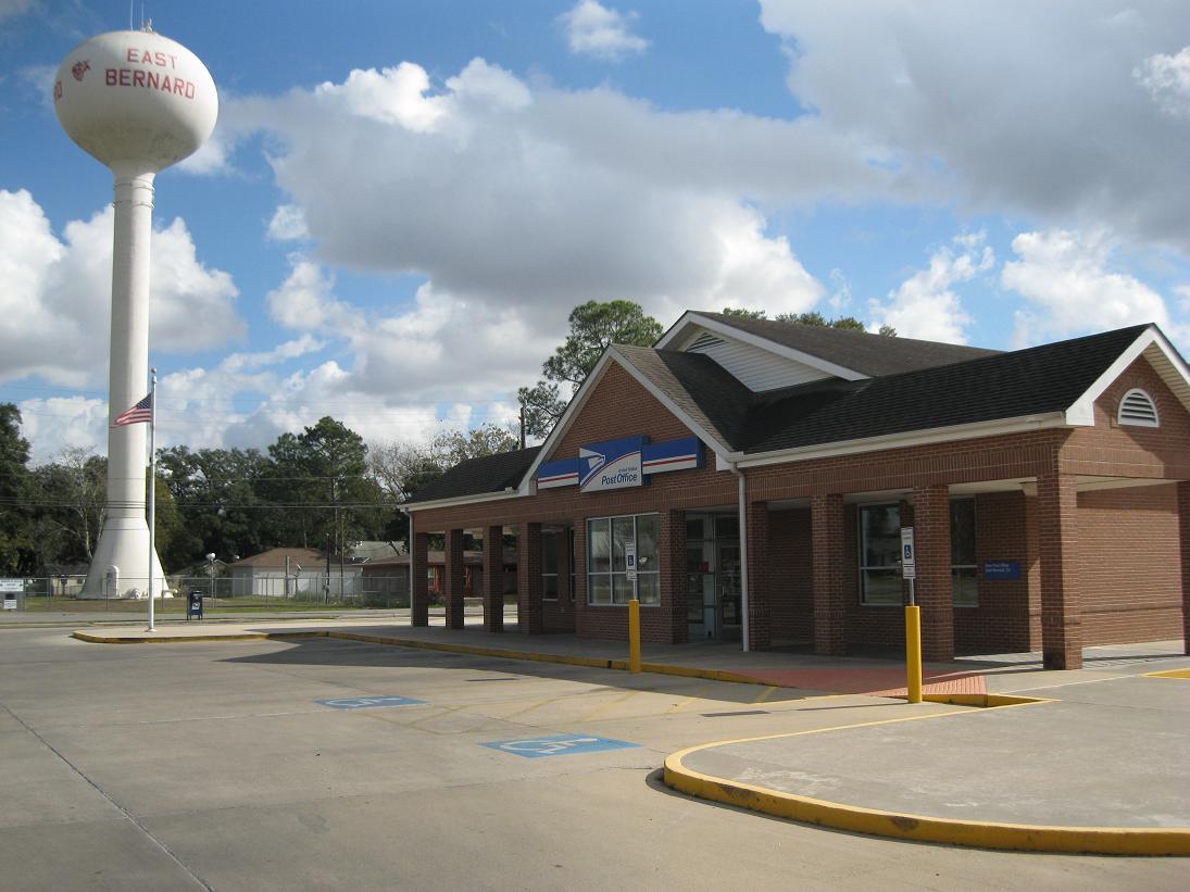


Why visit East Bernard
Townapedia lists 2 museums and landmarks, 1 park or trail and 6 places to eat in and around town.
July is the warmest month, with average highs of 95°F; January lows average 42°F.
Weather in East Bernard
Forecast from the National Weather Service. Full forecast
About East Bernard
East Bernard is a city in Wharton County, Texas, United States. The population was 2,218 at the 2020 census. U.S. Highway 90 Alternate (US 90A) and Texas State Highway 60 (SH 60) intersect within the city limits. East Bernard has its own school district, two auto dealerships and a number of other businesses.
From the Wikipedia article East Bernard, Texas (this version), under CC BY-SA 4.0.
Museums and landmarks2

Parks, trails and playgrounds1

Restaurants and cafes6



Sonic
Fast food · Burger · 0.5 mi
373 South Dill Street, East Bernard
Mo 07:00-23:00; Tu-Su 07:00-22:00
Churches and places of worship3

History
In 2000, East Bernard incorporated. As of 2007, East Bernard is one of Texas's newest cities.
East Bernard is on the west side of the San Bernard River at the intersection of State Highway 60 and U.S. Highway 90A, fifteen miles (24 km) north of Wharton in northeast Wharton County. The community was originally on the east side of the river, where Jethro Spivi built the first residence circa 1850; hence the name East Bernard. Settlement was slow until 1859 and the arrival of the Buffalo Bayou, Brazos and Colorado Railway. A bridge was built, and the depot, Bernard Station, though originally located on the east bank of the river, was moved by 1869 to the west side, to the site of East Bernard's future Main Street. The rest of the town grew up around the railway. The first post office was established in 1866, but the community was probably not officially named East Bernard until 1874.
After the Civil War, the community began to grow rapidly, as new settlers arrived with British surnames. Although Joseph Habermacher operated a store and saddle shop in Bernard Station sometime before 1867, the main influx of German and Slavic immigrants came after the 1880s. In the mid-1890s, the farming community had a population of 150, and businesses included a steam gin, a gristmill, a telegraph office, and two general stores.
From the History section of East Bernard, Texas on Wikipedia, under CC BY-SA 4.0.
Shopping2
Gas and EV charging4
Schools, colleges and libraries7
Healthcare2
Map of East Bernard
27 places. The map loads OpenStreetMap tiles when you open it.
Climate by month
Monthly table
| Month | High | Low | Rain |
|---|---|---|---|
| Jan | 64°F | 42°F | 3.8 in |
| Feb | 68°F | 45°F | 3.0 in |
| Mar | 74°F | 52°F | 3.1 in |
| Apr | 79°F | 58°F | 3.9 in |
| May | 86°F | 66°F | 4.8 in |
| Jun | 92°F | 72°F | 5.6 in |
| Jul | 95°F | 74°F | 4.2 in |
| Aug | 95°F | 73°F | 4.4 in |
| Sep | 90°F | 69°F | 4.9 in |
| Oct | 82°F | 59°F | 4.3 in |
| Nov | 73°F | 50°F | 4.2 in |
| Dec | 66°F | 44°F | 3.8 in |
U.S. Climate Normals 1991-2020 for Sealy (18 mi away), rain and snow from Wharton 3.1 Ne, NOAA NCEI.
People and cost of living
American Community Survey 5-year estimates, 2020-2024, U.S. Census Bureau. Estimates have margins of error, larger for small towns.
Disaster history
Wharton County has had 19 federal disaster declarations since 2000, most often for hurricanes.
- 2024-07-09: Hurricane Beryl (Hurricane)
- 2021-02-19: Severe Winter Storms (Severe Ice Storm)
- 2021-02-14: Severe Winter Storm (Severe Ice Storm)
- 2020-08-24: Tropical Storms Marco And Laura (Hurricane)
- 2020-07-26: Hurricane Hanna (Hurricane)
- 2020-03-25: Covid-19 Pandemic (Biological)
OpenFEMA disaster declarations summaries.
Getting there and nearby towns
Eagle Lake Airport (ELA) is the nearest airport with scheduled flights listed in OpenStreetMap, 16 miles away.
- Rosenberg 15 mi east, about 23 min by car
- Fulshear 16 mi northeast, about 26 min by car
- Eagle Lake 17 mi west, about 27 min by car
- Cumings 17 mi east, about 27 min by car
- Richmond 19 mi east, about 30 min by car
- Pecan Grove 21 mi east, about 34 min by car
- Katy 23 mi northeast, about 37 min by car
- Cinco Ranch 23 mi northeast, about 38 min by car
- Sugar Land 26 mi east, about 43 min by car
- Mission Bend 27 mi northeast, about 43 min by car
Drive times are estimates from straight-line distance, not routes.
Local news
Headlines from INDB, the NEMICO news database.
Reviews, tips and questions
Loading what members have shared...
Sources and licences
- NCES EDGE (Public domain): public schools
- NOAA NCEI U.S. Climate Normals 1991-2020 (Public domain): climate by month
- OpenFEMA (Public domain): disaster declarations
- OpenStreetMap contributors (ODbL 1.0): places, airports, map data
- U.S. Census Bureau (Public domain): population, income, housing, education, commute
- Wikidata (CC0 1.0): elevation, founding date, time zone, website
- Wikimedia Commons (see each image): photos
- Wikipedia (CC BY-SA 4.0): overview and history text
Photo credits
- East Bernard TX Post Office, Djmaschek, CC BY-SA 3.0
- East Bernard TX Veterans Memorial, Djmaschek, CC BY-SA 4.0
- East Bernard TX Wharton Pct 2, Djmaschek, CC BY-SA 4.0
- East Bernard TX Stadium, Djmaschek, CC BY-SA 4.0
- East Bernard TX Library, Djmaschek, CC BY-SA 4.0
- East Bernard TX Holy Cross Church, Djmaschek, CC BY-SA 4.0
- East Bernard TX Czech Marker, Djmaschek, CC BY-SA 4.0
- East Bernard TX Holy Cross Marker, Djmaschek, CC BY-SA 4.0


Page built October 30, 2026. Spotted a mistake? Tell us or suggest a place.