


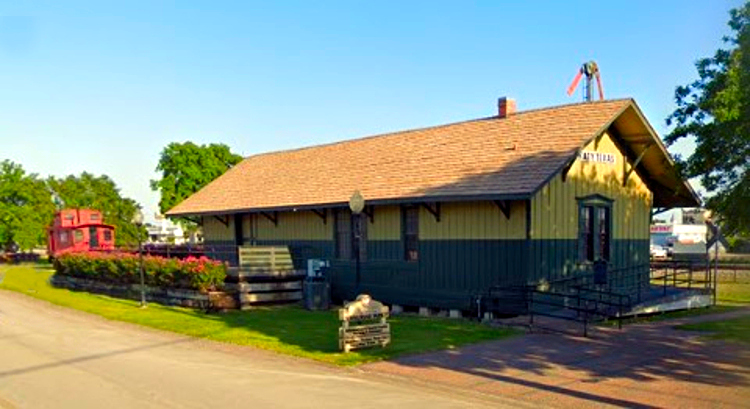


Katy, Texas
Katy is a city of 25,184 people in Fort Bend County, Texas, founded in 1945.
Why visit Katy
Townapedia lists 15 museums and landmarks, 19 parks and trails, 85 places to eat, 12 places to stay and 2 attractions in and around town.
Highlights include AMC Katy Mills 20, B. Ray and Charlotte Woods House, Johnny Nelson Katy Heritage Museum and Dig World.
Weather in Katy
Forecast from the National Weather Service. Full forecast
About Katy
Katy is a city in the U.S. state of Texas, approximately centered at the tripoint of Harris, Fort Bend, and Waller counties. The population was 21,894 at the 2020 census. It is the center of the urban Greater Katy area, itself forming the western part of the Greater Houston metropolitan area.
From the Wikipedia article Katy, Texas (this version), under CC BY-SA 4.0.
Things to do2

Museums and landmarks15

B. Ray and Charlotte Woods House
Monument and historic site · National Register of Historic Places · 1.0 mi
Building in Katy, Fort Bend County, Texas

3 more on the map.
Parks, trails and playgrounds19

Dig World
Sports field and stadium · 2.1 mi
5000 Katy Mills Boulevard, Katy
Sa 09:00-17:00; Su 11:00-17:00
Typhoon Texas
Sports field and stadium · 2.4 mi
555 Katy Fort Bend Road, Katy
Mo-Th,Su 10:30-19:00; Fr-Sa 10:30-21:00

Forbidden Gardens
Park · 4.0 mi
Former outdoor museum of Chinese culture and history in Texas

7 more on the map.
Restaurants and cafes85


Michys Chino Boricua
Restaurant · Puerto Rican, Asian · 2.4 mi
806 Katy Fort Bend Road, Katy
Mo-Su 11:00-21:00

PJ's Coffee of New Orleans
Cafe · Coffee Shop · 2.3 mi
1185 Katy Fort Bend Road, Katy
Mo-Fr 06:00-19:00; Sa 06:00-20:00; Su 06:00-18:00

No Label Brewing Co.
Brewery and winery · 1.6 mi
5351 1st Street, Katy
Mo-Fr 15:00-22:00; Sa 12:00-22:00; Su 12:00-18:00

73 more on the map.
History
The City of Katy sits on Karankawa tribal lands. European colonists' first record of contact with a tribe is in 1528. Over the next 250 years the area was trafficked by French and Spanish European colonists seeking land and trade opportunities. By 1779, the Karakawa were at war with Spanish settlers. In 1790 the war ended and shortly after settlement begins.
In the early 1800s Katy came be to be known as "Cane Island", named for the creek that runs through the area, a branch of Buffalo Bayou. The creek was filled with tall cane, not native to the area. It was presumed to have been planted by either the Karankawa Indians or Spanish explorers to aid in fur trapping until the 1820s.
In 1845 James J. Crawford received a land grant that included this area. The hot summers and thick clay soil made it difficult to attract settlers to the area. Freed slaves and their families including Thomas (Mary) Robinson and Milto McGinnis, along with Mr. Crawford, Peter Black, and John Sills were the only recorded residents of Cane Island in 1875.
From the History section of Katy, Texas on Wikipedia, under CC BY-SA 4.0.
Where to stay12
Country Inn & Suites, Katy (Houston West), TX
Motel and hotel · 2.0 mi
25218 Market Place Drive, Katy
Holiday Inn & Suites Houston West - Katy Mills
Motel and hotel · 1.9 mi
25406 Katy Mills Parkway, Katy
Homewood Suites by Hilton Houston/Katy Mills Mall
Motel and hotel · 2.0 mi
25495 Katy Mills Parkway, Katy
Churches and places of worship17
Shopping13
Gas and EV charging17
Schools, colleges and libraries59
Healthcare16
Map of Katy
250 places. The map loads OpenStreetMap tiles when you open it.
People and cost of living
American Community Survey 5-year estimates, 2020-2024, U.S. Census Bureau. Estimates have margins of error, larger for small towns.
Disaster history
Fort Bend County has had 22 federal disaster declarations since 2000, most often for hurricanes.
- 2024-07-09: Hurricane Beryl (Hurricane)
- 2021-02-19: Severe Winter Storms (Severe Ice Storm)
- 2021-02-14: Severe Winter Storm (Severe Ice Storm)
- 2020-08-24: Tropical Storms Marco And Laura (Hurricane)
- 2020-07-26: Hurricane Hanna (Hurricane)
- 2020-03-25: Covid-19 Pandemic (Biological)
OpenFEMA disaster declarations summaries.
Getting there and nearby towns
West Houston Airport (IWS) is the nearest airport with scheduled flights listed in OpenStreetMap, 10 miles away.
- Cinco Ranch 6 mi southeast, about 10 min by car
- Fulshear 7 mi south, about 11 min by car
- Four Corners 14 mi southeast, about 22 min by car
- Sugar Land 18 mi southeast, about 30 min by car
- Bellaire 24 mi east, about 38 min by car
- Houston 27 mi east, about 44 min by car
- Fresno 28 mi southeast, about 46 min by car
- Aldine 29 mi east, about 47 min by car
- The Woodlands 33 mi northeast, about 53 min by car
- Pearland 35 mi southeast, about 56 min by car
Drive times are estimates from straight-line distance, not routes.
Local news
Headlines from INDB, the NEMICO news database.
Reviews, tips and questions
Loading what members have shared...
Sources and licences
- NCES EDGE (Public domain): public schools
- OpenFEMA (Public domain): disaster declarations
- OpenStreetMap contributors (ODbL 1.0): places, airports, map data
- U.S. Census Bureau (Public domain): population, income, housing, education, commute
- Wikidata (CC0 1.0): elevation, founding date, time zone, website, landmarks and historic places
- Wikimedia Commons (see each image): photos
- Wikipedia (CC BY-SA 4.0): overview and history text
Photo credits
- Woods house katy 2008, Larry D. Moore, CC BY 4.0
- B.Ray and Charlotte Woods House - Katy, TX, bherrero.com, CC BY-SA 3.0
- Stewart house katy 2008, Larry D. Moore, CC BY 4.0
- Katy, TX, USA - panoramio - Idawriter, Idawriter, CC BY-SA 3.0
- The MKT Depot Katy Texas, United States Geological Survey, Public domain
- MKT Depot, Katy TX - April 2011, Roy Luck, CC BY 2.0
- MKT caboose, Katy TX - April 2011, Roy Luck, CC BY 2.0
- Mirus Academy, Katy TX, Slhogan94, CC BY-SA 3.0
- Katy, TX, USA - panoramio, Idawriter, CC BY-SA 3.0
- 2019-07-20 13 37 43 A mushroom cheeseburger and french fries at Texas Tradition in Katy, Harris County, Texas, Famartin, CC BY-SA 4.0
- Katy banner Palm trees along Kingsland Boulevard, Famartin, CC BY-SA 4.0
- 2019-07-20 08 32 24 Palm trees along Kingsland Boulevard in Katy, Fort Bend County, Texas, Famartin, CC BY-SA 4.0
- 2019-07-21 20 31 01 Sky just after sunset along Katy Mills Parkway in Katy, Fort Bend County, Texas, Famartin, CC BY-SA 4.0
- 2019-07-20 08 20 26 A serving of cranberry juice in a plastic cup at the Marriott Residence Inn on Katy Mills Parkway in Katy, Fort Bend County, Texas, Famartin, CC BY-SA 4.0
- 2019-07-20 08 13 29 A serving of orange juice in a plastic cup at the Marriott Residence Inn on Katy Mills Parkway in Katy, Fort Bend County, Texas, Famartin, CC BY-SA 4.0
- 2019-07-21 20 31 40 Sky just after sunset along Katy Mills Parkway in Katy, Fort Bend County, Texas, Famartin, CC BY-SA 4.0
- 2019-07-21 20 32 05 Sky just after sunset along Katy Mills Parkway in Katy, Fort Bend County, Texas, Famartin, CC BY-SA 4.0
- 2019-07-19 19 01 21 Palm trees along Katy Mills Parkway in Katy, Fort Bend County, Texas, Famartin, CC BY-SA 4.0
- 2019-07-20 08 09 51 A serving of apple juice in a plastic cup at the Marriott Residence Inn on Katy Mills Parkway in Katy, Fort Bend County, Texas, Famartin, CC BY-SA 4.0
- 2019-07-20 07 49 51 A bowl of granola in milk at the Marriott Residence Inn on Katy Mills Parkway in Katy, Fort Bend County, Texas, Famartin, CC BY-SA 4.0
- 2019-07-20 08 03 36 A plate of mini waffles at the Marriott Residence Inn on Katy Mills Parkway in Katy, Fort Bend County, Texas, Famartin, CC BY-SA 4.0
- 2019-07-20 07 45 55 A bowl of Quaker Instant Oatmeal Maple and Brown Sugar Flavor at the Marriott Residence Inn on Katy Mills Parkway in Katy, Fort Bend County, Texas, Famartin, CC BY-SA 4.0
- 2019-07-20 08 04 26 A plate of mini waffles covered in syrup at the Marriott Residence Inn on Katy Mills Parkway in Katy, Fort Bend County, Texas, Famartin, CC BY-SA 4.0
- 2019-07-20 07 41 09 A plate of scrambled eggs and sausage at the Marriott Residence Inn on Katy Mills Parkway in Katy, Fort Bend County, Texas, Famartin, CC BY-SA 4.0
- 2019-07-21 08 57 20 View southeast along Breezy Bend Drive at Mount Auburn Drive in the Pin Oak subdivision just south of the City of Katy in Fort Bend County, Texas, Famartin, CC BY-SA 4.0
- 2019-07-21 08 21 50 Spanish moss on a pine tree along Fernglen Drive just southeast of Katy in Fort Bend County, Texas, Famartin, CC BY-SA 4.0
- Katy Mills Mall old signage, Amtrak Guy 124, CC BY-SA 4.0
- 2019-07-20 09 20 36 View northwest along Misty Bend Drive at Mather Drive in the Pin Oak subdivision just south of the City of Katy in Fort Bend County, Texas, Famartin, CC BY-SA 4.0
- 2019-07-20 09 21 29 View southwest along Mather Drive at Misty Bend Drive in the Pin Oak subdivision just south of the City of Katy in Fort Bend County, Texas, Famartin, CC BY-SA 4.0
- EXIT 740 FM 1463, Sdogg7159, CC BY-SA 4.0
- James and Dove Stewart, bherrero.com, CC BY-SA 3.0
- Token (953772344), WayTru from Houston, TX, CC BY 2.0
- EXIT 737 Pederson Rd, Sdogg7159, CC BY-SA 4.0
- ISS045-E-177872 - View of Earth, Earth Science and Remote Sensing Unit , Lyndon B. Johnson Space Center, Public domain
- ISS045-E-177871 - View of Earth, Earth Science and Remote Sensing Unit , Lyndon B. Johnson Space Center, Public domain
- ISS021-E-9332 - View of Earth, Earth Science and Remote Sensing Unit , Lyndon B. Johnson Space Center, Public domain
- ISS020-E-7743 - View of Texas, Earth Science and Remote Sensing Unit , Lyndon B. Johnson Space Center, Public domain


Page built October 30, 2026. Spotted a mistake? Tell us or suggest a place.