




East McKeesport, Pennsylvania
East McKeesport is a borough of 2,002 people in Allegheny County, Pennsylvania, founded in December 14, 1895.
Why visit East McKeesport
Townapedia lists 7 museums and landmarks, 8 parks and trails, 11 places to eat and 5 attractions in and around town.
Highlights include McKeesport Connecting Railroad Bridge, McKeesport-Duquesne Bridge, Bowman Homestead and Carnegie Free Library of Braddock.
July is the warmest month, with average highs of 84°F; January lows average 22°F.
Weather in East McKeesport
Forecast from the National Weather Service. Full forecast
About East McKeesport
East McKeesport is a borough in Allegheny County, Pennsylvania, United States, and is part of the Pittsburgh metropolitan area. The population was 2,076 at the 2020 census.
From the Wikipedia article East McKeesport, Pennsylvania (this version), under CC BY-SA 4.0.
Things to do5

McKeesport Connecting Railroad Bridge
Bridge · 2.9 mi
Bridge in United States of America
McKeesport-Duquesne Bridge
Bridge · 2.7 mi
Bridge in Allegheny County, Pennsylvania


PRR Port Perry Bridge
Bridge · 2.3 mi
Railroad bridge in Pennsylvania
Union Railroad Port Perry Bridge
Bridge · 2.4 mi
Bridge in Pennsylvania, United States of America
Museums and landmarks7

Bowman Homestead
Monument and historic site · National Register of Historic Places · 1.4 mi
Building in Pennsylvania, United States
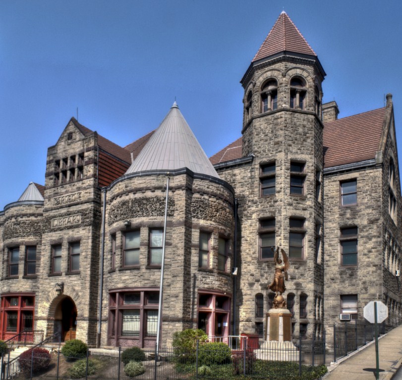
Carnegie Free Library of Braddock
Monument and historic site · National Register of Historic Places · 3.3 mi
Carnegie library in Pennsylvania
George Westinghouse Bridge
Bridge · National Register of Historic Places · 1.6 mi
Concrete arch bridge over Turtle Creek


Kennywood
Monument and historic site · National Register of Historic Places · 2.9 mi
Amusement park in Pennsylvania
Turtle Creek High School
Monument and historic site · National Register of Historic Places · 1.6 mi
High school in Pennsylvania, United States
Westinghouse Air Brake Company General Office Building
Monument and historic site · National Register of Historic Places · 0.5 mi
Historic building in Wilmerding, Pennsylvania, United States

Spaceballs The Museum and Gift Shop
Museum · 1.4 mi
3539 Bevan Road, North Versailles
"By appointment only"
Parks, trails and playgrounds8

White Oak Park
Park · 3.3 mi
County park in Allegheny County, Pennsylvania

Memorial Park Playground
Playground · 1.1 mi
313 Tintsman Avenue, North Versailles
sunrise-sunset
Restaurants and cafes11

Broad Street Bistro
Restaurant · American, Bar And Grill · 0.9 mi
1025 Broad Street, North Versailles
Mo 12:00-02:00; Tu-Th 14:00-02:00; Fr-Sa 11:00-02:00; Su 11:00-21:00

Bishop's Pizza III
Restaurant · Pizza · 0.9 mi
1416 Lincoln Highway, North Versailles

Subway
Fast food · Sandwich · 0.8 mi
995 Greensburg Pike, North Versailles
Su 08:30-21:00; Mo-Fr 07:00-22:00; Sa 07:30-22:00
Burger King
Fast food · Burger · 0.8 mi
121 Walmart Drive, North Versailles
Mo-Sa 06:00-00:00; Su 07:00-00:00
Dunkin' Donuts
Fast food · Donut, Coffee Shop · 0.6 mi
1121 Lincoln Highway, North Versailles
05:00-21:00
Raising Cane's
Fast food · Chicken · 0.9 mi
348 Lincoln Highway, North Versailles
Churches and places of worship9
East Suburban Seventh-day Adventist Church
Church · Seventh Day Adventist · 1.5 mi
1209 Luehm Avenue, North Versailles
Shopping6
Gas and EV charging3
Schools, colleges and libraries48
Dr Cleveland Steward Jr El Sch
School · 4.0 mi
5000 Gateway Campus Blvd, Monroeville
Healthcare1
Map of East McKeesport
98 places. The map loads OpenStreetMap tiles when you open it.
Climate by month
Monthly table
| Month | High | Low | Rain |
|---|---|---|---|
| Jan | 38°F | 22°F | 3.2 in |
| Feb | 40°F | 22°F | 2.7 in |
| Mar | 50°F | 29°F | 3.3 in |
| Apr | 62°F | 40°F | 3.2 in |
| May | 72°F | 51°F | 3.9 in |
| Jun | 80°F | 60°F | 4.7 in |
| Jul | 84°F | 64°F | 3.8 in |
| Aug | 83°F | 63°F | 3.7 in |
| Sep | 76°F | 56°F | 3.3 in |
| Oct | 65°F | 44°F | 2.9 in |
| Nov | 53°F | 35°F | 2.9 in |
| Dec | 42°F | 28°F | 3.0 in |
U.S. Climate Normals 1991-2020 for Braddock Lock 2 (3 mi away), NOAA NCEI.
People and cost of living
American Community Survey 5-year estimates, 2020-2024, U.S. Census Bureau. Estimates have margins of error, larger for small towns.
Disaster history
Allegheny County has had 8 federal disaster declarations since 2000, most often for hurricanes.
- 2020-03-30: Covid-19 Pandemic (Biological)
- 2020-03-13: Covid-19 (Biological)
- 2013-10-01: Severe Storms, Tornadoes, And Flooding (Severe Storm)
- 2012-10-29: Hurricane Sandy (Hurricane)
- 2010-04-16: Severe Winter Storms And Snowstorms (Snowstorm)
- 2005-09-10: Hurricane Katrina (Hurricane)
OpenFEMA disaster declarations summaries.
Getting there and nearby towns
Allegheny County Airport (AGC) is the nearest airport with scheduled flights listed in OpenStreetMap, 7 miles away.
- Duquesne 2 mi west, about 4 min by car
- Braddock 3 mi west, about 6 min by car
- Braddock Hills 3 mi northwest, about 6 min by car
- McKeesport 4 mi southwest, about 6 min by car
- Monroeville 4 mi northeast, about 6 min by car
- Churchill 4 mi northwest, about 7 min by car
- Whitaker 4 mi west, about 7 min by car
- Munhall 5 mi west, about 8 min by car
- Wilkinsburg 5 mi northwest, about 9 min by car
- West Mifflin 6 mi west, about 9 min by car
Drive times are estimates from straight-line distance, not routes.
Local news
Headlines from INDB, the NEMICO news database.
Reviews, tips and questions
Loading what members have shared...
Sources and licences
- NCES EDGE (Public domain): public schools
- NOAA NCEI U.S. Climate Normals 1991-2020 (Public domain): climate by month
- OpenFEMA (Public domain): disaster declarations
- OpenStreetMap contributors (ODbL 1.0): places, airports, map data
- U.S. Census Bureau (Public domain): population, income, housing, education, commute
- Wikidata (CC0 1.0): elevation, founding date, time zone, website, landmarks and historic places
- Wikimedia Commons (see each image): photos
- Wikipedia (CC BY-SA 4.0): overview and history text
Photo credits
- Broadway at US 30, East McKeesport, Nyttend, Public domain
- New gates to Kennywood (2005), Ski2007 of English Wikipedia, Public domain
- BCL 1024x768, Christopher Rolinson, CC BY 3.0 us
- BARGE ON THE MONONGAHELA RIVER SHOWS EFFECTS OF POLLUTION CAUSED BY AN OIL SPILL AT THE DUQUESNE WORKS OF THE UNITED STATES STEEL CORPORATION AT DUQUESNE, PENNSYLVANIA, NEAR PITTSBURGH. THE SPILL..., John L. Alexandrowicz, Public domain
- McKeesport-Duquesne Bridge deck, Doug Kerr from Albany, NY, United States, CC BY-SA 2.0
Page built October 30, 2026. Spotted a mistake? Tell us or suggest a place.