


Eastern Goleta Valley, California
Eastern Goleta Valley is a community of 28,295 people in Santa Barbara County, California.
Why visit Eastern Goleta Valley
Townapedia lists 31 museums and landmarks, 58 parks and trails, 155 places to eat, 17 places to stay and 15 attractions in and around town.
Highlights include Fairview Theater, The Hitchcock Cinema & Public House, Joseph and Lucy Foster Sexton House and Casa de la Guerra.
August is the warmest month, with average highs of 74°F; December lows average 40°F.
Weather in Eastern Goleta Valley
Forecast from the National Weather Service. Full forecast
About Eastern Goleta Valley
Eastern Goleta Valley is an unincorporated community and census-designated place (CDP) in Santa Barbara County, California, United States. As of the 2020 census, Eastern Goleta Valley had a population of 28,656. It is located between Goleta to the west, Santa Barbara to the east, the Pacific Ocean to the south, and the Santa Ynez Mountains to the north and includes the communities of Noleta and Hope Ranch. For statistical purposes, the United States Census Bureau designated the area as a census-designated place (CDP) prior to the 2020 census.
From the Wikipedia article Eastern Goleta Valley, California (this version), under CC BY-SA 4.0.
Things to do15

The Hitchcock Cinema & Public House
Cinema and theater · 2.3 mi
371 South Hitchcock Way, Santa Barbara

Lane Farms Produce Stand
Farm and orchard · 1.4 mi
308 South Walnut Lane, Santa Barbara
Mo-Sa 10:00-18:00; Su off

Antioch University Santa Barbara
School · 5.3 mi
Private university in Santa Barbara, California, U.S.
Arlington Theatre
Cinema and theater · 5.4 mi
Movie theater in Santa Barbara, California, United States

Arroyo Burro Beach
Beach · 3.9 mi
Public beach located in Santa Barbara, California, United States

Chumash Painted Cave State Historic Park
Monument and historic site · 3.9 mi
State park in California
Fielding Graduate University
School · 4.1 mi
Private university in Santa Barbara, California, United States
Lobero Theatre
Cinema and theater · 5.1 mi
Theater and chamber music hall in Santa Barbara, California, United States

Santa Barbara Light
Lighthouse · 5.0 mi
Lighthouse in California, United States
University of California, Santa Barbara
School · 4.2 mi
Public university near Goleta, California, United States and part of the University of California system
3 more on the map.
Museums and landmarks31

Joseph and Lucy Foster Sexton House
Monument and historic site · National Register of Historic Places · 2.0 mi
Historic house in California, United States
5490 Hollister Avenue, Goleta

Casa de la Guerra
Monument and historic site · National Register of Historic Places · 5.2 mi
Place in California listed on National Register of Historic Places
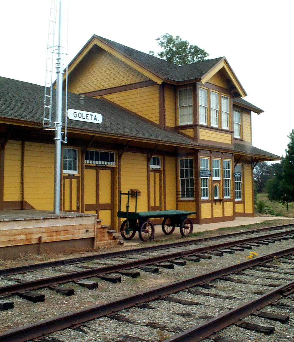
Goleta Depot
Monument and historic site · National Register of Historic Places · 3.9 mi
Place in California listed on National Register of Historic Places

Hill-Carrillo Adobe
Monument and historic site · National Register of Historic Places · 5.0 mi
Place in California listed on National Register of Historic Places

Janssens-Orella-Birk Building
Monument and historic site · National Register of Historic Places · 4.9 mi
Place in California listed on National Register of Historic Places

Mission Santa Barbara
Monument and historic site · National Register of Historic Places · 4.0 mi
18th-century Spanish mission in Santa Barbara, California

Presidio of Santa Barbara
Monument and historic site · National Register of Historic Places · 5.2 mi
18th-century Spanish fort in Santa Barbara, California, USA

Rafael Gonzalez House
Monument and historic site · National Register of Historic Places · 5.3 mi
Place in California listed on National Register of Historic Places

Santa Barbara County Courthouse
Monument and historic site · National Register of Historic Places · 4.9 mi
Place in California listed on National Register of Historic Places
Stow House
Monument and historic site · National Register of Historic Places · 3.8 mi
Place in California listed on National Register of Historic Places

Thomas Hope House
Monument and historic site · National Register of Historic Places · 1.2 mi
House in Santa Barbara, California


United States Post Office
Monument and historic site · National Register of Historic Places · 5.1 mi
Historic post office in Santa Barbara, California, USA
19 more on the map.
Parks, trails and playgrounds58

San Marcos Foothills Preserve
Park · 1.7 mi
Nature reserve in Santa Barbara County, California
Via Gaitero, Santa Barbara

Alice Keck Park Memorial Gardens
Park · 4.6 mi
Park in California, United States of America
De La Guerra Plaza
Park · 5.2 mi
Park in California, United States of America, United States of America
Douglas Family Preserve
Park · 4.4 mi
Public park in Santa Barbara, California, United States
Elings Park
Park · 3.6 mi
Park in California, United States of America
Franceschi Park
Park · 5.1 mi
Park in Santa Barbara County, California, United States of America
Mission Historical Park
Park · 4.2 mi
Public park in Santa Barbara, California, United States of America
Skofield Park
Park · 5.1 mi
Park in Santa Barbara, California, United States
46 more on the map.
Restaurants and cafes155

Bangkok Thai Cafe
Restaurant · Thai · 2.5 mi
3613 State Street, Santa Barbara
Mo off; Tu-Th 11:30-21:00; Fr-Su 11:30-21:30

Bree'osh
Cafe · Breakfast, Lunch, Coffee Shop, Pastry, Bread · 3.4 mi
2700 De La Vina Street, Santa Barbara
Mo-Su 06:30-14:00
Chuck's of Hawaii
Restaurant · Steak House · 2.0 mi
3888 State Street, Santa Barbara
Mo-Th,Su 17:00-21:30; Fr-Sa 17:00-22:00
Cody's Cafe
Cafe · Breakfast, Brunch, American · 0.9 mi
4898 Hollister Avenue, Santa Barbara
07:00-15:00

Cold Stone Creamery
Ice cream · Ice Cream · 2.4 mi
5718 Calle Real, Goleta
Mo,We-Th 11:30-22:00; Tu 12:30-22:00; Fr-Sa 11:30-23:00; Su...
Crushcakes & Cafe
Cafe · Dessert, Breakfast, Coffee Shop · 1.9 mi
5392 Hollister Avenue, Goleta
07:30-15:30
Dean: a coffee shop
Cafe · Coffee Shop · 3.1 mi
6100 Hollister Avenue, Goleta
Mo-Fr 06:00-15:00; Sa-Su 07:00-15:00
Del Pueblo Cafe
Restaurant · Mexican · 1.4 mi
5134 Hollister Avenue, Santa Barbara
Mo 09:00-14:00; Tu-Sa 09:30-14:00,16:45-20:00; Su 09:30-14:00,16:30-18:30
Del Valle Grill
Restaurant · Mexican · 2.5 mi
5746 Hollister Avenue, Goleta
Mo-Fr 10:30-21:00; Sa-Su 10:30-14:00
Dutch Garden
Restaurant · German · 1.3 mi
4213 State Street, Santa Barbara
Mo-Tu off; We-Su 11:00-21:00
143 more on the map.
Where to stay17
FOUND Hotels, Santa Barbara, Series by Marriott
Motel and hotel · 2.1 mi
3850 State Street, Santa Barbara
The Leta Santa Barbara Goleta, Tapestry Collection by Hilton
Motel and hotel · 2.2 mi
5650 Calle Real, Goleta
The Steward Santa Barbara, a Tribute Portfolio Hotel
Motel and hotel · 2.0 mi
5490 Hollister Avenue, Santa Barbara
Churches and places of worship34
Saint Barbara Greek Orthodox Church
Church · Greek Orthodox · 0.9 mi
1205 San Antonio Creek Road, Santa Barbara
Santa Barbara Korean Presbyterian Church
Church · Presbyterian · 0.7 mi
4595 Hollister Avenue, Santa Barbara
Live Oak Unitarian Universalist Congregation
Place of worship · 2.7 mi
820 North Fairview Avenue, Goleta
Trinity Evangelical Lutheran
Church · Evangelical Lutheran · 1.9 mi
909 North La Cumbre Road, Santa Barbara
Saint Raphael Catholic Church
Church · Catholic · 2.0 mi
5444 Hollister Avenue, Santa Barbara
The Church of Jesus Christ of Latter-day Saints
Church · Mormon · 2.1 mi
478 Cambridge Drive, Goleta
Shopping30
Gas and EV charging20
Schools, colleges and libraries67
Healthcare24
Map of Eastern Goleta Valley
250 places. The map loads OpenStreetMap tiles when you open it.
Climate by month
Monthly table
| Month | High | Low | Rain |
|---|---|---|---|
| Jan | 64°F | 41°F | 3.8 in |
| Feb | 64°F | 44°F | 3.9 in |
| Mar | 66°F | 46°F | 3.1 in |
| Apr | 68°F | 48°F | 0.9 in |
| May | 69°F | 51°F | 0.4 in |
| Jun | 70°F | 54°F | 0.1 in |
| Jul | 73°F | 58°F | 0.0 in |
| Aug | 74°F | 58°F | 0.0 in |
| Sep | 74°F | 56°F | 0.1 in |
| Oct | 73°F | 51°F | 0.7 in |
| Nov | 69°F | 44°F | 1.3 in |
| Dec | 64°F | 40°F | 2.9 in |
U.S. Climate Normals 1991-2020 for Santa Barbara Muni Ap 72392 (4 mi away), NOAA NCEI.
People and cost of living
American Community Survey 5-year estimates, 2020-2024, U.S. Census Bureau. Estimates have margins of error, larger for small towns.
Disaster history
Santa Barbara County has had 29 federal disaster declarations since 2000, most often for fires.
- 2024-04-13: Severe Winter Storms, Tornadoes, Flooding, Landslides, And Mudslides (Severe Storm)
- 2023-04-03: Severe Winter Storms, Straight-Line Winds, Flooding, Landslides, And Mudslides (Severe Storm)
- 2023-03-10: Severe Winter Storms, Flooding, Landslides, And Mudslides (Flood)
- 2023-01-14: Severe Winter Storms, Flooding, Landslides, And Mudslides (Flood)
- 2023-01-09: Severe Winter Storms, Flooding, And Mudslides (Flood)
- 2021-10-13: Alisal Fire (Fire)
OpenFEMA disaster declarations summaries.
Getting there and nearby towns
Santa Barbara Municipal Airport (SBA) is the nearest airport with scheduled flights listed in OpenStreetMap, 4 miles away.
- Goleta 4 mi west, about 7 min by car
- University of California-Santa Barbara 4 mi southwest, about 7 min by car
- Santa Barbara 5 mi southeast, about 8 min by car
- Isla Vista 5 mi southwest, about 8 min by car
- Carpinteria 16 mi east, about 26 min by car
- San Buenaventura (Ventura) 33 mi east, about 53 min by car
- Oxnard 37 mi southeast, about 1 h by car
- Port Hueneme 39 mi southeast, about 1 h by car
- Santa Paula 41 mi east, about 1 h by car
- Lompoc 42 mi west, about 1 h by car
Drive times are estimates from straight-line distance, not routes.
Local news
Headlines from INDB, the NEMICO news database.
Reviews, tips and questions
Loading what members have shared...
Sources and licences
- NCES EDGE (Public domain): public schools
- NOAA NCEI U.S. Climate Normals 1991-2020 (Public domain): climate by month
- OpenFEMA (Public domain): disaster declarations
- OpenStreetMap contributors (ODbL 1.0): places, airports, map data
- U.S. Census Bureau (Public domain): population, income, housing, education, commute
- Wikidata (CC0 1.0): elevation, founding date, time zone, website, landmarks and historic places
- Wikimedia Commons (see each image): photos
- Wikipedia (CC BY-SA 4.0): overview and history text
Photo credits
- Sexton House, Goleta, Bzeyen, CC BY-SA 3.0
- Santa Barbara County Courthouse, Konrad Summers from Santa Clarita (Valencia) , California, USA, CC BY-SA 2.0
- Hill-Carrillo Adobe, Ymblanter, CC BY-SA 3.0
- Thomas Hope House, DocFreeman24, CC BY-SA 4.0
- Mission Santa Barbara01, Bernard Gagnon, CC BY-SA 3.0
- USA-Santa Barbara-Post Office, Eugene Zelenko (thanks to my friends Nickolov family for generous help and company), CC BY-SA 4.0
- Rafael Gonzalez House2, Ymblanter, CC BY-SA 3.0
- Presidio Chapel, Ymblanter, CC BY-SA 3.0
- Janssens-Orella-Birk Building, Ymblanter, CC BY-SA 3.0
- Virginia Hotel Santa Barbara, Ymblanter, CC BY-SA 3.0
- Goleta Depot, Gcoombs at en.wikipedia, CC BY 2.5
- Casa de la Guerra right side, Ymblanter, CC BY-SA 3.0

Page built October 30, 2026. Spotted a mistake? Tell us or suggest a place.