



University of California-Santa Barbara, California
University of California-Santa Barbara is a community of 12,121 people in Santa Barbara County, California.
Why visit University of California-Santa Barbara
Townapedia lists 35 museums and landmarks, 45 parks and trails, 92 places to eat, 3 places to stay and 10 attractions in and around town.
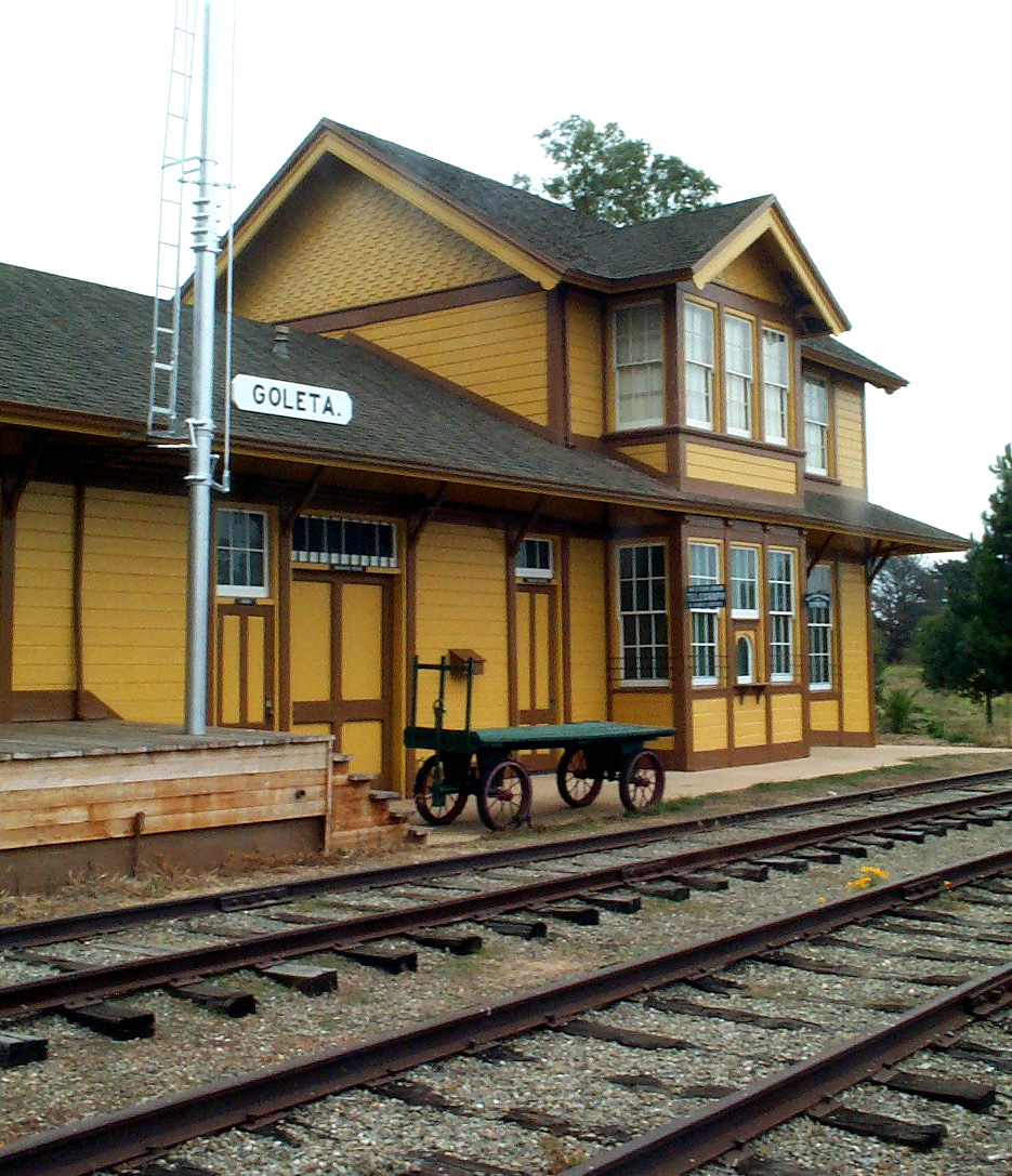
Highlights include Isla Vista Theater, Goleta Beach, Art, Design & Architecture Museum and Goleta Depot.
August is the warmest month, with average highs of 74°F; December lows average 40°F.
Weather in University of California-Santa Barbara
Forecast from the National Weather Service. Full forecast
About University of California-Santa Barbara
The University of California, Santa Barbara (UC Santa Barbara or UCSB) is a public land-grant research university in Santa Barbara County, California, United States. Tracing its roots back to 1891 as an independent teachers college, UC Santa Barbara joined the University of California system in 1944. It is the third-oldest campus in the system, after Berkeley, and UCLA.
From the Wikipedia article University of California, Santa Barbara (this version), under CC BY-SA 4.0.
Things to do10




University of California, Santa Barbara
School
Public university near Goleta, California, United States and part of the University of California system

Museums and landmarks35

Goleta Depot
Monument and historic site · National Register of Historic Places · 1.8 mi
Place in California listed on National Register of Historic Places


Joseph and Lucy Foster Sexton House
Monument and historic site · National Register of Historic Places · 2.2 mi
Historic house in California, United States

Stow House
Monument and historic site · National Register of Historic Places · 1.7 mi
Place in California listed on National Register of Historic Places
Art, Design and Architecture Museum at UCSB
Museum · 0.4 mi
Museum in Santa Barbara, California
South Coast Railroad Museum
Museum · 1.7 mi
Railroad museum in Goleta, California
23 more on the map.
Parks, trails and playgrounds45




33 more on the map.
Restaurants and cafes92


Ca'Dario Cucina Italiana
Restaurant · Italian · 1.5 mi
250 Storke Road, Goleta
Mo-Sa 11:00-15:00, 17:00-21:00; Su 16:00-21:00
Cristino's Bakery
Cafe · Mexican, Breakfast, Sandwich · 1.0 mi
170 Aero Camino, Goleta
Mo-Fr 06:00-20:00; Sa 06:30-14:00; Su 07:00-14:00
Dean: a coffee shop
Cafe · Coffee Shop · 1.3 mi
6100 Hollister Avenue, Goleta
Mo-Fr 06:00-15:00; Sa-Su 07:00-15:00
Dune Coffee Roasters
Cafe · Coffee Shop · 1.5 mi
250 Storke Road, Goleta
Mo-Fr 06:00-16:00; Sa-Su 07:00-16:00
Elubia's Kitchen
Restaurant · Latin American · 0.8 mi
6578 Trigo Road, Isla Vista
Su off; Mo-Sa 12:00-20:00
Hana Kitchen
Restaurant · Chinese, Chicken · 0.6 mi
6558 Pardall Road, Isla Vista
Su-Th 11:00-01:00; Fr-Sa 11:00-03:00
Kaiju
Restaurant · Curry, Ramen, Bubble Tea · 0.7 mi
901 Embarcadero del Mar, Isla Vista
Tu-Su 11:00-21:00
80 more on the map.
History
UCSB traces its origins back to the Anna Blake School, which was founded in 1891, and offered training in home economics and industrial arts. The Anna Blake School was taken over by the state in 1909 and became the Santa Barbara State Normal School, which then became the Santa Barbara State College in 1921.
In 1944, intense lobbying by an interest group in the City of Santa Barbara led by Thomas Storke and Pearl Chase persuaded the State Legislature, Gov. Earl Warren, and the Regents of the University of California to move the State College over to the more research-oriented University of California system. The State College system sued to stop the takeover, but the governor did not support the suit. A state constitutional amendment was passed in 1946 to stop subsequent conversions of State Colleges to University of California campuses.
From 1944 to 1958, the school was known as Santa Barbara College of the University of California, before taking on its current name. When the vacated Marine Corps training station in Goleta was purchased for the rapidly growing college, Santa Barbara City College moved into the vacated State College buildings.
From the History section of University of California, Santa Barbara on Wikipedia, under CC BY-SA 4.0.
Where to stay3
Churches and places of worship5
The Church of Jesus Christ of Latter-day Saints
Church · Mormon · 0.5 mi
6524 Cordoba Road, Goleta
Shopping9
Gas and EV charging2
Schools, colleges and libraries27
Healthcare5
Map of University of California-Santa Barbara
233 places. The map loads OpenStreetMap tiles when you open it.
Climate by month
Monthly table
| Month | High | Low | Rain |
|---|---|---|---|
| Jan | 64°F | 41°F | 3.8 in |
| Feb | 64°F | 44°F | 3.9 in |
| Mar | 66°F | 46°F | 3.1 in |
| Apr | 68°F | 48°F | 0.9 in |
| May | 69°F | 51°F | 0.4 in |
| Jun | 70°F | 54°F | 0.1 in |
| Jul | 73°F | 58°F | 0.0 in |
| Aug | 74°F | 58°F | 0.0 in |
| Sep | 74°F | 56°F | 0.1 in |
| Oct | 73°F | 51°F | 0.7 in |
| Nov | 69°F | 44°F | 1.3 in |
| Dec | 64°F | 40°F | 2.9 in |
U.S. Climate Normals 1991-2020 for Santa Barbara Muni Ap 72392 (1 mi away), NOAA NCEI.
People and cost of living
American Community Survey 5-year estimates, 2020-2024, U.S. Census Bureau. Estimates have margins of error, larger for small towns.
Disaster history
Santa Barbara County has had 29 federal disaster declarations since 2000, most often for fires.
- 2024-04-13: Severe Winter Storms, Tornadoes, Flooding, Landslides, And Mudslides (Severe Storm)
- 2023-04-03: Severe Winter Storms, Straight-Line Winds, Flooding, Landslides, And Mudslides (Severe Storm)
- 2023-03-10: Severe Winter Storms, Flooding, Landslides, And Mudslides (Flood)
- 2023-01-14: Severe Winter Storms, Flooding, Landslides, And Mudslides (Flood)
- 2023-01-09: Severe Winter Storms, Flooding, And Mudslides (Flood)
- 2021-10-13: Alisal Fire (Fire)
OpenFEMA disaster declarations summaries.
Getting there and nearby towns
Santa Barbara Municipal Airport (SBA) is the nearest airport with scheduled flights listed in OpenStreetMap, 1 miles away.
- Isla Vista 1 mi southwest, about 1 min by car
- Goleta 1 mi northwest, about 2 min by car
- Eastern Goleta Valley 4 mi northeast, about 7 min by car
- Santa Barbara 8 mi east, about 12 min by car
- Mission Canyon 8 mi east, about 13 min by car
- Montecito 12 mi east, about 20 min by car
- Summerland 15 mi east, about 24 min by car
- Toro Canyon 16 mi east, about 26 min by car
- Carpinteria 19 mi east, about 31 min by car
- Santa Ynez 20 mi northwest, about 32 min by car
Drive times are estimates from straight-line distance, not routes.
Local news
Headlines from INDB, the NEMICO news database.
Reviews, tips and questions
Loading what members have shared...
Sources and licences
- NCES EDGE (Public domain): public schools
- NOAA NCEI U.S. Climate Normals 1991-2020 (Public domain): climate by month
- OpenFEMA (Public domain): disaster declarations
- OpenStreetMap contributors (ODbL 1.0): places, airports, map data
- U.S. Census Bureau (Public domain): population, income, housing, education, commute
- Wikidata (CC0 1.0): landmarks and historic places
- Wikimedia Commons (see each image): photos
- Wikipedia (CC BY-SA 4.0): overview and history text
Photo credits
- Sexton House, Goleta, Bzeyen, CC BY-SA 3.0
- Goleta Depot, Gcoombs at en.wikipedia, CC BY 2.5
- Bike Parking (4758906380), Damian Gadal, CC BY 2.0
- Pandanus utilis at UCSB, November 2016, Malavnia, CC BY-SA 4.0
- What I am (4760998878), Damian Gadal, CC BY 2.0
- Classic Horror Films (4758298849), Damian Gadal, CC BY 2.0
- Empty Campus (4758256749), Damian Gadal, CC BY 2.0
- Nik-O-Lok shelf, Britta Gustafson, CC BY-SA 2.0
- Autofocus Fail ;-) (54239581052), Glenn Beltz from Goleta, CA, USA, CC BY 2.0
- Goleta Sunset 2023, Glenn Beltz, CC BY 2.0
- Agar Plates Cooling, PlaxcoLab, CC BY 2.0
- Biacore 3000 Surface Plasmon Resonance (SPR) Instrument - (1), PlaxcoLab, CC BY 2.0
- Large Gel Electrophoresis Chamber with Agarose gel inside - (3), PlaxcoLab, CC BY 2.0
- Large Gel Electrophoresis Chamber with Agarose gel inside - (1), PlaxcoLab, CC BY 2.0
- Lots of electrodes (3235856120), PlaxcoLab, CC BY 2.0
- Large Gel Electrophoresis Chamber with Agarose gel inside, PlaxcoLab, CC BY 2.0
- Biacore 3000 Surface Plasmon Resonance (SPR) Instrument, PlaxcoLab, CC BY 2.0
- Large Gel Electrophoresis Chamber with Agarose gel inside - (2), PlaxcoLab, CC BY 2.0
- Plate (3235837360), PlaxcoLab, CC BY 2.0
- East Asian Library of UCSB, AndyHe829, CC BY-SA 3.0
- Zea mays subsp. parviglumis (herbarium specimen UCSB049447), University of California Santa Barbara Herbarium (UCSB), CC0
- MLM Steeplechase WR, Trackinfo, CC BY-SA 4.0
- Rb-mot-vacuum-chamber, Darth luigi, CC0
- Lunar Eclipse at UCSB (51203940477), Glenn Beltz from Goleta, CA, USA, CC BY 2.0
- Under a lemon-scented gum tree at UCSB, PinchyCC, CC BY 4.0
- Bmw x5, Sonny doe, CC BY-SA 4.0
- Bmw x3, Sonny doe, CC BY-SA 4.0
- Spacex Launch as seen from UCSB (54239527832), Glenn Beltz from Goleta, CA, USA, CC BY 2.0
- UCSB During the Alisal Fire (51599410641), Glenn Beltz from Goleta, CA, USA, CC BY 2.0
- Eclipse Moon, beltz6, CC BY 2.0
- Cxcasii, Prezi2, CC BY-SA 4.0
- Common Orange Lichen - Xanthoria parietina (42342991404), Björn S..., CC BY-SA 2.0
- Common Orange Lichen - Xanthoria parietina (28196542117), Björn S..., CC BY-SA 2.0
- Lichen (41253622860), Björn S..., CC BY-SA 2.0
- Lichen (42350088724), Björn S..., CC BY-SA 2.0
- Lichen (43014800502), Björn S..., CC BY-SA 2.0
- Lichen (43016482082), Björn S..., CC BY-SA 2.0
- Lichen (29192208298), Björn S..., CC BY-SA 2.0
- Common Orange Lichen - Xanthoria parietina (43016483322), Björn S..., CC BY-SA 2.0
- Lichen (42342992824), Björn S..., CC BY-SA 2.0


_(54239581052).jpg)


Page built October 30, 2026. Spotted a mistake? Tell us or suggest a place.