


Why visit Kirdāsah
Townapedia lists 4 museums and landmarks, 1 park or trail, 3 places to eat and 1 place to stay in and around town.
Highlights include Abu Rawash and Grand Egyptian Museum.
Weather in Kirdāsah
Forecast from MET Norway (CC BY 4.0). Full forecast
About Kirdāsah
Kerdasa (Arabic: كرداسة, Arabic pronunciation: [keɾˈdæːsæ], Coptic: ⲭⲟⲣⲧⲁⲥⲁ) is a markaz in Giza Governorate, Egypt. It is famed for its hand-made textile crafts, woven carpets, and wall hangings in native traditional patterns. Kerdasa is a great place to find embroidered cotton, silk dresses (galabeyas) and other products. It is famous for trading fabrics nationwide, with traditional crafts, and handcrafted clothes and textiles, from dresses, galabiyas, etc., and is a popular destination for Egyptians before Arab and foreign tourists to purchase these products.
From the Wikipedia article Kerdasa (this version), under CC BY-SA 4.0.
Museums and landmarks4
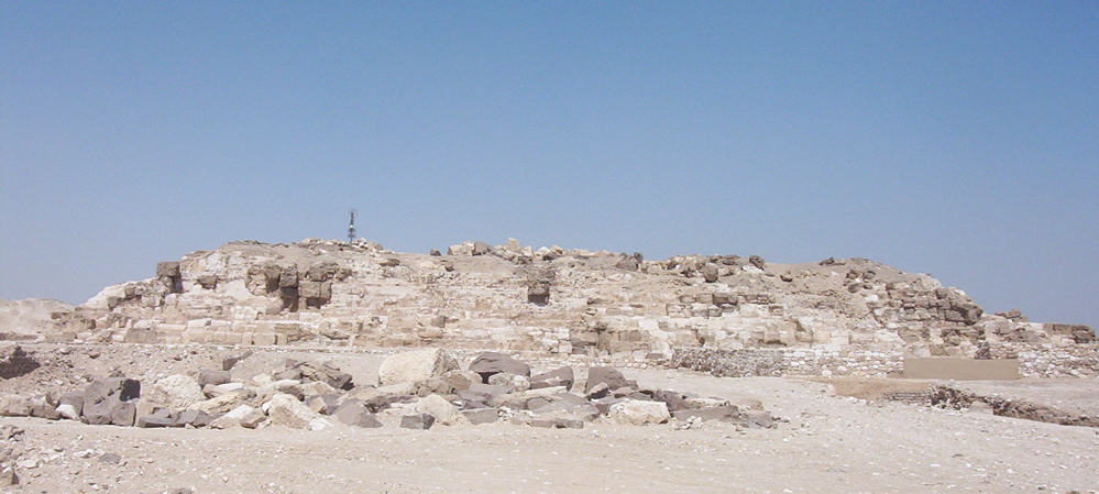
Abu Rawash
Monument and historic site · 3.5 km
Village in Giza Governorate, Egypt


Lepsius-I Pyramid
Monument and historic site · 1.9 km
Smooth-sided pyramid
Pyramid of Djedefre
Monument and historic site · 3.5 km
Smooth-sided pyramid
Parks, trails and playgrounds1

Restaurants and cafes3

Where to stay1

Churches and places of worship2
Schools, colleges and libraries1
Healthcare1
Map of Kirdāsah
13 places. The map loads OpenStreetMap tiles when you open it.
Getting there and nearby towns
Cairo West Air Base (CWE) is the nearest airport with scheduled flights listed in OpenStreetMap, 21 km away.
- Giza 10 km east, about 10 min by car
- Cairo 14 km east, about 14 min by car
- Shubrā al Khaymah 17 km northeast, about 17 min by car
- 6th of October City 25 km south, about 25 min by car
- Ḩalwān 28 km southeast, about 28 min by car
- New Cairo 35 km east, about 35 min by car
- Al-'Ubūr 42 km northeast, about 42 min by car
- Quwaysinā 60 km north, about 1 h by car
- Badr 59 km east, about 59 min by car
- Al ‘Āshir min Ramaḑān 68 km northeast, about 1 h 15 min by car
Drive times are estimates from straight-line distance, not routes.
Local news
Headlines from INDB.
Reviews, tips and questions
Loading what members have shared...
Sources and licences
- GeoNames (CC BY 4.0): population, coordinates, regions and time zone
- OpenStreetMap contributors (ODbL 1.0): places, airports, map data
- Wikidata (CC0 1.0): elevation, founding date, time zone, website, landmarks and historic places
- Wikimedia Commons (see each image): photos
- Wikipedia (CC BY-SA 4.0): overview and history text
Photo credits
- Abu Rawash Pyramid, No machine-readable author provided. AhlyMan assumed (based on copyright claims)., Public domain
- Grand Egyptian Museum, Mohamed abdelzaher, CC BY-SA 4.0
- Lepsius I Pyramid, Karl Richard Lepsius, Public domain
- Pompilus (Nanoclavelia) aegyptorum head, Bekah Rogers, CC0
- Pompilus (Nanoclavelia) aegyptorum lateral, Bekah Rogers, CC0
- Pompilus (Nanoclavelia) aegyptorum dorsal, Bekah Rogers, CC0
- Pompilus (Nanoclavelia) aegyptorum label, Bekah Rogers, CC0
- Canis anthus lupaster at Abu Rawash By Hatem Moushir, Hatem Moushir, CC BY-SA 4.0
- قبه جامعة القاهرة, Walid abdulrhman, CC BY-SA 4.0
- Pyramid - panoramio, TMbux, CC BY-SA 3.0


Page built November 8, 2026. Spotted a mistake? Tell us or suggest a place.