




Why visit Empire
Townapedia lists 5 museums and landmarks, 64 parks and trails, 48 places to eat, 1 place to stay and 1 attraction in and around town.
Highlights include Marcus Cinema, Daniel F. Akin House, Exchange Bank Building and Dakota Woods Dog Park.
July is the warmest month, with average highs of 81°F; January lows average 3°F.
Weather in Empire
Forecast from the National Weather Service. Full forecast
Things to do1

Museums and landmarks5
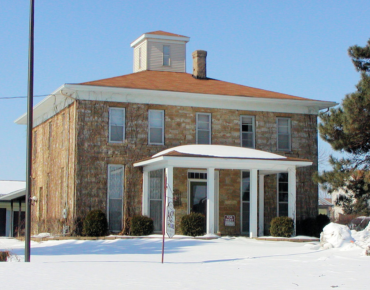
Daniel F. Akin House
Monument and historic site · National Register of Historic Places · 3.9 mi
United States historic place
19185 Akin Road, Farmington

Exchange Bank Building
Monument and historic site · National Register of Historic Places · 3.8 mi
Building in Farmington, Minnesota, United States
344 3rd Street, Farmington
214 Solvent Recovery Houses
Monument and historic site · 2.6 mi
Part of the former Gopher Ordnance Works
Parks, trails and playgrounds64

Rambling River Park
Park · 3.9 mi
Owned and maintained by the City of Farmington. Go here for Master Plan:...
17 Elm Street, Farmington
Dakota County Fairgrounds
Park · 4.5 mi
Fair is held every year in early August. Features the Dakota City Heritage Village which hosts special public events throughout the year...

Fountain Valley Golf Course
Golf course · 3.9 mi
2830 220th Street West, Farmington
Prairie Pines Park
Park · 4.2 mi
City owned public park for the Executive Estates Development area. First planning meeting was held on 1/12/17.
Southern Hills Golf Course
Golf course · 1.9 mi
18950 Chippendale Avenue, Farmington

52 more on the map.
Restaurants and cafes48

Bourbon Butcher Restaurant
Restaurant · Barbecue · 3.1 mi
20700 Chippendale Avenue W, Farmington
Mo-We 11:30-22:00; Th 11:30-23:00; Fr 11:30-23:59; Sa-Su 11:00-23:59
Las Enchiladas
Restaurant · Mexican · 4.1 mi
18500 Pilot Knob Road, Farmington
Su 11:00-20:00; Mo-Th 11:00-20:30; Fr-Sa 11:00-21:30
Mei Wei
Restaurant · Chinese · 4.1 mi
18500 Pilot Knob Road, Farmington
Su-Th 11:00-10:00; Fr-Sa 11:00-10:30

Blue Nose Coffee
Cafe · 3.1 mi
20700 Chippendale Avenue W, Farmington
Mo-Fr 06:00-19:00; Sa 07:00-19:00; Su 07:00-18:00

Farmington Lanes
Bar and pub · 3.5 mi
27 5th Street, Farmington
Mo-Th 13:00-11:00; Fr 13:00-01:00, Sa 11:00-01:00, Su 11:00-23:00
Gossips Bar And Grill
Bar and pub · 3.8 mi
309 3rd Street, Farmington
Su-Th 11:00-24:00, Fr-Sa 11:00-02:00

Farmington Steak House
Restaurant · Steak House · 3.8 mi
329 3rd Street, Farmington
Mo-Sa 11:00-21:00
Farm Town Brew Hall
Bar and pub · 3.1 mi
20700 Chippendale Avenue W, Farmington
Mo-We 11:30-22:00; Th 11:30-23:00; Fr 11:30-23:59; Sa 11:00-23:59;...
36 more on the map.
Where to stay1
Churches and places of worship15
Church of the Advent
Church · National Register of Historic Places · 3.7 mi
Community Of Hope Lutheran Church
Church · Nondenominational · 4.4 mi
14401 Biscayne Avenue, Rosemount
Christ Presbyterian Church
Church · Presbyterian · 3.9 mi
104 Elm Street, Farmington
Faith United Methodist Church
Church · Methodist · 3.8 mi
710 8th Street, Farmington
Saint John's Lutheran Church of Rich Valley
Church · Lutheran · 4.5 mi
14385 Blaine Avenue, Rosemount
Shopping6
Pellicci Ace Hardware
Hardware store · 4.3 mi
14635 South Robert Trail, Rosemount
Gas and EV charging11
Schools, colleges and libraries44
Healthcare5
Map of Empire
200 places. The map loads OpenStreetMap tiles when you open it.
Climate by month
Monthly table
| Month | High | Low | Rain |
|---|---|---|---|
| Jan | 22°F | 3°F | 1.0 in |
| Feb | 27°F | 7°F | 0.9 in |
| Mar | 40°F | 20°F | 1.8 in |
| Apr | 56°F | 34°F | 3.1 in |
| May | 68°F | 47°F | 4.3 in |
| Jun | 77°F | 57°F | 4.9 in |
| Jul | 81°F | 61°F | 4.5 in |
| Aug | 79°F | 58°F | 4.4 in |
| Sep | 72°F | 50°F | 3.4 in |
| Oct | 59°F | 37°F | 2.9 in |
| Nov | 42°F | 23°F | 1.7 in |
| Dec | 28°F | 11°F | 1.2 in |
U.S. Climate Normals 1991-2020 for Rosemount Rsch & Outreach Ctr (3 mi away), NOAA NCEI.
People and cost of living
American Community Survey 5-year estimates, 2020-2024, U.S. Census Bureau. Estimates have margins of error, larger for small towns.
Getting there and nearby towns
Stanton Airfield (SYN) is the nearest airport with scheduled flights listed in OpenStreetMap, 15 miles away.
- Farmington 4 mi west, about 6 min by car
- Rosemount 5 mi north, about 8 min by car
- Apple Valley 7 mi northwest, about 11 min by car
- Lakeville 8 mi west, about 13 min by car
- Eagan 10 mi north, about 16 min by car
- Inver Grove Heights 10 mi north, about 17 min by car
- Burnsville 11 mi northwest, about 18 min by car
- Hastings 12 mi east, about 20 min by car
- St. Paul Park 12 mi northeast, about 19 min by car
- Cottage Grove 13 mi northeast, about 20 min by car
Drive times are estimates from straight-line distance, not routes.
Local news
Headlines from INDB, the NEMICO news database.
Reviews, tips and questions
Loading what members have shared...
Sources and licences
- NCES EDGE (Public domain): public schools
- NOAA NCEI U.S. Climate Normals 1991-2020 (Public domain): climate by month
- OpenStreetMap contributors (ODbL 1.0): places, airports, map data
- U.S. Census Bureau (Public domain): population, income, housing, education, commute
- Wikidata (CC0 1.0): landmarks and historic places
- Wikimedia Commons (see each image): photos
Photo credits
- Whitetail Woods Regional Park, Minnesota - Hike around Empire Lake (28625865448), Tony Webster from Minneapolis, Minnesota, United States, CC BY 2.0
- Empire Lake - Whitetail Woods Regional Park, Dakota County, Minnesota (27522539637), Tony Webster from Minneapolis, Minnesota, United States, CC BY 2.0
- Akinhouse, Original uploader was Appraiser at en.wikipedia, CC BY-SA 3.0
- Farmington-Advent, Appraiser at English Wikipedia, CC BY-SA 3.0
- Mushrooms on hardwood tree, coprinellus micaceus fungus, Minnesota - Whitetail Woods Regional Park (42474466722), Tony Webster from Minneapolis, Minnesota, United States, CC BY 2.0
- Prairie Hiking Trail - Whitetail Woods Regional Park, Minnesota (41777004834), Tony Webster from Minneapolis, Minnesota, United States, CC BY 2.0
- Taraxacum dandelion seed head in grass (41977925894), Tony Webster from Minneapolis, Minnesota, United States, CC BY 2.0
- Cystiphora sonchi 84551974, Marilynn Miller, CC BY 4.0
- Chargepoint Electric Vehicle (EV) Charging Station, Dakota County, Minnesota (41490006075), Tony Webster from Minneapolis, Minnesota, United States, CC BY 2.0
- Picnic Shelter - Whitetail Woods Regional Park, Dakota County Parks, Minnesota (41977958194), Tony Webster from Minneapolis, Minnesota, United States, CC BY 2.0
- On the Lone Rock trail - panoramio, Jayesh Naithani, CC BY-SA 3.0
- Whitetail Woods Regional Park - Forest Hike, Minnesota (42343458272), Tony Webster from Minneapolis, Minnesota, United States, CC BY 2.0
- Dryad's Saddle Pheasant's Back Mushroom (cerioporus squamosus) (41623969505), Tony Webster from Minneapolis, Minnesota, United States, CC BY 2.0
- Whitetail Woods Camper Cabin, Dakota County, Minnesota (41776080594), Tony Webster from Minneapolis, Minnesota, United States, CC BY 2.0
- Water Bottle Refill Station at Park (53799136734), Tony Webster, CC BY 2.0
- Katadyn BeFree Water Filter Bottle, Hollow Fiber 0.1-micron filter (42646936672), Tony Webster from Minneapolis, Minnesota, United States, CC BY 2.0
- Katadyn BeFree Water Bottle 0.1-micron Hollow Fiber Filter (42691095220), Tony Webster from Minneapolis, Minnesota, United States, CC BY 2.0
- ISS053-E-428800 - View of Earth, Earth Science and Remote Sensing Unit, NASA Johnson Space Center, Public domain
- ISS053-E-411281 - View of Earth, Earth Science and Remote Sensing Unit, NASA Johnson Space Center, Public domain
- Lone Rock - panoramio, Jayesh Naithani, CC BY-SA 3.0
- Farming Irrigation Watering System - Minnesota Farm (42696295311), Tony Webster from Minneapolis, Minnesota, United States, CC BY 2.0
- Antique Sun - panoramio, Jayesh Naithani, CC BY-SA 3.0
- Intermediate wheatgrass flowering, Jpukabeals, CC BY-SA 4.0
- Kemps - Dairy Industry Processing Facility - Farmington, Minnesota (41669146174), Tony Webster from Minneapolis, Minnesota, United States, CC BY 2.0
- Hyadaphis tataricae - iNaturalist 91840212, Rose Zappa, CC BY 4.0
- Church of the Advent - panoramio (1), Jayesh Naithani, CC BY-SA 3.0
- Church of the Advent - panoramio, Jayesh Naithani, CC BY-SA 3.0
- A close-up view - panoramio, Jayesh Naithani, CC BY-SA 3.0
- 2026AdventFarmingtonMN, Travellers & Tinkers, CC BY-SA 4.0
- Exchange Bank Building - panoramio, Jayesh Naithani, CC BY-SA 3.0
- Exchange Bank Building, McGhiever, CC BY-SA 4.0
- American Pride - panoramio, Jayesh Naithani, CC BY-SA 3.0
- Daniel F. Akin House, McGhiever, CC BY-SA 4.0
- Daniel F. Akin House 2, McGhiever, CC BY-SA 4.0
- ISD 196 - East Office, Tylervigen, CC BY 4.0


Page built October 30, 2026. Spotted a mistake? Tell us or suggest a place.