




Lakeville, Minnesota
Lakeville is a city of 74,354 people in Dakota County, Minnesota, founded in 1850.
Why visit Lakeville
Townapedia lists 9 museums and landmarks, 121 parks and trails, 165 places to eat, 11 places to stay and 5 attractions in and around town.
Highlights include Buck Hill, Lakeville 21 Theatre, Daniel F. Akin House and Emil J. Oberhoffer House.
July is the warmest month, with average highs of 82°F; January lows average 8°F, and about 41 inches of snow fall in a normal year.
Weather in Lakeville
Forecast from the National Weather Service. Full forecast
About Lakeville
Lakeville () is the largest city in Dakota County, Minnesota, United States. An exurb in the Minneapolis–Saint Paul metropolitan area, it is about 20 miles (32 km) south of both downtown Minneapolis and downtown St. Paul along Interstate 35. The population was 69,490 at the 2020 census, making it the ninth-most populous city in Minnesota.
From the Wikipedia article Lakeville, Minnesota (this version), under CC BY-SA 4.0.
Things to do5
Buck Hill
Ski area · 3.7 mi
Small ski area since 1954 offering equipment rentals, lessons & snow tubing, plus a restaurant.
15400 Buck Hill Road, Burnsville
Mo-Th 10:00-21:00; Fr-Su,PH 09:00-21:00

Museums and landmarks9
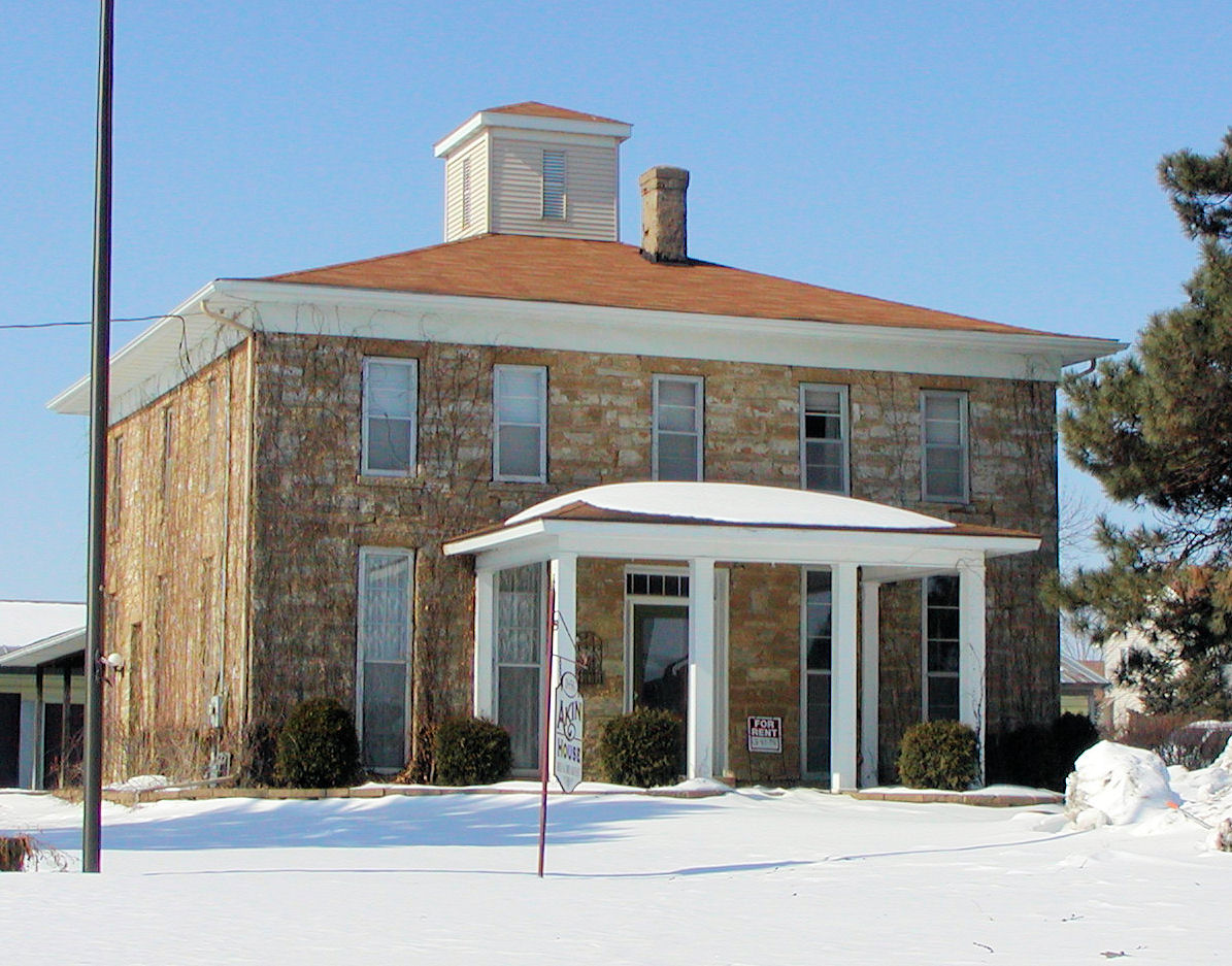
Daniel F. Akin House
Monument and historic site · National Register of Historic Places · 3.9 mi
United States historic place
19185 Akin Road, Farmington

Emil J. Oberhoffer House
Monument and historic site · National Register of Historic Places · 3.7 mi
Historic house in Lakeville, Minnesota

Exchange Bank Building
Monument and historic site · National Register of Historic Places · 5.8 mi
Building in Farmington, Minnesota, United States


Minneapolis Saint Paul Rochester & Dubuque Electric Traction Company Depot
Monument and historic site · National Register of Historic Places · 4.0 mi
Railway station in Burnsville, the United States of America



Parks, trails and playgrounds121


Minnesota Zoo
Park · 6.9 mi
Zoo in Apple Valley, Minnesota, United States


West Lake Marion Mountain Bike Trail
Hiking and trails · 2.0 mi
19720 Juno Trail
06:00-22:00

Crystal Lake Beach
Beach · 3.4 mi
Small beach with some space to have activities/events. Also a small recreation building right between the beach and the parking lot.
1101 Crystal Lake Road East, Burnsville
Hayes Park Arena
Sports field and stadium · 4.4 mi
14595 Hayes Road, Apple Valley
109 more on the map.
Restaurants and cafes165

Angry Inch Brewing
Brewery and winery · Grill, Burger · 2.0 mi
20841 Holyoke Avenue, Lakeville
We,Th 14:00-22:00; Fr,Sa 12:00-00:00, Su 12:00-20:00

BUCK '54 BAR & GRILL
Restaurant · Bar And Grill, American · 3.8 mi
15400 Buck Hill Road, Burnsville
Mo-Fr 14:00-22:00, Sa-Su 11:00-22:00
Blue Ox Sandwich Factory
Restaurant · Sandwich · 4.9 mi
14270 Buck Hill Road, Burnsville
Mo-Sa 11:00-19:00
Brick & Bourbon
Restaurant · Burger, American, Barbecue, Pasta · 4.5 mi
14883 Florence Trail, Apple Valley
Su-Th 11:00-22:00; Fr-Sa 11:00-00:00
Carbone's Bar & Grill
Restaurant · Pizza, Grill · 3.1 mi
7670 160th Street West, Lakeville
Mo-Tu 11:00-00:30, We-Sa 11:00-01:00, Su 11:00-00:00

Constellation Coffee
Cafe · Coffee Shop, Tea, Dessert · 4.6 mi
14800 Galaxie Avenue, Apple Valley
Tu-Sa 07:00-15:00

Cracker Barrel
Diner · American · 2.5 mi
17189 Kenyon Avenue, Lakeville
Su-Th 06:00-21:00; Fr-Sa 06:00-22:00
Curiouser Coffee & Conservatory
Cafe · Breakfast, Coffee Shop · 4.5 mi
14889 Florence Trail
Mo-Su 08:00-20:00
Denny's
Diner · American · 4.1 mi
7805 150th Street West, Apple Valley
Mo,Tu,Su 05:00-24:00, We-Sa 05:00-02:00
153 more on the map.
History
A military road was constructed between Fort Snelling and forts to the south. In 1855, J. J. Brackett, a Saint Paul lumber baron and mail carrier using the road, platted a site halfway between Saint Paul and Saint Peter on a lake he named Prairie Lake. The village was established as Lakeville Township in 1858. Notoriety came when Colonel Marion Savage expanded his entertainment business by constructing Antlers Amusement Park in 1910. Riding on fame from his success with the Dan Patch racing horse and the park's popularity, the lake was renamed Lake Marion, and the rail line serving the park was named the Dan Patch Railroad Line.
With the mostly rural landscape, early settlers were farmers. A high proportion were Scandinavian. Other ethnic groups included Irish, Scots, and English, each of whom had spread out from Hamilton Landing and Burnsville. In Karen Miller's diary from 1840 to 1895, Danes reportedly outnumbered Norwegians; travel to Minneapolis was not uncommon for the rural township. Enggren's Grocery was a downtown staple from 1900 until it closed in 2006.
From the History section of Lakeville, Minnesota on Wikipedia, under CC BY-SA 4.0.
Where to stay11
Churches and places of worship31
Church of the Advent
Church · National Register of Historic Places · 5.9 mi
The Church of Jesus Christ of Latter-day Saints
Church · Latter Day Saints · 4.0 mi
651 Southcross Drive East, Burnsville
Shopping30
Gas and EV charging32
Schools, colleges and libraries59
Healthcare19
Action Behavior Centers - ABA Therapy for Autism
Clinic and pharmacy · 4.6 mi
14949 Florence Trail, Apple Valley
Family Health Medical Clinic
Clinic and pharmacy · 2.7 mi
9974 214th Street West, Lakeville
Map of Lakeville
250 places. The map loads OpenStreetMap tiles when you open it.
Climate by month
Monthly table
| Month | High | Low | Rain | Snow |
|---|---|---|---|---|
| Jan | 23°F | 8°F | 1.1 in | 10.5 in |
| Feb | 28°F | 12°F | 0.8 in | 6.4 in |
| Mar | 41°F | 24°F | 1.7 in | 8.0 in |
| Apr | 56°F | 36°F | 2.7 in | 1.8 in |
| May | 69°F | 48°F | 3.9 in | 0.0 in |
| Jun | 78°F | 58°F | 4.9 in | 0.0 in |
| Jul | 82°F | 63°F | 4.2 in | 0.0 in |
| Aug | 79°F | 60°F | 4.4 in | 0.0 in |
| Sep | 72°F | 52°F | 3.2 in | 0.0 in |
| Oct | 58°F | 39°F | 2.8 in | 0.3 in |
| Nov | 42°F | 26°F | 1.6 in | 7.0 in |
| Dec | 28°F | 14°F | 1.0 in | 7.0 in |
U.S. Climate Normals 1991-2020 for Farmington 3 Nw Hcn (4 mi away), NOAA NCEI.
People and cost of living
American Community Survey 5-year estimates, 2020-2024, U.S. Census Bureau. Estimates have margins of error, larger for small towns.
Disaster history
Dakota County has had 7 federal disaster declarations since 2000, most often for biologicals.
- 2020-04-07: Covid-19 Pandemic (Biological)
- 2020-03-13: Covid-19 (Biological)
- 2012-07-06: Severe Storms And Flooding (Severe Storm)
- 2010-03-19: Flooding (Flood)
- 2005-09-13: Hurricane Katrina Evacuation (Hurricane)
- 2001-05-16: Severe Winter Storms, Flooding, And Tornadoes (Flood)
OpenFEMA disaster declarations summaries.
Getting there and nearby towns
Minneapolis-Saint Paul International Airport (MSP) is the nearest airport with scheduled flights listed in OpenStreetMap, 14 miles away.
- Farmington 4 mi east, about 7 min by car
- Apple Valley 5 mi northeast, about 9 min by car
- Burnsville 6 mi north, about 10 min by car
- Eagan 11 mi northeast, about 17 min by car
- Bloomington 11 mi north, about 18 min by car
- Eden Prairie 16 mi northwest, about 25 min by car
- Edina 16 mi north, about 25 min by car
- Cottage Grove 19 mi northeast, about 31 min by car
- Minneapolis 20 mi north, about 32 min by car
- St. Paul 20 mi north, about 33 min by car
Drive times are estimates from straight-line distance, not routes.
Local news
Headlines from INDB, the NEMICO news database.
Reviews, tips and questions
Loading what members have shared...
Sources and licences
- NCES EDGE (Public domain): public schools
- NOAA NCEI U.S. Climate Normals 1991-2020 (Public domain): climate by month
- OpenFEMA (Public domain): disaster declarations
- OpenStreetMap contributors (ODbL 1.0): places, airports, map data
- U.S. Census Bureau (Public domain): population, income, housing, education, commute
- Wikidata (CC0 1.0): elevation, founding date, time zone, website, landmarks and historic places
- Wikimedia Commons (see each image): photos
- Wikipedia (CC BY-SA 4.0): overview and history text
Photo credits
- Lakeville-City-Hall, Allmightyduck, CC BY-SA 3.0
- Buck Hill in summer, Baseball Bugs, CC BY-SA 4.0
- Akinhouse, Original uploader was Appraiser at en.wikipedia, CC BY-SA 3.0
- Oberhofferhouse, Appraiser at English Wikipedia, CC BY-SA 3.0
- Orchard Gardens Depot 2, Elkman, CC BY-SA 4.0
- Farmington-Advent, Appraiser at English Wikipedia, CC BY-SA 3.0
- Exchange Bank Building, McGhiever, CC BY-SA 4.0
- 2026SteveSimon, Travellers & Tinkers, CC BY-SA 4.0
- ZackFilipovich (cropped), Travellers & Tinkers, CC BY-SA 4.0
- 2026Carlbom, Travellers & Tinkers, CC BY-SA 4.0
- BiancaVirnig, Travellers & Tinkers, CC BY-SA 4.0
- 2026DrMattKlein, Travellers & Tinkers, CC BY-SA 4.0
- ZackFilipovich, Travellers & Tinkers, CC BY-SA 4.0
- 2026DavePinto, Travellers & Tinkers, CC BY-SA 4.0
- 2026ErinMurphy, Travellers & Tinkers, CC BY-SA 4.0
- Coffee steaming in a mug, PedanticNarrativeController, CC0
- 2026MattLittle (cropped), Travellers & Tinkers, CC BY-SA 4.0
- 2026MattLittle, Travellers & Tinkers, CC BY-SA 4.0
- 2026Little, Travellers & Tinkers, CC BY-SA 4.0
- MattLittle, Travellers & Tinkers, CC BY-SA 4.0
- Grumman Long Life Vehicle (LLV) of the USPS, Greg Gjerdingen, CC BY 2.0
- 1965 Oldsmobile Ninety-Eight Convertible - 42742074944, Greg Gjerdingen, CC BY 2.0
- 1965 Oldsmobile Ninety-Eight Convertible, Greg Gjerdingen, CC BY 2.0
- 1989 Nissan Pao's roof, Greg Gjerdingen, CC BY 2.0
- 1989 Nissan Pao's interior, Greg Gjerdingen, CC BY 2.0
- Chevrolet (34323097414), Greg Gjerdingen from Willmar, USA, CC BY 2.0
- Chevrolet (35168126715), Greg Gjerdingen from Willmar, USA, CC BY 2.0
- Chevrolet (34323085704), Greg Gjerdingen from Willmar, USA, CC BY 2.0
- ISS036-E-12484 - View of Earth, Earth Science and Remote Sensing Unit , Lyndon B. Johnson Space Center, Public domain
- ISS056-E-193895 - View of Earth, Earth Science and Remote Sensing Unit, NASA Johnson Space Center, Public domain
- ISS056-E-193894 - View of Earth, Earth Science and Remote Sensing Unit, NASA Johnson Space Center, Public domain
- ISS056-E-193896 - View of Earth, Earth Science and Remote Sensing Unit, NASA Johnson Space Center, Public domain
- ISS056-E-193897 - View of Earth, Earth Science and Remote Sensing Unit, NASA Johnson Space Center, Public domain
- ISS056-E-193899 - View of Earth, Earth Science and Remote Sensing Unit, NASA Johnson Space Center, Public domain
- ISS056-E-193898 - View of Earth, Earth Science and Remote Sensing Unit, NASA Johnson Space Center, Public domain
- ISS018-E-14018 - View of Earth, Earth Science and Remote Sensing Unit , Lyndon B. Johnson Space Center, Public domain
- FAM98C date of diveregence v corrected amino acids, Genbio123, CC BY-SA 4.0
- 2023-0927-Burnseville Redleaf, Bobak Ha'Eri, CC BY 3.0
- Progress Rail (PGR) Caboose No. 101, May 2011, Jerry Huddleston, CC BY 2.0
- Crystal Lake, Burnsville, MN (7122503029), WorldIslandInfo.com, CC BY 2.0


Page built October 30, 2026. Spotted a mistake? Tell us or suggest a place.