


Hastings, Minnesota
Hastings is a city of 22,117 people in Dakota County, Minnesota, founded in 1857.
Why visit Hastings
Townapedia lists 20 museums and landmarks, 42 parks and trails, 51 places to eat, 4 places to stay and 6 attractions in and around town.
Highlights include Hastings Bridge, Hastings High Bridge, Byron Howes House and Daniel Smith House.
July is the warmest month, with average highs of 83°F; January lows average 6°F.
Weather in Hastings
Forecast from the National Weather Service. Full forecast
About Hastings
Hastings is a city mostly in Dakota County, Minnesota, of which it is the county seat, with a portion in Washington County, Minnesota, United States. It is near the confluence of the Mississippi, Vermillion, and St. Croix Rivers. The population was 22,154 at the 2020 census. It is named for the first elected governor of Minnesota, Henry Hastings Sibley.
From the Wikipedia article Hastings, Minnesota (this version), under CC BY-SA 4.0.
Things to do6





Museums and landmarks20

Byron Howes House
Monument and historic site · National Register of Historic Places · 0.5 mi
Historic house in Minnesota, United States

Daniel Smith House
Monument and historic site · National Register of Historic Places · 2.8 mi
House in Prescott, Wisconsin

District No. 34 School
Monument and historic site · National Register of Historic Places · 2.2 mi
Schoolhouse in Minnesota, United States
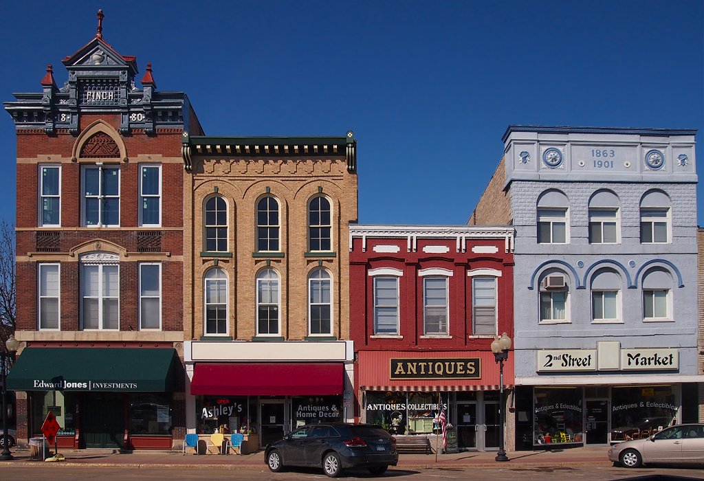
East Second Street Commercial Historic District
Monument and historic site · National Register of Historic Places · 0.9 mi
Historic district in Minnesota, United States

Fasbender Clinic
Monument and historic site · National Register of Historic Places · 0.6 mi
Hospital in Minnesota, United States
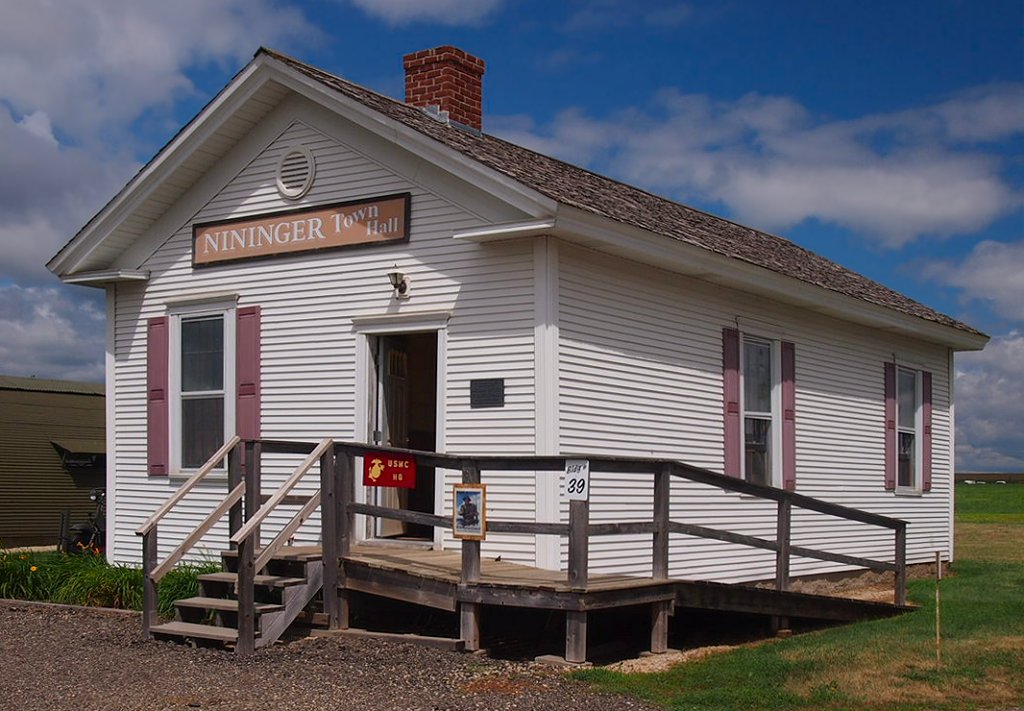
Good Templars Hall
Monument and historic site · National Register of Historic Places · 3.6 mi
Historic building in Minnesota, USA

H. S. Miller Bank
Monument and historic site · National Register of Historic Places · 2.8 mi
Building in Wisconsin, United States


Hastings Foundry-Star Iron Works
Monument and historic site · National Register of Historic Places · 1.1 mi
Building in Hastings, Minnesota, United States
Ignatius Eckert House
Monument and historic site · National Register of Historic Places · 0.6 mi
Hastings, Minnesota, listed on the NRHP in Dakota County, Minnesota
MacDonald–Todd House
Monument and historic site · National Register of Historic Places · 0.5 mi
Historic house in Minnesota, United States
Ramsey Mill and Old Mill Park
Monument and historic site · National Register of Historic Places · 0.6 mi
Hastings, Minnesota
Rudolph Latto House
Monument and historic site · National Register of Historic Places · 0.6 mi
Historic house in Minnesota, United States
8 more on the map.
Parks, trails and playgrounds42

The Hastings Family Aquatic Center
Sports field and stadium · 0.5 mi
901 Maple Street, Hastings
12:00-19:00; Tu,Th,Sa 12:00-17:00




30 more on the map.
Restaurants and cafes51

328 Grill
Restaurant · Burger, Sandwich, Soup, Salad, Pasta · 1.1 mi
350 33rd Street West, Hastings
Mo-Sa 11:00-22:00; Su 09:00-22:00


Caribou
Cafe · Coffee Shop · 1.3 mi
225 33rd Street West, Hastings
Mo,Su 06:00-19:00; Tu-Sa 05:30-19:00
Dunn Brothers Coffee
Cafe · Coffee Shop · 0.4 mi
919 Vermillion Street, Hastings
Mo-Sa 06:00-17:00; Su 06:15-17:00
Las Margaritas Mexican Restaurant
Restaurant · Mexican · 0.6 mi
2100 Vermillion Street, Hastings
Mo-We 11:00-21:45; Th-Sa 11:00-22:00; Su 11:00-21:30
Pizza Hut
Restaurant · Pizza · 1.3 mi
1330 South Frontage Road, Hastings
Su-Th 10:00-23:00, Fr-Sa 10:00-00:00
The Bar Drafthouse
Bar and pub · Pizza · 0.6 mi
2101 Vermillion Road
Mo-We 09:00-23:00; Th 09:00-00:00; Fr-Sa 09:00-01:00; Su 10:00-23:00

39 more on the map.
History
In the winter of 1820, a military detachment from Fort Snelling settled the area around Hastings to guard a blocked shipment of supplies. Lieutenant William G. Oliver camped in an area that came to be known as Oliver's Grove; in 1833 a trading post was opened there. After the Treaty of Mendota of 1851 opened the area for white settlement, Oliver's Grove was surveyed and incorporated as a city in 1857, a year before Minnesota's admission to the Union. The same year, Hastings was named the county seat of Dakota County. The name "Hastings" was drawn out of a bucket from suggestions placed in it by several of the original founders.
In the mid-19th century, Hastings, Prescott, Wisconsin, and the adjacent township of Nininger were areas of tremendous land speculation. Ignatius L. Donnelly promoted the area as a potential "New Chicago." The Panic of 1857 put an end to this dream. The speculation and panic caused the cities' growth to be less than expected given their location at the confluence of two significant rivers; today, their combined population is approximately 25,000, and all that remains of Nininger is a few building ruins.
From the History section of Hastings, Minnesota on Wikipedia, under CC BY-SA 4.0.
Where to stay4
Coratel Inn & Suites by Jasper Hastings
Motel and hotel · 0.8 mi
2450 Vermillion Street, Hastings
Churches and places of worship8
First Presbyterian Church
Church · National Register of Historic Places · 0.6 mi
Hastings Methodist Episcopal Church
Church · National Register of Historic Places · 0.5 mi
Our Saviour's Lutheran Church
Church · Lutheran · 0.4 mi
400 9th Street West, Hastings
Resurrection United Methodist of Hastings
Church · Methodist
615 15th Street West, Hastings
Shopping5
Gas and EV charging9
Schools, colleges and libraries25
Healthcare2
Allina Health United Hospital – Hastings Regina Campus
Hospital · 1.5 mi
1175 Nininger Road, Hastings
Allina Health - Hastings
Clinic and pharmacy · 2.1 mi
1880 North Frontage Road, Hastings
Map of Hastings
172 places. The map loads OpenStreetMap tiles when you open it.
Climate by month
Monthly table
| Month | High | Low | Rain |
|---|---|---|---|
| Jan | 24°F | 6°F | 0.9 in |
| Feb | 29°F | 9°F | 0.9 in |
| Mar | 41°F | 22°F | 1.8 in |
| Apr | 56°F | 36°F | 3.1 in |
| May | 69°F | 48°F | 4.3 in |
| Jun | 79°F | 59°F | 4.9 in |
| Jul | 83°F | 63°F | 4.4 in |
| Aug | 81°F | 61°F | 4.2 in |
| Sep | 73°F | 53°F | 3.2 in |
| Oct | 59°F | 40°F | 2.6 in |
| Nov | 43°F | 27°F | 1.7 in |
| Dec | 30°F | 14°F | 1.2 in |
U.S. Climate Normals 1991-2020 for Hastings Dam 2 (2 mi away), NOAA NCEI.
People and cost of living
American Community Survey 5-year estimates, 2020-2024, U.S. Census Bureau. Estimates have margins of error, larger for small towns.
Disaster history
Dakota County has had 7 federal disaster declarations since 2000, most often for biologicals.
- 2020-04-07: Covid-19 Pandemic (Biological)
- 2020-03-13: Covid-19 (Biological)
- 2012-07-06: Severe Storms And Flooding (Severe Storm)
- 2010-03-19: Flooding (Flood)
- 2005-09-13: Hurricane Katrina Evacuation (Hurricane)
- 2001-05-16: Severe Winter Storms, Flooding, And Tornadoes (Flood)
OpenFEMA disaster declarations summaries.
Getting there and nearby towns
St. Paul Downtown Airport (STP) is the nearest airport with scheduled flights listed in OpenStreetMap, 17 miles away.
- Cottage Grove 6 mi northwest, about 10 min by car
- Eagan 16 mi west, about 26 min by car
- Farmington 16 mi west, about 26 min by car
- Apple Valley 17 mi west, about 27 min by car
- St. Paul 19 mi northwest, about 31 min by car
- Burnsville 21 mi west, about 34 min by car
- Bloomington 24 mi west, about 38 min by car
- Minneapolis 26 mi northwest, about 42 min by car
- Edina 27 mi northwest, about 44 min by car
- Eden Prairie 31 mi west, about 50 min by car
Drive times are estimates from straight-line distance, not routes.
Local news
Headlines from INDB, the NEMICO news database.
Reviews, tips and questions
Loading what members have shared...
Sources and licences
- NCES EDGE (Public domain): public schools
- NOAA NCEI U.S. Climate Normals 1991-2020 (Public domain): climate by month
- OpenFEMA (Public domain): disaster declarations
- OpenStreetMap contributors (ODbL 1.0): places, airports, map data
- U.S. Census Bureau (Public domain): population, income, housing, education, commute
- Wikidata (CC0 1.0): elevation, founding date, time zone, website, landmarks and historic places
- Wikimedia Commons (see each image): photos
- Wikipedia (CC BY-SA 4.0): overview and history text
Photo credits
- HastingsCH, Appraiser at English Wikipedia, Public domain
- Hybrid - Early Victorian (Gothic Revival, Italianate) - Hastings, MN - William G. LeDuc House (2), Bmzuckerman, CC BY 4.0
- Hybrid - Early Victorian (Gothic Revival, Italianate) - Hastings, MN - William G. LeDuc House (1), Bmzuckerman, CC BY 4.0
- Hybrid - Early Victorian (Gothic Revival, Italianate) - Hastings, MN - William G. LeDuc House (3), Bmzuckerman, CC BY 4.0
- Hastings Methodist Episcopal Church summer, McGhiever, CC BY-SA 4.0
- Hastings Methodist Episcopal Church, McGhiever, CC BY-SA 4.0
- First Presbyterian Church of Hastings, McGhiever, CC BY-SA 4.0
- Eastbound Borealis in Hastings, May 2024, Jerry Huddleston from Hampton, Minnesota, US, CC BY 2.0
- CP 474, Hastings, chief_huddleston, CC BY 2.0
- Hastings City Hall SW, McGhiever, CC BY-SA 4.0
- Hastings City Hall SE, McGhiever, CC BY-SA 4.0
- 1884CityHallHastingsMN, Jonathunder, GFDL 1.2
- East 2nd St Commercial HD 2, McGhiever, CC BY-SA 3.0
- District 34 School, McGhiever, CC BY-SA 4.0
- Thompson-Fasbender House, McGhiever, CC BY-SA 3.0
- First Presbyterian Hastings, Todd Murray, CC BY-SA 3.0
- FasbenderClinicHastingsMN, Jonathunder, GFDL 1.2
- Nininger Town Hall, McGhiever, CC BY-SA 3.0
- H.S. Miller Bank 1, AlexiusHoratius, CC BY-SA 3.0
- Hastings Foundry, McGhiever, CC BY-SA 3.0
- Daniel Smith House Prescott 1, AlexiusHoratius, CC BY-SA 3.0
- West 2nd Homes-Strauss, Todd Murray, CC BY-SA 3.0
- Hastings Highway Bridge, Todd Murray, CC BY-SA 3.0
- Mississippi River railroad bridge in Hastings, Minnesota, Michael Hicks from Saint Paul, MN, USA, CC BY 2.0
- William G. LeDuc House, McGhiever, CC BY-SA 3.0
- Byron Howes House 2015, McGhiever, CC BY-SA 4.0
- Ignatius Eckert House, McGhiever, CC BY-SA 4.0
- MacDonald-Todd House, McGhiever, CC BY-SA 3.0
- VanDyke-Libby House, McGhiever, CC BY-SA 4.0
- Rudolph Latto House, McGhiever, CC BY-SA 4.0
- 1967 Buick Wildcat Convertible (35464653184), Greg Gjerdingen from Willmar, USA, CC BY 2.0
- 1967 Buick Wildcat Convertible (36165956541), Greg Gjerdingen from Willmar, USA, CC BY 2.0
- 1967 Buick Wildcat Convertible (35905272070), Greg Gjerdingen from Willmar, USA, CC BY 2.0
- 1967 Buick Wildcat Convertible (35492768063), Greg Gjerdingen from Willmar, USA, CC BY 2.0
- Eastbound Empire Builder passing Lake Isabel, March 2012, chief_huddleston, CC BY 2.0
- Ramsey Mill, McGhiever, CC BY-SA 4.0
- 1964 Studebaker Gran Turismo Hawk (29775464725), Greg Gjerdingen from Willmar, USA, CC BY 2.0
- 2012 Fiat 500 Sport (29692983991), Greg Gjerdingen from Willmar, USA, CC BY 2.0
- 1968 Dodge Charger R T (29147868354), Greg Gjerdingen from Willmar, USA, CC BY 2.0
- 1963 Chrysler 300 (29162715310), Greg Gjerdingen from Willmar, USA, CC BY 2.0


Page built October 30, 2026. Spotted a mistake? Tell us or suggest a place.