



Fairbanks Ranch, California
Fairbanks Ranch is a community of 2,703 people in San Diego County, California.
Why visit Fairbanks Ranch
Townapedia lists 1 museum or landmark, 12 parks and trails, 20 places to eat and 1 attraction in and around town.
Highlights include Fairbanks Ranch Country Club and Black Mountain Open Space Park.
August is the warmest month, with average highs of 83°F; December lows average 44°F.
Weather in Fairbanks Ranch
Forecast from the National Weather Service. Full forecast
About Fairbanks Ranch
Fairbanks Ranch is a census-designated place (CDP) in San Diego County, California. The population was 3,002 at the 2020 census, down from 3,148 at the 2010 census. The entire population is contained within two gated communities, divided into North and South sections by the formerly private San Dieguito Road.
From the Wikipedia article Fairbanks Ranch, California (this version), under CC BY-SA 4.0.
Things to do1

Museums and landmarks1

Parks, trails and playgrounds12



Black Mountain Open Space Park
Park · 4.1 mi
Open space park and nature area in San Diego, California, USA
San Dieguito River Park
Park · 3.7 mi
Park in San Diego County, California

Pacific Highlands Ranch Community Park
Park · 2.2 mi
5977 Village Center Loop Road, San Diego

Restaurants and cafes20

Amalfi Cucina Italiana
Restaurant · Italian · 2.0 mi
5980 Village Way, San Diego
Mo 16:00-21:00; Tu-Th 12:00-15:00,17:00-21:00; Fr-Sa 12:00-22:00;...

Pacific Social
Restaurant · 2.0 mi
6025 Village Way
Tu 15:00-21:00; We,Th 11:30-21:00; Fr 11:30-22:00; Sa 10:00-22:00;...

Cold Stone Creamery
Ice cream · Ice Cream · 2.1 mi
Mo-Th 11:30-21:30; Fr-Su 11:00-22:00
Sushi Exchange
Restaurant · 2.1 mi
13859 Carmel Valley Road
Mo-Th 11:30-14:00, 16:00-20:30; Fr-Su 11:30-20:30

8 more on the map.
Churches and places of worship2
Nativity Catholic Church
Church · Roman Catholic · 0.7 mi
6309 El Apajo Road, Rancho Santa Fe
Shopping3
Fairbanks Ranch Deli and Pizza
Shop · 0.5 mi
12636 San Dieguito Road, Rancho Santa Fe
Gas and EV charging2
Schools, colleges and libraries49
Healthcare2
Map of Fairbanks Ranch
92 places. The map loads OpenStreetMap tiles when you open it.
Climate by month
Monthly table
| Month | High | Low | Rain |
|---|---|---|---|
| Jan | 67°F | 46°F | 2.8 in |
| Feb | 66°F | 46°F | 3.4 in |
| Mar | 68°F | 49°F | 2.0 in |
| Apr | 70°F | 51°F | 1.1 in |
| May | 72°F | 55°F | 0.4 in |
| Jun | 76°F | 58°F | 0.1 in |
| Jul | 82°F | 63°F | 0.1 in |
| Aug | 83°F | 64°F | 0.1 in |
| Sep | 81°F | 60°F | 0.2 in |
| Oct | 78°F | 57°F | 0.7 in |
| Nov | 71°F | 50°F | 1.1 in |
| Dec | 66°F | 44°F | 2.3 in |
U.S. Climate Normals 1991-2020 for Rancho Bernardo (6 mi away), NOAA NCEI.
People and cost of living
American Community Survey 5-year estimates, 2020-2024, U.S. Census Bureau. Estimates have margins of error, larger for small towns.
Disaster history
San Diego County has had 35 federal disaster declarations since 2000, most often for fires.
- 2024-02-19: Severe Storm And Flooding (Flood)
- 2023-01-14: Severe Winter Storms, Flooding, Landslides, And Mudslides (Flood)
- 2023-01-09: Severe Winter Storms, Flooding, And Mudslides (Flood)
- 2020-10-16: Wildfires (Fire)
- 2020-03-22: Covid-19 Pandemic (Biological)
- 2020-03-13: Covid-19 (Biological)
OpenFEMA disaster declarations summaries.
Getting there and nearby towns
MCAS Miramar Airfield (NKX) is the nearest airport with scheduled flights listed in OpenStreetMap, 9 miles away.
- Rancho Santa Fe 2 mi north, about 4 min by car
- Solana Beach 4 mi west, about 7 min by car
- Del Mar 5 mi southwest, about 8 min by car
- Encinitas 6 mi northwest, about 10 min by car
- Harmony Grove 8 mi north, about 13 min by car
- Lake San Marcos 9 mi north, about 14 min by car
- San Marcos 10 mi north, about 16 min by car
- Poway 10 mi east, about 15 min by car
- Carlsbad 11 mi northwest, about 18 min by car
- San Diego 12 mi south, about 19 min by car
Drive times are estimates from straight-line distance, not routes.
Local news
Headlines from INDB, the NEMICO news database.
Reviews, tips and questions
Loading what members have shared...
Sources and licences
- NCES EDGE (Public domain): public schools
- NOAA NCEI U.S. Climate Normals 1991-2020 (Public domain): climate by month
- OpenFEMA (Public domain): disaster declarations
- OpenStreetMap contributors (ODbL 1.0): places, airports, map data
- U.S. Census Bureau (Public domain): population, income, housing, education, commute
- Wikidata (CC0 1.0): landmarks and historic places
- Wikimedia Commons (see each image): photos
- Wikipedia (CC BY-SA 4.0): overview and history text
Photo credits
- View From the Top of Black Mountain, San Diego, Ocatecir at English Wikipedia, CC BY-SA 3.0
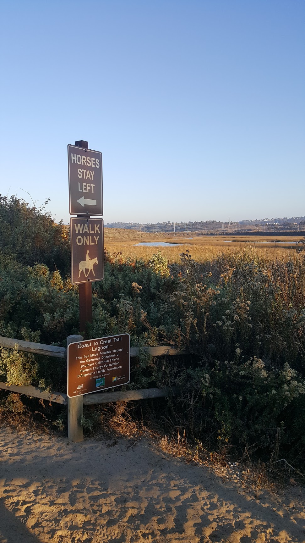
- Coast to Crest Trail, Carmelvalleyman, CC BY-SA 4.0
- The Manger (Unsplash), Greyson Joralemon greyson_joralemon1, CC0
- Horizon Christian Fellowship, Rancho Santa Fe, United States (Unsplash 6mThN6bc4YY), Matt Botsford mattbotsford, CC0
- LATE NIGHT (Unsplash), Matt Botsford mattbotsford, CC0
- Convolvulus simulans 34622563, Millie Basden, CC BY 4.0
- ISS045-E-21611 - View of Earth, Earth Science and Remote Sensing Unit , Lyndon B. Johnson Space Center, Public domain
- Chi-Huey Wong Recent, Ronyjeev1, CC BY-SA 4.0
- Nissan 300ZX Z32 2+2, Unknown author, CC BY-SA 2.0
- Ferocactus viridescens viridescens 31, Karen Fraser, CC0
- San Diego Panorama DSC 2644-DSC 2654 unwrapped, Troy Sankey, CC BY-SA 4.0
- Dudleya brevifolia 184259262, james davis, CC0
- Dudleya brevifolia 184259230, james davis, CC0
- Dudleya brevifolia 184259193, james davis, CC0
- Camissoniopsis bistorta 15771209, Millie Basden, CC BY 4.0
- Convolvulus simulans 69789713, Millie Basden, CC BY 4.0
- The Village at Pacific Highlands Ranch entrance, RightCowLeftCoast, CC BY 4.0
- San Diego Panorama DSC 2632-DSC 2643 unwrapped, Troy Sankey, CC BY-SA 4.0
- Pacific Highlands Ranch Library - North Entrance, RightCowLeftCoast, CC BY 4.0
- Pacific Highlands Ranch Library Seminar Room 118, RightCowLeftCoast, CC BY 4.0
- Pacific Highlands Ranch Library - South Entrance, RightCowLeftCoast, CC BY 4.0
- Trader-joes-mascot, Enoki Mushroom, CC BY-SA 4.0
- Playground at The Village at Pacific Highlands Ranch, San Diego, Midatii, CC BY-SA 4.0
- Rancho Santa Fe 2012-09-30 20-31-09, we6jbo, CC BY-SA 3.0
- Phoenix canariensis - Canary Island Date Palms at South Coast Wholesale Nursery, Southcoastwholesale, CC BY-SA 4.0
- HABS CAL,37-RANSF,3- (sheet 1 of 2) - Rancho Santa Fe Civic Center, Rancho Santa Fe, San Diego County, CA, Related names: Sinnard, L G Rice, Lilian Jenette H, K, transmitter Price, Virginia B, transmitter, Public domain
- HABS CAL,37-RANSF,11- (sheet 1 of 1) - Rancho Santa Fe, Rancho Santa Fe, San Diego County, CA, Related names: Sinnard, L G Rice, Lilian Jenette Farber, Lauren, historian, Public domain
- HABS CAL,37-RANSF,9- (sheet 1 of 2) - Sidney and Ruth Nelson Rowhouse, 6118 Paseo Delicias, Rancho Santa Fe, San Diego County, CA, Related names: Rice, Lilian Jenette Price, Virginia B, transmitter, Public domain


Page built October 30, 2026. Spotted a mistake? Tell us or suggest a place.