

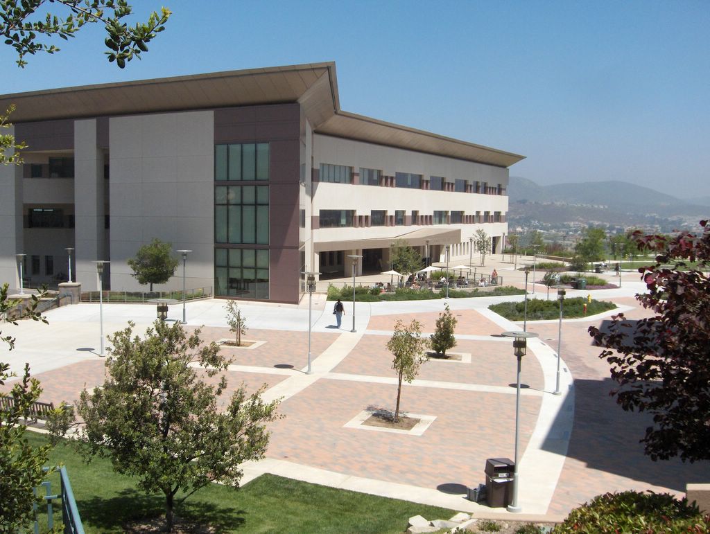


Lake San Marcos, California
Lake San Marcos is a community of 4,693 people in San Diego County, California.
Why visit Lake San Marcos
Townapedia lists 2 museums and landmarks, 9 parks and trails, 28 places to eat, 2 places to stay and 3 attractions in and around town.
Highlights include California State University San Marcos, San Elijo College, Rancho De Los Kiotes and Bradley Bike Park.
August is the warmest month, with average highs of 76°F; December lows average 47°F.
Weather in Lake San Marcos
Forecast from the National Weather Service. Full forecast
About Lake San Marcos
Lake San Marcos is an unincorporated community in the North County region of the San Diego metropolitan area. For statistical purposes, the United States Census Bureau has defined the community as a census-designated place (CDP). Surrounded by the city of San Marcos, the county-governed area receives certain services from the city. As of the 2020 census, Lake San Marcos had a population of 5,328.
From the Wikipedia article Lake San Marcos, California (this version), under CC BY-SA 4.0.
Things to do3
California State University San Marcos
School · 2.9 mi
Public university in San Marcos, California, United States


Museums and landmarks2


Rancho De Los Kiotes
Monument and historic site · National Register of Historic Places · 1.6 mi
Ranch in Carlsbad, California

Parks, trails and playgrounds9


Restaurants and cafes28

Pokewaii
Restaurant · Hawaiian · 1.5 mi
1158 West San Marcos Boulevard, San Marcos
Mo-Sa 12:00-19:00
Señor Pancho’s Mexican Restaurant
Restaurant · Mexican · 1.0 mi
1909 West San Marcos Boulevard, San Marcos
Mo-Su 08:00-22:00

Kotija, Jr.
Restaurant · Mexican · 1.0 mi
1693 Melrose Drive
Mo-Fr 06:00-21:30; Sa-Su 07:00-21:30
Panda Garden
Restaurant · Chinese · 1.1 mi
742 South Rancho Santa Fe Road, San Marcos
Shane's Pizza and Pints
Restaurant · Pizza · 1.4 mi
1523 San Elijo Road, San Marcos
16 more on the map.
History
There is considerable evidence of human inhabitation of the area long before the Spanish establishment of the Mission San Diego de Alcala in A.D. 1769. Native American tribes lived and flourished near the San Luis Rey River in the Late Prehistoric period. Much of this area was originally part of Rancho Vallecitos de San Marcos. On April 22, 1840, Governor Juan Bautista Alvarado granted the 8,877-acre Rancho Los Vallecitos de San Marcos to Don Jose Maria Alvarado who married Lugarda Osuna, daughter of the owner of San Dieguito Rancho, Don Juan Maria Osuna.
From the History section of Lake San Marcos, California on Wikipedia, under CC BY-SA 4.0.
Where to stay2
Lakehouse Hotel and Golf Resort
Motel and hotel · 0.6 mi
1025 La Bonita Drive, San Marcos
Churches and places of worship2
Saint Mark Catholic Church
Church · Roman Catholic · 1.2 mi
1147 Discovery Street, San Marcos
Shopping3
Gas and EV charging4
Schools, colleges and libraries45
Baypoint Preparatory Academy - San Diego
School · 3.7 mi
520 E. Carmel St., San Marcos
Healthcare1
Welcare Pharmacy Compunding and Perscriptions
Clinic and pharmacy · 1.0 mi
1921 West San Marcos Boulevard, San Marcos
Map of Lake San Marcos
99 places. The map loads OpenStreetMap tiles when you open it.
Climate by month
Monthly table
| Month | High | Low | Rain |
|---|---|---|---|
| Jan | 65°F | 48°F | 2.5 in |
| Feb | 64°F | 48°F | 2.6 in |
| Mar | 64°F | 51°F | 1.6 in |
| Apr | 66°F | 53°F | 0.9 in |
| May | 68°F | 57°F | 0.3 in |
| Jun | 70°F | 60°F | 0.1 in |
| Jul | 74°F | 64°F | 0.1 in |
| Aug | 76°F | 65°F | 0.0 in |
| Sep | 76°F | 64°F | 0.1 in |
| Oct | 73°F | 59°F | 0.5 in |
| Nov | 70°F | 52°F | 1.0 in |
| Dec | 65°F | 47°F | 1.7 in |
U.S. Climate Normals 1991-2020 for Carlsbad Palomar Ap (4 mi away), NOAA NCEI.
People and cost of living
American Community Survey 5-year estimates, 2020-2024, U.S. Census Bureau. Estimates have margins of error, larger for small towns.
Disaster history
San Diego County has had 35 federal disaster declarations since 2000, most often for fires.
- 2024-02-19: Severe Storm And Flooding (Flood)
- 2023-01-14: Severe Winter Storms, Flooding, Landslides, And Mudslides (Flood)
- 2023-01-09: Severe Winter Storms, Flooding, And Mudslides (Flood)
- 2020-10-16: Wildfires (Fire)
- 2020-03-22: Covid-19 Pandemic (Biological)
- 2020-03-13: Covid-19 (Biological)
OpenFEMA disaster declarations summaries.
Getting there and nearby towns
McClellan-Palomar Airport (CLD) is the nearest airport with scheduled flights listed in OpenStreetMap, 4 miles away.
- San Marcos 2 mi northeast, about 4 min by car
- Harmony Grove 4 mi east, about 7 min by car
- Carlsbad 5 mi west, about 7 min by car
- Vista 5 mi north, about 9 min by car
- Encinitas 6 mi southwest, about 9 min by car
- Rancho Santa Fe 6 mi south, about 10 min by car
- Escondido 8 mi east, about 13 min by car
- Oceanside 9 mi northwest, about 15 min by car
- Solana Beach 9 mi south, about 15 min by car
- Fairbanks Ranch 9 mi south, about 14 min by car
Drive times are estimates from straight-line distance, not routes.
Local news
Headlines from INDB, the NEMICO news database.
Reviews, tips and questions
Loading what members have shared...
Sources and licences
- NCES EDGE (Public domain): public schools
- NOAA NCEI U.S. Climate Normals 1991-2020 (Public domain): climate by month
- OpenFEMA (Public domain): disaster declarations
- OpenStreetMap contributors (ODbL 1.0): places, airports, map data
- U.S. Census Bureau (Public domain): population, income, housing, education, commute
- Wikidata (CC0 1.0): elevation, founding date, time zone, website, landmarks and historic places
- Wikimedia Commons (see each image): photos
- Wikipedia (CC BY-SA 4.0): overview and history text
Photo credits
- Rancho De Los Kiotes 2012-09-22 16-36-00, scerruti, CC BY-SA 3.0
- Cal State San Marcos library, Eamuscatuli at English Wikipedia, Public domain
- Coccinella septempunctata 105702576, Claire Jones, CC BY 4.0
- Lake View from Bridge, EnneDee, CC BY-SA 4.0
- Hunter Industries headquarters in San Marcos California, Alan Islas, CC BY-SA 4.0
- EDart system, War wizard90, CC BY-SA 4.0
- ISS060-E-78542 - View of Earth, Earth Science and Remote Sensing Unit, NASA Johnson Space Center, Public domain
- ISS062-E-149167 - View of Earth, Earth Science and Remote Sensing Unit, NASA Johnson Space Center, Public domain
- ISS065-E-232010 - View of Earth, Earth Science and Remote Sensing Unit , Lyndon B. Johnson Space Center, Public domain
- ISS062-E-149168 - View of Earth, Earth Science and Remote Sensing Unit, NASA Johnson Space Center, Public domain
- ISS065-E-438819 - View of Earth, Earth Science and Remote Sensing Unit , Lyndon B. Johnson Space Center, Public domain
- ISS065-E-438818 - View of Earth, Earth Science and Remote Sensing Unit , Lyndon B. Johnson Space Center, Public domain
- ISS060-E-78541 - View of Earth, Earth Science and Remote Sensing Unit, NASA Johnson Space Center, Public domain


Page built October 30, 2026. Spotted a mistake? Tell us or suggest a place.