



Why visit Fairfield
Townapedia lists 23 museums and landmarks, 4 parks and trails, 2 places to eat and 2 attractions in and around town.
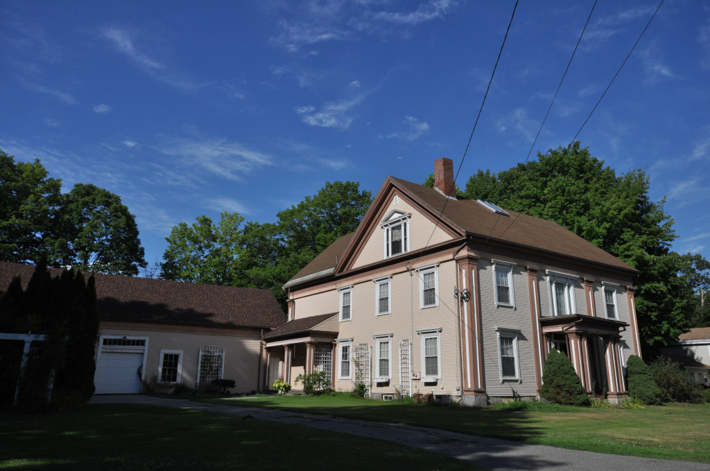
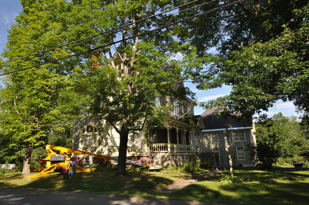
Highlights include Two Cent Bridge, Alvin O. Lombard House and Amos Gerald House.
July is the warmest month, with average highs of 80°F; January lows average 9°F.
Weather in Fairfield
Forecast from the National Weather Service. Full forecast
About Fairfield
Fairfield is a census-designated place (CDP) in the town of Fairfield in Somerset County, Maine, United States. The population was 2,569 at the 2000 census.
From the Wikipedia article Fairfield (CDP), Maine (this version), under CC BY-SA 4.0.
Things to do2
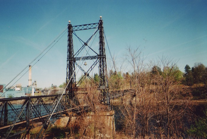
Two Cent Bridge
Bridge · National Register of Historic Places · 2.9 mi
Suspension bridge in Maine, U.S.

Museums and landmarks23

Alvin O. Lombard House
Monument and historic site · National Register of Historic Places · 3.0 mi
Historic house in Waterville, Maine

Amos Gerald House
Monument and historic site · National Register of Historic Places · 0.5 mi
Historic house in Maine, United States

Benton Grange No. 458
Monument and historic site · National Register of Historic Places · 1.0 mi
Building in Maine, United States of America

Connor-Bovie House
Monument and historic site · National Register of Historic Places
Historic house in Maine, United States
Cotton-Smith House
Monument and historic site · National Register of Historic Places · 0.4 mi
Fairfield, Maine, listed on the NRHP in Somerset County, Maine

Foster-Redington House
Monument and historic site · National Register of Historic Places · 3.0 mi
Historic house at 8 Park Place in Waterville, Maine

Heald House
Monument and historic site · National Register of Historic Places · 3.0 mi
Historic house in Maine, United States
Lawrence Library
Monument and historic site · National Register of Historic Places
Public library of Fairfield, Maine, United States

Lockwood Mill Historic District
Monument and historic site · National Register of Historic Places · 3.3 mi
Mill complex in Waterville, Maine, United States

Old Waterville High School
Monument and historic site · National Register of Historic Places · 3.0 mi
School building at 21 Gilman Street in Waterville, Maine

Old Waterville Post Office
Monument and historic site · National Register of Historic Places · 2.9 mi
Building in Maine, United States


Professional Building
Monument and historic site · National Register of Historic Places · 2.9 mi
Historic commercial building in Waterville, Maine
11 more on the map.
Parks, trails and playgrounds4

Restaurants and cafes2


Purple Cow House of Pancakes
Restaurant · 0.6 mi
Route 201
Mo-Th 05:00-20:00; Fr-Sa 05:00-21:30; Su 06:00-20:00
Churches and places of worship3
First Baptist Church
Church · National Register of Historic Places · 3.0 mi
Universalist-Unitarian Church
Church · National Register of Historic Places · 3.4 mi
Shopping1
Gas and EV charging1
Schools, colleges and libraries19
Healthcare1
Map of Fairfield
56 places. The map loads OpenStreetMap tiles when you open it.
Climate by month
Monthly table
| Month | High | Low | Rain |
|---|---|---|---|
| Jan | 28°F | 9°F | 3.1 in |
| Feb | 32°F | 10°F | 2.6 in |
| Mar | 40°F | 20°F | 3.3 in |
| Apr | 54°F | 32°F | 3.7 in |
| May | 66°F | 43°F | 3.3 in |
| Jun | 75°F | 53°F | 4.0 in |
| Jul | 80°F | 59°F | 3.4 in |
| Aug | 80°F | 57°F | 3.4 in |
| Sep | 72°F | 50°F | 3.8 in |
| Oct | 59°F | 38°F | 4.9 in |
| Nov | 46°F | 29°F | 3.9 in |
| Dec | 34°F | 17°F | 3.9 in |
U.S. Climate Normals 1991-2020 for Waterville Trtmt Plt (5 mi away), NOAA NCEI.
People and cost of living
American Community Survey 5-year estimates, 2020-2024, U.S. Census Bureau. Estimates have margins of error, larger for small towns.
Disaster history
Somerset County has had 19 federal disaster declarations since 2000, most often for severe storms.
- 2024-01-30: Severe Storm And Flooding (Severe Storm)
- 2023-09-14: Hurricane Lee (Hurricane)
- 2023-07-06: Severe Storm And Flooding (Flood)
- 2023-03-22: Severe Storm And Flooding (Severe Storm)
- 2020-04-04: Covid-19 Pandemic (Biological)
- 2020-03-13: Covid-19 (Biological)
OpenFEMA disaster declarations summaries.
Getting there and nearby towns
Waterville Robert LaFleur Airport (WVL) is the nearest airport with scheduled flights listed in OpenStreetMap, 6 miles away.
- Waterville 4 mi southwest, about 7 min by car
- Augusta 19 mi south, about 30 min by car
- Belfast 31 mi east, about 49 min by car
- Dexter 33 mi northeast, about 53 min by car
- Camden 37 mi southeast, about 1 h by car
- Bucksport 40 mi east, about 1 h by car
- Bangor 43 mi northeast, about 1 h 15 min by car
- Lewiston 45 mi southwest, about 1 h 15 min by car
- Brewer 45 mi east, about 1 h 15 min by car
- Auburn 47 mi southwest, about 1 h 15 min by car
Drive times are estimates from straight-line distance, not routes.
Local news
Headlines from INDB, the NEMICO news database.
Reviews, tips and questions
Loading what members have shared...
Sources and licences
- NCES EDGE (Public domain): public schools
- NOAA NCEI U.S. Climate Normals 1991-2020 (Public domain): climate by month
- OpenFEMA (Public domain): disaster declarations
- OpenStreetMap contributors (ODbL 1.0): places, airports, map data
- U.S. Census Bureau (Public domain): population, income, housing, education, commute
- Wikidata (CC0 1.0): elevation, founding date, time zone, website, landmarks and historic places
- Wikimedia Commons (see each image): photos
- Wikipedia (CC BY-SA 4.0): overview and history text
Photo credits
- FairfieldME LawrenceLibrary, Magicpiano, CC BY-SA 4.0
- FairfieldME ConnorBovieHouse, Magicpiano, CC BY-SA 4.0
- FairfieldME CottonSmithHouse, Magicpiano, CC BY-SA 4.0
- Lawerence Public Library, Fairfield, Maine, Duhc0mmunity, CC0
- Veterans Monument Park Fairfield, Maine, Duhc0mmunity, CC0
- Church-Converted-Residence in Fairfield, Maine, Duhc0mmunity, CC0
- FairfieldME AmosGeraldHouse, Magicpiano, CC BY-SA 4.0
- FairfieldME GeraldHotel, Magicpiano, CC BY-SA 4.0
- WatervilleME RedingtonHouse, Magicpiano, CC BY-SA 4.0
- TwocentbridgeME, DanielEng at English Wikipedia, CC BY 2.5
- CONNOR-BOVIE HOUSE, JERRYE & ROY KLOTZ MD, CC BY-SA 3.0
- Waterville, ME City Hall (2014) IMG 2652, Billy Hathorn, CC BY-SA 3.0
- One Post Office Square in Waterville, ME IMG 2630, Billy Hathorn, CC BY-SA 3.0
- AMOS GEROLD HOUSE, JERRYE & ROY KLOTZ MD, CC BY-SA 3.0
- Eastside of Alvin O. Lombard House, Jim Roberts, CC BY-SA 4.0
- Old Waterville High School, Jim Roberts, CC BY-SA 4.0
- Bridge & Lockwood Mills, Waterville, ME, Unknown author, Public domain
- Foster-Redington House, Jim Roberts, CC BY-SA 4.0
- Professional Building (Waterville, Maine), Jim Roberts, CC BY-SA 4.0
- Heald House (Waterville, Maine), Jim Roberts, CC BY-SA 4.0
- Colby College Museum of Art, Colby Mariam, CC BY-SA 4.0
- 110320-N-2257C-003 (5550186779), United States Navy Band from Washington, D.C., USA, Public domain
- Black cat at the Purple Cow Diner (4017343801), Leonora (Ellie) Enking from East Preston, United Kingdom, CC BY-SA 2.0
- ISS049-E-30887 - View of Earth, Earth Science and Remote Sensing Unit , Lyndon B. Johnson Space Center, Public domain
- ISS054-E-13065 - View of Earth, Earth Science and Remote Sensing Unit, NASA Johnson Space Center, Public domain
- ISS054-E-9844 - View of Earth, Earth Science and Remote Sensing Unit, NASA Johnson Space Center, Public domain
- BentonME GrangeHall, Magicpiano, CC BY-SA 4.0
- WatervilleME YoungSurgicalBuildingRenovations, Magicpiano, CC BY-SA 4.0


Page built October 30, 2026. Spotted a mistake? Tell us or suggest a place.