




Fairless Hills, Pennsylvania
Fairless Hills is a community of 8,827 people in Bucks County, Pennsylvania.
Why visit Fairless Hills
Townapedia lists 13 museums and landmarks, 10 parks and trails, 50 places to eat, 7 places to stay and 5 attractions in and around town.
Highlights include Cairn University, Sesame Place Philadelphia, Amos Palmer House and Fallsington Historic District.
July is the warmest month, with average highs of 86°F; January lows average 22°F.
Weather in Fairless Hills
Forecast from the National Weather Service. Full forecast
About Fairless Hills
Fairless Hills is a census-designated place (CDP) in Bucks County, Pennsylvania, United States. The CDP is located within Falls Township. The population was 9,046 at the 2020 census. That is up from 8,466 at the 2010 census.
From the Wikipedia article Fairless Hills, Pennsylvania (this version), under CC BY-SA 4.0.
Things to do5

Cairn University
School · 3.1 mi
Christian university near Philadelphia, PA

Sesame Place Philadelphia
Monument and historic site · 1.2 mi
Children's theme park in Middletown Township, Bucks County, Pennsylvania, United States, themed after children's TV series Sesame Street

Museums and landmarks13

Amos Palmer House
Monument and historic site · National Register of Historic Places · 2.9 mi
House in Lower Makefield Township, Pennsylvania
Fallsington Historic District
Monument and historic site · National Register of Historic Places · 1.8 mi
Historic district in Pennsylvania, United States
Harewood and Beechwood
Monument and historic site · National Register of Historic Places · 3.2 mi
Historic house in Pennsylvania, United States

Phineas Pemberton House
Monument and historic site · National Register of Historic Places · 1.3 mi
Historic house in Pennsylvania, United States
Sotcher Farmhouse
Monument and historic site · National Register of Historic Places
Historic house in Pennsylvania, United States
Village of Edgewood Historic District
Monument and historic site · National Register of Historic Places · 3.4 mi
Historic district in Lower Makefield Township, Pennsylvania, United States


Walt Disney Elementary School
Monument and historic site · National Register of Historic Places · 2.4 mi


1 more on the map.
Parks, trails and playgrounds10





Restaurants and cafes50

Bertucci's
Restaurant · Pizza, Italian · 1.4 mi
675 Middletown Boulevard, Langhorne
Mo-Th 11:30-21:30; Fr-Sa 11:30-22:30; Su 11:30-21:00
Chili's
Restaurant · Tex-Mex · 1.0 mi
610 Commerce Boulevard, Fairless Hills
Mo-Th,Su 11:00-22:00; Fr-Sa 11:00-23:00
Giovanni's Pizzeria
Restaurant · Pizza · 1.5 mi
928 Woodbourne Rd, Levittown
Mo-Th 10:30-22:00; Fr,Sa 10:30-23:00; Su 11:30-22:00
Margaritas
Restaurant · Mexican · 1.1 mi
198 North Bucks Town Drive, Langhorne
Mo-Th 11:00-23:00; Fr-Sa 11:00-24:00; Su 11:00-22:00

Miller's Ale House
Diner · American · 1.6 mi
2250 Lincoln Highway, Langhorne
Mo-Th 11:00-01:00, Fr-Sa 11:00-02:00, Su 11:00-24:00
Mission BBQ
Restaurant · Barbecue · 1.1 mi
636 Commerce Boulevard, Fairless Hills
Mo-Sa 11:00-21:00; Su 11:30-20:00
Olive Garden
Restaurant · Italian · 1.5 mi
2245 East Lincoln Highway, Langhorne
Mo-Th,Su 11:00-22:00; Fr-Sa 11:00-23:00
Outback Steakhouse
Restaurant · American, Steak · 1.1 mi
650 Commerce Boulevard, Fairless Hills
Mo-Th 11:00-21:30; Fr-Sa 11:00-22:30; Su 11:00-21:00
Red Lobster
Restaurant · Seafood · 1.5 mi
2275 East Lincoln Highway, Langhorne
Mo-Th,Su 11:00-22:00; Fr-Sa 11:00-23:00
Slacks Hoagie Shack
Restaurant · 0.9 mi
American restaurant in Fairless Hills
110 Lincoln Highway, Fairless Hills
Mo-Th, Su 10:00-20:00; Fr, Sa 10:00-21:00
TGI Friday's
Diner · American · 1.4 mi
685 Middletown Boulevard, Langhorne
Mo-Th,Su 11:00-01:00, Fr-Sa 11:00-02:00
38 more on the map.
History
Fairless Hills as it is known today began in 1951, when developer Danherst Corporation began erecting prefabricated homes built by Gunnison Magichomes, Inc. Gunnison was a wholly owned subsidiary of U.S. Steel. The development was financed by U.S. Steel with a loan of $50 million. It was named in honor of Benjamin Fairless, then president of U.S. Steel, which operated the "Fairless Works" plant that employed most of Fairless Hills' homeowners at the time.
The Sotcher Farmhouse was listed on the National Register of Historic Places in 1977.
From the History section of Fairless Hills, Pennsylvania on Wikipedia, under CC BY-SA 4.0.
Where to stay7
SpringHill Suites Philadelphia Langhorne
Motel and hotel · 1.2 mi
200 North Bucks Town Drive, Langhorne
Churches and places of worship9
Our Lady of Perpetual Help Byzantine Catholic Church
Place of worship · 1.4 mi
1773 Woodbourne Road, Levittown
Faith Presbyterian Church
Church · Presbyterian
525 South Olds Boulevard, Fairless Hills
Shopping15
Gas and EV charging7
Schools, colleges and libraries50
Battle Monument Intermediate School
School · 5.6 mi
145 Pennington Avenue, Trenton
Benjamin C Gregory Elementary School
School · 5.5 mi
500 Rutherford Avenue, Trenton
Healthcare5
Map of Fairless Hills
171 places. The map loads OpenStreetMap tiles when you open it.
Climate by month
Monthly table
| Month | High | Low | Rain | Snow |
|---|---|---|---|---|
| Jan | 39°F | 22°F | 3.7 in | 7.0 in |
| Feb | 42°F | 23°F | 3.1 in | 5.7 in |
| Mar | 50°F | 29°F | 4.6 in | 3.5 in |
| Apr | 62°F | 40°F | 4.0 in | 0.0 in |
| May | 72°F | 50°F | 4.0 in | 0.0 in |
| Jun | 81°F | 60°F | 4.6 in | 0.0 in |
| Jul | 86°F | 65°F | 4.9 in | 0.0 in |
| Aug | 84°F | 64°F | 4.7 in | 0.0 in |
| Sep | 77°F | 56°F | 4.7 in | 0.0 in |
| Oct | 66°F | 44°F | 4.2 in | 0.1 in |
| Nov | 55°F | 33°F | 3.6 in | 0.2 in |
| Dec | 44°F | 26°F | 4.7 in | 3.4 in |
U.S. Climate Normals 1991-2020 for Neshaminy Falls (6 mi away), NOAA NCEI.
People and cost of living
American Community Survey 5-year estimates, 2020-2024, U.S. Census Bureau. Estimates have margins of error, larger for small towns.
Disaster history
Bucks County has had 17 federal disaster declarations since 2000, most often for hurricanes.
- 2021-09-10: Remnants Of Hurricane Ida (Hurricane)
- 2020-03-30: Covid-19 Pandemic (Biological)
- 2020-03-13: Covid-19 (Biological)
- 2016-03-23: Severe Winter Storm And Snowstorm (Snowstorm)
- 2014-02-06: Severe Winter Storm (Severe Ice Storm)
- 2013-01-10: Hurricane Sandy (Hurricane)
OpenFEMA disaster declarations summaries.
Getting there and nearby towns
Trenton Mercer Airport (TTN) is the nearest airport with scheduled flights listed in OpenStreetMap, 7 miles away.
- Levittown 2 mi south, about 3 min by car
- Langhorne Manor 4 mi west, about 6 min by car
- Langhorne 4 mi west, about 6 min by car
- Parkland 4 mi west, about 7 min by car
- Florence 5 mi southeast, about 7 min by car
- Trenton 6 mi northeast, about 9 min by car
- Roebling 6 mi southeast, about 9 min by car
- Burlington 7 mi south, about 11 min by car
- The College of New Jersey 7 mi northeast, about 12 min by car
- White Horse 8 mi east, about 13 min by car
Drive times are estimates from straight-line distance, not routes.
Local news
Headlines from INDB, the NEMICO news database.
Reviews, tips and questions
Loading what members have shared...
Sources and licences
- NCES EDGE (Public domain): public schools
- NOAA NCEI U.S. Climate Normals 1991-2020 (Public domain): climate by month
- OpenFEMA (Public domain): disaster declarations
- OpenStreetMap contributors (ODbL 1.0): places, airports, map data
- U.S. Census Bureau (Public domain): population, income, housing, education, commute
- Wikidata (CC0 1.0): elevation, founding date, time zone, website, landmarks and historic places
- Wikimedia Commons (see each image): photos
- Wikipedia (CC BY-SA 4.0): overview and history text
Photo credits
- Fairless Hills, PA, Mr. Matté (if there is an issue with this image, contact me using this image's Commons talk page , my Commons user talk page , or my English Wikipedia user talk page ; I'll know about it a lot faster), CC BY 4.0
- Amos Palmer House, Langhorne, PA 01, Hshuvaeva, CC BY-SA 3.0
- FairlessHillsPA SotcherFarmhouse, User:Magicpiano, CC BY-SA 4.0
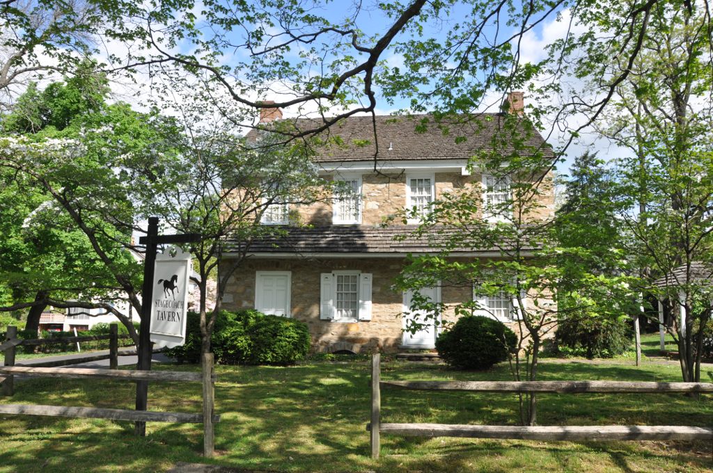
- FallsingtonPA StageCoachTavern, User:Magicpiano, CC BY-SA 4.0
- MiddletownTwpPA Beechwood, User:Magicpiano, CC BY-SA 4.0
- LowerMakefieldTwp EdgefieldVillageHD, User:Magicpiano, CC BY-SA 4.0
- BristolPA PhineasPembertonHouse, User:Magicpiano, CC BY-SA 4.0
- TullytownPA WaltDisneyElementarySchool, User:Magicpiano, CC BY-SA 4.0
- 2009-08-31B - Count's Splash Castle, Transity ( talk • contribs ), CC BY-SA 3.0
- Philadelphia Biblical University, Marduk, CC0
Page built October 30, 2026. Spotted a mistake? Tell us or suggest a place.