


Langhorne, Pennsylvania
Langhorne is a borough of 1,657 people in Bucks County, Pennsylvania, founded in 1876.
Why visit Langhorne
Townapedia lists 12 museums and landmarks, 8 parks and trails, 9 places to eat and 2 attractions in and around town.
Highlights include Cairn University, Sesame Place Philadelphia, Amos Palmer House and Belmont.
July is the warmest month, with average highs of 86°F; January lows average 22°F.
Weather in Langhorne
Forecast from the National Weather Service. Full forecast
About Langhorne
Langhorne Borough, formerly known as Attleboro, is a borough in Bucks County, Pennsylvania, United States. The population was 1,643 at the time of the 2020 census.
From the Wikipedia article Langhorne Borough, Pennsylvania (this version), under CC BY-SA 4.0.
Things to do2

Cairn University
School · 1.1 mi
Christian university near Philadelphia, PA

Sesame Place Philadelphia
Monument and historic site · 2.8 mi
Children's theme park in Middletown Township, Bucks County, Pennsylvania, United States, themed after children's TV series Sesame Street
Museums and landmarks12

Amos Palmer House
Monument and historic site · National Register of Historic Places · 3.3 mi
House in Lower Makefield Township, Pennsylvania
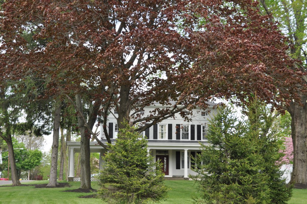
Belmont
Monument and historic site · National Register of Historic Places · 2.9 mi
Historic home in Bensalem, Pennsylvania

Edgemont
Monument and historic site · National Register of Historic Places · 1.0 mi
Historic home located in Middletown Township, Bucks County, Pennsylvania

Harewood and Beechwood
Monument and historic site · National Register of Historic Places · 0.6 mi
Historic house in Pennsylvania, United States

Hulmeville Historic District
Monument and historic site · National Register of Historic Places · 2.5 mi
Historic district in Pennsylvania, United States
Joseph Richardson House
Monument and historic site · National Register of Historic Places
Listed on the NRHP in Bucks County, Pennsylvania
Langhorne Historic District
Monument and historic site · National Register of Historic Places
Historic district in Pennsylvania, United States

Langhorne Library
Museum · National Register of Historic Places
Museum in Pennsylvania, United States of America
Tomlinson-Huddleston House
Monument and historic site · National Register of Historic Places
Historic house in Pennsylvania, United States

Twining Farm
Monument and historic site · National Register of Historic Places · 3.0 mi
Building in Pennsylvania, United States


Langhorne Manor School
Monument and historic site · National Register of Historic Places · 0.9 mi
Parks, trails and playgrounds8


Restaurants and cafes9



Dunkin'
Fast food · Donut, Coffee Shop · 1.0 mi
1255 East Old Lincoln Highway, Langhorne
Mo-Sa 05:00-19:00; Su 05:00-18:00
History
Langhorne, the town that includes Langhorne Borough, began in the 17th century at the intersection of older Lenni-Lenape paths. The earliest established settlers (three Dutch and two British) arrived in the early 18th century. One of the area's first notable residents was Joseph Richardson, who established a store and inn in the 1730s. The road from Bristol grew into a very important transportation center between Trenton and Philadelphia in the later 18th century and 19th centuries, with trade and travelers contributing to the economic growth of the area. Langhorne eventually became the stagecoach transportation hub of Bucks County, transporting people between Trenton and Philadelphia and was then known as Four Lanes End, later known as Richardsons Corner.
From the History section of Langhorne Borough, Pennsylvania on Wikipedia, under CC BY-SA 4.0.
Churches and places of worship4
Newtown Friends Meetinghouse and Cemetery
Church · National Register of Historic Places · 3.4 mi
Shopping2
Gas and EV charging8
Schools, colleges and libraries43
Map of Langhorne
88 places. The map loads OpenStreetMap tiles when you open it.
Climate by month
Monthly table
| Month | High | Low | Rain | Snow |
|---|---|---|---|---|
| Jan | 39°F | 22°F | 3.7 in | 7.0 in |
| Feb | 42°F | 23°F | 3.1 in | 5.7 in |
| Mar | 50°F | 29°F | 4.6 in | 3.5 in |
| Apr | 62°F | 40°F | 4.0 in | 0.0 in |
| May | 72°F | 50°F | 4.0 in | 0.0 in |
| Jun | 81°F | 60°F | 4.6 in | 0.0 in |
| Jul | 86°F | 65°F | 4.9 in | 0.0 in |
| Aug | 84°F | 64°F | 4.7 in | 0.0 in |
| Sep | 77°F | 56°F | 4.7 in | 0.0 in |
| Oct | 66°F | 44°F | 4.2 in | 0.1 in |
| Nov | 55°F | 33°F | 3.6 in | 0.2 in |
| Dec | 44°F | 26°F | 4.7 in | 3.4 in |
U.S. Climate Normals 1991-2020 for Neshaminy Falls (3 mi away), NOAA NCEI.
People and cost of living
American Community Survey 5-year estimates, 2020-2024, U.S. Census Bureau. Estimates have margins of error, larger for small towns.
Disaster history
Bucks County has had 17 federal disaster declarations since 2000, most often for hurricanes.
- 2021-09-10: Remnants Of Hurricane Ida (Hurricane)
- 2020-03-30: Covid-19 Pandemic (Biological)
- 2020-03-13: Covid-19 (Biological)
- 2016-03-23: Severe Winter Storm And Snowstorm (Snowstorm)
- 2014-02-06: Severe Winter Storm (Severe Ice Storm)
- 2013-01-10: Hurricane Sandy (Hurricane)
OpenFEMA disaster declarations summaries.
Getting there and nearby towns
Northeast Philadelphia Airport (PNE) is the nearest airport with scheduled flights listed in OpenStreetMap, 8 miles away.
- Levittown 4 mi southeast, about 7 min by car
- Eddington 6 mi south, about 10 min by car
- Florence 7 mi southeast, about 12 min by car
- Cornwells Heights 7 mi south, about 11 min by car
- Burlington 8 mi southeast, about 13 min by car
- Beverly 8 mi south, about 13 min by car
- Bryn Athyn 8 mi west, about 13 min by car
- Trenton 9 mi east, about 15 min by car
- Roebling 9 mi southeast, about 14 min by car
- Willow Grove 10 mi west, about 17 min by car
Drive times are estimates from straight-line distance, not routes.
Local news
Headlines from INDB, the NEMICO news database.
Reviews, tips and questions
Loading what members have shared...
Sources and licences
- NCES EDGE (Public domain): public schools
- NOAA NCEI U.S. Climate Normals 1991-2020 (Public domain): climate by month
- OpenFEMA (Public domain): disaster declarations
- OpenStreetMap contributors (ODbL 1.0): places, airports, map data
- U.S. Census Bureau (Public domain): population, income, housing, education, commute
- Wikidata (CC0 1.0): elevation, founding date, time zone, website, landmarks and historic places
- Wikimedia Commons (see each image): photos
- Wikipedia (CC BY-SA 4.0): overview and history text
Photo credits
- Langhorne, Pennsylvania, Doug Kerr, CC BY-SA 2.0
- Langhorne Library and Keystone Marker, June 2025, Mr. Matté (if there is an issue with this image, contact me using this image's Commons talk page , my Commons user talk page , or my English Wikipedia user talk page ; I'll know about it a lot faster), CC BY-SA 4.0
- Langhorne Library 01, Hshuvaeva, CC BY-SA 3.0
- Langhorne Library 02, Hshuvaeva, CC BY-SA 3.0
- Langhorne Library 03, Hshuvaeva, CC BY-SA 3.0
- Langhorne Library 04, Hshuvaeva, CC BY-SA 3.0
- Langhorne HD 08, Hshuvaeva, CC BY-SA 3.0
- Langhorne HD 04, Hshuvaeva, CC BY-SA 3.0
- Langhorne HD 14, Hshuvaeva, CC BY-SA 3.0
- Langhorne HD 10, Hshuvaeva, CC BY-SA 3.0
- Langhorne HD 11, Hshuvaeva, CC BY-SA 3.0
- Langhorne HD 09, Hshuvaeva, CC BY-SA 3.0
- Langhorne HD 07, Hshuvaeva, CC BY-SA 3.0
- Langhorne HD 01, Hshuvaeva, CC BY-SA 3.0
- Langhorne HD 06, Hshuvaeva, CC BY-SA 3.0
- Langhorne HD 13, Hshuvaeva, CC BY-SA 3.0
- Langhorne HD 02, Hshuvaeva, CC BY-SA 3.0
- Langhorne HD 12, Hshuvaeva, CC BY-SA 3.0
- Langhorne HD 05, Hshuvaeva, CC BY-SA 3.0
- Langhorne HD 03, Hshuvaeva, CC BY-SA 3.0
- Langhorne, United States (Unsplash), Jesse Gardner plasticmind, CC0
- 2022-11-02 13 26 05 View south along Pennsylvania State Route 213 (Maple Avenue) just south of Pennsylvania State Route 413 (Pine Street) in Langhorne, Bucks County, Pennsylvania, Famartin, CC BY-SA 4.0
- Langhorne, Pennsylvania (4071096297), Doug Kerr from Albany, NY, United States, CC BY-SA 2.0
- Langhorne, Pennsylvania (4071857352), Doug Kerr from Albany, NY, United States, CC BY-SA 2.0
- Langhorne, Pennsylvania (4071857184), Doug Kerr from Albany, NY, United States, CC BY-SA 2.0
- Langhorne, Pennsylvania (4071095441), Doug Kerr from Albany, NY, United States, CC BY-SA 2.0
- Langhorne, Pennsylvania (4071095579), Doug Kerr from Albany, NY, United States, CC BY-SA 2.0
- Joseph Richardson House Langhorne PA Nov 09, Doug Kerr from Albany, NY, United States, CC BY-SA 2.0
- Langhorne, Pennsylvania (4071096463), Doug Kerr from Albany, NY, United States, CC BY-SA 2.0
- Revolutionary War burial site, Langhorne, PA, alternate view, Aug. 2026, Mr. Matté (if there is an issue with this image, contact me using this image's Commons talk page , my Commons user talk page , or my English Wikipedia user talk page ; I'll know about it a lot faster), CC BY-SA 4.0
- Revolutionary War burial site, Langhorne, PA, Aug. 2026, Mr. Matté (if there is an issue with this image, contact me using this image's Commons talk page , my Commons user talk page , or my English Wikipedia user talk page ; I'll know about it a lot faster), CC BY-SA 4.0
- 2022-11-02 14 03 29 View north along Pennsylvania State Route 213 (Maple Avenue) just north of Pennsylvania State Route 413 (Pine Street) in Langhorne, Bucks County, Pennsylvania, Famartin, CC BY-SA 4.0
- Newtown Friends Meetinghouse, Shuvaev, CC BY-SA 3.0
- Twining Farm 01, Shuvaev, CC BY-SA 3.0
- Amos Palmer House, Langhorne, PA 01, Hshuvaeva, CC BY-SA 3.0
- Edgemont HABS Photo, Jack E. Boucher, photographer, Public domain
- MiddletownTwpPA Beechwood, User:Magicpiano, CC BY-SA 4.0
- Hulmeville Borough Hall, Marduk, CC0
- BensalemPA Belmont, User:Magicpiano, CC BY-SA 4.0
- Langhorne Manor School 01, Shuvaev, CC BY-SA 3.0


Page built October 30, 2026. Spotted a mistake? Tell us or suggest a place.