


Fort Thomas, Kentucky
Fort Thomas is a city of 17,169 people in Campbell County, Kentucky, founded in February 27, 1867.
Why visit Fort Thomas
Townapedia lists 93 museums and landmarks, 40 parks and trails, 143 places to eat, 8 places to stay and 8 attractions in and around town.
Highlights include Newport Aquarium, AMC, Abraham J. Friedlander House and Alkemeyer Commercial Buildings.
July is the warmest month, with average highs of 87°F; January lows average 24°F.
Weather in Fort Thomas
Forecast from the National Weather Service. Full forecast
About Fort Thomas
Fort Thomas is a home rule-class city in Campbell County, Kentucky, United States, on the southern bank of the Ohio River and the site of an 1890 US Army post. The population was 17,483 at the 2020 census, making it the largest city in Campbell County. It is part of the Cincinnati – Northern Kentucky metropolitan area.
From the Wikipedia article Fort Thomas, Kentucky (this version), under CC BY-SA 4.0.
Things to do8


The Southgate House Revival
Cinema and theater · 2.0 mi
111 East 6th Street, Newport
Museums and landmarks93

Abraham J. Friedlander House
Monument and historic site · National Register of Historic Places · 3.4 mi
House in Cincinnati, Ohio
Alkemeyer Commercial Buildings
Monument and historic site · National Register of Historic Places · 3.5 mi
Building in Ohio, United States
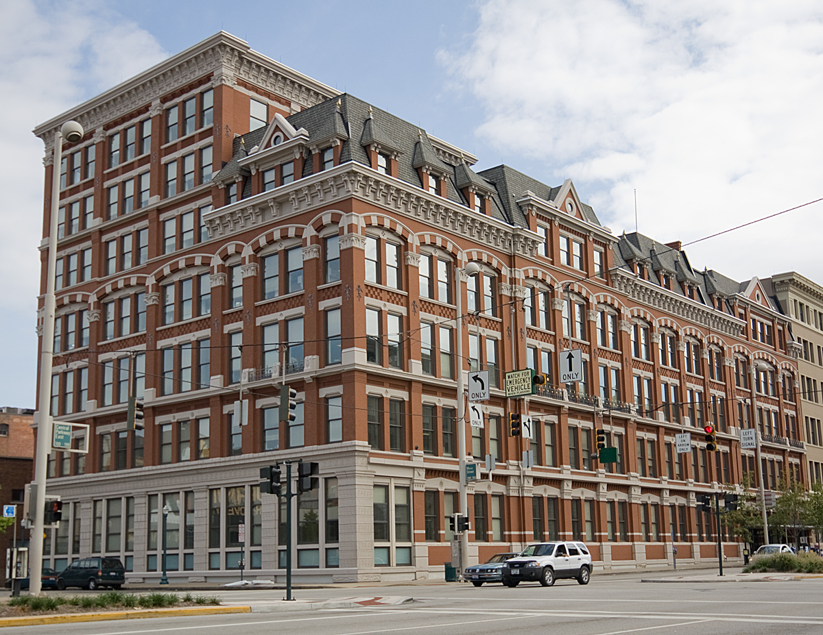
Alms and Doepke Dry Goods Company
Monument and historic site · National Register of Historic Places · 3.4 mi
United States historic place

Apostolic Bethlehem Temple Church
Monument and historic site · National Register of Historic Places · 3.7 mi
Church building in Ohio, United States of America

Bartlett Building
Monument and historic site · National Register of Historic Places · 3.2 mi
Building in Cincinnati, Ohio

Bavarian Brewing Company
Monument and historic site · National Register of Historic Places · 3.3 mi
Former brewery and historic brewery building in Covington, Kentucky, USA
Bellevue
Monument and historic site · National Register of Historic Places · 2.1 mi
House in Newport, Kentucky

Bernard Ratterman House
Monument and historic site · National Register of Historic Places · 3.4 mi
Historic house in Cincinnati, Ohio, U.S.
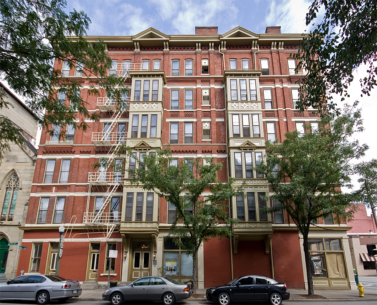


Brittany Apartments
Monument and historic site · National Register of Historic Places · 3.5 mi
Historic apartment building in Cincinnati, Ohio
Carew Tower
Monument and historic site · National Register of Historic Places · 3.3 mi
Skyscraper in Cincinnati, Ohio, United States
Cathedral Basilica of the Assumption
Monument and historic site · National Register of Historic Places · 2.7 mi
Roman Catholic cathedral in the United States
Cincinnati and Suburban Telephone Company Building
Monument and historic site · National Register of Historic Places · 3.5 mi
Office building in Cincinnati, United States of America
81 more on the map.
Parks, trails and playgrounds40


Bortz Family Nature Preserve
Hiking and trails · 1.6 mi
4893 Kellogg Avenue, Cincinnati
sunrise-sunset

28 more on the map.
Restaurants and cafes143

Bellevue Bistro
Restaurant · Sandwich · 2.2 mi
313 Fairfield Avenue, Bellevue
Mo-Tu 09:00-14:00; We closed; Th-Su 08:00-14:00
Bourbon House Pizza
Restaurant · Pizza · 2.2 mi
100 Aqua Way, Newport
Mo off; Tu-Th 16:00-21:00; Fr-Sa 11:00-22:00; Su 12:00-21:00

Carabello Coffee Company
Cafe · Coffee Shop · 1.8 mi
107 East 9th Street, Newport
Mo-Fr 07:00-20:00; Sa 08:00-20:00; Su off
Fessler's Legendary Pizza and Hoagies
Restaurant · Pizza, Italian, Hoagies · 2.2 mi
343 Fairfield Avenue, Bellevue
Su-Mo off; Tu-Th 11:00-21:00; Fr-Sa 11:00-22:00
Galactic Fried Chicken
Restaurant · Chicken · 2.3 mi
624 6th Avenue, Dayton
Th-Sa 11:30-21:00; Su,We 11:30-20:00
MRBL
Restaurant · Steak House, Sushi · 2.2 mi
119 Fairfield Avenue, Bellevue
We-Th 16:30-21:00; Fr 16:30-21:30; Sa 16:00-21:30; Su 16:00-20:30
Sake Bomb Sushi
Restaurant · Sushi, Korean · 2.1 mi
500 Monmouth Street, Newport
Mo-Fr 11:00-14:30,16:30-21:30; Sa 12:00-21:30; Su 13:00-21:30
Shiners On The Levee
Restaurant · 2.2 mi
Shiners On The Levee is a vibrant barbecue restaurant and live music bar nestled in Newport, KY, that has been serving the greater...
1 Levee Way, Newport
Mo 19:00-24:00; Tu closed; We-Th 17:00-24:00; Fr,Sa 11:00-02:00;...

Dead Low Brewing Co.
Bar and pub · 2.2 mi
5945;5959 Kellogg Avenue, Cincinnati
Tu-Th 16:00-21:00, Fr 16:00-22:00, Sa 12:00-22:00, Su 12:00-21:00
131 more on the map.
History
Evidence suggests that on or around 1749, prior to settlement by Europeans, a large battle occurred between a band of Cherokee Native Americans and victorious Miami tribe and Shawnee tribe Native Americans in what is now the city of Fort Thomas. As many as 600 graves of slain warriors have been unearthed by archeologists there.
From the History section of Fort Thomas, Kentucky on Wikipedia, under CC BY-SA 4.0.
Where to stay8
Churches and places of worship42
Saint Stephens Roman Catholic Church
Church · Catholic · 2.3 mi
3804 Eastern Avenue, Cincinnati
Brighton Street Baptist Chapel
Church · Baptist · 2.3 mi
706 Brighton Street, Newport
Shopping31
Gas and EV charging12
Schools, colleges and libraries56
Holy Trinity Junior High School and Child Development Center
School · Catholic · 1.8 mi
Healthcare6
Cincinnati VA Medical Center-Fort Thomas
Hospital · 1.3 mi
1000 South Fort Thomas Avenue, Fort Thomas
Map of Fort Thomas
250 places. The map loads OpenStreetMap tiles when you open it.
Climate by month
Monthly table
| Month | High | Low | Rain |
|---|---|---|---|
| Jan | 41°F | 24°F | 2.9 in |
| Feb | 45°F | 26°F | 2.8 in |
| Mar | 55°F | 33°F | 3.9 in |
| Apr | 67°F | 42°F | 4.4 in |
| May | 75°F | 53°F | 4.7 in |
| Jun | 83°F | 61°F | 4.6 in |
| Jul | 87°F | 65°F | 4.4 in |
| Aug | 86°F | 64°F | 3.4 in |
| Sep | 80°F | 56°F | 3.1 in |
| Oct | 68°F | 44°F | 3.0 in |
| Nov | 55°F | 34°F | 2.9 in |
| Dec | 45°F | 28°F | 3.3 in |
U.S. Climate Normals 1991-2020 for Cincinnati Lunken Ap (2 mi away), NOAA NCEI.
People and cost of living
American Community Survey 5-year estimates, 2020-2024, U.S. Census Bureau. Estimates have margins of error, larger for small towns.
Disaster history
Campbell County has had 14 federal disaster declarations since 2000, most often for severe storms.
- 2026-01-24: Severe Winter Storm (Winter Storm)
- 2025-04-24: Severe Storms, Straight-Line Winds, Tornadoes, Flooding, Landslides, And Mudslides (Severe Storm)
- 2025-04-03: Severe Storms, Straight-Line Winds, Tornadoes, And Flooding (Severe Storm)
- 2025-02-16: Severe Storms, Straight-Line Winds, Flooding, And Landslides (Severe Storm)
- 2020-03-28: Covid-19 Pandemic (Biological)
- 2020-03-13: Covid-19 (Biological)
OpenFEMA disaster declarations summaries.
Getting there and nearby towns
Lunken Airport (LUK) is the nearest airport with scheduled flights listed in OpenStreetMap, 2 miles away.
- Cincinnati 5 mi northwest, about 8 min by car
- Covington 5 mi southwest, about 8 min by car
- Norwood 5 mi north, about 9 min by car
- Forestville 6 mi east, about 10 min by car
- Erlanger 8 mi west, about 13 min by car
- Alexandria 9 mi southeast, about 14 min by car
- Finneytown 10 mi north, about 16 min by car
- Reading 10 mi north, about 16 min by car
- Monfort Heights 11 mi northwest, about 17 min by car
- Bridgetown 11 mi northwest, about 17 min by car
Drive times are estimates from straight-line distance, not routes.
Local news
Headlines from INDB, the NEMICO news database.
Reviews, tips and questions
Loading what members have shared...
Sources and licences
- NCES EDGE (Public domain): public schools
- NOAA NCEI U.S. Climate Normals 1991-2020 (Public domain): climate by month
- OpenFEMA (Public domain): disaster declarations
- OpenStreetMap contributors (ODbL 1.0): places, airports, map data
- U.S. Census Bureau (Public domain): population, income, housing, education, commute
- Wikidata (CC0 1.0): elevation, founding date, time zone, website, landmarks and historic places
- Wikimedia Commons (see each image): photos
- Wikipedia (CC BY-SA 4.0): overview and history text
Photo credits
- Fort Thomas Commercial 1, Bill Eichelberger, CC BY-SA 4.0
- Highlands high school fort thomas ky foto by andy hemmer cincinnati, AndyHemmerCincinnati, CC BY-SA 4.0
- Fort Thomas, Kentucky, Warren LeMay, CC BY-SA 2.0
- Fort Thomas Post Office, Fort Thomas Avenue, Fort Thomas, KY (52365458439), Warren LeMay from Covington, KY, United States, CC BY-SA 2.0
- Fort Thomas Mess Hall Left Side and Gazebo, Tetratasm, CC BY-SA 4.0
- Fort Thomas Mess Hall, Bill Eichelberger, CC BY-SA 4.0
- Fort Thomas Mess Hall Sidewalk View, Tetratasm, CC BY-SA 4.0
- Fort Thomas Mess Hall Right Side, Tetratasm, CC BY-SA 4.0
- Fort Thomas Commercial 2, Bill Eichelberger, CC BY-SA 4.0
- October Evening in Fort Thomas, Bpk14, CC BY-SA 4.0
- Highland Country Club Fort Thomas Ky foto by Andy Hemmer Cincinnati, AndyHemmerCincinnati, CC BY-SA 4.0
- BrittanyApartments, Photo by Greg Hume ( Greg5030 ), CC BY 3.0
- StAugustineComplex, Photo by Greg Hume ( Greg5030 ), CC BY-SA 3.0
- PhoenixClub, Photo by Greg Hume ( Greg5030 ), CC BY 3.0
- MutterGottesHistoricDistrict, Photo by Greg Hume ( Greg5030 ), CC BY 3.0
- Gwynne, Photo by Greg Hume ( Greg5030 ), CC BY 3.0
- CovenantPresbyterian, Photo by Greg Hume ( Greg5030 ), CC BY 3.0
- Taft NHS 1, Bedford at English Wikipedia, Public domain
- Race Street Historic District building, Nyttend, Public domain
- ApostolicBeth, Unknown author, CC BY 3.0
- SCMayerHouse, Photo by Greg Hume ( Greg5030 ), CC BY 3.0
- WadsworthElectric, Photo by Greg Hume ( Greg5030 ), CC BY 3.0
- AlmsDoepkeBuilding, Unknown author, CC BY 3.0
- Cincinnati part IX embracing 11th & 19th wards. (1869), Unknown author, Public domain
- StPaulDistrict, Photo by Greg Hume ( Greg5030 ), CC BY 3.0
- HolyCrossMonastery, Photo by Greg Hume ( Greg5030 ), CC BY 3.0
- Terrace Plaza Hotel, Cincinnati, Ohio (78788), Pub. by Bell Block News & Novelty Co., Cincinnati, Ohio. "Tichnor Quality Views," Reg. U. S. Pat. Off. Made Only by Tichnor Bros., Inc., Boston, Mass., Public domain
- ImmaculateConceptionChurch, Photo by Greg Hume ( Greg5030 ), CC BY 3.0
- Main and Third Street Cluster, Nyttend, Public domain
- BavarianBrewing, Photo by Greg Hume ( Greg5030 ), CC BY 3.0
- JohnChurchCompanyBuilding, Photo by Greg Hume ( Greg5030 ), CC BY 3.0
- 123E4LR, Greg Hume, CC BY 3.0
- StFrancisXavierChurch frontview, MamaGeek at en.wikipedia, CC BY-SA 3.0
- Findlay Market Cincinnati, Lanskeith17, Public domain
- HooperBuilding, Photo by Greg Hume ( Greg5030 ), CC BY 3.0
- Union Trust Building in Cincinnati, Nyttend, Public domain
- Fourth and Walnut Centre, Cincinnati, OH (47221101471), Warren LeMay from Cincinnati, OH, United States, CC0
- KrumburgBuilding, Unknown author, CC BY 3.0
- Renovated Cincinnati Music Hall 2, Larsonj3, CC BY-SA 4.0
- BernardRattermanHouse, Photo by Greg Hume ( Greg5030 ), CC BY 3.0


Page built October 30, 2026. Spotted a mistake? Tell us or suggest a place.