


Franklin, New Hampshire
Franklin is a city of 8,799 people in Merrimack County, New Hampshire, founded in 1764.
Why visit Franklin
Townapedia lists 19 museums and landmarks, 33 parks and trails, 13 places to eat, 1 place to stay and 12 attractions in and around town.
Highlights include Sulphite Railroad Bridge, Tilton Island Park Bridge, Franklin Falls Historic District and Hall Memorial Library.
July is the warmest month, with average highs of 82°F; January lows average 9°F.
Weather in Franklin
Forecast from the National Weather Service. Full forecast
About Franklin
Franklin is a city in Merrimack County, New Hampshire, United States. At the 2020 census, the population was 8,741, the lowest figure of New Hampshire's 13 cities. Franklin includes the village of West Franklin.
From the Wikipedia article Franklin, New Hampshire (this version), under CC BY-SA 4.0.
Things to do12

Sulphite Railroad Bridge
Bridge · National Register of Historic Places · 1.8 mi
Historic railroad bridge in Franklin, New Hampshire, United States

Tilton Island Park Bridge
Bridge · National Register of Historic Places · 4.2 mi
Footbridge in Tilton, United States of America



Museums and landmarks19

Franklin Falls Historic District
Monument and historic site · National Register of Historic Places · 1.3 mi
Historic district in New Hampshire, United States
Hall Memorial Library
Monument and historic site · National Register of Historic Places · 3.9 mi
Library in Northfield, New Hampshire, United States
18 Park Street, Northfield

Tilton Downtown Historic District
Monument and historic site · National Register of Historic Places · 4.1 mi
Historic district in Tilton, New Hampshire

Charles E. Tilton Mansion
Monument and historic site · National Register of Historic Places · 4.0 mi
Historic house in New Hampshire, United States

Daniel Webster Family Home
Monument and historic site · National Register of Historic Places · 3.4 mi
House in Franklin, New Hampshire
East Andover Village Center Historic District
Monument and historic site · National Register of Historic Places · 3.9 mi
Historic district in New Hampshire, United States
Gershom Durgin House
Monument and historic site · National Register of Historic Places · 5.1 mi
United States historic house
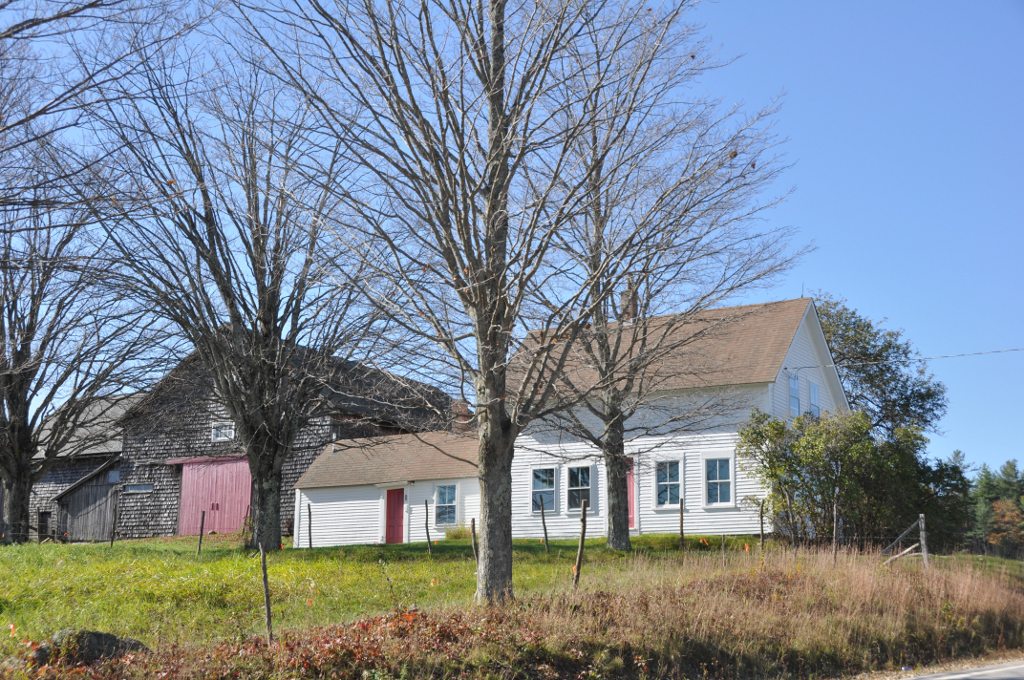
Hersey Farms Historic District
Monument and historic site · National Register of Historic Places · 3.3 mi
Historic district in New Hampshire, United States

House by the Side of the Road
Monument and historic site · National Register of Historic Places · 4.0 mi
Historic house in New Hampshire, United States

Memorial Arch of Tilton
Monument and historic site · National Register of Historic Places · 4.2 mi
Arch on Elm Street in Northfield, New Hampshire, United States

Salisbury Academy Building
Monument and historic site · National Register of Historic Places · 5.6 mi
Historic school building at 9 Old Coach Road in Salisbury, New Hampshire

Sanbornton Square Historic District
Monument and historic site · National Register of Historic Places · 5.1 mi
Historic district in Sanbornton, New Hampshire
7 more on the map.
Parks, trails and playgrounds33


.jpg)


Daniel Webster Birthplace State Historic Site
Park · 3.1 mi
Park and historic site in Franklin, New Hampshire



21 more on the map.
Restaurants and cafes13

Vulgar Brewing
Brewery and winery · 1.4 mi
378 Central Street
We 16:00-20:00; Th 12:00-20:00; Fr-Sa 12:00-20:00; Su 12:00-19:00

Casamigos
Restaurant · Mexican · 4.1 mi
276 Main Street, Tilton
Su 11:00-21:00; Mo-Th 11:00-21:30; Fr-Sa 11:00-22:00
Tilton House of Pizza
Restaurant · Pizza · 4.0 mi
298 Main Street, Tilton



Domino's
Fast food · Pizza · 2.3 mi
900 Central Street, Franklin
Mo-Th 10:30-24:00; Fr-Sa 10:30-01:30; Su 10:30-01:00
1 more on the map.
History
Situated at the confluence of the Pemigewasset and Winnipesaukee rivers that form the Merrimack River, the town was settled by Anglo-European colonists in 1764 and originally known as "Pemigewasset Village". It was taken from portions of Salisbury, Andover, Sanbornton and Northfield. The name "Franklin" was adopted in 1820 in honor of statesman and founding father Benjamin Franklin. Water power from the falls on the Winnipesaukee River helped it develop as a mill town. It incorporated as a town in 1828, and then as a city in 1895.
Daniel Webster was born in a section of Franklin that was then part of Salisbury. There is a state historic site located off Route 127 that preserves the famous orator's childhood home. As an adult, Webster owned "The Elms", a farm near the Merrimack River along present-day Route 3.
In 1943, the Army Corps of Engineers created the Franklin Falls Reservoir above Franklin by constructing the Franklin Falls Dam for flood control on the Pemigewasset River.
From the History section of Franklin, New Hampshire on Wikipedia, under CC BY-SA 4.0.
Where to stay1
Churches and places of worship17
Hill Center Church
Church · National Register of Historic Places · 5.0 mi
Northfield Union Church
Church · National Register of Historic Places · 5.9 mi
Unitarian Universalist Congregation of Franklin
Place of worship · 1.2 mi
206 Central Street, Franklin
Shopping2
Gas and EV charging7
Schools, colleges and libraries20
Compass Classical Academy Charter School (E)
School · 4.0 mi
5 Elm Street, Northfield
Compass Classical Academy Charter School (H)
School · 4.0 mi
5 Elm Street, Northfield
Healthcare3
Map of Franklin
127 places. The map loads OpenStreetMap tiles when you open it.
Climate by month
Monthly table
| Month | High | Low | Rain |
|---|---|---|---|
| Jan | 30°F | 9°F | 3.1 in |
| Feb | 33°F | 10°F | 2.8 in |
| Mar | 42°F | 20°F | 3.3 in |
| Apr | 56°F | 31°F | 3.5 in |
| May | 68°F | 43°F | 3.6 in |
| Jun | 76°F | 52°F | 4.3 in |
| Jul | 82°F | 58°F | 4.2 in |
| Aug | 80°F | 56°F | 4.1 in |
| Sep | 72°F | 48°F | 3.7 in |
| Oct | 59°F | 37°F | 4.9 in |
| Nov | 46°F | 26°F | 3.9 in |
| Dec | 35°F | 17°F | 4.0 in |
U.S. Climate Normals 1991-2020 for Franklin Falls Dam (1 mi away), NOAA NCEI.
People and cost of living
American Community Survey 5-year estimates, 2020-2024, U.S. Census Bureau. Estimates have margins of error, larger for small towns.
Disaster history
Merrimack County has had 21 federal disaster declarations since 2000, most often for severe storms.
- 2020-04-03: Covid-19 Pandemic (Biological)
- 2020-03-13: Covid-19 (Biological)
- 2018-01-02: Severe Storm And Flooding (Severe Storm)
- 2013-03-19: Severe Winter Storm And Snowstorm (Severe Storm)
- 2012-10-30: Hurricane Sandy (Hurricane)
- 2011-11-01: Severe Storm (Severe Storm)
OpenFEMA disaster declarations summaries.
Getting there and nearby towns
Laconia Municipal Airport (LCI) is the nearest airport with scheduled flights listed in OpenStreetMap, 15 miles away.
- Belmont 10 mi east, about 15 min by car
- Bristol 11 mi north, about 17 min by car
- Laconia 13 mi northeast, about 20 min by car
- Concord 16 mi south, about 26 min by car
- Contoocook 16 mi south, about 25 min by car
- Ashland 17 mi north, about 27 min by car
- Enfield 27 mi northwest, about 44 min by car
- Farmington 30 mi east, about 49 min by car
- Lebanon 32 mi northwest, about 51 min by car
- Manchester 34 mi south, about 55 min by car
Drive times are estimates from straight-line distance, not routes.
Local news
Headlines from INDB, the NEMICO news database.
Reviews, tips and questions
Loading what members have shared...
Sources and licences
- NCES EDGE (Public domain): public schools
- NOAA NCEI U.S. Climate Normals 1991-2020 (Public domain): climate by month
- OpenFEMA (Public domain): disaster declarations
- OpenStreetMap contributors (ODbL 1.0): places, airports, map data
- U.S. Census Bureau (Public domain): population, income, housing, education, commute
- Wikidata (CC0 1.0): elevation, founding date, time zone, website, landmarks and historic places
- Wikimedia Commons (see each image): photos
- Wikipedia (CC BY-SA 4.0): overview and history text
Photo credits
- FranklinNH CentralStreet, User:Magicpiano, CC BY-SA 4.0
- NorthfieldNH HallMemorialLibrary 01, User:Magicpiano, CC BY-SA 4.0
- Tilton Downtown, Ken Gallager at en.wikipedia, Public domain
- Franklin NH 6, AlexiusHoratius, CC BY-SA 3.0
- AndoverNH GershomDurginHouse, User:Magicpiano, CC BY-SA 4.0
- AndoverNH EastAndoverGrangeHall, User:Magicpiano, CC BY-SA 4.0
- Sulphite Railroad Bridge, Former Boston & Maine Railroad (originally Tilton , Franklin (Merrimack County, New Hampshire), Jet Lowe, Public domain
- Tilton Mansion, Ken Gallager at en.wikipedia, Public domain
- Hill Village Bible Church, User:Magicpiano, CC BY-SA 4.0
- Tilton Island Park Bridge, Ken Gallager at en.wikipedia, Public domain
- Memorial Arch of Tilton 1882, SayCheeeeeese, Public domain
- AndoverNH HerseyFarms 01, User:Magicpiano, CC BY-SA 4.0
- Northfield Union Church 6514, Jomegat, CC BY-SA 3.0
- FranklinNH WebsterFamilyHome, User:Magicpiano, CC BY-SA 4.0
- House by Side of Road, Ken Gallager at en.wikipedia, Public domain
- AndoverNH TuckerMountainSchool, User:Magicpiano, CC BY-SA 4.0
- Sanbornton Square, Ken Gallager ( talk ), CC BY-SA 3.0
- SalisburyNH AcademyBuilding, User:Magicpiano, CC BY-SA 4.0
- FranklinNH DanielWebsterBirthplace, User:Magicpiano, CC BY-SA 4.0


Page built October 30, 2026. Spotted a mistake? Tell us or suggest a place.