


Belfast, United Kingdom
Belfast is a regional capital of 348,005 people in Northern Ireland, United Kingdom.
Why visit Belfast
Townapedia lists 100 museums and landmarks, 73 parks and trails, 126 places to eat, 33 places to stay and 43 attractions in and around town.
Highlights include Belfast Zoo, Belfast Waterfront Conference and Exhibition Centre, Crumlin Road Gaol and Ulster Museum.
Weather in Belfast
Forecast from MET Norway (CC BY 4.0). Full forecast
About Belfast
Belfast ( BEL-fast, , -fahst; from Irish: Béal Feirste [bʲeːlˠ ˈfʲɛɾˠ(ə)ʃtʲə]) is the capital, largest city and main port of Northern Ireland. It stands on the banks of the river Lagan, and is connected to the open sea through Belfast Lough and the North Channel. The city is the most populous in Northern Ireland and the second-largest, after Dublin, on the island of Ireland, with a recorded population in 2021 of 345,418 and of 704,406 for the greater metropolitan area.
From the Wikipedia article Belfast (this version), under CC BY-SA 4.0.
Travel tips from other travellers: Belfast on Wikivoyage (CC BY-SA 4.0).
Photos of Belfast


Things to do43

Belfast Zoo
Zoo and aquarium · 4.2 mi
Zoo in Northern Ireland
Antrim Road, Belfast
Mar 21-Sep 30 10:00-20:00; Oct 01-Mar 20 10:00-16:00


Grand Opera House
Cinema and theater · 0.4 mi
Opera house in Belfast, County Antrim, Northern Ireland
2-4 Great Victoria Street, Belfast


Albert Bridge, Belfast
Bridge · 0.5 mi
Bridge in Belfast, County Antrim, Northern Ireland

Dargan Bridge, Belfast
Bridge · 0.4 mi
Railway bridge in Belfast, Northern Ireland

Governor's Bridge, Belfast
Bridge · 1.5 mi
Irish roadbridge over the River Lagan in south Belfast

King's Bridge
Bridge · 1.4 mi
Bridge in Belfast, County Antrim, Northern Ireland



Brian Friel Theatre
Cinema and theater · 0.9 mi
Studio theatre at Queen's University, Belfast, Northern Ireland
31 more on the map.
Museums and landmarks100


Ulster Museum
Museum · 1.1 mi
Part of the National Museum of Northern Ireland
Botanic Gardens, Belfast
Tu-Su 10:00-17:00

Eileen Hickey Irish Republican History Museum
Museum · 1.0 mi
5 Conway Place, Belfast
Tu-Sa 10:00-14:00


Giant's Ring
Monument and historic site · 4.0 mi
Neolithic henge monument

Northern Ireland War Memorial
Museum · 0.4 mi
War memorial in Belfast, Northern Ireland, United Kingdom


88 more on the map.
Parks, trails and playgrounds73


Sir Thomas and Lady Dixon Park
Park · 4.4 mi
Public park, Belfast, Northern Ireland, UK

Alexandra Park
Park · 1.5 mi
Jan 04-31 07:30-16:30; Feb 01-07,Oct 31-Nov 13 07:30-17:00; Feb...



Bog Meadows
Park · 1.9 mi
Nature reserve in Belfast, Northern Ireland, UK
Musgrave Park, Belfast
Park · 2.7 mi
Park in Belfast, Northern Ireland
61 more on the map.
Restaurants and cafes126

Ben Madigan’s Bar & Kitchen
Bar and pub · Regional · 2.2 mi
169-175 Cavehill Road, Belfast
Mo-Sa 11:30-01:00; Su 12:00-24:00
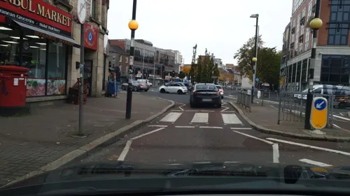
Bites of India
Restaurant · Indian · 0.6 mi
11 Botanic Avenue, Belfast
Mo-Sa 11:00-23:00; Su 13:00-22:00
Caffè Nero
Cafe · Coffee Shop · 2.3 mi
376-378 Upper Newtownards Road, Belfast
Mo-Sa 07:30-22:00; Su 08:00-22:00
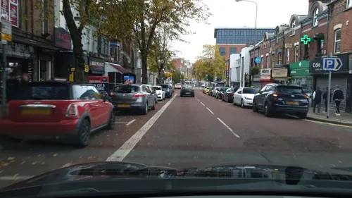
Caffè Nero
Cafe · Coffee Shop · 0.7 mi
42 Botanic Avenue, Belfast
Mo-Fr 07:00-21:00; Sa 07:00-20:00; Su 08:00-20:00
General Merchants
Cafe · Brunch, Breakfast, Cake · 3.0 mi
481 Upper Newtownards Road, Belfast
Mo-Sa 08:00-17:00; Su 09:00-17:00
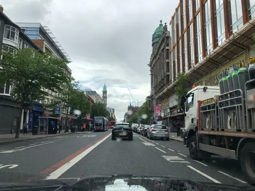
Ground Espresso Bars
Cafe · Coffee Shop
42 Queen Street, Belfast
Mo-Fr 07:30-16:00; Sa 09:00-17:00; Su 11:00-16:00



Cafe Smart
Cafe · Breakfast, Coffee Shop, Irish, Local · 2.0 mi
56 Belmont Road, Belfast
Mo-Sa 07:45-16:30, Su 09:00-16:30
114 more on the map.
History
The name Belfast is derived from the Irish Béal Feirste (Irish pronunciation: [bʲeːlˠ ˈfʲɛɾˠ(ə)ʃtʲə]), "mouth of the Farset", a river which name comes from Irish fearsaid, meaning a sandbar or tidal ford. This was formed where the Farset flowed into the Lagan (until culverted in the late 18th century) along what is now High Street. It was at this low-water crossing, under or near the current Queen's Bridge, that the early settlement developed.
The compilers of Ulster Scots dialects use various transcriptions for the local pronunciations of "Belfast" including Bilfawst, Bilfaust or Baelfawst.
As a legacy of emigration, Belfast has lent its name to more than a dozen settlements in the United States with the largest being Belfast, Maine, as well as one each in Australia, Canada, New Zealand and South Africa.
Read more of the history
The site of Belfast has been occupied since at least the Neolithic. The Giant's Ring, a 5,000-year-old henge, is located near the city, and remains of Iron Age hill forts can still be seen on the surrounding hills. At the beginning of the 14th century, Papal tax rolls recorded two churches: the "Chapel of Dundela" at Knock (Irish cnoc, meaning "hill") in the east, connected by some accounts to the 7th-century evangelist St. Colmcille,and, the "Chapel of the Ford", which may have been a successor to a much older parish church on the present Shankill (Seanchill, "Old Church") Road, dating back to the 9th, or possibly to St. Patrick in the mid 5th century.
In the early 13th century, the Normans established a settlement at the ford comprising a fort, a parish church (now St. George's), and a watermill. This fort became the original Belfast Castle. Seized in the 14th century by the O'Neills of Clandeboye, it was retaken, demolished, and rebuilt several times until, at the end of the 16th century, the Irish power was broken in scorched-earth Nine Years' War.
Conn O'Neill, the last Gaelic lord to command the Lagan Valley, is commemorated in Belfast by the Connswater river. The O'Neills' former stronghold overlooking Belfast is recalled in the name Castlereagh, from An Caisleán Riabhach meaning "the grey castle". Their stone inauguration chair was removed from the Castlereagh Hills and is on display in the Ulster Museum.
With a commission from King James VI, in 1613 Sir Arthur Chichester undertook the Plantation of Belfast and the surrounding area, building a new castle in what is now Castle Place, and attracting mainly English and Manx settlers. The subsequent arrival of Scottish Presbyterians embroiled Belfast in its only recorded siege: denounced from London by John Milton as "ungrateful and treacherous guests", in 1649 the newcomers were temporarily expelled by an English Parliamentarian army. In 1689, Catholic Jacobite forces, briefly in command of the town, abandoned it in advance of the landing at Carrickfergus of William, Prince of Orange, who proceeded through Belfast to his celebrated victory on 12 July 1690 at the Boyne.
Together with French Huguenots, the Scots introduced the production of linen, a flax-spinning industry that in the 18th century carried Belfast trade to the Americas. Fortunes were made carrying rough linen clothing and salted provisions to the slave plantations of the West Indies; sugar and rum to Baltimore and New York City; and for the return to Belfast flaxseed and tobacco from the colonies.
From the 1760s, profits from the trade financed improvements in the town's commercial infrastructure, including the Lagan Canal, new docks and quays, and the construction of the White Linen Hall which together attracted to Belfast the linen trade that had formerly gone through Dublin. Abolitionist sentiment, however, defeated the proposal of the greatest of the merchant houses, Cunningham and Greg, in 1786 to commission ships for the Middle Passage.As "Dissenters" from the established Anglican church (with its episcopacy and ritual), Presbyterians were conscious of sharing, if only in part, the disabilities of Ireland's dispossessed Roman Catholic majority; and of being denied representation in the Irish Parliament. Belfast's two MPs remained nominees of the Chichesters (Marquesses of Donegall). With their emigrant kinsmen in America, the region's Presbyterians were to share a growing disaffection from the Crown.
When early in the American War of Independence, Belfast Lough was raided by the privateer John Paul Jones, the townspeople assembled their own Volunteer militia. Formed ostensibly for defence of the Kingdom, Volunteer corps were soon pressing their own protest against "taxation without representation". Further emboldened by the French Revolution, a more radical element in the town, the Society of United Irishmen, called for Catholic emancipation and a representative national government. In hopes of French assistance, in 1798 the Society organised a republican insurrection. The rebel tradesmen and tenant farmers were defeated north of the town at the Battle of Antrim and to the south at the Battle of Ballynahinch.
Britain seized on the rebellion to abolish the Irish Parliament, unlamented in Belfast, and to incorporate Ireland in a United Kingdom. In 1832, British parliamentary reform permitted the town its first electoral contest – an occasion for an early and lethal sectarian riot.
While other Irish towns experienced a loss of manufacturing, Belfast underwent rapid industrial expansion from the 1820s. After a cotton boom and bust, the town emerged as the global leader in the production of linen goods (mill, and finishing, work largely employing women and children), winning the moniker "Linenopolis". Shipbuilding led the development of heavier industry.
From the History section of Belfast on Wikipedia, under CC BY-SA 4.0.
More about Belfast
Economy
Services (including retail, health, professional & scientific) account for three quarters of jobs in the Belfast. Only 6% remain in manufacturing. The balance is in distribution and construction. In recent years, unemployment has been comparatively low (under 3% in the summer of 2023) for the UK. On the other hand, Belfast has a high rate of people economically inactive (close to 30%). It is a group, encompassing homemakers, full-time carers, students and retirees, that in Belfast has been swollen by the exceptionally large proportion of the population (27%) with long-term health problems or disabilities (and who, in Northern Ireland generally, are less likely to be employed than in other UK regions).
An early report on the post-Belfast Agreement prospects for the city economy underscored another distinctive feature of its working-age population. While it appeared well qualified, with 24% educated to degree level, at "the other end of the educational spectrum", 26 per cent had no qualifications at all, a much higher share than in English cities.
Arts and culture
From Georgian Belfast, the city retains a civic legacy. In addition to Clifton House (Belfast Charitable Society, 1774), this includes the Linen Hall Library (Belfast Society for Promoting Knowledge, 1788), the Ulster Museum, founded in 1833 by the Belfast Natural History Society as the Belfast Municipal Museum and Art Gallery, and the Botanic Gardens (established in 1828 by the Belfast Botanic and Horticultural Society). These remain important cultural venues: in the case of the Gardens, for outdoor festivities including the Belfast Melā, the city's annual August celebration of global cultures.
Of the many stage venues built in the 19th century, and film theatres built in the twentieth, there remains the Ulster Hall (1862), which hosts concerts, including those of the Ulster Orchestra, classical recitals and party-political meetings; the Grand Opera House (1895) badly damaged in bomb blasts in the early 1990s, restored and enlarged 2020; the Strand Cinema (1935) now being developed as an arts centre; and the Queens Film Theatre (QFT) (1968) focussed on art house and world cinema. The two independent cinemas offer their screens for the Belfast Film Festival and the Belfast International Arts Festival.
Education
Children from Catholic and Protestant homes in Belfast are taught, for the most part, separately on a pattern that, by the mid-19th century, had been established throughout Ireland. Primary and secondary education is divided between (Catholic) Maintained Schools and (non-Catholic/ "Protestant") Controlled Schools. They are bound by the same curriculum, but their teaching staff are trained separately (in the university colleges of St Mary's and Stranmillis).
Since the 1980s, two smaller school sectors have emerged: grant-maintained Integrated schools, which by design bring together children and staff from both communities, and Irish language medium schools
The Belfast [later Royal Belfast] Academical Institution, opened its doors in 1810 with the intention, in the words of its founder, former United Irishman William Drennan, of being "perfectly unbiased by religious distinctions". The principle was not embraced by the town's middle-classes. In practice, "Inst" provided a grammar education to the town's Presbyterian families while Anglicans favoured the older Royal Belfast Academy (1785); Catholics, St Malachy's diocesan college (1833) and Wesleyans, Methodist College Belfast (1865).
From the Wikipedia article Belfast, under CC BY-SA 4.0.
Notable people from Belfast
 C. S. LewisBritish writer, lay theologian, and scholar (1898–1963)Photo: John S. Murray, Public domain
 William Thomson, 1st Baron KelvinBritish physicist and engineer (1824–1907)Photo: T. & R. Annan & Sons; restored by..., Public domain
 George BestNorthern Irish footballer (1946–2005)Photo: Bert Verhoeff for Anefo , NL-HaNA,..., CC0
 Betty WilliamsNorthern Irish peace activist (1943–2020)Photo: Kingkongphoto &..., CC BY-SA 2.0
 Kenneth BranaghBritish actor and filmmaker (born 1960)Photo: K6ka, CC BY-SA 4.0
 Jocelyn Bell BurnellBritish astrophysicist (born 1943)Photo: Launch_of_IYA_2009,_Paris_-_Grygar,_B..., CC BY-SA 3.0
 David TrimbleFirst Minister of Northern Ireland from 1998 to 2002Photo: Chris McAndrew, CC BY 3.0
 Gary MooreNorthern Irish musician (1952–2011)Photo: Tibban99, CC BY 3.0
 Chaim Herzog6th President of Israel (1983–1993) – (born1918–1997)Photo: Knesset photographer, CC BY-SA 4.0
 Gerry AdamsIrish republican politician (born 1948)Photo: Sinn Féin, CC BY 2.0
- Jonny EvansNorthern Irish association football player (born 1988)
- Van MorrisonNorthern Irish musician (born 1945)


Born in Belfast, according to Wikidata (CC0). Each name links to its Wikipedia article.
Where to stay33
Maldron Hotel Belfast City
Motel and hotel · Irish, Italian, Regional, Sandwich
20 Brunswick Street, Belfast
Churches and places of worship42
Kingdom Hall of Jehovah's Witnesses
Church · Jehovahs Witness · 4.6 mi
319 Whitewell Road, Newtownabbey
Church of the Holy Evangelists
Church · Anglican · 5.2 mi
Church Road, Newtownabbey
St Peter's Cathedral
Church · Roman Catholic · 0.8 mi
Saint Peters Square North, Belfast
Kirkpatrick Memorial Presbyterian Church
Church · Presbyterian · 2.3 mi
259 Upper Newtownards Road, Belfast
Shopping65
Gas and EV charging32
Schools, colleges and libraries35
All Saints College
School · Roman Catholic · 3.1 mi
Glen Road, Belfast
Healthcare33
Mater Infirmorum Hospital
Hospital · 1.0 mi
45-54 Crumlin Road, Belfast
Map of Belfast
250 places. The map loads OpenStreetMap tiles when you open it.
Getting there and nearby towns
George Best Belfast City Airport (BHD) is the nearest airport with scheduled flights listed in OpenStreetMap, 2 miles away.
- Castlereagh 2 mi southeast, about 4 min by car
- Newtownabbey 4 mi north, about 7 min by car
- Holywood 5 mi northeast, about 8 min by car
- Dundonald 5 mi east, about 8 min by car
- Carryduff 6 mi south, about 9 min by car
- Jordanstown 6 mi north, about 10 min by car
- Carnmoney 6 mi north, about 10 min by car
- Lisburn 7 mi southwest, about 11 min by car
- Greenisland 7 mi north, about 12 min by car
- Comber 8 mi southeast, about 13 min by car
Drive times are estimates from straight-line distance, not routes.
Keep exploring
Local news
Headlines from INDB.
Reviews, tips and questions
Loading what members have shared...
Sources and licences
- GeoNames (CC BY 4.0): population, coordinates, regions and time zone
- Mapillary (see each image): photos
- OpenStreetMap contributors (ODbL 1.0): places, airports, map data
- Wikidata (CC0 1.0): elevation, founding date, time zone, website, landmarks and historic places
- Wikimedia Commons (see each image): photos
- Wikipedia (CC BY-SA 4.0): overview and history text
Photo credits
- Belfast City view (7), MOs810, CC BY 4.0
- Belfast Zoo White Tiger, Quichot, Public domain
- Belfast (473), October 2009, Ardfern, CC BY-SA 3.0
- Albert Bridge, Belfast, Paul McIlroy, CC BY-SA 2.0
- Belfast (074), October 2009, Ardfern, CC BY-SA 3.0
- Governor's Bridge, Belfast, Simon Cobb, CC0
- Kings Bridge, Stranmillis, Slowtech2000, CC BY-SA 4.0
- Giants Ring, Lordjaysus ( talk ), CC BY-SA 3.0
- Northern Ireland War Memorial, Belfast, Boselaphus, CC BY-SA 4.0
- Ormeau Park, Simon Cobb, CC0
- Japanese garden Lady Dixon Park, Peter Clarke, CC BY-SA 3.0
- The Peace tree, Woodvale Park 04.08.22, Whiteabbey, CC BY-SA 4.0
- The Duncairn, Banfiduncairn, CC BY-SA 4.0
- Alexandra Park - the 'Catholic' side - panoramio, Keith Ruffles, CC BY 3.0
- Jehovah's Witnesses outside the British Museum 02, Philafrenzy, CC BY-SA 4.0
- Armagh Cathedral (Church of Ireland), JohnArmagh (shifted & cropped by Rabanus Flavus ), CC BY-SA 4.0
- Ravenhill new Stand, Aaronsc at English Wikipedia, Public domain
- Titanic Belfast side view, Own work, CC BY-SA 4.0
- HMS Caroline, Surgeon Oscar Parkes, Public domain
- IMO 5516111 SS Nomadic, 1911 20180914 113426 (46770595105), Irid Escent, CC BY-SA 2.0
- Belfast Botanic Gardens glasshouse, Robert Young, CC BY 2.0
- CrumlinRoad.Gaol, Agadant, CC BY-SA 3.0
- Belfast City Hospital, eowin, CC BY-SA 2.0
- Irish Republican History Museum - interior, Mx. Granger, CC0
- Linen Hall Library Belfast, Man vyi, Public domain
- Mater Infirmorum Hospital, Keresaspa, CC BY-SA 3.0
- St. Malachy's College, plaque, Gavan Connolly, CC BY-SA 3.0
- The Northern Whig, Simon Cobb, CC0
- Ulster Hospital, Stubacca, CC BY-SA 3.0
- Waterfront Hall Belfast, Man vyi, Public domain
- Windsor House, Belfast, May 2010 (02), Ardfern, CC BY-SA 3.0
- Cultúrlann McAdam Ó Fiaich, Eric Jones, CC BY-SA 2.0
- Glass house, Merville Garden Village, CC BY-SA 4.0
- McCaughey House, Whiteabbey Hospital, Mckyj, CC BY-SA 4.0
- Crumlin Road Goal, GrimsbyT, CC BY-SA 4.0
- DSCF1332, Dom0803, CC BY-SA 3.0
- Strand Cinema (Belfast-2007), sjdunphy, CC BY-SA 2.0
- Irish Republican History Museum - exterior, Mx. Granger, CC0
- Titanic Belfast HDR, Own work, CC BY-SA 4.0
- Ten Square, LittleT889, CC BY 4.0
- Train Crossing The The Lagan Railway Bridge In Belfast - Northern Ireland - panoramio, William Murphy, CC BY-SA 3.0
- Grand Opera House, Belfast, February 2013 (03), Ardfern, CC BY-SA 3.0
- Triceratops skeleton - Ulster Museum 1, Bazonka, CC BY-SA 3.0
- Belfast Barge - Northern Ireland - panoramio, William Murphy, CC BY-SA 3.0
- Street-level photo, laye, CC BY-SA 4.0
- Street-level photo, toho, CC BY-SA 4.0
- Street-level photo, toho, CC BY-SA 4.0
- Street-level photo, laye, CC BY-SA 4.0
- Street-level photo, mackerski, CC BY-SA 4.0
- Street-level photo, yannakis, CC BY-SA 4.0
- Street-level photo, mackerski, CC BY-SA 4.0
- Street-level photo, toho, CC BY-SA 4.0
- Street-level photo, cyclestreets, CC BY-SA 4.0
- Street-level photo, mackerski, CC BY-SA 4.0
- Street-level photo, debigc, CC BY-SA 4.0
- Street-level photo, fifsqn, CC BY-SA 4.0
- Street-level photo, toho, CC BY-SA 4.0
- Street-level photo, username23, CC BY-SA 4.0
- Street-level photo, mackerski, CC BY-SA 4.0
- Street-level photo, username23, CC BY-SA 4.0
- Street-level photo, laye, CC BY-SA 4.0
- Street-level photo, cyclestreets, CC BY-SA 4.0
- Street-level photo, yannakis, CC BY-SA 4.0
- Street-level photo, lineo, CC BY-SA 4.0
- Street-level photo, lineo, CC BY-SA 4.0


Page built November 10, 2026. Spotted a mistake? Tell us or suggest a place.