


Fort William, United Kingdom
Fort William is a town of 15,757 people in Scotland, United Kingdom.
Why visit Fort William
Townapedia lists 21 museums and landmarks, 9 parks and trails, 48 places to eat, 68 places to stay and 5 attractions in and around town.
Highlights include Banavie Swing Bridge, Highland Cinema, West Highland Museum and Cameron Obelisk.
Weather in Fort William
Forecast from MET Norway (CC BY 4.0). Full forecast
About Fort William
Fort William is a town in the Lochaber region of the Scottish Highlands, located at the head of Loch Linnhe.
From the Wikipedia article Fort William, Scotland (this version), under CC BY-SA 4.0.
Travel tips from other travellers: Fort William on Wikivoyage (CC BY-SA 4.0).
Photos of Fort William


Things to do5
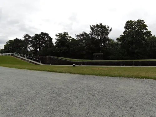
Banavie Swing Bridge
Bridge · 2.0 mi
Bridge in Banavie, Highland, Scotland, UK, carries the A830 road across the Caledonian Canal

Highland Cinema
Cinema and theater
A unique, award-winning independent two-screen cinema in the heart of Fort William, screening blockbusters, independent films, classics,...
Cameron Square, Fort William
Mo-Su 09:00-22:00

Banavie Railway Swing Bridge
Bridge · 2.0 mi
Bridge in Highland, Scotland, UK

Museums and landmarks21

West Highland Museum
Museum
Museum in Highland, Scotland, United Kingdom
Cameron Square, Fort William
Jan-Apr,Oct-Dec Mo 13:00-16:00; Tu-Fr 10:00-16:00; Jan-Jul,Sep-Dec...




9 more on the map.
Parks, trails and playgrounds9



Restaurants and cafes48
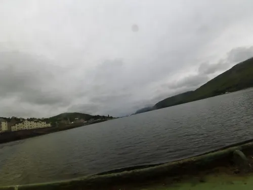



Highland Cinema Restaurant & Bar
Restaurant · Pizza, Burger, Salad, Snack, Coffee Shop, Breakfast, Lunch, Cake
Highland Cinema's restaurant in Fort William serves seasonal breakfast, lunch and dinner. Specialising in authentic stone-baked pizzas,...
Mo-Su 08:00-22:00


Ben Nevis
Bar and pub · Coffee Shop, Ice Cream, Local, Tea
103 High Street, Fort William
12:00-15:00,17:00-21:00

The Old Deli
Cafe
32 High Street, Fort William
Su-We 08:00-17:00; Th-Sa 08:00-21:00
Fox William Coffee Shop & Café
Cafe
127 High Street, Fort William
Mo-Sa 08:00-16:00; Su 09:00-17:00
36 more on the map.
History
Historically, the Fort William area of Lochaber was old Clan Chattan and then Clan Cameron country, and there were a number of mainly Cameron settlements in the area (such as Blarmacfoldach). Before the building of the fort, Inverlochy was the main local settlement and was also the site of two battles—the first Battle of Inverlochy in 1431 and the second Battle of Inverlochy in 1645.
The town grew in size as a settlement when the fort was constructed to control the population after Oliver Cromwell's invasion during the Wars of the Three Kingdoms, and then to suppress the Jacobite risings after the 1688 overthrow of the House of Stuart.
During the 1745 Jacobite Rising, known as the Forty-Five, Fort William was besieged for two weeks by the Jacobite forces, from 20 March to 3 April 1746. However, although the Jacobites had captured both of the other forts in the chain of three Great Glen fortifications (Fort Augustus and the original Fort George), they failed to take Fort William. Fort William Sheriff Court held its first hearing in 1794.
In 1934, the Laggan Dam on the River Spean was completed as part of the Lochaber hydroelectric scheme by Balfour Beatty for the British Aluminium Company. The supervising engineers were the firm of C. S. Meik and William Halcrow, now known as the Halcrow Group. The dam was built to power the aluminium smelter.
Read more of the history
During the Second World War, Fort William was the home of HMS St Christopher, which was a training base for Royal Navy Coastal Forces.
Fort William Town Hall, which started life as an 18th-century church, was converted for municipal use in 1881. It was burnt down in 1975.
A "waterfront" development was proposed by the council in 2007, but failed due to lack of public support. The development would have included a hotel, shops, and housing. The proposed development was slated to take 7 years by the local council, but opponents of the project said that it was unlikely to be completed before 2020. It was announced in April 2010 that the project had been abandoned.
From the History section of Fort William, Scotland on Wikipedia, under CC BY-SA 4.0.
More about Fort William
Geography
The town lies at the southern end of the Great Glen. Fort William lies near the head of Loch Linnhe, one of Scotland's longest sea lochs, beside the mouth of the rivers Nevis and Lochy. They join in the intertidal zone and briefly become one river before discharging to the sea. The town and its suburbs are surrounded by mountains. Its suburbs of Lochyside, Caol and Corpach are on the shore of Loch Eil. It is close to Ben Nevis, the highest mountain in the British Isles, Glen Nevis, and the settlement of Achnaphubuil, which is on the opposite shore of the loch. The original railway station, which was at the south end of the town, was opened on 7 August 1894.
The town is centred on the High Street, which was pedestrianised in the 1990s. Off this, there are several squares: Monzie Square (named after the Cameron Campbells of Monzie, Perthshire, former landowners in the town); Station Square, where the long-since demolished railway station used to be; Gordon Square (named after the Gordons, who in the late 18th century owned land where the town now stands, when the town was named Gordonsburgh); and Cameron Square—formerly known as Town Hall Square. There is also Fraser Square, which is not so square-like, since it now opens out into Middle Street, but which still houses the Imperial Hotel.
Economy
The area is a tourism centre for hikers due to its proximity to Ben Nevis, and to drivers wanting to see a nearby railway bridge, the Glenfinnan Viaduct. The Glenfinnan Viaduct was used in the film Harry Potter and the Chamber of Secrets and in three other films in the series, and is often called The Harry Potter Bridge. To address the automotive congestion, travellers by train are given discounts at local venues.
Just outside the town is a large aluminium plant once operated by Alcan and powered by the Lochaber hydroelectric scheme, in its day the biggest tunnelling project in the world. This was formerly served by the Lochaber Narrow Gauge Railway better known locally as the Puggy Line.
In November 2016, Sanjeev Gupta's Liberty Steel Group purchased the Lochaber aluminium plant from Rio Tinto.
On 3 April 2021, it came to light during Gupta's financial troubles involving Greensill Capital that the Jahama Highland Estates (formerly the "Alcan Estate") had been purchased in 2016 as part of the Rio Tinto deal for the Lochaber aluminium plant, because the furnace requires so much power that the smelter is located near a hydroelectric plant, which drains the basin of the 114,000-acre (46,000-hectare) Estate.
Education
Lochaber High School is the local high school and serves a large catchment area which includes the surrounding villages.
West Highland College is part of the University of the Highlands and Islands. It hosts the School of Adventure Studies (SOAS) offering both further education courses and higher education honours degrees.
From the Wikipedia article Fort William, Scotland, under CC BY-SA 4.0.
Notable people from Fort William
 Andrew Thomas McDonaldCatholic archbishopPhoto: William Drummond Young, CC BY-SA 4.0
 Ewen HendersonmusicianPhoto: Thesupermat, CC BY-SA 3.0
- Mike DixonBritish biathlete
- Duncan ShearerScottish footballer (born 1962)
- Allan MacDonaldScottish Roman Catholic priest, poet, folklore collector, and activist
- Gary VeneruzzoCanadian ice hockey player
- Derek SharpCanadian musician
- Katie DouganScottish rugby union player
- Hugh O'ConnorCanadian journalist and filmmaker
- Elizabeth KelsoJournalist, editor, community leader
- Hugh Stewart CochraneBritish military officer (1829–1884); recipient of the Victoria Cross
- Chick LangAmerican football tackle


Born in Fort William, according to Wikidata (CC0). Each name links to its Wikipedia article.
Where to stay68
Churches and places of worship10
Shopping31
Gas and EV charging2
Schools, colleges and libraries6
Healthcare4
Map of Fort William
204 places. The map loads OpenStreetMap tiles when you open it.
Getting there and nearby towns
Oban Airport (OBN) is the nearest airport with scheduled flights listed in OpenStreetMap, 27 miles away.
- Caol 1 mi north, about 2 min by car
- Kinlochleven 9 mi southeast, about 14 min by car
- Spean Bridge 9 mi northeast, about 14 min by car
- Ballachulish 10 mi south, about 16 min by car
- Fort Augustus 28 mi northeast, about 45 min by car
- Dunbeg 29 mi southwest, about 46 min by car
- Mallaig 30 mi northwest, about 48 min by car
- Oban 31 mi southwest, about 50 min by car
- Isle Of Mull 36 mi southwest, about 58 min by car
- Tobermory 39 mi west, about 1 h by car
Drive times are estimates from straight-line distance, not routes.
Keep exploring
Local news
Headlines from INDB.
Reviews, tips and questions
Loading what members have shared...
Sources and licences
- GeoNames (CC BY 4.0): population, coordinates, regions and time zone
- Mapillary (see each image): photos
- OpenStreetMap contributors (ODbL 1.0): places, airports, map data
- Wikidata (CC0 1.0): elevation, founding date, time zone, website, landmarks and historic places
- Wikimedia Commons (see each image): photos
- Wikipedia (CC BY-SA 4.0): overview and history text
Photo credits
- 04399 Ex Mackintosh Memorial Church, Fort William 009, WeeHolly, CC BY-SA 4.0
- 04399 Ex Mackintosh Memorial Church, Fort William 007, WeeHolly, CC BY-SA 4.0
- 04399 Ex Mackintosh Memorial Church, Fort William 004, WeeHolly, CC BY-SA 4.0
- 04399 Ex Mackintosh Memorial Church, Fort William 001, WeeHolly, CC BY-SA 4.0
- 04399 Ex Mackintosh Memorial Church, Fort William 013, WeeHolly, CC BY-SA 4.0
- 04399 Ex Mackintosh Memorial Church, Fort William 005, WeeHolly, CC BY-SA 4.0
- 04399 Ex Mackintosh Memorial Church, Fort William 008, WeeHolly, CC BY-SA 4.0
- 04399 Ex Mackintosh Memorial Church, Fort William 006, WeeHolly, CC BY-SA 4.0
- 04399 Ex Mackintosh Memorial Church, Fort William 002, WeeHolly, CC BY-SA 4.0
- West Highland Museum, Kenneth Allen, CC BY-SA 2.0
- St Mary's Catholic Church, Fort William, Lucas Kendall, CC BY-SA 4.0
- Fort William St Andrews Episcopal Church, AllyD, CC BY-SA 4.0
- Fort William, Fassifern Road, Cameron Obelisk - 20140422195644, Enric, CC BY-SA 4.0
- FortWilliamParade, Elizabeth B. Thomsen, CC BY-SA 4.0
- Donald Cameron of Lochiel Statue, Fort William (9064128141), Loz Pycock from London, UK, CC BY-SA 2.0
- THE GREAT GLEN WETHERSPOONS FORT WILLIAM SCOTLAND SEP2013 (9689150836), calflier001, CC BY-SA 2.0
- Craigs Burial Ground, Fort William (4), Lucas Kendall, CC BY-SA 4.0
- Street-level photo, smsm1, CC BY-SA 4.0
- Street-level photo, trigpoint, CC BY-SA 4.0
- Street-level photo, xdTAGCLAN, CC BY-SA 4.0
- Street-level photo, southglos, CC BY-SA 4.0
- Street-level photo, smsm1, CC BY-SA 4.0
- Street-level photo, victuallers, CC BY-SA 4.0
- Street-level photo, trigpoint, CC BY-SA 4.0
- Street-level photo, trigpoint, CC BY-SA 4.0
- Street-level photo, hobgoblin, CC BY-SA 4.0
- Street-level photo, chrisbeddow, CC BY-SA 4.0
- Street-level photo, chrisbeddow, CC BY-SA 4.0


Page built November 10, 2026. Spotted a mistake? Tell us or suggest a place.