


Why visit Nairn
Townapedia lists 13 museums and landmarks, 7 parks and trails, 37 places to eat, 18 places to stay and 1 attraction in and around town.
Highlights include Nairn Museum and Nairn Golf Club.
Weather in Nairn
Forecast from MET Norway (CC BY 4.0). Full forecast
About Nairn
Nairn (; Scottish Gaelic: Inbhir Narann) is a town and former royal burgh in the Highland Council area of Scotland. It is an ancient fishing port and market town around 17 miles (27 km) east of Inverness, at the point where the River Nairn enters the Moray Firth. It is the traditional county town of Nairnshire.
From the Wikipedia article Nairn (this version), under CC BY-SA 4.0.
Travel tips from other travellers: Nairn on Wikivoyage (CC BY-SA 4.0).
Photos of Nairn


Things to do1

Museums and landmarks13



Captain James Rose RN Academical Square For the square see.NH8856 : Academical Square Tablet
Monument and historic site
1 more on the map.
Parks, trails and playgrounds7






Restaurants and cafes37
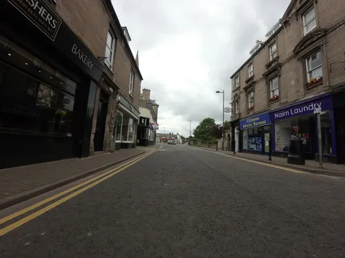
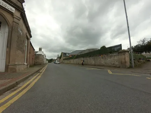
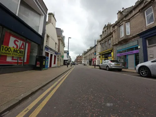
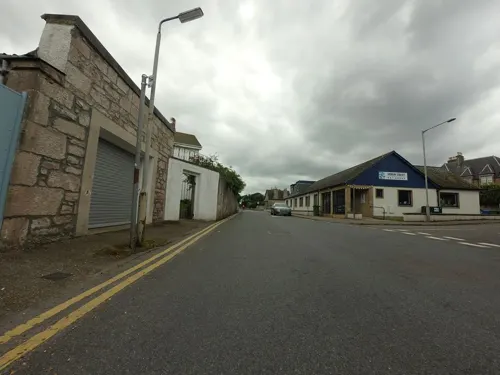
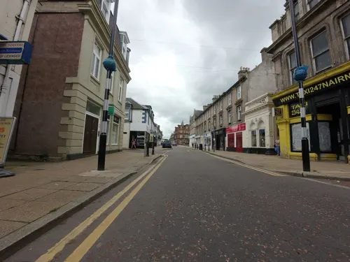
Nairn Tandoori
Restaurant · Indian · 0.5 mi
61 High Street, Nairn






25 more on the map.
History
The History of Nairn is a broad and diverse topic spanning its Palaeolithic and Mesolithic roots before recorded history, to the Picts and the visitation of Roman general Agricola, its possible founding under the name Ekkailsbakki by Sigurd, Earl of Orkney, its royal burgh status under David I, its strong links to monarchs and regents of Scotland and its strategic position in multiple wars and famine.
From the History section of Nairn on Wikipedia, under CC BY-SA 4.0.
More about Nairn
Geography
Formerly part of the Supercontinent of Rodinia as evidenced by the discovery of Dalradian Supergroup rocks, Nairn encompasses a 2+5⁄8-by-1+1⁄2-mile (4-by-2.5-kilometre) position on the mouth of the River Nairn and is fronted by the North Sea at the Moray Firth with two extensive beaches, the east beach being predominantly sand with dune vegetation (such as marram grass) and the west having more rock though becoming more sand as it reaches the river mouth. The Culbin Sands forms part of one of the most extensive areas of stabilised blown sand in Britain. The soil by the coast is largely a thin and loose organic layer developing directly on the sand and this has been strengthened in areas such as Culbin for forestry.
The town itself is predominantly flat rising from sea level to 40 feet (12 metres) in Fishertown and the majority of the town sitting at 65 feet (20 metres) above sea level. Sections of Nairn do reach as high as 95 feet (29 metres) near Balblair. The low ground near the coast is fertile and the soil rich free loam over sand or gravel. In the town thin, rather acidic soils are present throughout. The alluvial plain has shown Permo-Triassic sandstones, thick accumulations of Jurassic sandstones and dark shales, and erosion by ice sheets. Excavation can reveal dark, muddy glacial deposits, with occasional fossils and shells.
Arts and culture
On 27 May 1960 Nairn's The Regal Ballroom on Leopold Street played host to an act that became a huge cultural influence on the world of music. A cover band touring Scotland on The Beat Ballad Show Tour with Johnny Gentle as the lead vocalists and featuring three relatively unknown musicians—the founding members of The Beatles. John Lennon, Paul McCartney and George Harrison, who played under the name The Silver Beetles. The cover act's set list included Raining in My Heart by Buddy Holly and I Need Your Love Tonight by Elvis Presley. The Ballerina Ballroom of Nairn hosted many famous acts over the years, including Pink Floyd and The Who in 1967, Status Quo in 1970, and Fleetwood Mac and Slade in 1971. The town continues to host the Nairn International Jazz Festival each August, usually attracting some well-known musicians, including Bob Wilber and the Soprano Summit Jazz supergroup.
One link to Nairn's agricultural cultural roots is the Nairn Farmer's Show, hosted by the Nairnshire Farming Society since 1798. The show features livestock competitions of cattle, sheep and horses with trade stands as well as craft and food fairs. Locals produce baked goods, honey, jams and handicrafts such as knitting to be pitted against each other in contest..
Education
Nairn is serviced by one secondary school, Nairn Academy, on Duncan Drive in the Tradespark area, where it has been since 1976. Before that it was in the building occupied by the current Rosebank Primary school on Lodgehill Road. Nairn Academy was founded in 1832 under the name Rose's Academical Institution by Captain James Rose. Other facilities formerly existed, including Delnies School (1875-1985), the boys' preparatory boarding school known as Seaforth in 1901 and Alton Burn in 1911. As well as Rosebank Primary school, Nairn is also the location of Millbank Primary school on Millbank Crescent. Nairn Academy also takes students from Cawdor, Croy and Auldearn Primary Schools.
In 1818 we are offered insight into the status of the school facilities by the parish minister.
The parochial school is by no means fit for the education of one half of the children of the parish; and the situation of it is such, that the health of both teacher and children, is very much endangered.
In 2021 Nairn Academy ranked 204th out of 340 schools based on the percentage of pupils attaining five Highers, at 35%—higher than nearby Inverness High School with 13% and below Inverness Royal Academy with 41% and Charleston Academy Highland with 45%.
From the Wikipedia article Nairn, under CC BY-SA 4.0.
Notable people from Nairn
 Murray RoseAustralian swimmer, Olympic gold medalist, former world record-holder (1939-2012)Photo: Jodi Rose, CC0
 Margaret FultonAustralian food writer (1924-2019)Photo: Eva Rinaldi, CC BY-SA 2.0
 Isaac B. CameronAmerican politician (1851-1930)Photo: Baker's Art Gallery, Public domain
- Willie WhitelawBritish politician (1918–1999)
- Jon HenricksAustralian swimmer, Olympic gold medallist, former world record-holder
- James Augustus GrantScottish explorer and collector (1827 – 1892)
- Robert W. GardnerScottish footballer (1847–1887)
- Don BoydBritish writer and director
- Davie JohnstonBritish association football player (1942-2004)
- Mairi ChisholmScottish nurse and ambulance driver
- John AndersonScottish television personality, teacher and coach (1931–2024)
- Angus CameronBritish colonial administrator


Born in Nairn, according to Wikidata (CC0). Each name links to its Wikipedia article.
Where to stay18
Churches and places of worship7
Shopping14
Gas and EV charging1
Schools, colleges and libraries4
Healthcare3
Map of Nairn
105 places. The map loads OpenStreetMap tiles when you open it.
Getting there and nearby towns
Inverness Airport (INV) is the nearest airport with scheduled flights listed in OpenStreetMap, 7 miles away.
- Auldearn 3 mi east, about 5 min by car
- Ardersier 6 mi west, about 10 min by car
- Croy 7 mi southwest, about 12 min by car
- Rosemarkie 9 mi west, about 14 min by car
- Fortrose 9 mi west, about 15 min by car
- Cromarty 9 mi northwest, about 14 min by car
- Forres 10 mi east, about 16 min by car
- Balloch 11 mi southwest, about 17 min by car
- Avoch 11 mi west, about 18 min by car
- Culloden 12 mi southwest, about 19 min by car
Drive times are estimates from straight-line distance, not routes.
Keep exploring
Local news
Headlines from INDB.
Reviews, tips and questions
Loading what members have shared...
Sources and licences
- GeoNames (CC BY 4.0): population, coordinates, regions and time zone
- Mapillary (see each image): photos
- OpenStreetMap contributors (ODbL 1.0): places, airports, map data
- Wikidata (CC0 1.0): elevation, founding date, time zone, website
- Wikimedia Commons (see each image): photos
- Wikipedia (CC BY-SA 4.0): overview and history text
Photo credits
- Nairn High Street, Lucas Kendall, CC BY-SA 4.0
- Nairn West Signal Box, kitmasterbloke, CC BY 4.0
- Nairn Old Parish Church 04, Auldcathy, CC BY-SA 4.0
- St Mary's RC Church, Nairn 01, Auldcathy, CC BY-SA 4.0
- St Mary's RC Church, Nairn 02, Auldcathy, CC BY-SA 4.0
- Nairn Old Parish Church in Darkness, Arossmorrison, CC0
- Nairn Old Parish Church, Arossmorrison, CC0
- Nairn Old Parish Church View, Arossmorrison, CC0
- Nairn Old Parish Church Side View, Arossmorrison, CC0
- Nairn Old Parish Church 01, Auldcathy, CC BY-SA 4.0
- Nairn Old Parish Church 02, Auldcathy, CC BY-SA 4.0
- Nairn Old Parish Church 03, Auldcathy, CC BY-SA 4.0
- Old Parish Church, Nairn 02, Braveheart, CC BY-SA 4.0
- Waverley Hotel, Nairn 01, Braveheart, CC BY-SA 4.0
- Nairn Library, Braveheart, CC BY-SA 4.0
- Viewfield House, Nairn 02, Braveheart, CC BY-SA 4.0
- Rays - panoramio, Alexander Reuss, CC BY 3.0
- IPad (7th generation) RedWarn icon error, 512 megabytes, CC BY-SA 3.0
- The Little Theatre - panoramio, Brycie, CC BY 3.0
- 09 1433c - Nairn Links and Bandstand (4237844123), nairnbairn, CC BY-SA 2.0
- Street-level photo, toho, CC BY-SA 4.0
- Street-level photo, tallguy, CC BY-SA 4.0
- Street-level photo, tallguy, CC BY-SA 4.0
- Street-level photo, tallguy, CC BY-SA 4.0
- Street-level photo, tallguy, CC BY-SA 4.0
- Street-level photo, toho, CC BY-SA 4.0
- Street-level photo, tallguy, CC BY-SA 4.0
- Street-level photo, tallguy, CC BY-SA 4.0
- Street-level photo, tallguy, CC BY-SA 4.0
- Street-level photo, tallguy, CC BY-SA 4.0
- Street-level photo, tallguy, CC BY-SA 4.0
- Street-level photo, tallguy, CC BY-SA 4.0
- Street-level photo, rudolfmayer, CC BY-SA 4.0
- Street-level photo, tallguy, CC BY-SA 4.0
- Street-level photo, toho, CC BY-SA 4.0
- Street-level photo, tallguy, CC BY-SA 4.0
- Street-level photo, tallguy, CC BY-SA 4.0
- Street-level photo, toho, CC BY-SA 4.0
- Street-level photo, coetserw, CC BY-SA 4.0
- Street-level photo, tallguy, CC BY-SA 4.0
- Street-level photo, tallguy, CC BY-SA 4.0
- Street-level photo, tallguy, CC BY-SA 4.0
- Street-level photo, tallguy, CC BY-SA 4.0
- Street-level photo, tallguy, CC BY-SA 4.0
- Street-level photo, toho, CC BY-SA 4.0
- Street-level photo, tallguy, CC BY-SA 4.0
- Street-level photo, toho, CC BY-SA 4.0


Page built November 10, 2026. Spotted a mistake? Tell us or suggest a place.