


Peterborough, United Kingdom
Peterborough is a city of 163,379 people in England, United Kingdom, founded in 655.
Why visit Peterborough
Townapedia lists 120 museums and landmarks, 147 parks and trails, 456 places to eat, 39 places to stay and 13 attractions in and around town.
Highlights include Showcase Cinemas, Trinity Bridge, Whittlesey Museum and Nene Valley Railway.
Weather in Peterborough
Forecast from MET Norway (CC BY 4.0). Full forecast
About Peterborough
Peterborough ( PEE-tər-bər-ə, -burr-ə) is a cathedral city in the City of Peterborough district in the ceremonial county of Cambridgeshire, England. The city is 74 miles (119 km) north of London, on the River Nene. As of the 2021 census, the Peterborough urban area had a population of 192,178, In 2023, the Peterborough City Council estimated the population of the wider district to be 219,510.
From the Wikipedia article Peterborough (this version), under CC BY-SA 4.0.
Travel tips from other travellers: Peterborough on Wikivoyage (CC BY-SA 4.0).
Photos of Peterborough


Things to do13


Trinity Bridge
Bridge · 7.8 mi
Grade I listed bridge in Lincolnshire, England

Embassy Theatre
Cinema and theater
Former theatre and cinema in Peterborough, England

Moor Farm Shop and Tearoom
Farm and orchard · 4.9 mi
Brick to 1 meter then larch lap to pitched roof. Single story. New Solar panels on South facing roof pitch, 95%+ cover.
Decoy Road, Peterborough

1 more on the map.
Museums and landmarks120

Whittlesey Museum
Museum · 5.1 mi
Museum in Whittlesey, Cambridgeshire, England, UK
Market Street, Peterborough
Fr-Su 14:30-16:30; Sa 10:00-12:00

Nene Valley Railway
Museum · 3.9 mi
Heritage railway in the United Kingdom


Peterborough Museum and Art Gallery
Museum
History and art museum in Peterborough, England, United Kingdom


Burghley House
Museum · 9.8 mi
Grand sixteenth-century country house near Stamford, Lincolnshire, England, UK

Crowland Abbey
Monument and historic site · 7.9 mi
Parish church of Church of England in Crowland, Lincolnshire, England, UK


Flag Fen
Monument and historic site · 2.4 mi
Archaeological open-air museum in Peterborough, Cambridgeshire, England, UK
108 more on the map.
Parks, trails and playgrounds147

Barnack Hills & Holes National Nature Reserve
Park · 7.9 mi
UK nature reserve



Deeping Lakes Nature Reserve
Park · 5.7 mi
Nature reserve in Lincolnshire
Castor Hanglands National Nature Reserve
Park · 4.5 mi
Nature reserve in Cambridgeshire
Dogsthorpe Star Pit
Park · 3.1 mi
Nature reserve in the United Kingdom
135 more on the map.
Restaurants and cafes456
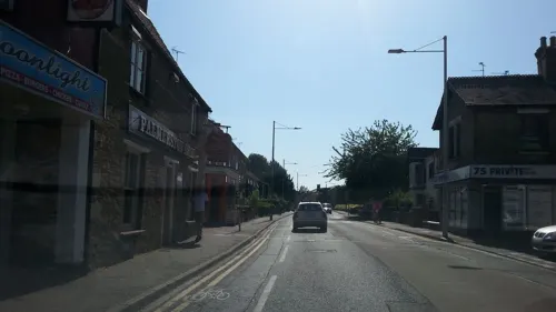
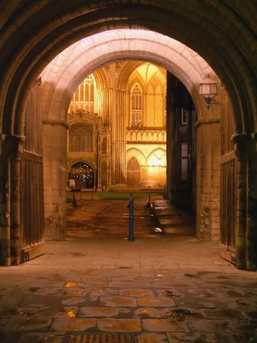
Caffè Nero
Cafe · Coffee Shop
36 Long Causeway, Peterborough
Mo-Fr 07:00-18:00; Sa 07:30-18:00; Su 08:30-17:30
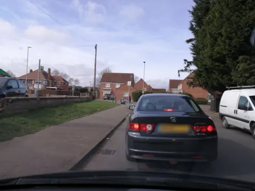



The Banyan Tree
Restaurant · Indian
53 Westgate, Peterborough
Mo-We 12:00-14:30,17:30-23:30; Th-Fr 12:00-14:30,17:30-24:00; Sa...
Bombay Brasserie
Restaurant · Indian · 0.4 mi
47 Broadway, Peterborough
Mo-Sa 12:00-15:00, 17:30-23:00, Su 12:00-15:00, 17:00-22:30

Katana
Restaurant · Asian · 0.4 mi
44 Broadway, Peterborough
We-Fr 17:00-22:00; Sa 12:00-23:00; Su 12:00-22:00
Middletons Steakhouse & Grill
Restaurant · Steak House
9-15 Bridge Street, Peterborough
Mo-Su 11:30-23:00
NATA Lisboa
Restaurant · Coffee Shop, Sandwich
9-10 Midgate, Peterborough
Mo-Th 07:00-21:00; Fr 07:00-23:00; Sa 08:00-24:00; Su 09:00-21:00
444 more on the map.
History
The original name of the town was Medeshamstede. The town's name changed to Burgh from the late tenth century, possibly after Abbot Kenulf had built a defensive wall around the abbey, which was dedicated to Saint Peter; eventually this developed into the form Peterborough. In the 12th century the town was also known as Gildenburgh, which is found in the Peterborough version of the Anglo-Saxon Chronicle (see Peterborough Chronicle below) and a history of the abbey by the monk Hugh Candidus. The town does not appear to have been a borough until at least the 12th century.
Read more of the history
Peterborough and its surrounding areas have been inhabited for thousands of years because it is where permanently drained land in The Fens is created by the River Nene. Remains of Iron Age settlement and what is thought to be religious activity can be seen at the Flag Fen archaeological site to the east of the city centre. The Romans established a fortified garrison town at Durobrivae on Ermine Street, five miles (8.0 km) to the west in Water Newton, around the middle of the 1st century AD. Durobrivae's earliest appearance among surviving records is in the Antonine Itinerary of the late 2nd century. There was also a large 1st century Roman fort at Longthorpe, designed to house half a legion, or about 3,000 soldiers; it may have been established as early as around AD 44–48. Peterborough was an important area of ceramic production in the Roman period, providing Nene Valley Ware that was traded as far away as Cornwall and the Antonine Wall, Caledonia.
Peterborough is shown by its original name Medeshamstede to have possibly been an Anglian settlement before AD 655, when Sexwulf founded a monastery on land granted to him for that purpose by Peada of Mercia, who converted to Christianity and was briefly ruler of the smaller Middle Angles sub-group. His brother Wulfhere murdered his own sons, similarly converted and then finished the monastery by way of atonement.
Hereward the Wake rampaged through the town in 1069 or 1070. Outraged, Abbot Turold erected a fort or castle, which, from his name, was called Mont Turold: this mound, or hill, is on the outside of the deanery garden, now called Tout Hill, although in 1848 Tot-hill or Toot Hill. The abbey church was rebuilt and greatly enlarged in the 12th century. The Peterborough Chronicle, a version of the Anglo-Saxon one, contains unique information about the history of England after the Norman conquest, written here by monks in the 12th century. This is the only known prose history in English between the conquest and the later 14th century. The burgesses received their first charter from "Abbot Robert" – probably Robert of Sutton (1262–1273). The place suffered materially in the war between King John and the confederate barons, many of whom took refuge in the monastery here and in Crowland Abbey, from which sanctuaries they were forced by the king's soldiers, who plundered the religious houses and carried off great treasures. The abbey church became one of Henry VIII's retained, more secular, cathedrals in 1541, having been assessed at the Dissolution as having revenue of £1,972.7s.0¾d per annum.
When civil war broke out, Peterborough was divided between supporters of King Charles I and the Long Parliament. The city lay on the border of the Eastern Association of counties which sided with Parliament, and the war reached Peterborough in 1643 when soldiers arrived in the city to attack Royalist strongholds at Stamford and Crowland. The Royalist forces were defeated within a few weeks and retreated to Burghley House, where they were captured and sent to Cambridge. While the Parliamentary soldiers were in Peterborough, however, they ransacked the cathedral, destroying the Lady Chapel, chapter house, cloister, high altar and choir stalls, as well as mediaeval decoration and records.
Among the privileges claimed by the abbot as early as the 13th century was that of having a prison for felons taken in the Soke of Peterborough, a liberty within Northamptonshire. This afforded it administrative and judicial independence from the rest of the county, with it having a quarter sessions separate from the rest of Northamptonshire from 1349. In 1576 Bishop Edmund Scambler sold the lordship of the hundred of Nassaburgh, which was coextensive with the Soke, to Queen Elizabeth I, who gave it to Lord Burghley, and from that time until the 19th century he and his descendants, the Earls and Marquesses of Exeter, had a separate gaol for prisoners arrested in the Soke. The abbot formerly held four fairs, of which two, St. Peter's Fair, granted in 1189 and later held on the second Tuesday and Wednesday in July, and the Brigge Fair, granted in 1439 and later held on the first Tuesday, Wednesday and Thursday in October, were purchased by the corporation from the Ecclesiastical Commissioners in 1876. The Bridge Fair, as it is now known, granted to the abbey by King Henry VI, survives. Prayers for the opening of the fair were once said at the morning service in the cathedral, followed by a civic proclamation and a sausage lunch at the town hall which still takes place. The mayor traditionally leads a procession from the town hall to the fair where the proclamation is read, asking all persons to "behave soberly and civilly, and to pay their just dues and demands according to the laws of the realm and the rights of the City of Peterborough".
Railway lines began operating locally during the 1840s, but it was the 1850 opening of the Great Northern Railway's line from London to York that transformed Peterborough from a market town to an industrial centre. Lord Exeter had opposed the railway passing through Stamford, so Peterborough, situated between two main terminals at London and Doncaster, increasingly developed as a regional hub.
From the History section of Peterborough on Wikipedia, under CC BY-SA 4.0.
More about Peterborough
Geography
According to the Köppen classification the British Isles experience a maritime climate characterised by relatively cool summers and mild winters. Compared with other parts of the country, East Anglia is slightly warmer and sunnier in the summer and colder and frostier in the winter. Owing to its inland position, furthest from the landfall of most Atlantic depressions, Cambridgeshire is one of the driest counties in the UK, receiving, on average, around 600 mm (2.0 ft) of rain per year. The Met Office weather station at Wittering, within the unitary authority of Peterborough, recorded a maximum temperature of 39.9 °C (103.8 °F) on 19 July 2022. The lowest temperature in recent years was −13.4 °C (7.9 °F) during February 2012.
Economy
Figures plotting growth from 1995 to 2004, revealed that Peterborough had become the most successful economy among unitary authorities in the East of England. They also revealed that the city's economy had grown faster than the regional average and any other economy in the region. It has a strong economy in the environmental goods and services sector and has the largest cluster of environmental businesses in the UK.
In 1994, Peterborough designated itself one of four environment cities in the UK and began working to become the country's acknowledged environment capital. Peterborough Environment City Trust (PECT), an independent charity, was set up at the same time to work towards this goal, delivering projects promoting healthier and sustainable living in the city. Until 2017, PECT organised a yearly 'Green Festival' centered around Cathedral Square, Peterborough, which also benefited local artists and arts organisations through attracting Arts Council funding grants aided by arts facilitator organisation Metal. During the summer of 2018 the last Green Festival was held at Nene Park, in 2019 Peterborough's community environmental projects attracted ministerial attention from the environment secretary Michael Gove. During the COVID-19 pandemic of 2020–21 Peterborough's culture and leisure umbrella charity, Vivacity ceased operating.
Arts and culture
The former public library on Broadway was funded by Scottish philanthropist Andrew Carnegie and opened in 1906; Carnegie was made first freeman of the city on the day of the opening ceremony.
Peterborough enjoys a wide range of events including the annual East of England Show, Peterborough Festival and CAMRA beer festival, which takes place on the river embankment in late August. The yearly festivals have attracted arts funding and enabled further community projects within the city. Nationally published cartoonist John Elson, from Peterborough, has provided imagery for many of the events.
The city acts as the central hub for the region's visual arts community, with the Peterborough Artists Open Studio organisation (PAOS), celebrating its 21st anniversary year as of 2021. A number of statues by the British sculptor Antony Gormley were re-installed in the city in 2018. Removed for repair works from their original setting on concrete pillars next to the rowing lake in Nene Park, they can now be seen on top of buildings surrounding Cathedral Square in the town centre.
Education
Peterborough has one independent school: The Peterborough School at Westwood House, founded in 1895. The school caters for girls and now boys up to the age of 18. Peterborough's state schools have recently undergone significant change. Five of the city's fifteen secondary schools were closed in July 2007, to be demolished over the coming years. John Mansfield (now an adult learning centre), Hereward (formerly Eastholm, now City of Peterborough Academy, sponsored by the Greenwood Dale Foundation Trust) and Deacon's were replaced with the flagship Thomas Deacon Academy, designed by Lord Foster of Thames Bank which opened in September 2007.
Queen Katharine Academy (previously The Voyager School), which has specialist media arts status, replaced Bretton Woods and Walton Community School. It is part of the Thomas Deacon Education Trust. The schools that remain have been extended and enlarged. Over £200 million was spent and the changes on-going to 2010. The King's School is one of seven schools established, or in some cases re-endowed and renamed, by King Henry VIII during the dissolution of the monasteries to pray for his soul. In 2006, 39.4% of Peterborough local education authority pupils attained five grades A* to C, including English and Mathematics, in the General Certificate of Secondary Education, lower than the national average of 45.8%.
From the Wikipedia article Peterborough, under CC BY-SA 4.0.
Notable people from Peterborough
 William PaleyChristian apologist, natural theologian, utilitarian; (1743-1805)Photo: George Romney, Public domain
 Andy BellBritish singer-songwriter; member of ErasurePhoto: Andrew Hurley, CC BY-SA 2.0
 Maxim RealityBritish singer, rapper and musicianPhoto: aliina s., CC BY 2.0
 Louis SmithBritish artistic gymnast (born 1989)Photo: los_bandito_anthony from UK, CC BY 2.0
 John HillEnglish author and botanist (1716-1775)Photo: Uncertain, Public domain
 Jodie Turner-SmithBritish actressPhoto: Gage Skidmore, CC BY-SA 3.0
 Luke SteeleEnglish association football player (born 1984)Photo: Maximiliaan Ronaldszoon, CC BY-SA 4.0
 John LandenmathematicianPhoto: John Landen, Public domain
 Aston MerrygoldBritish singer, songwriter and actorPhoto: Sueisfine, CC BY-SA 3.0
 Henry KingsleyBritish writer (1830-1876)Photo: published by John Lane, NY, 1906, Public domain
- Adrian LyneBritish film director
- Luke PasqualinoBritish actor


Born in Peterborough, according to Wikidata (CC0). Each name links to its Wikipedia article.
Where to stay39
Delta Hotels Peterborough
Motel and hotel · 3.6 mi
Peterborough Business Park, Lynchwood, Peterborough
Churches and places of worship140
Christ the Carpenter
Church · Anglican · 1.7 mi
93a Chestnut Avenue, Peterborough
Shopping95
Gas and EV charging38
Schools, colleges and libraries135
St Augustine's CofE (Voluntary Aided) Junior School
School · Anglican · 0.7 mi
Palmerston Road, Peterborough
Healthcare34
Lloyds Pharmacy
Clinic and pharmacy · 3.1 mi
13-14 Ortongate Centre, Peterborough
Hampton Vale Pharmacy
Clinic and pharmacy · 3.1 mi
Stewartby Avenue, Peterborough
Map of Peterborough
250 places. The map loads OpenStreetMap tiles when you open it.
Getting there and nearby towns
Sywell Aerodrome (ORM) is the nearest airport with scheduled flights listed in OpenStreetMap, 29 miles away.
- Eye 3 mi northeast, about 5 min by car
- Yaxley 4 mi south, about 6 min by car
- Castor 4 mi west, about 7 min by car
- Whittlesey 5 mi east, about 8 min by car
- Glinton 5 mi northwest, about 8 min by car
- Primrose Place 6 mi east, about 9 min by car
- Stilton 6 mi south, about 10 min by car
- Helpston 6 mi northwest, about 9 min by car
- Folksworth 6 mi southwest, about 10 min by car
- Northborough 6 mi north, about 10 min by car
Drive times are estimates from straight-line distance, not routes.
Keep exploring
Local news
Headlines from INDB.
Reviews, tips and questions
Loading what members have shared...
Sources and licences
- GeoNames (CC BY 4.0): population, coordinates, regions and time zone
- Mapillary (see each image): photos
- OpenStreetMap contributors (ODbL 1.0): places, airports, map data
- Wikidata (CC0 1.0): elevation, founding date, time zone, website, landmarks and historic places
- Wikimedia Commons (see each image): photos
- Wikipedia (CC BY-SA 4.0): overview and history text
Photo credits
- Stagecoach 13911 BU69 XYM – B – Cambridge to Peterborough (49467760917), Jṏs, CC BY 2.0
- Westgate House, Peterborough (6226849548), Gwydion M. Williams from Coventry, Great Britain, CC BY 2.0
- Trinity Bridge (Crowland, Lincolnshire, England) seated figure, Thorvaldsson, CC BY 3.0
- Whittlesey Town Hall June 2012, Chalkietom, CC BY-SA 4.0
- Nene Valley Railway Polish Tank Slask Tkp No 5485 Wansford, PeterSkuce, CC BY-SA 4.0
- Front of Burghley House 2009, Anthony Masi from UK, CC BY 2.0
- West Front Croyland Abbey, Thorvaldsson, CC BY-SA 3.0
- HillsAndHoles, Dave Crosby from Peterborough, England, CC BY-SA 2.0
- Gamsey Wood 2, Dudley Miles, CC BY-SA 4.0
- Grimeshaw Wood 7, Dudley Miles, CC BY-SA 4.0
- Lady's Wood 7, Dudley Miles, CC BY-SA 4.0
- Peterborough Cathedral March 2010, NotFromUtrecht, CC BY-SA 3.0
- Fotheringhay Church, Northamptonshire, John Spooner, CC BY 2.0
- Peterborough City Hospital, Davecrosby uk, CC BY-SA 3.0
- Railworld Peterborough, Chris Allen, CC BY-SA 2.0
- Serpintinegreen, Lofty at English Wikipedia, Public domain
- Kings School, Peterborough, Julian Dowse, CC BY-SA 2.0
- Clare Cottage, Magnus Manske, CC BY-SA 3.0
- Showcasecinemapeterborough, User:Mickey McCarthy, Public domain
- Peterborough Cathedral Exterior 1, Cambridgeshire, UK - Diliff, Diliff, CC BY-SA 3.0
- Holme Fen, Wehha, CC BY-SA 3.0
- Fotheringhay church, Theroadislong, CC BY-SA 4.0
- Hugh llewelyn 60 059 (5627298168), Hugh Llewelyn, CC BY-SA 2.0
- Hugh llewelyn 365 532 (6332102020), Hugh Llewelyn, CC BY-SA 2.0
- Hugh llewelyn 60 059 (5627297672), Hugh Llewelyn, CC BY-SA 2.0
- Hugh llewelyn 365 540 (6332102724), Hugh Llewelyn, CC BY-SA 2.0
- BR Battle of Britain class 34081 "92 Squadron" Locomotive on the Nene Valley Railway, Hugh Llewelyn, CC BY-SA 2.0
- Ashton lead tank at Peterborough Museum and Art Gallery, Lajmmoore, CC BY-SA 4.0
- Street-level photo, adam2, CC BY-SA 4.0
- Street-level photo, coljay72, CC BY-SA 4.0
- Street-level photo, dok72, CC BY-SA 4.0
- Street-level photo, coljay72, CC BY-SA 4.0
- Street-level photo, dzidek23, CC BY-SA 4.0
- Street-level photo, dzidek23, CC BY-SA 4.0
- Street-level photo, adam2, CC BY-SA 4.0
- Street-level photo, dzidek23, CC BY-SA 4.0
- Street-level photo, dzidek23, CC BY-SA 4.0
- Street-level photo, dzidek23, CC BY-SA 4.0
- Street-level photo, dzidek23, CC BY-SA 4.0
- Street-level photo, adam2, CC BY-SA 4.0
- Street-level photo, alexanderar, CC BY-SA 4.0
- Street-level photo, dzidek23, CC BY-SA 4.0
- Street-level photo, alexanderar, CC BY-SA 4.0
- Street-level photo, adam2, CC BY-SA 4.0
- Street-level photo, dzidek23, CC BY-SA 4.0


Page built November 10, 2026. Spotted a mistake? Tell us or suggest a place.