


Plymouth, United Kingdom
Plymouth is a city of 260,203 people in England, United Kingdom.
Why visit Plymouth
Townapedia lists 87 museums and landmarks, 75 parks and trails, 142 places to eat, 36 places to stay and 32 attractions in and around town.
Highlights include National Marine Aquarium, Palace Theatre, Mount Edgcumbe House and The Box.
Weather in Plymouth
Forecast from MET Norway (CC BY 4.0). Full forecast
About Plymouth
Plymouth is a port city and unitary authority in Devon, England. It is located on the county's south coast between the rivers Plym and Tamar, about 36 miles (58 km) south-west of Exeter and 193 miles (311 km) south-west of London. It is the most populous settlement in Devon.
From the Wikipedia article Plymouth (this version), under CC BY-SA 4.0.
Travel tips from other travellers: Plymouth on Wikivoyage (CC BY-SA 4.0).
Photos of Plymouth


Things to do32

National Marine Aquarium
Zoo and aquarium · 0.6 mi
Marine aquarium in the city of Plymouth, England
Mo-Su 10:00-17:00

Palace Theatre
Cinema and theater · 0.5 mi
Theatre in Plymouth, England


Kitley Show Cave
Monument and historic site · 6.4 mi
Cave in Devon, England


Royal Albert Bridge
Bridge · 3.6 mi
Railway bridge spanning the River Tamar in England


Vue
Cinema and theater · 0.9 mi
Located at the Barbican Leisure Park, Vue Plymouth has 15 screens, seating 1390 people. Free onsite parking with areas for blue badge...
Shapters Road, Plymouth

Plymouth Breakwater Lighthouse
Lighthouse · 2.6 mi
Lighthouse in Devon, England
20 more on the map.
Museums and landmarks87
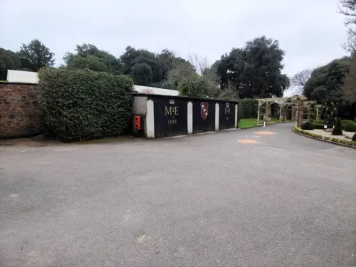
Mount Edgcumbe House
Monument and historic site · 1.9 mi
House museum in Cornwall, England, UK
Cremyll Torpoint, Cornwall

The Box
Museum
Art museum and history museum in Devon, England, United Kingdom
Tavistock Place
Tu-Su 10:00-17:00; PH 10:00-17:00

Saltash Heritage Museum
Museum · 3.9 mi
17 Lower Fore Street, Saltash
Apr-Nov We 14:00-16:00, Sa 10:00-16:00; Jul-Sep We 14:00-16:00, Fr...

Saltram House
Museum · 2.8 mi
George II era mansion located in Plympton, Devon, England, UK

Armada Memorial
Monument and historic site · 0.4 mi
Monument in Plymouth, England


Antony House
Museum · 4.8 mi
Grade I listed historic house museum in Cornwall, England, UK


Cast-iron Victorian Urinal
Monument and historic site · 1.2 mi
On-man cast-iron early C20 urinal by Jennings, manufactured McFarlane, Glasgow.
Michael Foot memorial
Monument and historic site · 0.8 mi
Memorial in Plymouth, Devon, England
75 more on the map.
Parks, trails and playgrounds75

Plymouth Hoe
Park · 0.4 mi
Public space in Plymouth, Devon, England, UK

Sutton Harbour Marina
Marina and boat launch · 0.5 mi


Victoria Park, Millbridge, Plymouth
Park · 0.6 mi
Park in Millbridge, Plymouth, England

Mount Edgcumbe Country Park
Park · 2.2 mi
Country park in Maker-with-Rame, Cornwall, England, UK
Penlee Battery
Park · 4.2 mi
Artillery battery and nature reserve in Cornwall, England

63 more on the map.
Restaurants and cafes142
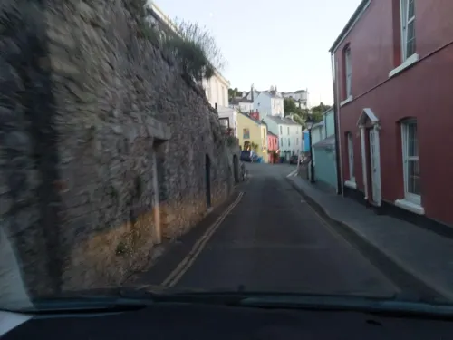
Boringdon Arms
Bar and pub · 1.4 mi
13 Boringdon Terrace, Plymouth
Mo-Th 12:00-23:00, Fr,Sa 12:00-24:00, Su 12:00-10:30
The Gog and Magog
Bar and pub · 0.4 mi
57-59 Southside Street, Plymouth
Mo,Tu,We,Th,Su 08:00-24:00; Fr,Sa 08:00-25:00
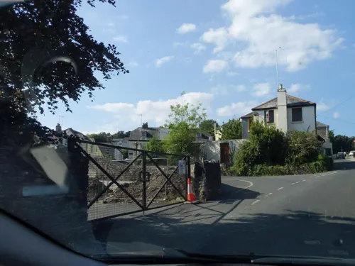
Kings Arms
Bar and pub · 3.9 mi
Tamerton Foiliot Road
Tu-Th 12:00-22:00; Fr 12:00-23:00; Sa 08:30-23:00; Su 12:00-19:00
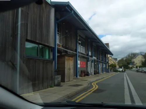
The Bridge
Restaurant · British · 1.3 mi
33 Shaw Way, Plymouth
Mo 09:00-18:00; Tu-Sa 09:00-23:00; Su 09:00-22:30
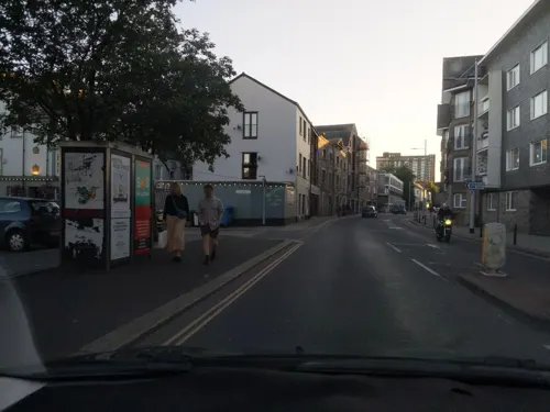
Boston Tea Party
Cafe · Coffee Shop · 0.4 mi
82-84 Vauxhall Street, Plymouth
Mo-Sa 07:00-19:00; Su 08:00-19:00
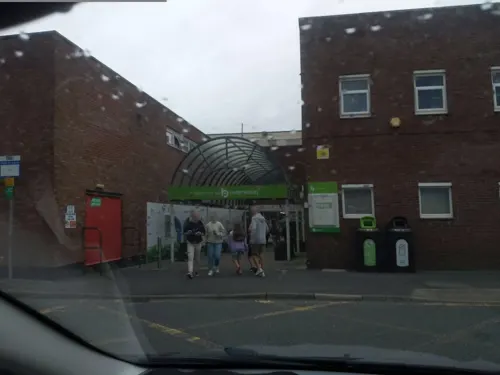
Divino Lounge
Restaurant · British · 2.4 mi
24-28 The Broadway, Plymouth
Su-Th 09:00-23:00, Fr-Sa 09:00-00:00



Eddystone Inn
Bar and pub · 3.8 mi
Heybrook Drive
Mo-Th 11:30-22:30; Fr,Sa 11:30-23:30; Su 10:30-21:00

130 more on the map.
History
Upper Palaeolithic deposits, including bones of Homo sapiens have been found in local caves, and artefacts dating from the Bronze Age to the Middle Iron Age have been found at Mount Batten, showing that it was one of few principal trading ports of pre-Roman Britannia dominating continental trade with Armorica. An unidentified settlement named Tamari Ostts is listed in Ptolemy's Geographia and is presumed to be located in the area of the modern city. An ancient promontory fort was located at Rame Head at the mouth of Plymouth Sound with ancient hillforts located at Lyneham Warren to the east, Boringdon Camp and Maristow Camp to the north.
The settlement of Plympton, further up the river Plym than the current Plymouth, was also an early trading port. As the river silted up in the early 11th century, mariners and merchants were forced to settle downriver, at the current day Barbican near the river mouth. At the time this village was called Sutton, meaning south town in Old English. The name Plym Mouth, meaning "mouth of the river Plym" was first mentioned in a Pipe Roll of 1211. Plympton Priory owned land at Sutton and secured a charter from Henry III in 1254 granting the priory the right to hold a weekly market and annual fair at Sutton, making it a market town.
Read more of the history
During the Hundred Years' War, a French attack in 1340 burned a manor house and took some prisoners, but failed to get into the town. The town was burned by Breton raiders in 1403. On 12 November 1439, the market town of Sutton was incorporated as a borough and was formally renamed 'Plymouth', with a subsequent charter the following year formalising its boundaries. It was the first time a borough charter had been issued by parliament, rather than directly from the monarch.
In the late 15th century, Plymouth Castle, a "castle quadrate", was constructed close to the area now known as The Barbican; it included four round towers, one at each corner, as featured on the city coat of arms.
The castle served to protect Sutton Pool, which is where the fleet was based in Plymouth prior to the establishment of Plymouth Dockyard. An act of Parliament, the Fortification of Plymouth Act 1512 (4 Hen. 8. c. 20), was passed to further fortify Plymouth. The work included defensive walls at the entrance to Sutton Pool, across which a chain was extended in times of danger. Defences on St Nicholas Island also date from this time, and a string of six artillery blockhouses were built, including one on Fishers Nose at the south-eastern corner of the Hoe. This location was further strengthened by the building of a fort (later known as Drake's Fort) in 1596; it was the site of the Citadel, established in the 1660s.
During the 16th century, locally produced wool was the major export commodity. Plymouth was the home port for successful maritime traders, among them Sir John Hawkins, who led England's first foray into the Atlantic slave trade, as well as Sir Francis Drake, Mayor of Plymouth in 1581–2. Crews for the first English failed settlement attempt at Roanoke Colony in North America departed in 1587 under Sir Walter Raleigh's and Drake's leadership; returning bearing maize, tobacco and potatoes.
In 1588, according to legend, Drake insisted on completing his game of bowls on the Hoe before engaging the Spanish Armada. In 1620, the Pilgrims set sail for the New World from Plymouth, establishing Plymouth Colony – the second English colony in what is now the United States
In 1625, the mayor estimated that African slavers captured that summer about 1,000 villagers, from the town's area, to be sold in Africa.
During the English Civil War, Plymouth sided with the Parliamentarians and was besieged for almost four years by the Royalists. The last major attack by the Royalists was by Sir Richard Grenville leading thousands of soldiers towards Plymouth, but they were defeated by the Plymothians at Freedom Fields Park. The civil war ended as a Parliamentary win, but monarchy was restored by King Charles II in 1660, who imprisoned many of the Parliamentary heroes on Drake's Island. Construction of the Royal Citadel began in 1665, after the Restoration; it was armed with cannon facing both out to sea and into the town, rumoured to be a reminder to residents not to oppose the Crown. Mount Batten tower also dates from around this time.
Throughout the 17th century, Plymouth had gradually lost its pre-eminence as a trading port. By the middle of the century, commodities manufactured elsewhere in England cost too much to transport to Plymouth and the city had no means of processing sugar or tobacco imports, major products from the colonies. Local sailors turning to piracy such as Henry Every became infamous, celebrated in the London play The Successful Pyrate. It played a part in the Atlantic slave trade during the early 18th century, although it was relatively small.
In the nearby parish of Stoke Damerel the first dockyard, HMNB Devonport, opened in 1690 on the eastern bank of the river Tamar. Further docks were built here in 1727, 1762 and 1793. The settlement that developed here was called "Dock" or "Plymouth Dock" at the time, and a new town, separate from Plymouth, grew up. In 1712, there were 318 men employed and, by 1733, the population had grown to 3,000 people.
From the History section of Plymouth on Wikipedia, under CC BY-SA 4.0.
More about Plymouth
Geography
Plymouth lies between the Plym to the east and the Tamar to the west; both rivers flow into the natural harbour of Plymouth Sound. Since 1967, the unitary authority of Plymouth has included the, once independent, towns of Plympton and Plymstock which lie along the east of the Plym. The Tamar forms the county boundary between Devon and Cornwall; its estuary forms the Hamoaze on which is sited Devonport Dockyard.
The Plym, which flows off Dartmoor to the north-east, forms a smaller estuary to the east of the city called Cattewater. Plymouth Sound is protected from the sea by the Plymouth Breakwater, in use since 1814. In the Sound is Drake's Island, which is seen from Plymouth Hoe; it is a flat public area on top of limestone cliffs. The Unitary Authority of Plymouth is 80 km2 (31 mi2). The topography rises from sea level to a height, at Roborough, of about 509 feet (155 m) above Ordnance Datum (AOD).
Geologically, Plymouth has a mixture of limestone, Devonian slate, granite and Middle Devonian limestone. Plymouth Sound, Shores and Cliffs is a Site of Special Scientific Interest, because of its geology. The bulk of the city is built upon Upper Devonian slates and shales and the headlands at the entrance to Plymouth Sound are formed of Lower Devonian slates, which can withstand the power of the sea.
Economy
Due to its coastal location, the economy of Plymouth has traditionally been maritime, in particular the defence sector with over 12,000 people employed and approximately 7,500 in the armed forces. The Plymouth Gin Distillery has been producing Plymouth Gin since 1793, which was exported around the world by the Royal Navy. During the 1930s, it was the most widely distributed gin and had a controlled term of origin until 2015. Since the 1980s, employment in the defence sector has decreased substantially and the public sector is now prominent particularly in administration, health, education, medicine and engineering.
Devonport Dockyard is the UK's only naval base that refits nuclear submarines and the Navy estimates that the Dockyard generates about 10% of Plymouth's income. Plymouth has the largest cluster of marine and maritime businesses in the south west with 270 firms operating within the sector. Other substantial employers include the university with almost 3,000 staff, the national retail chain The Range at their Estover headquarters, as well as the Plymouth Science Park employing 500 people in 50 companies.
Arts and culture
Built in 1815, Union Street was at the heart of Plymouth's historical culture. It became known as the servicemen's playground, as it was where sailors from the Royal Navy would seek entertainment of all kinds. During the 1930s, there were 30 pubs and it attracted such performers as Charlie Chaplin to the New Palace Theatre. It was described in 2008 as the late-night hub of Plymouth's entertainment strip.
Outdoor events and festivals are held including the annual British Firework Championships in August, which attracts tens of thousands of people across the waterfront. In August 2006 the world record for the most simultaneous fireworks was surpassed, by Roy Lowry of the University of Plymouth, over Plymouth Sound. From 2014, MTV Crashes Plymouth has taken place every July on Plymouth Hoe, hosting big-name acts such as The 1975, Little Mix, Tinie Tempah and Busted.
Between 1992 and 2012, the Music of the Night celebration was performed in the Royal Citadel by the 29 Commando Regiment and local performers to raise money for local and military charities. A number of other smaller cultural events taken place annually, including Plymouth Art Weekender, Plymouth Fringe Festival and Illuminate Festival.
Education
There are three universities based in the city: the University of Plymouth, Plymouth Marjon University and the Arts University Plymouth.
The University of Plymouth enrolls 23,155 total students as of 2018/19 (57th largest in the UK out of 169). It also employs 2,900 staff with an annual income of around £160 million. It was founded in 1992 from Polytechnic South West (formerly Plymouth Polytechnic) following the Further and Higher Education Act 1992. It has a wide range of courses including those in marine focused business, marine engineering, marine biology and Earth, ocean and environmental sciences, surf science, shipping and logistics. The university formed a joint venture with the fellow Devonian University of Exeter in 2000, establishing the Peninsula College of Medicine and Dentistry. The college was ranked eighth out of 30 universities in the UK in 2011 for medicine. Its dental school was established in 2006, which also provides free dental care in an attempt to improve access to it in the South West.
The University of St Mark & St John (known as "Marjon" or "Marjons") specialises in teacher training, and offers training across the country and abroad.
From the Wikipedia article Plymouth, under CC BY-SA 4.0.
Notable people from Plymouth
 Robert Falcon ScottRoyal Navy officer and explorer (1868–1912)Photo: Henry Maull (1829–1914) and John Fox..., Public domain
 Rosie Huntington-WhiteleyBritish model (born 1987)Photo: LucaFazPhoto, CC BY-SA 4.0
 Tom DaleyBritish diverPhoto: Jim Thurston, CC BY-SA 2.0
 William Blighofficer of the British Royal Navy and colonial administrator (1754-1817)Photo: Alexander Huey, Public domain
 Trevor FrancisEnglish association football player and manager (1954–2023)Photo: Original: Hans van Dijk for Anefo..., CC0
 John HawkinsEnglish navigator, admiral, privateer and slave trader (1532-1595)Photo: English School / Unidentified painter, Public domain
 Michael FootBritish politician (1913-2010)Photo: Marcel Antonisse / Anefo, CC0
 Tobias FurneauxRoyal Navy officer and explorer (1735-1781)Photo: James Northcote, Public domain
 May SuttonUS tennis player (1886–1975)Photo: Bain News Service, publisher, Public domain
 David CrossEnglish electric violinist and keyboardistPhoto: roberto scorta, CC BY 2.0
- William Elford LeachEnglish zoologist and marine biologist (1790/1–1836)
- Donald WinnicottBritish pediatric psychiatrist and psychoanalyst (1896–1971)


Born in Plymouth, according to Wikidata (CC0). Each name links to its Wikipedia article.
Where to stay36
Churches and places of worship61
Shopping68
Gas and EV charging18
Schools, colleges and libraries39
Healthcare34
Map of Plymouth
250 places. The map loads OpenStreetMap tiles when you open it.
Getting there and nearby towns
Cornwall Airport Newquay (NQY) is the nearest airport with scheduled flights listed in OpenStreetMap, 38 miles away.
- Plymstock 2 mi east, about 4 min by car
- Torpoint 2 mi west, about 4 min by car
- Plympton 4 mi east, about 6 min by car
- Saltash 4 mi northwest, about 7 min by car
- Wembury 5 mi southeast, about 7 min by car
- Brixton 5 mi east, about 8 min by car
- Lower Tregantle 6 mi west, about 9 min by car
- Newton Ferrers 6 mi southeast, about 10 min by car
- Yealmpton 7 mi east, about 11 min by car
- Landrake 7 mi northwest, about 12 min by car
Drive times are estimates from straight-line distance, not routes.
Keep exploring
Local news
Headlines from INDB.
Reviews, tips and questions
Loading what members have shared...
Sources and licences
- GeoNames (CC BY 4.0): population, coordinates, regions and time zone
- Mapillary (see each image): photos
- OpenStreetMap contributors (ODbL 1.0): places, airports, map data
- Wikidata (CC0 1.0): elevation, founding date, time zone, website, landmarks and historic places
- Wikimedia Commons (see each image): photos
- Wikipedia (CC BY-SA 4.0): overview and history text
Photo credits
- Bird graffiti, New George Street, Plymouth, Devon - September 2022, Mutney, CC BY-SA 4.0
- St Luke's charity shop, New George Street, Plymouth, Devon - May 2025 (1), Mutney, CC BY 4.0
- Bird graffiti and strike poster, New George Street, Plymouth, Devon - September 2022, Mutney, CC BY-SA 4.0
- St Luke's charity shop, New George Street, Plymouth, Devon - May 2025 (2), Mutney, CC BY 4.0
- Greggs, New George Street, Plymouth, Devon - May 2025, Mutney, CC BY 4.0
- H. Samuel jewellers shop, New George Street, Plymouth, Devon - May 2025, Mutney, CC BY 4.0
- South Western Ambulance Service bus 1871 (J126 UNV), Plymouth, 27 July 2013, Chris Sampson, CC BY 2.0
- Streamers card & party shop, New George Sttreet, Plymouth, Devon - May 2024, Mutney, CC BY 4.0
- Mobile phone accessories kiosk, New George Street, Plymouth, Devon - May 2025, Mutney, CC BY 4.0
- National Marine Aquarium, MyNameIsClare, Public domain
- New Palace Theatre Plymouth, Smalljim, CC BY 3.0
- Smeatons tower - Plymouth Hoe, Herbythyme, CC BY-SA 4.0
- Kitley Show Cave, Yealmpton, Devon, Langcliffe, CC BY-SA 4.0
- Laira Bridge Plymouth, UK, Graham Richardson from Plymouth, England, CC BY 2.0
- Royal Albert Bridge 2009, Geof Sheppard, CC BY-SA 4.0
- Tamar Bridge from train, David McCormick, CC BY-SA 3.0
- Plymouth Museum and Art Gallery, Smalljim, CC BY 3.0
- Saltram House 2008, Chilli Head from Weston-super-Mare, UK, CC BY 2.0
- Armada Memorial, Plymouth Hoe, Nilfanion, CC BY-SA 3.0
- The Royal Citadel, Plymouth from Mount Batten, No machine-readable author provided. Adam Cuerden assumed (based on copyright claims)., Public domain
- Antony House 03, Brian, CC BY-SA 2.0
- Royal Albert Bridge (86394), Lee Vilenski, CC BY-SA 4.0
- Beacon Down Bowling Club in Central Park, Plymouth, Lee Vilenski, CC BY-SA 4.0
- Victoria Park, Millbridge, Plymouth, Onlytruejames, CC BY-SA 3.0
- St Jude's Church Plymouth, N Chadwick, CC BY-SA 2.0
- All Saints Church Millbrook Cornwall, Ashley Smith, CC BY-SA 4.0
- BereFerrersChurch, Lobsterthermidor at English Wikipedia, CC0
- Home Park (20968), Lee Vilenski, CC BY-SA 4.0
- BoringdonHallDevonSouthFront, own photo, Public domain
- Derriford Hospital, Tony Atkin, CC BY-SA 2.0
- Duke of Cornwall Hotel 3a, Smalljim, CC BY-SA 3.0
- Steam Locomotive - panoramio (1), Mark A Coleman, CC BY 3.0
- Plymouth Synagogue, Nilfanion, CC BY-SA 3.0
- Theatre Royal, Plymouth, painma, CC BY-SA 4.0
- Mount Edgcumbe blockhouse, Nilfanion, CC BY-SA 3.0
- Swans Swimming in Sutton Harbour, Plymouth, Partonez, CC BY-SA 4.0
- Plymouth (2021-11-19) 33, Simon Cobb, CC0
- Kingsand, Cornwall - Halfway House Inn, Delta 51, CC BY-SA 4.0
- Plymouth (2021-11-19) 05, Simon Cobb, CC0
- Homepark2, Euanargyle, CC BY-SA 4.0
- Charles Church May 2002, Kevincolyer, Public domain
- Saltash Ferry mural, Saltash Heritage Museum, Cornwall - January 2024, Mutney, CC0
- Street-level photo, WaggyDog, CC BY-SA 4.0
- Street-level photo, WaggyDog, CC BY-SA 4.0
- Street-level photo, WaggyDog, CC BY-SA 4.0
- Street-level photo, WaggyDog, CC BY-SA 4.0
- Street-level photo, WaggyDog, CC BY-SA 4.0
- Street-level photo, WaggyDog, CC BY-SA 4.0
- Street-level photo, WaggyDog, CC BY-SA 4.0
- Street-level photo, WaggyDog, CC BY-SA 4.0
- Street-level photo, WaggyDog, CC BY-SA 4.0
- Street-level photo, WaggyDog, CC BY-SA 4.0
- Street-level photo, WaggyDog, CC BY-SA 4.0
- Street-level photo, WaggyDog, CC BY-SA 4.0
- Street-level photo, WaggyDog, CC BY-SA 4.0
- Street-level photo, WaggyDog, CC BY-SA 4.0
- Street-level photo, ebel, CC BY-SA 4.0
- Street-level photo, WaggyDog, CC BY-SA 4.0
- Street-level photo, WaggyDog, CC BY-SA 4.0
- Street-level photo, WaggyDog, CC BY-SA 4.0
- Street-level photo, WaggyDog, CC BY-SA 4.0
- Street-level photo, WaggyDog, CC BY-SA 4.0
- Street-level photo, WaggyDog, CC BY-SA 4.0
- Street-level photo, WaggyDog, CC BY-SA 4.0
- Street-level photo, WaggyDog, CC BY-SA 4.0
- Street-level photo, WaggyDog, CC BY-SA 4.0


Page built November 10, 2026. Spotted a mistake? Tell us or suggest a place.