


Stonehaven, United Kingdom
Stonehaven is a town of 11,150 people in Scotland, United Kingdom.
Why visit Stonehaven
Townapedia lists 17 museums and landmarks, 8 parks and trails, 26 places to eat, 9 places to stay and 3 attractions in and around town.
Highlights include Cowie Bridge, White Bridge, Stonehaven, Tolbooth Museum and Dunnottar Castle.
Weather in Stonehaven
Forecast from MET Norway (CC BY 4.0). Full forecast
About Stonehaven
Stonehaven is a coastal town on the northeast coast of Scotland, 15 miles (24 km) south of Aberdeen. The town had a population of 11,177 at the 2022 Census.
From the Wikipedia article Stonehaven (this version), under CC BY-SA 4.0.
Travel tips from other travellers: Stonehaven on Wikivoyage (CC BY-SA 4.0).
Photos of Stonehaven

Things to do3
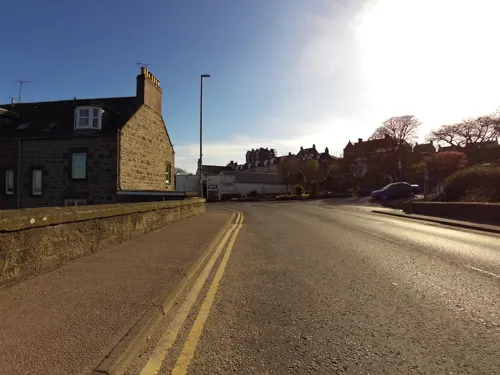
Cowie Bridge
Bridge
Bridge in Aberdeenshire, Scotland, UK, carries the B979 road across Cowie Water

White Bridge, Stonehaven
Bridge
Footbridge in Stonehaven, Aberdeenshire, Scotland, UK, across Carron Water

Gallows Hill (Hangmans Hill)
Scenic view · 0.8 mi
Final place for condemned criminals.
Museums and landmarks17

Tolbooth Museum
Museum · 0.4 mi
Old Pier, Stonehaven
Oct-Mar: Sa,Su 12:30-15:30; Apr-Sep: We-Mo 13:30-16:30

Dunnottar Castle
Monument and historic site · 1.3 mi
Apr-Sep Mo-Su,PH 09:00-18:00; Oct,Mar Mo-Su,PH 10:00-17:00;...
Stonehaven Tolbooth
Museum · 0.4 mi
Historic building in Stonehaven, Scotland
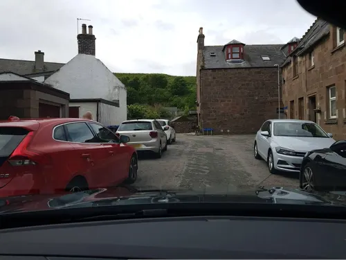


Spurryhillock
Monument and historic site · 0.8 mi
Industrial estate and archaeological site on Stonehaven, Aberdeenshire, Scotland, UK
Stonehaven and Dunnotar War Memorial
Monument and historic site · 0.7 mi
War memorial in Stonehaven, Aberdeenshire, Scotland, UK
5 more on the map.
Parks, trails and playgrounds8






Restaurants and cafes26
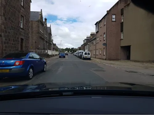
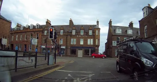



The Old Pier Coffee House
Cafe · Ice Cream, Baguette, Soup · 0.4 mi
Old Pier, Stonehaven
Tu-Su 09:00-16:00

Royal China
Restaurant · Chinese, Thai
5 Barclay Street, Stonehaven
Mo-Th,Su 16:30-22:00; Fr-Sa 16:30-23:00

14 more on the map.
History
The town lies at the southern origin of the ancient Causey Mounth trackway, which was built on high ground to make passable this only available medieval route from coastal points south of Aberdeen. This ancient passage specifically connected the Bridge of Dee to Cowie Castle via the Portlethen Moss and the Stonehaven central plaza. The route was taken by the Earl Marischal and Marquess of Montrose when they led a Covenanter army of over 9,000 men in the first battle of the Wars of the Three Kingdoms in 1639.
The Covenanters were imprisoned in Dunnottar Castle, where many died. A memorial to them can be found in Dunnottar Church. Other castles in the vicinity are Fetteresso Castle and Muchalls Castle, both of which are in private ownership and not open to the public. The oldest surviving structure in Stonehaven is the Stonehaven Tolbooth at the harbour, used as an early prison and now a museum.
Read more of the history
Dunnottar Castle, perched atop a rocky outcrop, was home to the Keith family, and during the Scottish Wars of Independence, the Scottish Crown Jewels were hidden there. In 1296 King Edward I of England took the castle, only for William Wallace to reclaim it in 1297, burning down the church in the process with the entire English garrison still in it. In 1650, Oliver Cromwell sacked the castle to find the Crown Jewels following an eight-month siege (having previously destroyed the English Crown Jewels). However, just before the castle fell, the Crown Jewels were smuggled out by some ladies who took them by boat to a small church just down the coast in the village of Kinneff, where they remained undetected for eleven years.
Stonehaven was a Jacobite town in the Fifteen and it was a safe base for the retreating Jacobite army to stay overnight on the night of 5–6 February 1716. In the Forty-Five Stonehaven, part of the Episcopalian north-east, was again ‘reliably Jacobite’ and it was one of the north-eastern ports where reinforcements, plus money and equipment were periodically landed from France. After 1709, when Dunnottar Parish Church was taken over by the Church of Scotland Episcopalian services were held in the tolbooth until a meeting house was built in the High Street in 1738. Following the failure of the Forty-Five, the Duke of Cumberland ordered the building to be demolished. Services were then held in a house on the High Street. Stonehaven Town Hall, which is an events venue in the town, was completed in 1878.
Near the Cowie Bridge, at the north of Stonehaven, was a fishing village known as Cowie, which has now been subsumed into Stonehaven. Somewhat further north are the ruins of Cowie Castle. Slightly to the west of Stonehaven is the ruined Ury House, originally a property of the Frasers.
In 1906 the new breakwater was nearing completion, and in the Annual Report of the Fishery Board for Scotland the hope was expressed that it would encourage the fishermen to acquire steam drifters. The Second Edition Six inch Ordnance Survey Map of Stonehaven shows the town at about this time, including the breakwater. Unfortunately, as the statistics show, the decline of the town as a fishing port continued.
A fossil of the oldest known land animal, Pneumodesmus newmani, a species of millipede, was found at Stonehaven's Cowie Beach in 2004.
From the History section of Stonehaven on Wikipedia, under CC BY-SA 4.0.
More about Stonehaven
Geography
Stonehaven is 15 miles (24 km) south of Aberdeen sheltered in Stonehaven Bay. The Carron Water and Cowie Water run through the town. Stonehaven lies adjacent to a deeply indented bay surrounded on three sides by higher land between Downie Point and Garron Point. The harbour, consisting of two basins, was improved in the 1820s by the engineer Robert Stevenson (grandfather of the author Robert Louis Stevenson), and became an important centre of the 19th century herring trade; the harbour is bordered on the north by Bellman's Head and the south by Downie Point. At the western edge of Stonehaven west of the A90 road lies the village of Kirkton of Fetteresso. Nearby to the south, Fowlsheugh is a coastal nature reserve, known for its 230-foot-high cliff formations and habitat supporting prolific seabird nesting colonies.
Stonehaven has grown rapidly since the oil boom in Aberdeen. The increasing demand for new, middle-class housing has seen four new estates being appended to the town, creating an expanse of suburbs and Stonehaven has been bypassed since 1984.
Parts of Stonehaven near to the Carron Water were prone to flooding following heavy rain. Aberdeenshire Council has completed construction of flood defenses in 2023 that have now been effective at preventing flooding from major storms.
Education
The town has a secondary school, Mackie Academy, which was founded at the site occupied currently by Arduthie School. Mackie takes pupils from a relatively large chunk of southern Aberdeenshire with its catchment zone stretching from Johnshaven and St Cyrus (Although the primary school is in the catchment area for Mearns Academy in Laurencekirk) in the south to Netherley in the north and out to Drumlithie in the west.
The feeder primary schools include: Glenbervie, Inverbervie, Lairhillock, Gourdon, Catterline, Kinneff, Arduthie, Mill’o forest, Dunnottar and Carronhill.
Arduthie School is one of the three primary schools in Stonehaven serving a large portion of the north and east of the town as well as the surrounding countryside to the north-west.
Dunnottar School was founded in 1889. It is linked to the notable Parish Church and the historic Dunnottar Castle and is located at the edge of the old town. It serves the old town and the majority of the countryside surrounding Stonehaven As part of the Stonehaven flooding in 2009 the school was affected and pupils had to be relocated for a week while work was undertaken. There have been plans to replace this school in recent years, but they are now abandoned.
Mill O' Forest School, is located in the newer part of Stonehaven and serves the south and parts of the north of the town. It opened in 1977.
From the Wikipedia article Stonehaven, under CC BY-SA 4.0.
Notable people from Stonehaven
 Robert William ThomsonScottish businessman and inventor (1822-1873)Photo: R. & E. Taylor (Firm) / After Thomas..., Public domain
 James MurdochBritish journalist and academicPhoto: Unknown author Unknown author, Public domain
 John DuncanScottish weaver and botanist (1794-1881)Photo: Unknown author Unknown author, CC BY 4.0
- Jack ReillySoccer player (born 1943)
- John Reith, 1st Baron ReithBritish broadcasting executive and politician (1889–1971)
- Alex JohnstoneBritish politician (1961-2016)
- Sarah RoweBritish cyclist
- Robert Barclay AllardiceScottish pedestrian (1779-1854)
- Doug AndersonScottish professional football left back (1914-1989)
- Alexander Vass AndersonBritish Army general
- George Thomson ChapmanNew Zealand merchant, bookseller, photographer and publisher
- Brian MitchellScottish footballer (born 1963)


Born in Stonehaven, according to Wikidata (CC0). Each name links to its Wikipedia article.
Where to stay9
Churches and places of worship8
Shopping4
Gas and EV charging2
Schools, colleges and libraries6
Healthcare3
Map of Stonehaven
86 places. The map loads OpenStreetMap tiles when you open it.
Getting there and nearby towns
Aberdeen International Airport (ABZ) is the nearest airport with scheduled flights listed in OpenStreetMap, 17 miles away.
- Newtonhill 5 mi northeast, about 9 min by car
- Portlethen 8 mi north, about 13 min by car
- Inverbervie 9 mi south, about 14 min by car
- Drumoak 9 mi northwest, about 15 min by car
- Peterculter 10 mi north, about 15 min by car
- Milltimber 10 mi north, about 16 min by car
- Cove 11 mi northeast, about 17 min by car
- Cults 11 mi north, about 17 min by car
- Aberdeen 13 mi north, about 21 min by car
- Dundee 45 mi southwest, about 1 h 15 min by car
Drive times are estimates from straight-line distance, not routes.
Keep exploring
Local news
Headlines from INDB.
Reviews, tips and questions
Loading what members have shared...
Sources and licences
- GeoNames (CC BY 4.0): population, coordinates, regions and time zone
- Mapillary (see each image): photos
- OpenStreetMap contributors (ODbL 1.0): places, airports, map data
- Wikidata (CC0 1.0): elevation, founding date, time zone, website, landmarks and historic places
- Wikimedia Commons (see each image): photos
- Wikipedia (CC BY-SA 4.0): overview and history text
Photo credits
- White Bridge, Stonehaven, 2024, Watty62, CC BY-SA 4.0
- White Bridge, Stonehaven, 2024 - detail, Watty62, CC BY-SA 4.0
- Stonehaven, Thomas K, CC BY 3.0
- Dunnottar Church, Stonehaven, Aberdeenshire. East facing frontage, Rosser1954, CC BY-SA 4.0
- Cowie chapel, St Mary's of the Storms, Martyn Gorman, CC BY-SA 2.0
- Old Tolbooth Museum, Old Pier, Stonehaven, Panama1958, CC BY-SA 4.0
- UryHouse(AlanThomson)May2006, Alan Thomson, CC BY-SA 2.0
- Rc Church of The Immaculate Conception, Arbuthnott Place, Stonehaven, Watty62, CC BY-SA 4.0
- Mackie Academy 2021 03, NemesisAT, CC BY-SA 4.0
- Renault Captur II TCe 90 (2021) (52018928315), Charles from Port Chester, New York, CC BY 2.0
- Dunnottar Castle (38584884012), Herbert Frank from Wien (Vienna), AT, CC BY 2.0
- Stonehaven Open Air Pool, Pamela Adam, CC BY 2.0
- Street-level photo, hobgoblin, CC BY-SA 4.0
- Street-level photo, hobgoblin, CC BY-SA 4.0
- Street-level photo, toho, CC BY-SA 4.0
- Street-level photo, smsm1, CC BY-SA 4.0
- Street-level photo, tallguy, CC BY-SA 4.0
- Street-level photo, hobgoblin, CC BY-SA 4.0
- Street-level photo, toho, CC BY-SA 4.0
- Street-level photo, tallguy, CC BY-SA 4.0
- Street-level photo, tallguy, CC BY-SA 4.0
- Street-level photo, hobgoblin, CC BY-SA 4.0
- Street-level photo, hobgoblin, CC BY-SA 4.0
- Street-level photo, drnoble, CC BY-SA 4.0
- Street-level photo, tallguy, CC BY-SA 4.0
- Street-level photo, hobgoblin, CC BY-SA 4.0
- Street-level photo, toho, CC BY-SA 4.0
- Street-level photo, hobgoblin, CC BY-SA 4.0
- Street-level photo, toho, CC BY-SA 4.0
- Street-level photo, tallguy, CC BY-SA 4.0
- Street-level photo, toho, CC BY-SA 4.0


Page built November 10, 2026. Spotted a mistake? Tell us or suggest a place.