
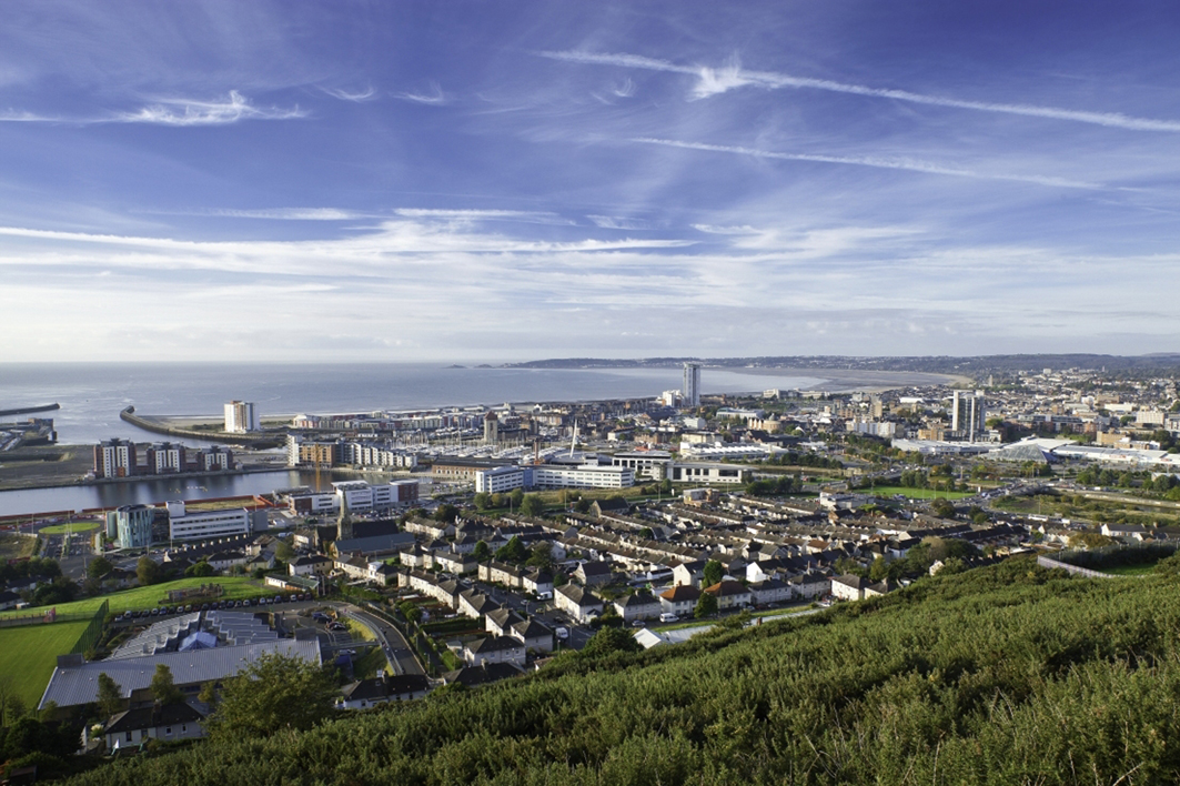


Swansea, United Kingdom
Swansea is a city of 300,352 people in Wales, United Kingdom, founded in 1158.
Why visit Swansea
Townapedia lists 166 museums and landmarks, 150 parks and trails, 517 places to eat, 54 places to stay and 67 attractions in and around town.
Highlights include Brangwyn Hall, Mumbles Lighthouse, Mission Gallery and National Waterfront Museum.
Weather in Swansea
Forecast from MET Norway (CC BY 4.0). Full forecast
About Swansea
Swansea ( SWON-zee; Welsh: Abertawe [abɛrˈtawɛ]) is a port and coastal city in Wales. It is the second-largest city in the country. The city forms a principal area, officially known as the City and County of Swansea (Welsh: Dinas a Sir Abertawe).
From the Wikipedia article Swansea (this version), under CC BY-SA 4.0.
Travel tips from other travellers: Swansea on Wikivoyage (CC BY-SA 4.0).
Photos of Swansea


Things to do67


Aberdulais Falls
Waterfall · 8.2 mi
Waterfall in Neath Port Talbot, Wales, UK

Dylan Thomas Theatre
Cinema and theater · 0.4 mi
Theatre in Swansea, Wales




Pontardawe Arts Centre
Cinema and theater · 7.9 mi
Multi-purpose cultural venue in Pontardawe, Neath Port Talbot, Wales
Herbert Street, Pontardawe
Grand Theatre, Swansea
Cinema and theater
Theatre and former cinema in Swansea, Wales
55 more on the map.
Museums and landmarks166

Mission Gallery
Museum · 0.4 mi
Art gallery in Swansea, Wales
Gloucester Place, Swansea
We-Su 11:00-17:00

National Waterfront Museum
Museum
Museum of industrial and maritime history in Swansea, Wales, United Kingdom
Oystermouth Road
Mo-Su 10:00-17:00


Oystermouth Castle
Monument and historic site · 4.0 mi
Sa-Su 11:00-17:00; Apr 1-Sep 30 Mo-Su 11:00-17:00


Neath Castle
Monument and historic site · 6.7 mi
Castle in Neath, Wales, UK


Mansion House
Monument and historic site · 0.7 mi
Official residence of the Mayor of Swansea and venue for functions for charities and businesses
Ffynone Drive, Swansea
Loughor Castle
Monument and historic site · 6.4 mi
Medieval castle in Loughor, Swansea, Wales, UK
154 more on the map.
Parks, trails and playgrounds150

Llanelli Wetland Centre
Hiking and trails · 8.2 mi
Sep-Oct 09:30-17:00; Sep-Oct,Feb Tu,We off; Nov-Jan Th-Mo...


Kilvey Community Woodland
Park · 1.2 mi
Nature reserve in Swansea, Wales

Gnoll Estate Country Park
Park · 7.6 mi
Park in the Vale of Neath, Wales
Gnoll Estate Fairyland, Neath

Bishop's Wood
Park · 5.0 mi
Nature reserve in the Gower Peninsula, Wales, UK
Clyne Valley Country Park
Park · 3.0 mi
Area of parkland in south Wales
Cwm Clydach RSPB Reserve
Park · 7.3 mi
RSPB nature reserve in the United Kingdom
138 more on the map.
Restaurants and cafes517

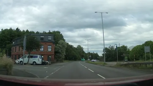
The Mile End Inn
Bar and pub · Local · 1.5 mi
107 Ffordd Fabian
Sa-Su 12:00-23:00; Tu, Fr 13:00-23:00; Mo, We-Th 15:00-23:00

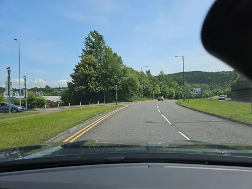
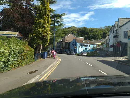



The Dunvant
Bar and pub · Diner, Local · 3.6 mi
234 Dunvant Road
Mo-Th 11:00-23:00; Fr-Sa 11:00-00:00; Su 11:00-23:00
Butchers at Alltwen
Bar and pub · 7.7 mi
Alltwen Hill, Alltwen
Mo off; Tu off; We-Th 12:00-22:30; Fr-Sa 12:00-23:30; Su 12:00-16:30

Plough & Harrow Murton
Bar and pub · 5.0 mi
18 Oldway, Bishopston
Mo-Tu 17:00-23:00; We-Sa 12:00-15:00,17:00-23:00; Su 12:00-22:30;...
The Brit
Bar and pub · 7.7 mi
Rhes Llundain, Cwmafan
Jan-Apr Mo off; Tu off; We-Th 12:00-22:00; Fr-Sa 12:00-23:00; Su...
505 more on the map.
History
The area around Swansea has a unique archaeological history dating back to the Palaeolithic. Finds at Long Hole Cave on the Gower Peninsula have been interpreted as those of the first modern humans in Britain, and the same area is also home to the oldest ceremonial burial in Western Europe, discovered at Paviland in 1823 and dated to 22,000 BC. The area also has many Bronze Age and Iron Age sites, such as the burial mound at Cillibion and the hill forts at Llwynheiernin and Cil Ifor. There are also the remains of a Roman villa also on the Gower peninsula.
The area that would become Swansea was known as the Cantref Eginog in ancient times, located on the eastern edge of the cwmwd (commote) of Gwyr, the easternmost cantref of Ystrad Tywi. This area was noted for its valuable land and was highly contested by the early Welsh kingdoms. During the Viking Age, the mouth of the Tawe became a focus for trade, and a trade post may have been founded sometime between the 9th and 11th centuries.
The settlement remained under Welsh control until the Norman invasion of Wales, when Iestyn ap Gwrgant ceded the settlement as part of the new Lordship of Gower to Henry de Beaumont, 1st Earl of Warwick in the early 1100s. The Lordship included land around Swansea Bay as far as the River Tawe, the manor of Kilvey beyond the Tawe, and the peninsula itself.
Read more of the history
In the following years, Henry built Swansea Castle c. 1106, and minted coins bearing the names Swensi, Sweni and Svenshi c. 1140. Swansea was designated chief town of the lordship and received its first borough charter sometime between 1158 and 1184 from William de Newburgh, 3rd Earl of Warwick. This charter contains the earliest reference in English to Sweynesse and gave it the status of a borough, granting the townsmen (called burgesses) certain rights to develop the area. In 1215 King John granted a second charter, in which the name appears as Sweyneshe. A town seal which is believed to date from this period names the town as Sweyse. Another charter was granted in 1304.
From the early 1700s to the late 1800s, Swansea was the world's leading copper-smelting area. Numerous smelters along the River Tawe received copper and other metal ores shipped from Cornwall and Devon, as well as from North and South America, Africa, and Australia. The industry declined severely in the late 1800s, and none of the smelters are now active.
The port of Swansea initially traded in wine, hides, wool, cloth and later in coal. After the invention of the reverbatory furnace in the late 1600s, copper smelting could use coal rather than the more expensive charcoal. At the same time, the mines of Cornwall were increasing copper production. Swansea became the ideal place to smelt the Cornish copper ores, being close to the coalfields of South Wales and having an excellent port to receive ships carrying Cornish copper ore. Because each ton of copper ore smelted used about three tons of coal, it was more economical to ship the copper ore to Wales rather than sending the coal to Cornwall.
The first copper smelter at Swansea was established in 1717, followed by many more. Once smelting was established, the smelters began receiving high-grade ore and ore concentrates from around the world. More coal mines opened to meet demand from northeast Gower to Clyne and Llangyfelach. In the 1850s Swansea had more than 600 furnaces, and a fleet of 500 oceangoing ships carrying out Welsh coal and bringing back metal ore from around the world. At that time most of the copper matte produced in the United States was sent to Swansea for refining.
Smelters also processed arsenic, zinc, tin, and other metals. Nearby factories produced tinplate and pottery. The Swansea smelters became so adept at recovering gold and silver from complex ores that in the 1800s they received ore concentrates from the United States, for example from Arizona in the 1850s, and Colorado in the 1860s.
The city expanded rapidly in the 18th and 19th centuries, and was termed "Copperopolis". From the late 17th century to 1801, Swansea's population grew by 500%—the first official census (in 1841) indicated that, with 6,099 inhabitants, Swansea had become significantly larger than Glamorgan's county town, Cardiff, and was the second most populous town in Wales behind Merthyr Tydfil (which had a population of 7,705). However, the census understated Swansea's true size, as much of the built-up area lay outside the contemporary boundaries of the borough; the total population was actually 10,117. Swansea's population was later overtaken by Merthyr in 1821 and by Cardiff in 1881, although in the latter year Swansea once again surpassed Merthyr. Much of Swansea's growth was due to migration from within and beyond Wales—in 1881 more than a third of the borough's population had been born outside Swansea and Glamorgan, and just under a quarter outside Wales.
Through its copper industry Swansea established long-range connections with Chile, where businessmen like Charles Saint Lambert imported smelting technology from Swansea and also sent Chilean copper ore concentrate to Swansea for processing. Lambert's success in modernising the Chilean copper industry during the second quarter of the nineteenth century is thought to have sowed the seeds for the later demise of the copper smelting business in Swansea.
Copper smelting at Swansea declined in the late 1800s for a number of reasons: copper mining in Cornwall declined; the price of copper dropped from £112 in 1860 to £35 in the 1890s; in the early 1900s, mining shifted to lower-grade copper deposits in North and South America, and the lower-grade ore could not support transportation to Swansea.
From the History section of Swansea on Wikipedia, under CC BY-SA 4.0.
More about Swansea
Geography
Swansea may be divided into four physical areas. The geology is complex, providing diverse scenery. The Gower Peninsula was the first area in the United Kingdom to be designated as an Area of Outstanding Natural Beauty (AONB). Apart from the southeast corner, the whole of the Gower Peninsula is within the AONB. Swansea has numerous urban and country parklands. The region has featured regularly in the Wales in Bloom awards.
Economy
Swansea originally developed as centre for metals and mining, especially the copper industry, from the beginning of the 18th century. The industry reached its apogee in the 1880s, when 60% of the copper ores imported to Britain were smelted in the Lower Swansea valley. However, by the end of the Second World War these heavy industries were in decline, and over the post-war decades Swansea shared in the general trend towards a post-industrial, service sector economy.
Of the 105,900 people estimated to work within the City and County of Swansea, over 90% are employed in the service sectors, with relatively high shares (compared to the Welsh and UK averages) in public administration, education & health and banking, finance & insurance, and correspondingly high proportions of employment in occupations associated with the service sector, including professional, administrative/secretarial and sales/customer service occupations. The local authority believes this pattern reflects Swansea's role as a service centre for South West Wales.
Economic activity and employment rates in Swansea were slightly above the Welsh average in October 2008, but lower than the UK average. In 2005, GVA per head in Swansea was £14,302 – nearly 4% above the Welsh average but 20% below the UK average. Median full-time earnings in Swansea were £21,577 in 2007, almost identical to the Welsh average.
Arts and culture
The Royal Institution of South Wales was founded in 1835 as the Swansea Literary and Philosophical Society.
The Grand Theatre in the centre of the city is a Victorian theatre which celebrated its centenary in 1997 and which has a capacity of a little over a thousand people. It was opened by the celebrated opera singer Adelina Patti and was refurbished from 1983 to 1987. The annual programme ranges from pantomime and drama to opera and ballet.
Fluellen Theatre Company is a professional theatre company based in Swansea who perform at the Grand Theatre and the Dylan Thomas Centre. The Taliesin building on the university campus has a theatre, opened in 1984.
Education
Swansea University has a campus in Singleton Park overlooking Swansea Bay. Its engineering department is recognised as a centre of excellence with work on computational techniques for solving engineering design problems. The department of physics is known for its research at the frontiers of theoretical physics, particularly in the areas of elementary particle physics and string theory. In 2015, Swansea University opened a new Bay Campus situated in the Jersey Marine area of Swansea. In 2017, Swansea University Medical School was ranked as the third best medical school in the United Kingdom, behind Oxford and Cambridge.
From the Wikipedia article Swansea, under CC BY-SA 4.0.
Notable people from Swansea
 Catherine Zeta-JonesBritish actress (born 1969)Photo: Margaret Gardiner, CC BY 3.0
 Chris ColemanWelsh association football player and managerPhoto: Steindy ( talk ) 16:08, 10 November..., CC BY-SA 3.0
 Joe RodonWelsh association football playerPhoto: Timmy96, CC0
 Michael HeseltineBritish Conservative politician, former Deputy Prime Minister of the United KingdomPhoto: Chatham House, CC BY 2.0
 Jazz RichardsWelsh association footballer (born 1991)Photo: Jon Candy from Cardiff, Wales, CC BY-SA 2.0
 Nicole CookeWelsh cyclistPhoto: Unknown author, CC BY-SA 2.5
 Russell T DaviesWelsh screenwriter and television producerPhoto: Gary Kirk, CC BY-SA 4.0
 Carwyn JonesFirst Minister of Wales from 2009 to 2018Photo: ©House of Lords / photography by Roger Harris, CC BY 3.0
- Dylan ThomasWelsh poet and writer (1914–1953)
- Clive GrangerBritish economist
- Rowan WilliamsArchbishop of Canterbury (2002–2012)
- William Robert GroveBritish judge and chemist (1811–1896)


Born in Swansea, according to Wikidata (CC0). Each name links to its Wikipedia article.
Where to stay54
Churches and places of worship156
Shopping149
Gas and EV charging41
Schools, colleges and libraries133
Healthcare50
Map of Swansea
250 places. The map loads OpenStreetMap tiles when you open it.
Getting there and nearby towns
Swansea Airport (SWS) is the nearest airport with scheduled flights listed in OpenStreetMap, 6 miles away.
- Dunvant 4 mi west, about 6 min by car
- Clydach 5 mi northeast, about 8 min by car
- Briton Ferry 5 mi east, about 9 min by car
- Gorseinon 5 mi northwest, about 9 min by car
- Bishopston 5 mi southwest, about 9 min by car
- Three Crosses 5 mi west, about 8 min by car
- Pontlliw 6 mi northwest, about 9 min by car
- Grovesend 6 mi northwest, about 10 min by car
- Neath 7 mi northeast, about 11 min by car
- Pen-clawdd 7 mi west, about 11 min by car
Drive times are estimates from straight-line distance, not routes.
Keep exploring
Local news
Headlines from INDB.
Reviews, tips and questions
Loading what members have shared...
Sources and licences
- GeoNames (CC BY 4.0): population, coordinates, regions and time zone
- Mapillary (see each image): photos
- OpenStreetMap contributors (ODbL 1.0): places, airports, map data
- Wikidata (CC0 1.0): elevation, founding date, time zone, website, landmarks and historic places
- Wikimedia Commons (see each image): photos
- Wikipedia (CC BY-SA 4.0): overview and history text
Photo credits
- P.3. Swansea City Centre 2012, Numero007, CC BY-SA 4.0
- Swansea's Crow Boy - panoramio (1), Ask a Physicist, CC BY 3.0
- Little Bird, Princess Way, Swansea, Stu's Images, CC BY-SA 3.0
- Swansea's Crow Boy - panoramio, Ask a Physicist, CC BY 3.0
- Swansea Castle Square, Gordon Cragg, CC BY-SA 2.0
- Swansea, United Kingdom (Unsplash LLeKNRAPPls), Claus Pescha clauspescha, CC0
- MumblesLighthouse2, Lilo Lil, CC BY 2.0
- Aberdulais Falls (4987), Nilfanion, CC BY-SA 4.0
- Langland Bay, Tiia Monto, CC BY-SA 3.0
- Loughor Bridge, Wiccasha, Public domain
- Mission Gallery, Matthew Otten, CC BY-SA 4.0
- National Waterfront Museum (19125415205), Reading Tom from Reading, UK, CC BY 2.0
- Glynn Vivian Art Gallery, Swansea, close-up, Sionk, CC BY-SA 3.0
- NeathCastleRemains, Darren Wyn Rees at Aberdare Blog, CC BY 3.0
- Aberavon Beach view to Swansea Bay, Darren Wyn Rees, CC BY-SA 4.0
- Afan Forest Park 1, Purple128, CC BY-SA 3.0
- Ebenezer chapel, Aberavon, Jaggery, CC BY-SA 2.0
- Canolfan Dylan Thomas, Abertawe, Ham, CC BY-SA 3.0
- Brangwyn hall, No machine-readable author provided. Sloman assumed (based on copyright claims)., Public domain
- Gwesty Morgans, Abertawe, Ham, CC BY-SA 3.0
- Quadrant Union Street, Llanishen ( talk )., Public domain
- Eglwys St Mary's Church, Swansea Abertawe Wales 01, Llywelyn2000, CC BY-SA 4.0
- LlanelliLB02, Lesbardd, CC BY-SA 4.0
- Ebenezer Baptist Church, Swansea, Ham, CC BY-SA 3.0
- St James Priory, User:Sloman, Public domain
- Capel Moriah, GeraintTudur2, CC BY-SA 3.0
- Croeso Lounge, Mumbles, Peter Glyn, CC BY-SA 3.0
- The Bridge Llangennech, CapG, CC BY-SA 2.0
- The Grand Hotel, Port Talbot, Sionk, CC BY-SA 4.0
- St Marys Church Swansea, Sloman ( talk ), Public domain
- Kilvey Community Woodland entrance, Nigel Davies, CC BY-SA 2.0
- Cwm Deri liqueurs, Vouliagmeni, CC BY-SA 4.0
- Youmna Mouhamad Soapbox science, Nejaby, CC BY-SA 4.0
- Pony herd in the autumn (Unsplash), Susan Yin syinq, CC0
- Somewhere in Wales, Matty Ring, CC BY 2.0
- Mural, Dylan Thomas Theatre, Swansea, Wales, Stu's Images, CC BY-SA 3.0
- Swansea Museum 6, Tiia Monto, CC BY-SA 3.0
- Egypt Centre Swansea 2, Tiia Monto, CC BY-SA 3.0
- Oystermouth Castle, December 2018 (3), No Swan So Fine, CC BY-SA 4.0
- Plantasia 3, kulmalukko, CC BY-SA 3.0
- Street-level photo, southglos, CC BY-SA 4.0
- Street-level photo, toho, CC BY-SA 4.0
- Street-level photo, toho, CC BY-SA 4.0
- Street-level photo, laye, CC BY-SA 4.0
- Street-level photo, southglos, CC BY-SA 4.0
- Street-level photo, matth81, CC BY-SA 4.0
- Street-level photo, matth81, CC BY-SA 4.0
- Street-level photo, matthewitt, CC BY-SA 4.0
- Street-level photo, laye, CC BY-SA 4.0
- Street-level photo, matth81, CC BY-SA 4.0


Page built November 10, 2026. Spotted a mistake? Tell us or suggest a place.