


Why visit Wigan
Townapedia lists 67 museums and landmarks, 44 parks and trails, 248 places to eat, 4 places to stay and 7 attractions in and around town.
Highlights include Omniplex Cinema, Adam Viaduct, Museum of Wigan Life and Walmesley Monument.
Weather in Wigan
Forecast from MET Norway (CC BY 4.0). Full forecast
About Wigan
Wigan is a town in Greater Manchester, England. The town lies midway between the cities of Manchester, 16 miles (25.7 km) to the south-east, and Liverpool, 17 miles (27 km) to the south-west. It is the largest settlement in the Metropolitan Borough of Wigan and is its administrative centre. The town has a population of 107,732 and the wider borough of 330,714.
From the Wikipedia article Wigan (this version), under CC BY-SA 4.0.
Travel tips from other travellers: Wigan on Wikivoyage (CC BY-SA 4.0).
Photos of Wigan


Things to do7


Adam Viaduct
Bridge · 0.5 mi
Railway bridge in Wigan, Greater Manchester, England, UK

Museums and landmarks67

Museum of Wigan Life
Museum
Centre in Wigan, Greater Manchester, England, United Kingdom
Library Street, Wigan
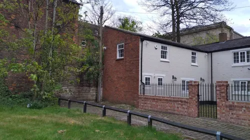



Gidlow Hall moated site
Monument and historic site · 3.0 mi
Archaeological site in Wigan, Greater Manchester, England, UK
55 more on the map.
Parks, trails and playgrounds44

Mesnes Park
Park · 0.6 mi
Park in Wigan, Greater Manchester, England, United Kingdom

The Brick Community Stadium
Sports field and stadium · 0.8 mi
Loire Drive, Wigan


Three Sisters Recreation Area
Park · 2.4 mi
Nature reserve and park in Wigan, Greater Manchester, England, UK


32 more on the map.
Restaurants and cafes248

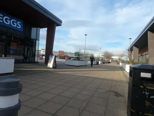


Costa
Cafe · Coffee Shop · 0.7 mi
12 Loire Drive, Wigan
Mo-Fr 06:00-20:00; Sa 07:30-18:30; Su 07:30-18:00

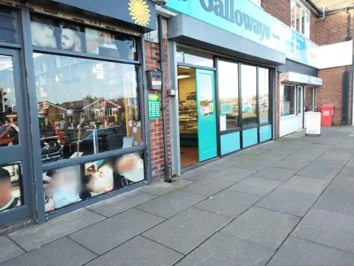
Galloways
Bakery · 2.3 mi
Unit 1 Walthew Lane, Wigan
Mo-Sa 07:30-17:30; Su 10:00-16:00; BH 10:00-16:00


Bath Springs
Bar and pub · 2.8 mi
The pub formerly belonged to the Bath Springs brewery of Ellis, Warde & Co. of Ormskirk.
455 Wigan Road, Wigan
12:00-00:00

India Lounge
Restaurant · Indian · 0.7 mi
Vauxhall Road, Wigan
Mo-Th 17:30-22:30; Fr-Sa 17:30-23:30; Su 16:30-22:30
236 more on the map.
History
The name of the town has been recorded variously as Wigan in 1199, Wygayn in 1240 and Wygan in numerous historical documents.
The name Wigan is probably a Celtic place-name; it might be a diminutive form of Brittonic wīg 'homestead, settlement" (later Welsh gwig), plus the nominal suffix -an (compare with numerous places in France named Le Vigan); the place name may refer to a Latin vicus. It has also been suggested directly a Celtic personal name Wigan, a name corresponding to Gaulish Vicanus, Old Welsh Uuicant or Old Breton Uuicon.
Similar place-names to the English Wigan exist in France, such as Le Vigan, Gard (Avicantus, Roman inscription; Locus de Vicano 1050) of unknown origin and Le Vigan, Lot, from Latin vicanum, derived form of vicus 'town' + suffix -anum, and the hamlets in Normandy such as (Le) Vigan (L'Oudon, Calvados) and Manoir du Vigan that derive from a Celtic given-name *Wigan, found as feodum Wigani in the 12th century or turres Wiguen at Thaon (Calvados) and survives in the Norman surname Vigan (still in use in Calvados).
Read more of the history
There is very little evidence of prehistoric activity in the area, especially pre-Iron Age. In the 1st century, the area was conquered by the Romans during which time, it was in the territory of a Celtic people known as the Brigantes. The late second-century Antonine Itinerary mentions a Roman settlement called Coccium 17 miles (27 km) from the Roman fort at Manchester (Mamucium) and 20 miles (32 km) from the fort at Ribchester (Bremetennacum). Although the distances are slightly out, it has been assumed that Coccium is Roman Wigan. Possible derivations of Coccium include from the Latin coccum, meaning "scarlet in colour, scarlet cloth", or from cocus, meaning "cook". Over the years chance finds (coins and pottery) provided clear indications that a Roman settlement existed at Wigan, although its size and status remained unknown.
In 2005, investigations ahead of the Grand Arcade development, and at the Joint Service Centre development in 2008, have proven that Wigan was a significant Roman site in the late first and second centuries AD. The excavated remains of ditches at Ship Yard off Millgate were consistent with use by the Roman military and possibly formed part of the defences for a fort or a temporary camp. More remains were excavated to the south, in the area of McEwen's Yard (opposite the baths), where foundations of a large and important building were discovered, together with many other Roman features. The building is 36 by 18 metres (118 by 59 ft) in size with stone walls and a tiled roof. It contained around nine or ten rooms including three with hypocausts. It had a colonnaded portico on the northern side, which presumably formed the main entrance. The structure's ground-plan and the presence of the hypocausts show it may have been a bath-house. A timber building excavated at the Joint Service Centre (top of the Wiend) has been interpreted as a barrack block. This suggests a Roman fort occupied the crest of the hill, taking advantage of the strategic position overlooking the River Douglas. The evidence gained from these excavations shows that Wigan was an important Roman settlement, and was almost certainly the place referred to as Coccium in the Antonine Itinerary.
In the Anglo-Saxon period, the area was probably under the control of the Northumbrians and later the Mercians. Celtic names in the area around Wigan—such as Ashton in Makerfield and Ince—indicate a continued Celtic presence in the area in the face of Anglo-Saxon incursions. In the early 10th century, there was an influx of Scandinavians expelled from Ireland. This can be seen in place names such as Scholes, part of Wigan which derives from the Scandinavian skali meaning "hut". Further evidence comes from some street names in Wigan which have Scandinavian origins.
Wigan is not mentioned in the Domesday Book, possibly because it was included in the Neweton barony (now Newton-le-Willows). It is thought that the mention of the unnamed church in the manor of Neweton is Wigan Parish Church (not the church of St. Oswald (Winwick) which is specifically named in the Domesday Book). The rectors of the parish church were lords of the manor of Wigan, a sub-manor of Neweton, until the 19th century. Wigan was incorporated as a borough in 1246 following the issue of a charter by King Henry III to John Maunsell, the local church rector and lord of the manor. The borough was later granted another charter in 1257–1258, allowing the lord of the manor to hold a market every Monday and two annual fairs. The town is recorded on the earliest-surviving map of Britain, the Gough Map made around 1360, which highlights its position on the main western north–south highway with distance markers to Preston and Warrington.
Edward II visited Wigan in 1323 in an effort to stabilise the region which had been the source of the Banastre Rebellion in 1315. Edward stayed in nearby Up Holland Priory and held court in the town over a period of several days. During the medieval period Wigan expanded and prospered and in 1536, antiquarian John Leland described the town, saying "Wigan paved; as big as Warrington and better builded. There is one parish church amid the town. Some merchants, some artificers, some farmers."
From the History section of Wigan on Wikipedia, under CC BY-SA 4.0.
More about Wigan
Geography
Wigan lies to the west and north of Hindley and Ashton-in-Makerfield, and is about 16 miles (26 km) north-west of Manchester city centre, 8 miles (13 km) west of Bolton and 10 miles (16 km) north of Warrington.
The historic town of Wigan forms a tightly integrated conurbation along with the Metropolitan Borough of Wigan districts of Orrell and Ince-in-Makerfield; this is connected by ribbon development to Standish and Abram. These areas, together with the West Lancashire town of Skelmersdale, are defined by the Office for National Statistics as the Wigan Urban Area, with a total population of 166,840. The town is part of the Manchester Larger Urban Zone.
Economy
The Grand Arcade shopping centre was opened on 22 March 2007. Construction, which cost £120 million, started in 2005 on the site of Wigan Casino and The Ritz. The area around the pier is planned to be redeveloped, in a multi-million pound project rebranding the area as the Wigan Pier Quarter. Plans for the redevelopment of the area have been in place since 2006. Trencherfield Mill, at the centre of the pier development, has been refurbished and used for apartments and office space.
The Wigan Life Centre south building opened on 19 September 2011, housing office accommodation for Wigan Council, Wigan Leisure and Culture Trust and NHS Ashton, Leigh and Wigan, Wigan Library and a swimming pool and fitness suite, with a walk of fame, "Believe Square", for local public figures and groups. Plans for the 18-storey Tower Grand, which would have been the tallest building in Wigan, were scrapped after the 2008 financial crisis. The Galleries Shopping Centre, which houses shops as well as an indoor market, was bought for £8 million by the council in 2018, as part of a regeneration plan due to long-term decline.
Arts and culture
Wigan has been well known for its popular music since the days of George Formby Sr and George Formby Jr. It was the birthplace of the Eight Lancashire Lads, a dancing troupe who gave the young Charlie Chaplin his professional debut. One member of the troupe was John Willie Jackson, the "John Willie" to whom George Formby would often refer in his songs. Local bands that gained wider repute include the Verve, the Railway Children, Witness, the Tansads, Limahl of Kajagoogoo and Starsailor. The Verve were one of the most important British rock groups of the 1990s, finding success in the UK and abroad. The band was formed when the members met at Winstanley College in 1989. In 2021, the Lathums continued the town's popular music tradition by scoring a UK number one with their debut studio album How Beautiful Life Can Be and Torpedo Pig that split in 2019.
From 1973 to 1981, Wigan Casino was the location for Wigan's weekly Northern Soul all-nighters. The venue began as a dance hall called Empress Ballroom. Wigan Casino rose to prominence in the 1970s and, in 1978, it was named the "best disco in the world" by Billboard, an American music magazine. The building was gutted by fire in 1982 and was demolished the following year. This was the inspiration for the 1989 dance record Wigan by Baby Ford.
Education
Wigan and Leigh College, a further education college with over 8,000 total students, has three campuses in Wigan: Parsons Walk Centre, Wigan School for the Arts and the Engineering & Construction Centre of Excellence (Pagefield Centre). There is also Wigan UTC, a university technical college, in the town centre. In the wider borough, there are two sixth form colleges, St John Rigby College and Winstanley College. High schools in the town are the Deanery High School, St. John Fisher Catholic High School, St. Peter's Catholic High School, Hawkley Hall High School and Rose Bridge Academy in Ince, with more throughout the borough. Wigan Grammar School was established in 1597 and closed in 1972.
From the Wikipedia article Wigan, under CC BY-SA 4.0.
Notable people from Wigan
 Richard AshcroftEnglish singer-songwriterPhoto: Edwardrhodes06, CC BY-SA 4.0
 Owen FarrellEnglish international rugby union player (born 1991)Photo: Clément Bucco-Lechat, CC BY-SA 3.0
 Jason LoweEnglish association football player (born 1991)Photo: EchetusXe, CC BY-SA 4.0
 Andy GriffinEnglish association football player (born 1979)Photo: TuborgLight, CC BY-SA 3.0
 Matthew HolmesBritish cyclistPhoto: Geof Sheppard, CC BY-SA 4.0
 George NevinsonBritish water polo player (1882–1963)Photo: unknown; uploaded by Galaxyneo, Public domain
- LimahlBritish pop singer
- Gerrard WinstanleyEnglish reformer and activist (1609-1676)
- Benjamin JonesEnglish racing cyclist (1882-1963)
- George FormbyEnglish actor, singer-songwriter and comedian (1904–1961)
- Roy KinnearBritish actor (1934–1988)
- Jenny MeadowsBritish athletics competitor


Born in Wigan, according to Wikidata (CC0). Each name links to its Wikipedia article.
Where to stay4
Churches and places of worship84
Saint John the Divine
Church · Anglican · 1.9 mi
Church Street, Wigan
Catholic Church of St Oswald and St Edmund Arrowsmith
Church · 4.0 mi
Haigh & Aspull Parish Church of St. David
Church · Anglican · 2.8 mi
Copperas Lane, Wigan
Shopping47
Gas and EV charging10
Schools, colleges and libraries62
Bryn Saint Peter's Church of England Primary School
School · Anglican · 2.9 mi
Downall Green Road, Wigan
Healthcare24
Map of Wigan
250 places. The map loads OpenStreetMap tiles when you open it.
Getting there and nearby towns
Liverpool John Lennon Airport (LPL) is the nearest airport with scheduled flights listed in OpenStreetMap, 17 miles away.
- Ince-in-Makerfield 1 mi southeast, about 2 min by car
- Hindley 2 mi east, about 4 min by car
- Abram 3 mi southeast, about 5 min by car
- Shevington 3 mi northwest, about 5 min by car
- Bickershaw 3 mi southeast, about 6 min by car
- Ashton in Makerfield 4 mi south, about 7 min by car
- Garswood 4 mi south, about 6 min by car
- Blackrod 4 mi northeast, about 7 min by car
- Appley Bridge 4 mi northwest, about 7 min by car
- Westhoughton 5 mi east, about 7 min by car
Drive times are estimates from straight-line distance, not routes.
Keep exploring
Local news
Headlines from INDB.
Reviews, tips and questions
Loading what members have shared...
Sources and licences
- GeoNames (CC BY 4.0): population, coordinates, regions and time zone
- Mapillary (see each image): photos
- OpenStreetMap contributors (ODbL 1.0): places, airports, map data
- Wikidata (CC0 1.0): elevation, founding date, time zone, website, landmarks and historic places
- Wikimedia Commons (see each image): photos
- Wikipedia (CC BY-SA 4.0): overview and history text
Photo credits
- Wigan Pier and the Leeds & Liverpool Canal, Dave Green, CC BY-SA 2.0
- Terminus Warehouse, Wigan, David Dixon, CC BY-SA 2.0
- No 1 Wigan Pier (18995803605), Reading Tom from Reading, UK, CC BY 2.0
- No 1 Wigan Pier (18995802485), Reading Tom from Reading, UK, CC BY 2.0
- Wigan terminus warehouse, User:Chris55, CC BY 3.0
- St Joseph's Church, Wigan, Gerald England, CC BY-SA 2.0
- Taylor Gallery at the Museum of Wigan Life, Hindleyite, CC BY 3.0
- Mesnes Park, Wigan, Plucas58, CC BY-SA 4.0
- St Oswald's church, Ashton-in-Makerfield 1, Rodhullandemu, CC BY-SA 4.0
- Wigan Parish Church and war memorial, Rept0n1x, CC BY-SA 3.0
- Wigan athletics dw stadium, Arne Müseler, CC BY-SA 3.0 de
- St James' Church, Wigan, S Parish, CC BY-SA 2.0
- St John the Divine, Pemberton, Wigan, Plucas58, CC BY-SA 4.0
- Steam engine, Trencherfield Mill, Chris Allen, CC BY-SA 2.0
- Wigan Hall 2, Francis Franklin, CC BY-SA 4.0
- St Jude, Wigan, David Dixon, CC BY-SA 2.0
- Parkland in Ashfield Park, Standish, Voello, CC BY 4.0
- All Saints Church Wigan, Francis C. Franklin, CC BY-SA 4.0
- St. Joseph's - panoramio, Andrei Dan Suciu, CC BY 3.0
- Coops Factory, Wigan, John Topping, CC BY-SA 2.0
- Worthington Manor House, Plucas58, CC BY-SA 3.0
- Street-level photo, tonys999, CC BY-SA 4.0
- Street-level photo, tonys999, CC BY-SA 4.0
- Street-level photo, tonys999, CC BY-SA 4.0
- Street-level photo, tonys999, CC BY-SA 4.0
- Street-level photo, tonys999, CC BY-SA 4.0
- Street-level photo, tonys999, CC BY-SA 4.0
- Street-level photo, tonys999, CC BY-SA 4.0
- Street-level photo, tonys999, CC BY-SA 4.0
- Street-level photo, tonys999, CC BY-SA 4.0
- Street-level photo, tonys999, CC BY-SA 4.0
- Street-level photo, tonys999, CC BY-SA 4.0
- Street-level photo, tonys999, CC BY-SA 4.0
- Street-level photo, tonys999, CC BY-SA 4.0
- Street-level photo, tonys999, CC BY-SA 4.0
- Street-level photo, tonys999, CC BY-SA 4.0
- Street-level photo, tonys999, CC BY-SA 4.0
- Street-level photo, mappo2, CC BY-SA 4.0


Page built November 10, 2026. Spotted a mistake? Tell us or suggest a place.