
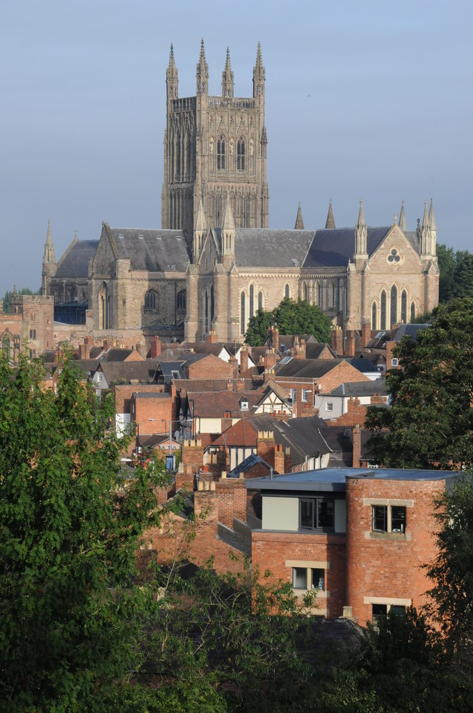


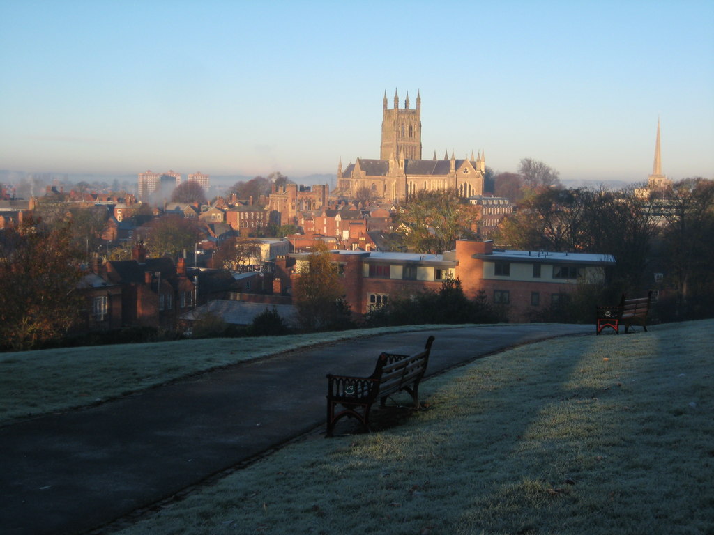
Worcester, United Kingdom
Worcester is a city of 101,659 people in England, United Kingdom.
Why visit Worcester
Townapedia lists 37 museums and landmarks, 44 parks and trails, 274 places to eat, 16 places to stay and 6 attractions in and around town.
Highlights include Odeon, Greyfriars, The George Marshall Medical Museum and Fort Royal Park.
Weather in Worcester
Forecast from MET Norway (CC BY 4.0). Full forecast
About Worcester
Worcester is a cathedral city in Worcestershire, England, of which it is the county town. It is 30 mi (48 km) south-west of Birmingham, 27 mi (43 km) north of Gloucester, 23 mi (37 km) north-east of Hereford, and 50.8 mi (81 km) north-west of Oxford. The city is situated on the River Severn, 1.5 mi (2.4 km) north of the confluence with the River Teme. The population was 103,872 in the 2021 census.
From the Wikipedia article Worcester, England (this version), under CC BY-SA 4.0.
Travel tips from other travellers: Worcester on Wikivoyage (CC BY-SA 4.0).
Photos of Worcester


Things to do6


Museums and landmarks37


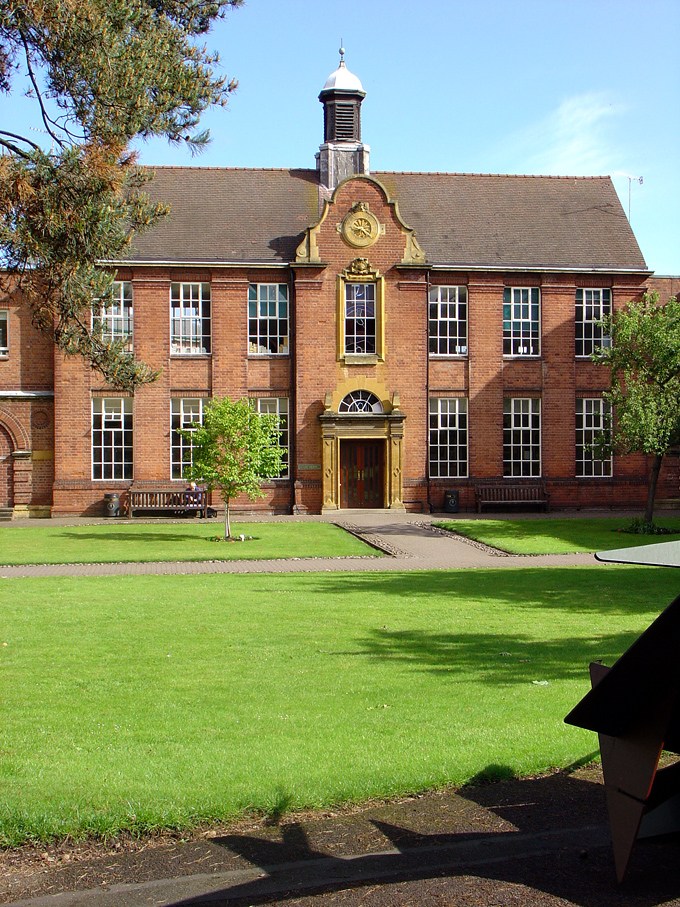
City Art Gallery & Museum
Museum · 0.5 mi
Tu-Sa 10:00-16:00; Su 10:00-15:00

The Commandery
Museum
Grade I listed building and museum in Worcester, United Kingdom
Sidbury, Worcester

Museum of Royal Worcester
Museum
Ceramics museum in Worcester, England
Mo-Sa 10:00-17:00; Su 10:00-16:00

Whittington Tump
Monument and historic site · 2.1 mi
Mound in central Worcestershire, England

Worcester Boer War Memorial
Monument and historic site
War memorial in Worcester, England


Spetchley Park Gardens
Monument and historic site · 2.9 mi
Elgar Birthplace Museum
Museum · 2.6 mi
Birthplace of Edward Elgar and museum in Lower Broadheath, Worcestershire, England
Elgar's Birthplace Museum
Museum · 2.7 mi
Mo-Su 10:00-17:00; Tu off; We off; Th off
25 more on the map.
Parks, trails and playgrounds44




Laugherne Brook Local Nature Reserve (Area 4, Coles Meadow)
Hiking and trails · 1.3 mi
Public space with brook
Sapphire Crescent, Worcester
24/7
Worcester Woods Country Park
Park · 1.7 mi
Park in Worcester, United Kingdom
Laugherne Brook Local Nature Reserve (Area 5, Oldbury Road North)
Hiking and trails · 1.4 mi
Oldbury Road, Worcester
24/7
Laugherne Brook Local Nature Reserve (Area 2, Greenacres Road)
Hiking and trails · 1.3 mi
Greenacres Road, Worcester
24/7
Laugherne Brook Local Nature Reserve (Area 3, Greenacres Road North)
Hiking and trails · 1.2 mi
Greenacres Road, Worcester
24/7

Splash Pad
Sports field and stadium · 1.3 mi
Sep Mo-Su 11:00-16:00; Jul-Aug Mo-Su 11:00-18:00; Apr-Jun Mo-Su 11:00-16:00

32 more on the map.
Restaurants and cafes274

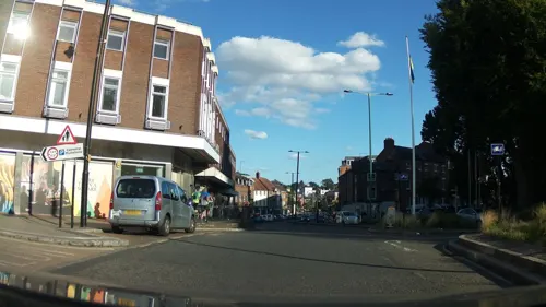
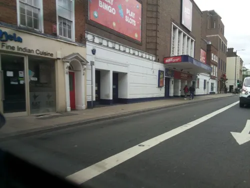
Cosy Club
Restaurant · British
6 Cathedral Square, Worcester
Su-We 09:00-23:00, Th 09:00-24:00, Fr,Sa 09:00-01:00
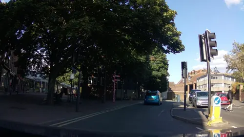
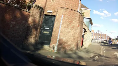
ASK Italian
Restaurant · Italian
2 High Street, Cathedral Square, Worcester
Mo-Fr 11:30-22:00; Sa 11:30-23:00; Su 11:30-21:00



Starbucks
Cafe · Coffee Shop
3 High Street, Worcester
PH 07:30-18:00; Mo-Fr 06:45-19:30; Sa 07:00-19:30; Su 07:30-19:00

Pasta Di Piazza
Restaurant · Pizza, Italian, Mediterranean, Grill
68 Broad Street, Worcester
Mo-Su 12:00-22:00
The Gurkha Chulo
Restaurant · Indian · 1.4 mi
51 Canada Way, Worcester
Mo-Th 16:30-10:30; Fr-Sa 16:30-23:00; Su 16:30-21:30

262 more on the map.
History
A trade route past Worcester dating from Neolithic times became the Roman Icknield Street included a ford crossing the River Severn, which was tidal below Worcester, and around 400 BC linked Celtic built British hillforts. Evidence exists that Iron Age defensive ditches may have been constructed in the first century AD, while there are no signs of Roman military use or of municipal buildings to indicate an administrative role. By the 3rd century AD, Roman Worcester was larger than the later medieval city but shrank to a defended position on the river's southern end.
By the 7th century, following centuries of warfare with the Vikings, Worcester had become a centre for the Anglo-Saxon army. In 680, Worcester was chosen by the Hwicce as their fort over the larger Gloucester fort.
Following their conquest of England, in 1069 the Normans completed a Motte and Bailey castle just south of the cathedral on what had been a cemetery for the cathedral monks. Nothing now remains of the former Worcester Castle.
Read more of the history
During the early medieval period, Worcester's position as the only river crossing between the bridges at Gloucester and Bridgnorth led to its growth as a market town on the main road from London to mid-Wales running through to Kidderminster, Bridgnorth, and Shrewsbury. Worcester continued to be a centre of religious life. Several monasteries were established which provided a hospital and education, including Worcester School. Parts of the city were destroyed by fire during a civil war between King Stephen and Empress Matilda, daughter of Henry I in 1139, 1150 and 1151. A later fire in 1189 destroyed much of the city for the fourth time that century. In 1189 the city received a royal charter and in 1227 a further charter allowed the creation of a Gild Merchant.
The late 12th century saw persecution and expulsion of the small Jewish community of Worcester. The bishop of Worcester wrote an anti-Judaic treatise around 1190, and in 1219 strict rules were imposed on Jews within the diocese. In 1263 the Jews were attacked by baronial forces and most were killed. In 1275 the remaining Jews were expelled to Hereford.
By late medieval times the population had reached 1,025 families, excluding the cathedral quarter, so that it probably stood under 10,000, and the suburbs extended beyond the city walls. Manufacture of cloth and allied trades developed into an important local industry. Worcester elected its Member of Parliament and the city council was organised into two chambers whose committees agreed the city's finances, rules and ordinances.
The Dissolution of the monasteries by Henry VIII between 1536 and 1541, forced the city to found schools to replace monastic education. The city was designated a county corporate in 1621, giving it autonomy from local government and permitting governance by a mayor and co-opted councillors.
The English Civil Wars broke out in 1642, lasting until 1651, and were marked with several major events in and around Worcester including the Battle of Powick Bridge of September 1642. The Battle of Worcester, the final conflict of the wars, was fought from the Royalist Headquarters at the Commandery but ended with a victory for the Oliver Cromwell forces of 30,000 men.
After the restoration of the monarchy in 1660, and during the 18th century Worcester experienced significant economic growth, and in 1748 Daniel Defoe could note that 'the inhabitants are generally esteemed rich, being full of business, occasioned chiefly by the clothing-trade'. The Royal Worcester Porcelain Company was established in 1751. However, significant poverty existed, and in 1794 a large workhouse was built at Tallow Hill.
Worcester's Georgian architecture, has been described as 'one of the most impressive Georgian streetscapes in the Midlands'. Many public buildings were built or rebuilt in this period, including the Grade I listed Worcester Guildhall, the city bridge, and the Royal Infirmary (since 2010 the city campus of the University of Worcester).
The annual Three Choirs Festival and horse races on Pitchcroft attracts many visitors.
By the late 18th century Worcester's cloth industry had developed into a major centre for glove-making industry, employing around 30,000 people in the area at its peak employed by over 150 firms making half the gloves in Britain and with large worldwide exports. The industry had declined by the mid 20th century due to low import duty on foreign competitors and cheaper products. Surviving manufacturers concentrated on high-end fashionable goods with one company still making gloves for the Royal Family as of 2011.
Riots took place in 1831 reflecting discontent with the city administration and the lack of democratic representation. Citizens petitioned the House of Lords for permission to build a County Hall. Local government reform took place in 1835 creating elections for councillors. The Shire Hall, which was designed by Charles Day and Henry Rowe in the Greek Revival style, was completed in 1835.
In 1815 the Worcester and Birmingham Canal opened. Railways reached Worcester in 1850 with Shrub Hill station and in 1860 when Foregate Street station was opened. The railways created many jobs building passenger coaches and signalling in the Worcester Engine Works alongside Shrub Hill Station. Their 1864 polychrome brick building was probably designed by Thomas Dickson.
The British Medical Association (BMA) was founded in 1832 in the board room of the old Worcester Royal Infirmary building in Castle Street.
From the History section of Worcester, England on Wikipedia, under CC BY-SA 4.0.
More about Worcester
Geography
The district is bounded by the districts of Malvern Hills to the west, and Wychavon to the east. The population of the local government district in 2021 was 103,837. The built up area extends slightly beyond the city boundaries in places and had a population in 2021 of 105,465.
Notable suburbs include Barbourne, Blackpole, Cherry Orchard, Claines, Diglis, Dines Green, Henwick, Northwick, Red Hill, Ronkswood, St Peter the Great (also known as St Peter's), Tolladine, Warndon and Warndon Villages. Most of Worcester is on the eastern side of the River Severn. However, Henwick, Lower Wick, St John's and Dines Green are on the western side.
Worcester enjoys a temperate climate with generally warm summers and mild winters. However, it can experience more extreme weather and flooding is often a problem. In 1670, the River Severn burst its banks in the worst flood ever seen by the city. The closest flood height to the Flood of 1670 was when torrential rains caused the Severn to flood in July 2007, which is recorded in the Diglis Basin. This recurred in 2014.
Economy
One of Worcester's famous products, Lea & Perrins Worcestershire sauce, is made and bottled at a Midland Road factory, its home since 16 October 1897. Lea and Perrins originally partnered a chemist's shop on the site of the Debenhams's store in Crowngate Shopping Centre. Worcester has what is claimed to be the oldest newspaper in the world still in publication: Berrow's Worcester Journal. It traces its descent from a news-sheet started in 1690.
The foundry heritage of the city is represented by Morganite Crucible at Norton which produces graphitic shaped products and cements for use in the modern industry. The city is home to the European manufacturing plant of Yamazaki Mazak Corporation, a global Japanese machine tool builder established here in 1980. Worcester Heating Systems was started in the city in 1962 by Cecil Duckworth. The company was bought by Bosch and renamed Worcester Bosch in 1996.
Arts and culture
Every three years Worcester becomes home to the Three Choirs Festival, which dates from the 18th century and is credited with being the oldest music festival in the British Isles. The location rotates between the cathedral cities of Gloucester, Hereford and Worcester. Famous for championing English music, especially that of Elgar, Vaughan Williams and Gustav Holst, Worcester hosted the festival in July 2017, but had to postpone its 2020 festival until 2021. The Worcester Festival (established in 2003 by Chris Jaeger MBE) occurs in August and consists of music, theatre, cinema and workshop events, along with a beer festival. For one weekend a year the city plays host to the Worcester Music Festival – a weekend of original music performed predominantly by local bands and musicians. All performances are free and take place around the city centre in bars, clubs, community buildings, churches and the central library.
Founded in 2012, the Worcester Film Festival, places Worcestershire on the film-making map and encourages local people to get involved in making film. The first festival took place at the Hive and included screenings, workshops and talks.
Education
The high schools located in the city are Bishop Perowne CofE College, Blessed Edward Oldcorne Catholic College, Christopher Whitehead Language College, Tudor Grange Academy, Nunnery Wood High School, and the New College Worcester which caters for blind and partially sighted pupils aged 11–18. Independent schools in the city include some of the oldest schools in the country. The Royal Grammar School, first mentioned in 1291, merged with the Alice Ottley School in 2007. The King's School located in the grounds of Worcester Cathedral was re-founded in 1541 under King Henry VIII. Other independent schools include the Independent Christian School, the River School in Fernhill Heath, and New College Worcester.
The University of Worcester was awarded university status in 2005 by the Privy Council, previously known since 1997 as University College Worcester (UCW) and before that as Worcester College of Higher Education. The city is also home to two colleges, Worcester Sixth Form College and Heart of Worcestershire College.
From the Wikipedia article Worcester, England, under CC BY-SA 4.0.
Notable people from Worcester
 Edward KelleyEnglish alchemistPhoto: Thomas Pennant, Public domain
 Matt RichardsBritish swimmerPhoto: National Lottery Good Causes, CC BY 3.0
 Dave MasonBritish musician (1946–2026)Photo: Jim Summaria, CC BY-SA 3.0
 Nell HudsonBritish actressPhoto: JackieM8, CC BY-SA 4.0
 Suze RandallEnglish photographer and modelPhoto: Toglenn, CC BY-SA 3.0
 R. G. D. AllenBritish economist (1906–1983)Photo: Library of the London School of..., No restrictions
 Ian WalkerBritish sailorPhoto: lotsemann, CC BY-SA 2.0
 James CaladoBritish racing driverPhoto: KVYTICAL, CC BY-SA 4.0
- John AdamsAmerican composer (born 1947)
- Philip Henry GosseEnglish naturalist (1810-1888)
- Charles OlsonAmerican writer (1910–1970)
- Ellen WoodEnglish writer, editor (1814-1887)


Born in Worcester, according to Wikidata (CC0). Each name links to its Wikipedia article.
Where to stay16
Churches and places of worship64
Cathedral Church of Christ and the Blessed Mary, the Virgin of Worcester
Church · Anglican
College Yard, Worcester
Church of St Michael and All Angels, Martin Hussingtree
Church · 3.6 mi
Shopping45
Gas and EV charging13
Schools, colleges and libraries58
Blessed Edward Oldcorne Catholic College
School · Roman Catholic · 0.7 mi
Timberdine Avenue, Worcester
Healthcare18
Map of Worcester
250 places. The map loads OpenStreetMap tiles when you open it.
Getting there and nearby towns
Gloucestershire Airport (GLO) is the nearest airport with scheduled flights listed in OpenStreetMap, 21 miles away.
- Hallow 3 mi northwest, about 4 min by car
- Fernhill Heath 3 mi north, about 5 min by car
- Lower Broadheath 3 mi northwest, about 5 min by car
- Kempsey 3 mi south, about 6 min by car
- Droitwich 6 mi northeast, about 10 min by car
- Ombersley 6 mi north, about 9 min by car
- Peopleton 6 mi southeast, about 10 min by car
- Great Malvern 7 mi southwest, about 11 min by car
- Pershore 8 mi southeast, about 13 min by car
- Hanley Swan 8 mi south, about 12 min by car
Drive times are estimates from straight-line distance, not routes.
Keep exploring
Local news
Headlines from INDB.
Reviews, tips and questions
Loading what members have shared...
Sources and licences
- GeoNames (CC BY 4.0): population, coordinates, regions and time zone
- Mapillary (see each image): photos
- OpenStreetMap contributors (ODbL 1.0): places, airports, map data
- Wikidata (CC0 1.0): elevation, founding date, time zone, website, landmarks and historic places
- Wikimedia Commons (see each image): photos
- Wikipedia (CC BY-SA 4.0): overview and history text
Photo credits
- Worcester from Fort Royal Hill, Philip Halling, CC BY-SA 2.0
- William Colton, South African War Memorial Worcester, David James, CC BY-SA 4.0
- Sixways SlickSystems East Stand, CaveyCoUk, CC BY 3.0
- Worcester Cathedral from the Town Bridge, SimonWiseman, CC0
- Fort Royal Hill, Philip Halling, CC BY-SA 2.0
- Clock block rgs, Newton2, CC BY 2.5
- Stanbrook Abbey Exterior, Amanda Retreats, CC BY-SA 3.0
- WorcesterArenaInterior, Bblfan, CC0
- St John the Baptist Church at Claines, Angela Jones, CC BY-SA 2.0
- King Charles House - 29 New Street, Worcester, Elliott Brown, CC BY 2.0
- Worcester Cathedral, Worcester, Edward Swift, CC BY-SA 4.0
- Stanbrook Abbey Church, Wass, Yorkshire - Feilden Clegg and Bradley Studios ® Tim Crocker (30695438266), The National Churches Trust, CC BY 2.0
- Worcester City Museum & Art Gallery, England - DSCF0780, Rept0n1x, CC BY-SA 3.0
- The Greyfriars, Friar Street, Worcester (3919913061), Elliott Brown from Birmingham, United Kingdom, CC BY 2.0
- Cart in "The Commandery" - panoramio, ingawh, CC BY-SA 3.0
- Collections of the Museum of Royal Worcester (5), Seth Whales, CC BY-SA 4.0
- Sunset Whittington Tump fro The Firs - panoramio, Kevin Woodcock, CC BY 3.0
- Street-level photo, rct36, CC BY-SA 4.0
- Street-level photo, southglos, CC BY-SA 4.0
- Street-level photo, southglos, CC BY-SA 4.0
- Street-level photo, southglos, CC BY-SA 4.0
- Street-level photo, southglos, CC BY-SA 4.0
- Street-level photo, southglos, CC BY-SA 4.0
- Street-level photo, southglos, CC BY-SA 4.0
- Street-level photo, southglos, CC BY-SA 4.0
- Street-level photo, southglos, CC BY-SA 4.0
- Street-level photo, southglos, CC BY-SA 4.0
- Street-level photo, southglos, CC BY-SA 4.0
- Street-level photo, southglos, CC BY-SA 4.0
- Street-level photo, toby, CC BY-SA 4.0
- Street-level photo, southglos, CC BY-SA 4.0


Page built November 10, 2026. Spotted a mistake? Tell us or suggest a place.