


Worthing, United Kingdom
Worthing is a city of 113,866 people in England, United Kingdom.
Why visit Worthing
Townapedia lists 43 museums and landmarks, 68 parks and trails, 205 places to eat, 19 places to stay and 14 attractions in and around town.
Highlights include The Dome, Connaught Theatre, Cissbury Ring and Worthing Museum and Art Gallery.
Weather in Worthing
Forecast from MET Norway (CC BY 4.0). Full forecast
About Worthing
Worthing is a seaside town and borough in West Sussex, England, at the foot of the South Downs, 11 miles (18 km) west of Brighton, and 18 miles (29 km) east of Chichester. With a population of 113,094 and an area of 12.5 square miles (32.4 km2), the borough is the second largest component of the Brighton and Hove built-up area, the 15th most populous urban area in the United Kingdom. Northern parts of the borough, including the Worthing Downland Estate, form part of the South Downs National Park. In 2019, the Art Deco Worthing Pier was dubbed the best in Britain.
From the Wikipedia article Worthing (this version), under CC BY-SA 4.0.
Travel tips from other travellers: Worthing on Wikivoyage (CC BY-SA 4.0).
Photos of Worthing


Things to do14


Connaught Theatre
Cinema and theater · 0.4 mi
Theatre in Worthing, England


Shoreham Tollbridge
Bridge · 4.1 mi
Bridge over the River Adur in West Sussex, England

Worthing Town Hall including Assembly Hall and Worthing Room
Cinema and theater
Town hall and theatre/concert hall complex in Worthing, West Sussex, England, UK

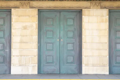


Peter Pans Playground
Monument and historic site · 0.7 mi
Amusement park in England

2 more on the map.
Museums and landmarks43

Cissbury Ring
Monument and historic site · 3.0 mi
Cissbury Ring hillfort, prehistoric flint mine and associated remains
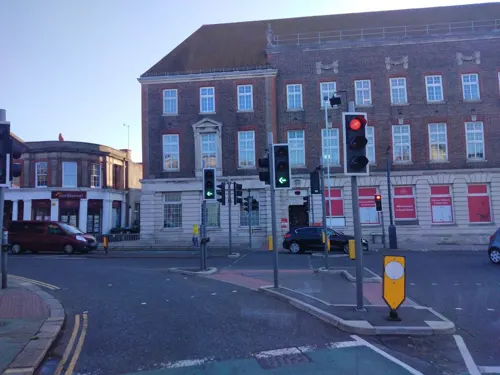
Worthing Museum and Art Gallery
Museum
Museum in Worthing, England, United Kingdom
We,Fr,Sa 10:00-17:00; Th 10:00-20:00; Su 11:00-15:00


Marlipins Museum
Museum · 4.4 mi
Museum in West Sussex, England, United Kingdom

Muntham Court Romano-British site
Monument and historic site · 4.3 mi
Archaeological site in Findon, Arun, West Sussex, England, UK

Castle Goring
Monument and historic site · 3.0 mi
Arundel Road, Worthing
Flint mine and a bowl barrow on Church Hill, 400m south west of Findon Place
Monument and historic site · 3.6 mi
Archaeological site in West Sussex, England, UK
31 more on the map.
Parks, trails and playgrounds68

Beach House Park, Worthing
Park · 0.6 mi
Formal garden in Worthing, England

Worthing Golf Club
Golf course · 2.0 mi
18 hole Par 66 Upper Course & 18 hole Par 71 Lower Course
Links Road, Worthing

Clapham Wood
Park · 3.7 mi
Woodland area in Clapham, West Sussex, England
Mill Hill, Shoreham
Park · 4.8 mi
Nature reserve in West Sussex, England


56 more on the map.
Restaurants and cafes205



New Thai Spice
Restaurant · Thai
36 South Farm Road, Worthing
Tu-Fr 12:00-14:30,17:00-22:00; Sa 12:00-22:00; Su 12:00-21:00
Perch on the Pier
Restaurant · Burger, Cake, Chicken, Coffee Shop, Donut, Fish, Fish And Chips, Kebab, Sandwich, Seafood, Steak House · 0.8 mi
Marine Parade, Worthing
Mo-We 09:00-16:00; Th-Su 09:00-21:00

Brooksteed Alehouse
Bar and pub
38 South Farm Road, Worthing
Mo 16:00-19:30; Tu-Sa 12:00-21:30; Su 12:30-17:45

Durrington Cafe
Cafe · Coffee Shop, Sandwich, Burger · 1.6 mi
All Day Breakfast, Lunch and Roast Dinner
25 The Strand Parade, Worthing
Mo-Sa 07:00-16:00, Su 08:00-15:00

193 more on the map.
History
From around 4000 BC, the South Downs above Worthing was Britain's earliest and largest flint-mining area, with four of the UK's 14 known flint mines lying within 7 miles (11 km) of the centre of Worthing. The flint mine at Cissbury, the highest point in the borough of Worthing, had around 270 mine shafts, some up to 12 metres (39 ft) deep, dug using tools made from the bone and antlers of red deer. More than an industrial complex, the site probably had sacred and ritualistic meaning to Neolithic people perhaps due to its stark white colour and its association with the Earth's surface and the entrance to the underworld. Graffiti or art scratched into the chalk at Cissbury and nearby Harrow Hill may be the earliest dateable examples of Neolithic art in Britain. An excavation at Little High Street dates the earliest remains from Worthing town centre to the Bronze Age. There is also an important Bronze Age hill fort on the western fringes of the modern borough at Highdown Hill.
Read more of the history
During the Iron Age, one of Britain's largest hill forts was built at Cissbury Ring. The area was part of the civitas of the Regni during the Romano-British period. Several of the borough's roads date from this era and lie in a grid layout known as centuriation. A Romano-British farmstead once stood in the centre of the town, at a site close to Worthing Town Hall. In the 5th and 6th centuries, the area became part of the Kingdom of Sussex. The place names of the area, including the name Worthing itself, date from this period.
Worthing remained an agricultural and fishing hamlet for centuries until the arrival of wealthy visitors in the 1750s. Princess Amelia stayed in the town in 1798 and the fashionable and wealthy continued to stay in Worthing, which became a town in 1803. The town expanded and elegant developments such as Park Crescent and Liverpool Terrace were begun. The area was a stronghold of smugglers in the 19th century and was the site of rioting by the Skeleton Army in the 1880s.
Oscar Wilde holidayed in the town in 1893 and 1894, writing the Importance of Being Earnest during his second visit. The town was home to several literary figures in the 20th century, including Nobel Prize-winner Harold Pinter. On 9 October 1934 violent confrontations took place in the town between protestors and Oswald Mosley's British Union of Fascists which subsequently became known as the Battle of South Street. During the Second World War, Worthing was home to several allied military divisions in preparation for the D-Day landings, in particular many Canadian divisions.
Worthing became the world's 229th Transition Town in October 2009. The project explored the town's transition to life after oil, and was established by local residents as a way of planning the town's Energy Descent Action Plan.
From the History section of Worthing on Wikipedia, under CC BY-SA 4.0.
More about Worthing
Geography
Worthing is situated in West Sussex in South East England, 49 miles (79 km) south of London and 10 miles (16 km) west of Brighton and Hove. Historically within Sussex, in the rape of Bramber, Worthing is built on the South Coast Plain facing the English Channel. To the north of the urban area are the chalk hills of the South Downs, which form a National Park. The suburbs of High Salvington and Findon Valley climb the lower slopes of the Downs, reaching up to the 120-metre (394 ft) contour line, whereas the highest point in the borough reaches 184 metres (604 ft) at Cissbury Ring. Land at Cissbury Ring and the adjacent publicly owned Worthing Downland Estate together form a 145-hectare (360-acre) area of open access land within the borough. Further high points are at West Hill (139m) north-west of High Salvington and at Highdown Hill (81m) on the boundary with Ferring. Cissbury Ring forms the only Site of Special Scientific Interest in the borough.
Economy
Worthing's economy is dominated by the service industry, particularly financial services. Major employers include GSK, LEMO electronics, Rayner Lenses, HM Revenue & Customs, the Environment Agency and Southern Water.
In October 2009, GlaxoSmithKline confirmed that 250 employees in Worthing would lose their jobs at the factory, which makes the antibiotics co-amoxiclav (Augmentin) and amoxicillin (Amoxin) and hundreds of other products. As of 2009, there were approximately 43,000 jobs in the borough.
Although Worthing was voted the most profitable town in Britain for three consecutive years at the end of the 1990s, the Annual Survey of Hours and Earnings 2009 found that Worthing residents' mean pre-tax pay is only £452 per week, compared to £487 for West Sussex and £535 for South East England as a whole.
In 2008, Worthing was in the top 10 urban areas in England for jobs in each of three key sectors, thought to have a significant impact on economic performance: creative, high-tech industries and knowledge-intensive business services. The 2012 UK Town and City Index from Santander UK ranked Worthing as the second highest town or city in the UK for connectivity and ranked fifth in the UK overall out of 74 towns and cities.
Arts and culture
Salvington in Worthing was the birthplace of philosopher and scholar John Selden in 1584. Jane Austen's unfinished final novel Sanditon is thought to have been significantly based on experiences from her stay in Worthing in 1805. Two of Percy Bysshe Shelley's earliest works were printed in Worthing, including The Necessity of Atheism in 1811, which resulted in Shelley's expulsion from Oxford University and falling out with his father. Shelley's grandfather built Castle Goring and his father was the first chairman of what became Worthing Council. Oscar Wilde wrote The Importance of Being Earnest while staying in the town in the summer of 1894; its main character Jack/Ernest Worthing is named after it. In the 1960s, playwright Harold Pinter lived wrote The Homecoming at his home in Ambrose Place. Other literary figures to have lived in the town include W.E. Henley, W.H. Hudson, Stephen Spender, Dorothy Richardson, Edward Knoblock, Beatrice Hastings, Maureen Duffy, Vivien Alcock, John Oxenham and his daughter Elsie J. Oxenham.
Education
Worthing has 22 primary schools, six secondary schools, one primary and secondary special school, two independent schools, one sixth form college and one college of higher and further education.
Founded by 1890 as the Worthing School of Art and Science, Northbrook College's main campus is located on the outskirts of Worthing at West Durrington, where its creative arts degrees are validated by the University of the Arts London. Northbrook's Broadwater campus is set to close in 2025 and courses are to be consolidated at West Durrington and at the Broadwater campus of the town's sixth form college, Worthing College. Northbrook and Worthing Colleges share a principal and are both part of the Chichester College Group.
West Sussex County Council provides six state secondary schools: Bohunt School Worthing in Broadwater is a coeducational academy school, Durrington High School and St Andrews High School and Worthing High School are all coeducational, with St Andrew's taking in girls from 2021. Davison High School in East Worthing is a girls' school. St Oscar Romero Catholic School in Goring is a Catholic School. Our Lady of Sion School in the town centre is a private school for children aged 3–18.
From the Wikipedia article Worthing, under CC BY-SA 4.0.
Notable people from Worthing
 Gwendoline ChristieBritish actress (born 1978)Photo: Elena Ternovaja, CC BY-SA 3.0
 Nicollette SheridanEnglish-born American actressPhoto: Fleur_&_Nicollette_Sheridan.jpg :..., CC BY-SA 2.0
 Harrison ReedEnglish association football player (born 1995)Photo: Timmy96, CC0
 Harry HayAmerican gay rights activist (1912-2002)Photo: Slobodandimitrov, CC BY-SA 4.0
 Thomas Sackville, 1st Earl of DorsetEnglish politician and poet (1536-1608)Photo: John de Critz, Public domain
 Toby CollyerEnglish footballer (born 2004)Photo: Timmy96, CC0
 Kristina CookBritish three-day eventing riderPhoto: Henry Bucklow/Lazy Photography ( Sffubs ), CC BY-SA 3.0
 Peter WightEnglish actorPhoto: Simon Richards, CC BY 3.0
- John RichardsonEnglish actor (1934–2021)
- Luke AtkinsonEnglish actor
- Luke PritchardBritish guitarist
- Britt AllcroftBritish filmmaker (1943–2024)


Born in Worthing, according to Wikidata (CC0). Each name links to its Wikipedia article.
Where to stay19
Churches and places of worship71
Shopping83
Gas and EV charging13
Schools, colleges and libraries51
Davison Church of England High School for Girls, Worthing
School · Anglican · 0.9 mi
Selborne Road, Worthing
Goring Church of England (Aided) Primary School
School · Anglican · 2.0 mi
35A Mulberry Lane, Worthing
Healthcare38
Map of Worthing
250 places. The map loads OpenStreetMap tiles when you open it.
Getting there and nearby towns
Brighton City Airport (ESH) is the nearest airport with scheduled flights listed in OpenStreetMap, 4 miles away.
- Lancing 2 mi east, about 4 min by car
- Goring-by-Sea 2 mi west, about 3 min by car
- Findon 4 mi north, about 6 min by car
- Shoreham-by-Sea 5 mi east, about 7 min by car
- Steyning 5 mi northeast, about 8 min by car
- Rustington 6 mi west, about 9 min by car
- Washington 6 mi north, about 10 min by car
- Littlehampton 7 mi west, about 12 min by car
- Portslade 7 mi east, about 12 min by car
- Storrington 8 mi northwest, about 12 min by car
Drive times are estimates from straight-line distance, not routes.
Keep exploring
Local news
Headlines from INDB.
Reviews, tips and questions
Loading what members have shared...
Sources and licences
- GeoNames (CC BY 4.0): population, coordinates, regions and time zone
- Mapillary (see each image): photos
- OpenStreetMap contributors (ODbL 1.0): places, airports, map data
- Openverse (see each image): photos
- Wikidata (CC0 1.0): elevation, founding date, time zone, website, landmarks and historic places
- Wikimedia Commons (see each image): photos
- Wikipedia (CC BY-SA 4.0): overview and history text
Photo credits
- Worthing Station Platform 2 Building, Aprocryphan, CC BY-SA 4.0
- Shoreham beach - Flickr - peganum, peganum from Small Dole, England, CC BY-SA 2.0
- Old Shoreham Bridge, Old Shoreham (IoE Code 297270), The Voice of Hassocks, Public domain
- Worthing Town Hall, The Voice of Hassocks, Public domain
- Shoreham, the Marlipins, Michael Coppins, CC BY-SA 4.0
- View of Muntham Court Romano-British site, Ivan Bandura, CC BY 4.0
- Worthing Tabernacle, Chapel Road, Worthing (June 2013), The Voice of Hassocks, Public domain
- Angmering Baptist Church, Angmering, The Voice of Hassocks, CC0
- Coombes church, Oxenhillshaw ( talk ), Public domain
- Lancing College Chapel, John Salmon, CC BY-SA 2.0
- Connaught Theatre, Worthing, The Voice of Hassocks, Public domain
- Beach House Park, Worthing (Looking Southwest towards War Pigeon Memorial), The Voice of Hassocks, Public domain
- Christ Church, Worthing (from Marine Parade car park roof) (IoE Code 432521), The Voice of Hassocks, Public domain
- Church of the English Martyrs, Goring-by-Sea, Worthing, The Voice of Hassocks, Public domain
- Cissbury Ring rampart 1, Simon Burchell, CC BY-SA 3.0
- North side of Castle Goring, Peetred at English Wikipedia, CC BY-SA 3.0
- Davison High School, Charlesdrakew, Public domain
- Worthing Hospital, West Sussex, WSHFT Communications, CC BY-SA 4.0
- St Mary's Church, Goring-by-Sea, Worthing (IoE Code 432516), The Voice of Hassocks, Public domain
- Burlington Hotel, Worthing (IoE Code 433269), The Voice of Hassocks, Public domain
- Cissbury Ring rampart 5, Simon Burchell, CC BY-SA 3.0
- Dome Cinema Worthing January 2008, Bruce Tomsett, CC BY 3.0
- Bubble & Squeak Special and hot chocolate - Monty's 2025-12-05, Andy Li, CC0
- Beans on toast - Monty's 2025-12-05, Andy Li, CC0
- Bacon & egg sandwich - Monty's 2026-02-19, Andy Li, CC0
- Mushrooms and cheese on toast - Monty's 2026-02-19, Andy Li, CC0
- Worthing Pier Pavilion Theatre, The wub, CC BY-SA 4.0
- Worthing high salvington windmill - panoramio - osde8info, osde8info, CC BY 3.0
- Assembly Hall, Worthing, House Buy Fast, CC BY 2.0
- Street-level photo, andreste96, CC BY-SA 4.0
- Street-level photo, andreste96, CC BY-SA 4.0
- Street-level photo, rskedgell, CC BY-SA 4.0
- Street-level photo, rskedgell, CC BY-SA 4.0
- Street-level photo, andreste96, CC BY-SA 4.0
- Street-level photo, andreste96, CC BY-SA 4.0


Page built November 10, 2026. Spotted a mistake? Tell us or suggest a place.