


Why visit Georgetown
Townapedia lists 11 museums and landmarks, 20 parks and trails, 11 places to eat and 9 attractions in and around town.
Highlights include Gilbert Hill, Honey Hill, Benedict House and Shop and Branchville Railroad Tenement.
Weather in Georgetown
Forecast from the National Weather Service. Full forecast
About Georgetown
Georgetown is a census-designated place in Fairfield County, Connecticut, United States. It is located in the area where the towns of Wilton, Redding and Weston meet. Prior to a 1950 vote, Branchville, a neighborhood in the town of Ridgefield, was also included as part of Georgetown; some Branchville residents still share the Georgetown 544 area code.
From the Wikipedia article Georgetown, Connecticut (this version), under CC BY-SA 4.0.
Things to do9


Museums and landmarks11

Benedict House and Shop
Monument and historic site · National Register of Historic Places · 3.6 mi
Ridgefield, Connecticut, listed on the NRHP in Fairfield County

Branchville Railroad Tenement
Monument and historic site · National Register of Historic Places · 1.6 mi
Building in Connecticut, United States

Cannondale Historic District
Monument and historic site · National Register of Historic Places · 1.4 mi
Historic district in Connecticut, United States
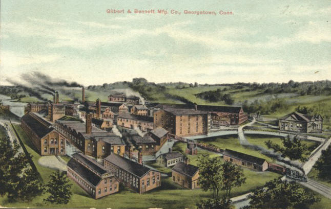
Georgetown Historic District
Monument and historic site · National Register of Historic Places · 0.9 mi
In towns of Redding and Wilton, Connecticut, NRHP-listed

Hurlbutt Street School
Museum · National Register of Historic Places · 3.2 mi
Museum in Connecticut, United States of America

Marvin Tavern
Monument and historic site · National Register of Historic Places · 2.1 mi
Building in Connecticut, United States

Weir Farm National Historical Park
Monument and historic site · National Register of Historic Places · 1.5 mi
National Historical Park in Fairfield County, Connecticut
Wilton Center Historic District
Monument and historic site · National Register of Historic Places · 3.2 mi
Historic district in Connecticut, United States


Parks, trails and playgrounds20

Flanders Nature Center & Land Trust
Park · 2.0 mi
Park in Connecticut, United States of America




8 more on the map.
Restaurants and cafes11

Heibeck’s Stand
Restaurant · Burger, Ice Cream, American, Mexican, Hot Dog, Fries · 1.1 mi
951 Danbury Road, WIlton
The Georgetown Owl Saloon & Restaurant
Restaurant · 1.2 mi
19 Main Street, Redding;Georgetown
We-Su 16:00-22:00


Uncle Leo's & Rosny Cafe
Bakery · 1.2 mi
19 Main Street, Redding;Georgetown
06:00-14:00

Dunkin'
Fast food · Donut, Coffee Shop · 1.6 mi
15 Ethan Allen Highway, Ridgefield
Churches and places of worship5
Bethlehem Lutheran Church
Church · Lutheran · 1.2 mi
5 North Main Street, Redding
Shopping6
Keough's Paint & Hardware
Hardware store · 1.6 mi
1 Ethan Allen Highway, Ridgefield
Schools, colleges and libraries15
Healthcare1
Map of Georgetown
78 places. The map loads OpenStreetMap tiles when you open it.
People and cost of living
American Community Survey 5-year estimates, 2020-2024, U.S. Census Bureau. Estimates have margins of error, larger for small towns.
Disaster history
The county has had 25 federal disaster declarations since 2000, most often for hurricanes.
- 2024-09-20: Severe Storm, Flooding, Landslides, And Mudslides (Severe Storm)
- 2024-08-21: Severe Storms, Flooding, Landslides, And Mudslides (Severe Storm)
- 2021-10-30: Remnants Of Hurricane Ida (Hurricane)
- 2021-08-22: Hurricane Henri (Hurricane)
- 2021-01-12: Tropical Storm Isaias (Hurricane)
- 2020-08-06: Tropical Storm Isaias (Hurricane)
OpenFEMA disaster declarations summaries.
Getting there and nearby towns
Danbury Municipal Airport (DXR) is the nearest airport with scheduled flights listed in OpenStreetMap, 9 miles away.
- South Wilton 5 mi south, about 8 min by car
- Route 7 Gateway 6 mi north, about 9 min by car
- Poplar Plains 6 mi southeast, about 9 min by car
- Coleytown 7 mi southeast, about 11 min by car
- Lakes East 7 mi northwest, about 11 min by car
- Bethel 8 mi north, about 13 min by car
- Lakes West 8 mi northwest, about 12 min by car
- Compo 9 mi southeast, about 15 min by car
- Norwalk 10 mi south, about 17 min by car
- Danbury 11 mi north, about 18 min by car
Drive times are estimates from straight-line distance, not routes.
Local news
Headlines from INDB, the NEMICO news database.
Reviews, tips and questions
Loading what members have shared...
Sources and licences
- NCES EDGE (Public domain): public schools
- OpenFEMA (Public domain): disaster declarations
- OpenStreetMap contributors (ODbL 1.0): places, airports, map data
- U.S. Census Bureau (Public domain): population, income, housing, education, commute
- Wikidata (CC0 1.0): elevation, founding date, time zone, website, landmarks and historic places
- Wikimedia Commons (see each image): photos
- Wikipedia (CC BY-SA 4.0): overview and history text
Photo credits
- GeorgetownCTRRStation1919, Noroton at en.wikipedia, Public domain
- Georgetown Bible Church 002, Pedro Xing, CC0
- North Main Georgetown 017, Pedro Xing, CC0
- Georgetown Volunteer Fire Co. No. 1 001, Pedro Xing, CC0
- Wilton Town Hall, Wilton (Fairfield County, Connecticut), James Rainey, Photographer, Public domain
- Old building near Branchville Station 004, Pedro Xing, CC0
- RidgefieldCT BenedictHouse, User:Magicpiano, CC BY-SA 4.0
- Hurlbutt Street Schoolhouse, DavidAFinkelstein, CC BY-SA 3.0
- Weir Farm National Historic Site - front of the house, Ser Amantio di Nicolao, CC BY-SA 3.0
- Marvin Tavern, DavidAFinkelstein, CC BY-SA 3.0
- PostcardGeorgetownCTGilbertAndBennettMfg1909, Unknown author Unknown author, Public domain
- WiltonCTCannonXingSchoolhouse09162007, Noroton, Public domain
- Woodcock Nature Center programs building, Jllm06, CC BY-SA 3.0
- GuilfordCT FirstCongregationalChurch, Magicpiano, CC BY-SA 4.0
- Weir Farm National Historic Site - studio windows, Ser Amantio di Nicolao, CC BY-SA 3.0
- Danbury Branch crossing Old Mill Road 009, Pedro Xing, CC0
- US 7 nb approaching CT 57-107, June 2024, Mr. Matté (if there is an issue with this image, contact me using this image's Commons talk page , my Commons user talk page , or my English Wikipedia user talk page ; I'll know about it a lot faster), CC BY-SA 4.0
- Danbury Branch crossing the Norwalk River 008, Pedro Xing, CC0
- High peak frame tent, Don Williams, Public domain
- 2016 Nissan Maxima SR, Forged Bronze, front right, Mr.choppers, CC BY-SA 3.0
- 1935 Auburn 851 Salon Phaeton Sedan, rear left, Mr.choppers, CC BY-SA 3.0
- Gilbert and Bennett factory 004, Pedro Xing, CC0
- Gilbert and Bennett factory detail 006, Pedro Xing, CC0
- Gilbert and Bennett HQ SW oblique 005, Pedro Xing, CC0
- Gilbert and Bennett HQ 003, Pedro Xing, CC0
- Gilbert and Bennett demolition 2012 011, Pedro Xing, CC0
- Gilbert and Bennett demolition 2012 010, Pedro Xing, CC0
- Weir Farm National Historic Site - Mahonri Young's studio windows, Ser Amantio di Nicolao, CC BY-SA 3.0
- Weir Farm National Historic Site - barns and rocks, Ser Amantio di Nicolao, CC BY-SA 3.0
- Weir Farm National Historic Site - studios, Ser Amantio di Nicolao, CC BY-SA 3.0
- Weir Farm National Historic Site - Weir Farmhouse, Ser Amantio di Nicolao, CC BY-SA 3.0
- Weir Farm National Historic Site - Weir Studio on left, Young Studio on right, Ser Amantio di Nicolao, CC BY-SA 3.0
- Weir Farm National Historic Site - path from Visitors' Center to Weir Farmhouse, Ser Amantio di Nicolao, CC BY-SA 3.0
- Weir Farm National Historic Site - Young Studio, sink, Ser Amantio di Nicolao, CC BY-SA 3.0
- Weir Farm National Historic Site - Weir Farmhouse from side, Ser Amantio di Nicolao, CC BY-SA 3.0
- Weir Farm National Historic Site - Weir's paintbox, Ser Amantio di Nicolao, CC BY-SA 3.0
- Weir Farm National Historic Site - landscape, Ser Amantio di Nicolao, CC BY-SA 3.0
- Weir Farm National Historic Site - scrub land, Ser Amantio di Nicolao, CC BY-SA 3.0
- Weir Farm National Historic Site - trees, Ser Amantio di Nicolao, CC BY-SA 3.0
- Weir Farm National Historic Site - Weir's studio, Ser Amantio di Nicolao, CC BY-SA 3.0


Page built October 30, 2026. Spotted a mistake? Tell us or suggest a place.