


Why visit Coleytown
Townapedia lists 22 museums and landmarks, 12 parks and trails and 9 attractions in and around town.
Highlights include Fairfield University, Westport Country Playhouse, Bradley Edge Tool Company Historic District and Bradley-Wheeler House.
July is the warmest month, with average highs of 85°F; January lows average 22°F, and about 34 inches of snow fall in a normal year.
Weather in Coleytown
Forecast from the National Weather Service. Full forecast
About Coleytown
Coleytown is a census-designated place (CDP) in the town of Westport, Fairfield County, Connecticut, United States. It occupies the northeastern corner of the town and is bordered to the north by the town of Weston and to the east by the town of Fairfield. As of the 2020 census, Coleytown had a population of 3,522.
From the Wikipedia article Coleytown, Connecticut (this version), under CC BY-SA 4.0.
Things to do9

Fairfield University
School · 2.8 mi
University located in Fairfield, Connecticut

Westport Country Playhouse
Cinema and theater · 2.5 mi
Theater in Westport, Connecticut

White Barn Theatre
Cinema and theater · 3.1 mi
Theater in Norwalk, Connecticut

Museums and landmarks22

Bradley Edge Tool Company Historic District
Monument and historic site · National Register of Historic Places · 1.5 mi
Historic district in Connecticut, United States

Bradley-Wheeler House
Monument and historic site · National Register of Historic Places · 2.4 mi
Historic house in Connecticut, United States
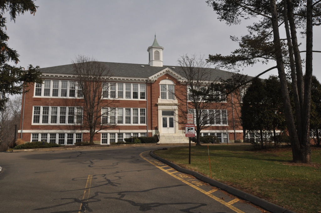
Bridge Street Historic District
Monument and historic site · National Register of Historic Places · 3.9 mi
Historic district in Connecticut, United States

Bronson Windmill
Monument and historic site · National Register of Historic Places · 2.7 mi
Windmill in Connecticut, United States of America
David Ogden House
Monument and historic site · National Register of Historic Places · 3.7 mi
Historic house in Connecticut, United States

Godillot Place
Monument and historic site · National Register of Historic Places · 2.7 mi
Building in Connecticut, United States

Greenfield Hill Grange No. 133
Monument and historic site · National Register of Historic Places · 2.6 mi
Building in Connecticut, United States of America
Greenfield Hill Historic District
Monument and historic site · National Register of Historic Places · 2.7 mi
Historic district in Connecticut, United States
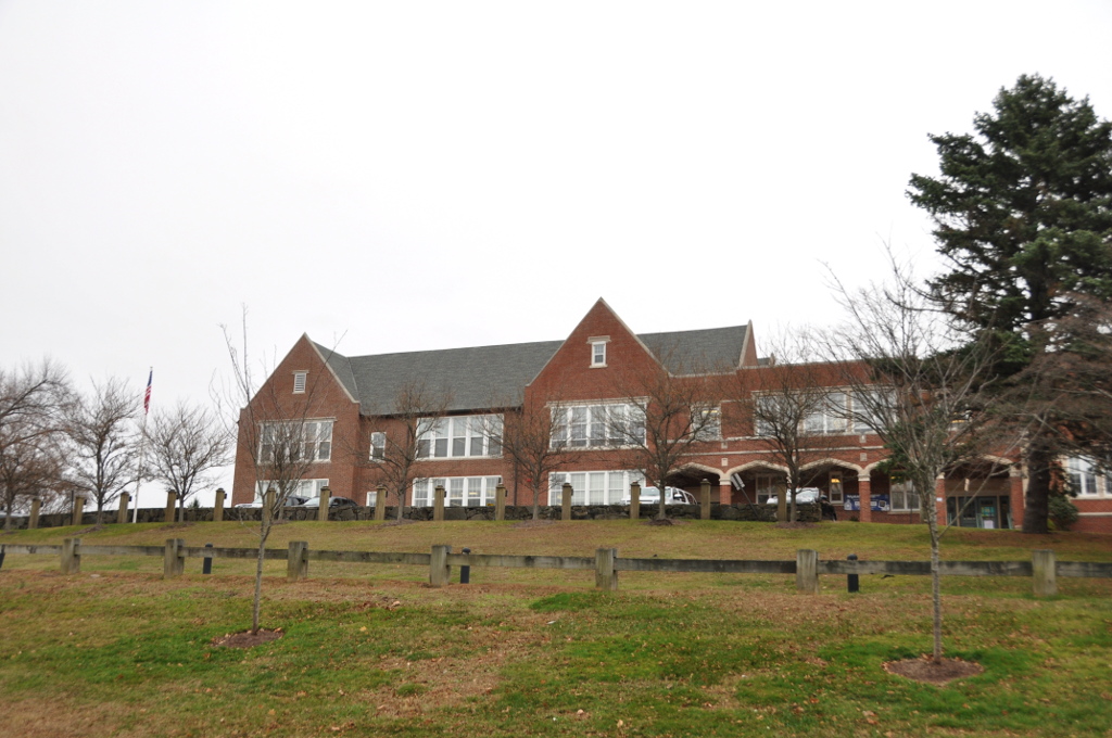
Greens Farms School
Monument and historic site · National Register of Historic Places · 2.9 mi
17 Morningside Dr. South, Westport

Hurlbutt Street School
Museum · National Register of Historic Places · 3.8 mi
Museum in Connecticut, United States of America

John Osborne House
Monument and historic site · National Register of Historic Places · 3.7 mi
Historic house in Connecticut, United States
Kettle Creek Historic District
Monument and historic site · National Register of Historic Places · 1.6 mi
Historic district in Connecticut
10 more on the map.
Parks, trails and playgrounds12


Town Farm Ball Complex
Park · 1.7 mi
3 Baseball Fields, Sofball Field, Batting Cages and Tennis Courts

Churches and places of worship7


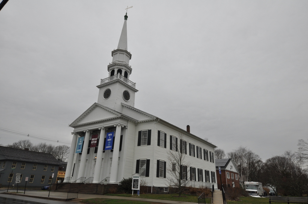
First Congregational Church of Guilford
Church · 3.7 mi
Church building in Connecticut, United States of America


Our Lady of the Assumption Church
Church · 3.0 mi
Church building in Connecticut, United States of America
St. Jerome Church
Church · 3.9 mi
Church building in Connecticut, United States of America
Unitarian Universalist Congregation in Westport
Church · 0.8 mi
Church in Connecticut, USA
Schools, colleges and libraries39
Fairfield Woods Middle School
School · 4.9 mi
1115 Fairfield Woods Rd., Fairfield
Map of Coleytown
89 places. The map loads OpenStreetMap tiles when you open it.
Climate by month
Monthly table
| Month | High | Low | Rain | Snow |
|---|---|---|---|---|
| Jan | 38°F | 22°F | 4.3 in | 9.1 in |
| Feb | 41°F | 23°F | 3.1 in | 11.9 in |
| Mar | 49°F | 30°F | 4.7 in | 5.9 in |
| Apr | 62°F | 40°F | 4.4 in | 0.5 in |
| May | 72°F | 50°F | 4.1 in | 0.0 in |
| Jun | 80°F | 58°F | 4.9 in | 0.0 in |
| Jul | 85°F | 64°F | 3.8 in | 0.0 in |
| Aug | 83°F | 63°F | 3.8 in | 0.0 in |
| Sep | 76°F | 56°F | 5.2 in | 0.0 in |
| Oct | 64°F | 45°F | 4.6 in | 0.0 in |
| Nov | 53°F | 35°F | 4.2 in | 0.8 in |
| Dec | 43°F | 27°F | 4.4 in | 5.8 in |
U.S. Climate Normals 1991-2020 for Stamford 5 N Hcn (11 mi away), NOAA NCEI.
People and cost of living
American Community Survey 5-year estimates, 2020-2024, U.S. Census Bureau. Estimates have margins of error, larger for small towns.
Disaster history
The county has had 25 federal disaster declarations since 2000, most often for hurricanes.
- 2024-09-20: Severe Storm, Flooding, Landslides, And Mudslides (Severe Storm)
- 2024-08-21: Severe Storms, Flooding, Landslides, And Mudslides (Severe Storm)
- 2021-10-30: Remnants Of Hurricane Ida (Hurricane)
- 2021-08-22: Hurricane Henri (Hurricane)
- 2021-01-12: Tropical Storm Isaias (Hurricane)
- 2020-08-06: Tropical Storm Isaias (Hurricane)
OpenFEMA disaster declarations summaries.
Getting there and nearby towns
Igor I. Sikorsky Memorial Airport (BDR) is the nearest airport with scheduled flights listed in OpenStreetMap, 11 miles away.
- Poplar Plains 2 mi west, about 3 min by car
- South Wilton 4 mi west, about 6 min by car
- Southport 4 mi southeast, about 7 min by car
- Sacred Heart University 6 mi northeast, about 10 min by car
- Norwalk 7 mi southwest, about 11 min by car
- Bridgeport 8 mi east, about 12 min by car
- Trumbull Center 9 mi northeast, about 15 min by car
- Darien Downtown 10 mi southwest, about 15 min by car
- Stamford 13 mi southwest, about 20 min by car
- Shelton 14 mi northeast, about 22 min by car
Drive times are estimates from straight-line distance, not routes.
Local news
Headlines from INDB, the NEMICO news database.
Reviews, tips and questions
Loading what members have shared...
Sources and licences
- NCES EDGE (Public domain): public schools
- NOAA NCEI U.S. Climate Normals 1991-2020 (Public domain): climate by month
- OpenFEMA (Public domain): disaster declarations
- OpenStreetMap contributors (ODbL 1.0): places, airports, map data
- U.S. Census Bureau (Public domain): population, income, housing, education, commute
- Wikidata (CC0 1.0): elevation, founding date, time zone, website, landmarks and historic places
- Wikimedia Commons (see each image): photos
- Wikipedia (CC BY-SA 4.0): overview and history text
Photo credits
- Old town hall, Westport, CT, Kohlnf, CC BY-SA 3.0
- Godillot place, Kohlnf, CC BY-SA 3.0
- Westport Bank and Trust Company, Westport, CT, USA 2012 C, WestportWiki, CC BY-SA 3.0
- GREENFIELD HILL GRANGE NO. 133 FAIRFIELD COUNTY, JERRYE & ROY KLOTZ, M.D., CC BY-SA 4.0
- David Ogden House HABS 1938, Everett H. Keeler, Public domain
- Bradley-Wheeler House, Westport, CT 01, WestportWiki, CC BY-SA 3.0
- Hurlbutt Street Schoolhouse, DavidAFinkelstein, CC BY-SA 3.0
- WestportCT FormerPostOffice, Magicpiano, CC BY-SA 3.0
- National hall building circa 1966, Kohlnf, CC BY-SA 3.0
- SHAMBAUGH HOUSE, WESTPORT, FAIRFIELD COUNTY, CT, JERRYE & ROY KLOTZ, M.D., CC BY-SA 4.0
- RESTMORE, FAIRFIELD COUNTY, CT, JERRYE & ROY KLOTZ, M.D., CC BY-SA 4.0
- JOHN OSBORNE HOUSE, FAIRFIELD COUNTY, CT, JERRYE & ROY KLOTZ, M.D., CC BY-SA 4.0
- WestportCT BridgeStreetHD 1, User:Magicpiano, CC BY-SA 4.0
- Frederic Bronson Windmill, 3015 Bronson Road, Fairfield (Fairfield County, Connecticut), Jack Boucher, Public domain
- Old Burial Ground, Kings Highway, Compo Hills, Westport, CT, 06880, USA - Feb 2013 02, WestportWiki, CC BY-SA 3.0
- WestportCT GreenFarmsSchool, Magicpiano, CC BY-SA 3.0
- WestportCT Earthplace exterior, Jllm06, Public domain
- GuilfordCT FirstCongregationalChurch, Magicpiano, CC BY-SA 4.0
- Fairfield Entrance, Stagophile ( talk ), CC BY-SA 3.0
- Westport Country Playhouse, WestportWiki, CC BY-SA 3.0
- Our Lady of the Assumption Church, Westport, Connecticut, WestportWiki, CC BY-SA 3.0
- First Unitarian Church in Westport 01 - soaring sanctuary on right, Jllm06, CC BY-SA 4.0
- First Unitarian Church in Westport 03 - entrance from parking area uo to vestibule, Jllm06, CC BY-SA 4.0
- First Unitarian Church in Westport 02, Jllm06, CC BY-SA 4.0
- First Unitarian Church in Westport 04 - wings with offices and vestibule, Jllm06, CC BY-SA 4.0
- Rolnick Observatory 071, Pedro Xing, CC0
- Iron Mountain - Data Pick Up Vehicle, USA - July 2013, User:WestportWiki, CC BY-SA 3.0
- CT 57 sb at CT 136 nb, June 2025, Mr. Matté (if there is an issue with this image, contact me using this image's Commons talk page , my Commons user talk page , or my English Wikipedia user talk page ; I'll know about it a lot faster), CC BY-SA 4.0
- Lighthouse Point Park - lighthouse and view of downtown New Haven, Jllm06, CC BY-SA 4.0
- CT Science Center 06, Jllm06, CC BY-SA 4.0
- CT Science Center 04 - Forces in Motion, Jllm06, CC BY-SA 4.0
- CT Science Center 07 - CT Geology, Jllm06, CC BY-SA 4.0
- CT Science Center 01 - Lobby, Jllm06, CC BY-SA 4.0
- CT Science Center 10 - Sports Lab, Jllm06, CC BY-SA 4.0
- CT Science Center 08 - View of CT River and Founders Bridge, Jllm06, CC BY-SA 4.0
- CT Science Center 11 - Wall of Invention and Ingenuity, Jllm06, CC BY-SA 4.0
- CT Science Center 03 - Walter Wick image, Jllm06, CC BY-SA 4.0
- CT Science Center 09 - View of I91 and the CT River, Jllm06, CC BY-SA 4.0
- CT Science Center 05 - View south, Jllm06, CC BY-SA 4.0
- CT Science Center 02 - Theater, Jllm06, CC BY-SA 4.0


Page built October 30, 2026. Spotted a mistake? Tell us or suggest a place.