



Glen Ridge, New Jersey
Glen Ridge is a borough of 7,943 people in Essex County, New Jersey.
Why visit Glen Ridge
Townapedia lists 58 museums and landmarks, 31 parks and trails, 202 places to eat, 2 places to stay and 10 attractions in and around town.
Highlights include Ironbound Farm Market, Belleville Turnpike Bridge, Central Presbyterian Church and Montclair Art Museum.
July is the warmest month, with average highs of 86°F; January lows average 21°F.
Weather in Glen Ridge
Forecast from the National Weather Service. Full forecast
About Glen Ridge
Glen Ridge is a borough in Essex County, in the U.S. state of New Jersey. As of the 2020 United States census, the borough's population was 7,802, an increase of 275 (+3.7%) from the 2010 census count of 7,527, which in turn reflected an increase of 256 (+3.5%) from the 7,271 counted in the 2000 census. The borough is one of a few in New Jersey preserving the use of gas lamps for street lighting.
From the Wikipedia article Glen Ridge, New Jersey (this version), under CC BY-SA 4.0.
Things to do10

Ironbound Farm Market
Farm and orchard · 0.6 mi
1 Lackawanna Plaza, Montclair
Mo,Th-Sa 10:00-19:00; Su 10:00-18:00

Belleville Turnpike Bridge
Bridge · 3.2 mi
Bridge in North Arlington, in New Jersey

Columbus Hall
Cinema and theater · 2.4 mi
Building in Orange, New Jersey
Freeman Parkway Bridge
Bridge
Deck arch bridge in Glen Ridge, New Jersey, United States

Lincoln Group of Schools
School · 2.9 mi
Group of schools in New Jersey, US
Wellmont Theatre
Cinema and theater · 0.8 mi
Theater and concert venue in Montclair, New Jersey, United States
Museums and landmarks58

Central Presbyterian Church
Monument and historic site · National Register of Historic Places · 1.1 mi
Church building in New Jersey, United States of America
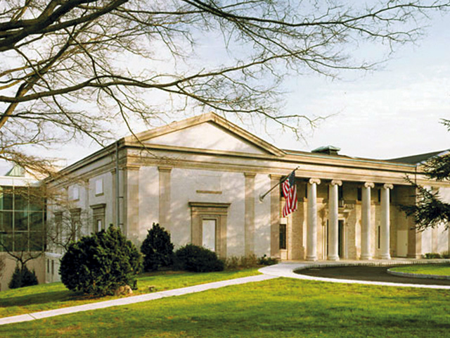
Montclair Art Museum
Museum · National Register of Historic Places · 1.4 mi
Art museum in Montclair, New Jersey
3 South Mountain Avenue, Montclair

Ambrose-Ward Mansion
Monument and historic site · National Register of Historic Places · 3.0 mi
Mansion in East Orange, New Jersey

Ampere
Monument and historic site · National Register of Historic Places · 2.8 mi
Railway station in East Orange, the United States of America
Anderson Park
Monument and historic site · National Register of Historic Places · 2.7 mi
County park in Montclair, United States of America
Bloomfield
Monument and historic site · National Register of Historic Places · 0.9 mi
Railroad station in New Jersey
Bloomfield Green Historic District
Monument and historic site · National Register of Historic Places · 0.7 mi
Historic district in Essex County, New Jersey
Bradner's Pharmacy
Monument and historic site · National Register of Historic Places · 1.7 mi
Building in New Jersey, United States of America


Branch Brook Park
Monument and historic site · National Register of Historic Places · 2.8 mi
County park of Essex County, New Jersey
Brick Church
Monument and historic site · National Register of Historic Places · 2.8 mi
New Jersey Transit rail station
Carnegie Library
Monument and historic site · National Register of Historic Places · 1.1 mi
Historic building in Montclair, New Jersey, United States
Casa Deldra
Monument and historic site · National Register of Historic Places · 1.7 mi
Historic house in Montclair, New Jersey
46 more on the map.
Parks, trails and playgrounds31

Edgemont Memorial Park
Park · 1.5 mi
Municipal park in Montclair, New Jersey

19 more on the map.
Restaurants and cafes202

Antika Grill
Restaurant · Mediterranean · 1.1 mi
Mediterranean restaurant and hookah lounge
578 Bloomfield Avenue, Montclair
Mo-Th,Su 11:00-24:00; Fr-Sa 11:00-26:00

Absolute Zero Rolled Ice Cream
Ice cream · Ice Cream · 0.8 mi
410 Bloomfield Avenue, Montclair
Tu-Fr 13:00-22:00; Sa 12:00-22:00; Su 12:00-21:00; Mo off
Ah'Pizz Montclair
Restaurant · Italian, Pizza · 0.8 mi
7 North Willow Street, Montclair
Mo-Th 11:00-22:00; Fr-Sa 11:00-23:00; Su 12:00-21:00
Ani Ramen House
Restaurant · Japanese, Ramen · 1.0 mi
511 Bloomfield Avenue, Montclair
Su-Th 11:30-22:00; Fr-Sa 11:30-23:00
Aozora
Restaurant · Japanese, Sushi, Asian Fusion · 0.8 mi
407 Bloomfield Avenue, Montclair
Mo 12:00-21:30; We 14:30-21:30; Th 12:00-22:00; Fr-Sa 12:00-22:30;...

Bareburger
Restaurant · Burger, American · 1.0 mi
480 Bloomfield Avenue, Montclair
Su-Th 11:30-22:00; Fr-Sa 11:30-23:00
Boschetto
Restaurant · Italian, Pizza · 0.7 mi
111 Grove Street, Montclair
Mo-Th 16:00-21:00; Fr-Sa 12:00-21:00; Su 12:00-20:00
Brookside Thai
Restaurant · Thai · 0.6 mi
380 Broad Street, Bloomfield
Mo-We 16:30-21:00, Th-Su 12:00-21:00
Cap't Loui
Restaurant · Cajun, Seafood · 1.1 mi
10 Park Street, Montclair
Su-Th 11:30-22:00; Fr-Sa 11:30-23:00
Casa Turano Parkside Pizzeria
Restaurant · Pizza · 0.7 mi
455 Broad Street, Bloomfield
Mo-Th 11:00-21:00, Fr-Sa 11:00-22:00, Su 12:00-21:00
Charm Thai Cuisine
Restaurant · Thai · 1.1 mi
600 Bloomfield Avenue, Montclair
Mo-Th 11:30-21:30; Fr-Sa 11:30-22:00; Su 11:30-20:30
190 more on the map.
History
In 1666, 64 Connecticut families led by Robert Treat bought land from the Lenni Lenape Native Americans and named it New Ark to reflect a covenant to worship freely without persecution. The territory included the future municipalities of Bloomfield, Montclair, Belleville and Nutley. When Bloomfield was established in 1812, Glen Ridge was a section "on the hill" composed mostly of farms and woodlands with the exception of a thriving industrial area along Toney's Brook in the glen. For most of the nineteenth century, three water-powered mills produced lumber, calico, pasteboard boxes and brass fittings. A copper mine and a sandstone quarry were located on the north side of the brook.
In 1856, the Newark and Bloomfield Railroad arrived. The train stopped at Moffett's Mill in Glen Ridge on a daily basis. In 1860, N&B Railroad constructed a platform at Prospect Street known as Ridgewood Station, and its trains made regular stops there. In 1872, the New York and Greenwood Lake Railway began operating with one track and a station at Ridgewood Avenue. A new Ridgewood Station was built in 1887.
In 1891, Mountainside Hospital, a local hospital with more than 300 beds now known as HackensackUMC Mountainside, was founded. The Glen Ridge Country Club was founded in 1894, making it one of the state's oldest clubs.
From the History section of Glen Ridge, New Jersey on Wikipedia, under CC BY-SA 4.0.
Where to stay2
Churches and places of worship41
Reformed Dutch Church of Second River
Church · National Register of Historic Places · 3.1 mi
Masjid Al-Wadud
Place of worship · Sunni · 0.5 mi
222 Bloomfield Avenue, Montclair
Shopping24
Gas and EV charging8
Schools, colleges and libraries66
Healthcare20
Mountainside Medical Group - Pulmonary & Sleep Medicine
Clinic and pharmacy · 1.1 mi
160 Walnut Street, Montclair
Planned Parenthood Montclair Center
Clinic and pharmacy · 0.9 mi
29 North Fullerton Avenue, Montclair
The DRIPBaR Montclair
Clinic and pharmacy · 1.1 mi
608 Bloomfield Avenue, Montclair
Map of Glen Ridge
250 places. The map loads OpenStreetMap tiles when you open it.
Climate by month
Monthly table
| Month | High | Low | Rain |
|---|---|---|---|
| Jan | 38°F | 21°F | 3.6 in |
| Feb | 41°F | 22°F | 2.9 in |
| Mar | 49°F | 30°F | 4.2 in |
| Apr | 63°F | 40°F | 4.1 in |
| May | 72°F | 49°F | 4.0 in |
| Jun | 80°F | 59°F | 4.6 in |
| Jul | 86°F | 64°F | 4.8 in |
| Aug | 84°F | 62°F | 4.5 in |
| Sep | 78°F | 54°F | 4.5 in |
| Oct | 65°F | 43°F | 4.3 in |
| Nov | 53°F | 34°F | 3.6 in |
| Dec | 43°F | 27°F | 3.4 in |
U.S. Climate Normals 1991-2020 for Essex Fells Service Bldg (5 mi away), NOAA NCEI.
People and cost of living
American Community Survey 5-year estimates, 2020-2024, U.S. Census Bureau. Estimates have margins of error, larger for small towns.
Disaster history
Essex County has had 21 federal disaster declarations since 2000, most often for hurricanes.
- 2021-09-05: Remnants Of Hurricane Ida (Hurricane)
- 2021-09-02: Remnants Of Hurricane Ida (Hurricane)
- 2020-12-11: Tropical Storm Isaias (Hurricane)
- 2020-03-25: Covid-19 Pandemic (Biological)
- 2020-03-13: Covid-19 (Biological)
- 2018-06-08: Severe Winter Storm And Snowstorm (Severe Storm)
OpenFEMA disaster declarations summaries.
Getting there and nearby towns
Essex County Airport (CDW) is the nearest airport with scheduled flights listed in OpenStreetMap, 6 miles away.
- Ampere North 2 mi south, about 3 min by car
- Brookdale 2 mi northeast, about 4 min by car
- East Orange 3 mi south, about 4 min by car
- Upper Montclair 3 mi north, about 4 min by car
- North Arlington 4 mi east, about 7 min by car
- Essex Fells 4 mi northwest, about 7 min by car
- Caldwell 4 mi northwest, about 7 min by car
- East Newark 4 mi southeast, about 7 min by car
- Clifton 5 mi northeast, about 7 min by car
- Newark 6 mi south, about 9 min by car
Drive times are estimates from straight-line distance, not routes.
Local news
Headlines from INDB, the NEMICO news database.
Reviews, tips and questions
Loading what members have shared...
Sources and licences
- NCES EDGE (Public domain): public schools
- NOAA NCEI U.S. Climate Normals 1991-2020 (Public domain): climate by month
- OpenFEMA (Public domain): disaster declarations
- OpenStreetMap contributors (ODbL 1.0): places, airports, map data
- U.S. Census Bureau (Public domain): population, income, housing, education, commute
- Wikidata (CC0 1.0): elevation, founding date, time zone, website, landmarks and historic places
- Wikimedia Commons (see each image): photos
- Wikipedia (CC BY-SA 4.0): overview and history text
Photo credits
- Lolly lady Glen Ridge jeh, Jim.henderson, CC0
- Montclair Art Museum (Montclair, New Jersey), Blondhairblueeyed at English Wikipedia . Later version(s) were uploaded by DavidRavenMoon at English Wikipedia ., CC BY-SA 3.0
- Central Presbyterian Church, Montclair, New Jersey, Jrogers123, CC BY-SA 3.0
- Edison Battery 177 Main St Lakeside Av jeh, Jim.henderson, CC0
- Ampere Station station view, Historic American Buildings Survey, Public domain
- Bound Brook Park (13971717804), Hypnotica Studios Infinite from Toms River, New Jersey, USA, CC BY 2.0
Page built October 30, 2026. Spotted a mistake? Tell us or suggest a place.