


Why visit Grafton
Townapedia lists 14 museums and landmarks, 15 parks and trails, 12 places to eat, 3 places to stay and 3 attractions in and around town.
Highlights include Highland Avenue Bridge, Kevich Light, Bigelow School and Cedarburg Covered Bridge.
July is the warmest month, with average highs of 81°F; January lows average 17°F.
Weather in Grafton
Forecast from the National Weather Service. Full forecast
About Grafton
Grafton is a village in Ozaukee County, Wisconsin, United States. Located approximately 20 miles (32 km) north of Milwaukee and in close proximity to Interstate 43, it is a suburban community in the Milwaukee metropolitan area. The village incorporated in 1896, and at the time of the 2020 census the population was 12,094.
From the Wikipedia article Grafton, Wisconsin (this version), under CC BY-SA 4.0.
Things to do3

Highland Avenue Bridge
Bridge · 2.2 mi
Bridge in Cedarburg, Wisconsin

Kevich Light
Lighthouse · 2.9 mi
Lighthouse on Lake Michigan in Grafton, Wisconsin, United States

Museums and landmarks14

Bigelow School
Monument and historic site · National Register of Historic Places · 4.1 mi
Former school in Mequon, Wisconsin

Cedarburg Covered Bridge
Bridge · National Register of Historic Places · 3.1 mi
Covered bridge in Cedarburg, Wisconsin, US
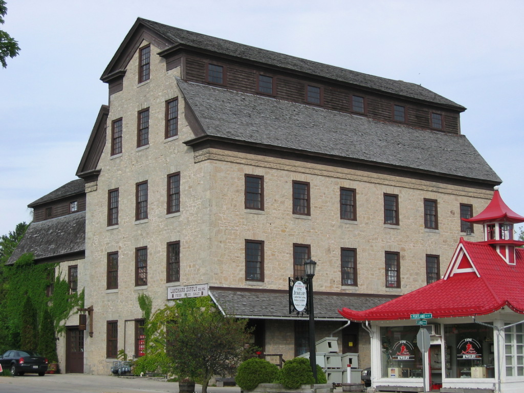
Cedarburg Mill
Monument and historic site · National Register of Historic Places · 2.8 mi
Gristmill and historic landmark in Cedarburg, Wisconsin

Cedarburg Woolen Co. Worsted Mill
Monument and historic site · National Register of Historic Places · 0.5 mi
Building in Wisconsin, United States

Columbia Historic District
Monument and historic site · National Register of Historic Places · 2.7 mi
Historic district in Cedarburg, Wisconsin

Grafton Flour Mill
Monument and historic site · National Register of Historic Places · 0.4 mi
Mill in Grafton, Wisconsin, United States

Hamilton Historic District
Monument and historic site · National Register of Historic Places · 3.1 mi
Listed on the NRHP in Ozaukee County, Wisconsin

Hilgen and Wittenberg Woolen Mill
Monument and historic site · National Register of Historic Places · 2.7 mi
Former textile mill in Cedarburg, Wisconsin

Milwaukee Falls Lime Company
Monument and historic site · National Register of Historic Places · 1.4 mi
Historic landmark in Ozaukee County, Wisconsin

Payne Hotel
Monument and historic site · National Register of Historic Places · 4.0 mi
Saukville, Wisconsin, listed on the NRHP in Ozaukee County
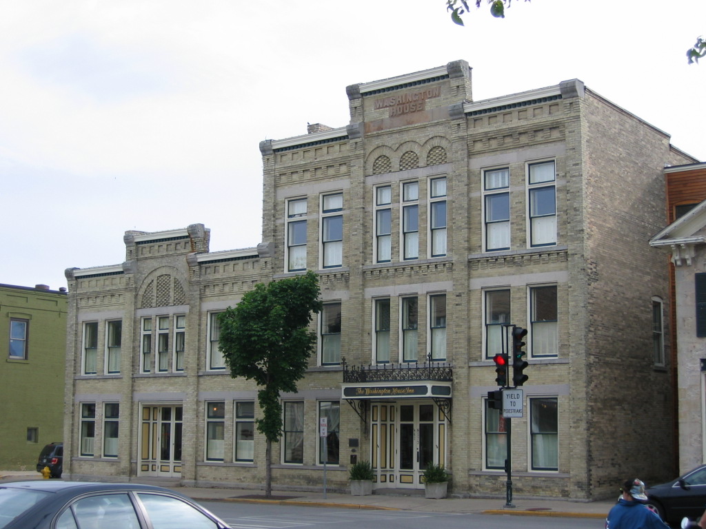
Washington Avenue Historic District
Monument and historic site · National Register of Historic Places · 2.7 mi
Historic district in Wisconsin, United States


Wayside House
Monument and historic site · National Register of Historic Places · 3.0 mi
Historic building in Cedarburg, Wisconsin, USA
2 more on the map.
Parks, trails and playgrounds15



3 more on the map.
Restaurants and cafes12

Hefner's Custard
Restaurant · Custard, Burger · 2.1 mi
N71 W5184 Columbia Road, Cedarburg
11:00-21:00



Domino's
Fast food · Pizza · 1.4 mi
385 Falls Road, Grafton
Mo-Th 10:30-24:00; Fr-Sa 10:30-01:00; Su 10:30-24:00
McDonald's
Fast food · Burger · 1.2 mi
2570 Washington Street, Grafton
Su-Th 05:00-22:00; Fr, Sa 05:00-23:00
McDonald's
Fast food · Burger · 1.2 mi
606 Falls Road, Grafton
Mo-Th 05:00-22:00; Fr-Sa 05:00-23:00; Su 05:00-22:00
History
The first Europeans to visit the area were the Jesuit missionaries Claude-Jean Allouez and Claude Bablon, who visited a Native American village on the Milwaukee River near the future site of Grafton around 1670.
Timothy Wooden, who arrived in 1839 from the eastern United States, is considered Grafton's first permanent white resident. The majority of the early residents were immigrants from Germany and Ireland. In the early 1840s, the village was called Hamburg, because Jacob Eichler, one of the village founders, was an immigrant from Hamburg, Germany. A post office for "Hamburgh" was established in 1844.
The Wisconsin territorial legislature officially created the town of Grafton in 1846. The village of Grafton was officially incorporated from some of the town's land on March 30, 1896.
The village's early settlers utilized the Milwaukee River as a source of power for milling. In 1846, a group farmers built the Grafton Flour Mill. In 1880, the owner of Cedarburg's woolen mill opened a mill in Grafton to make worsted yarn. At its height, Grafton's woolen mill employed 100 people.
From the History section of Grafton, Wisconsin on Wikipedia, under CC BY-SA 4.0.
Where to stay3
Churches and places of worship1
Shopping9
Gas and EV charging3
Schools, colleges and libraries22
Healthcare5
Map of Grafton
87 places. The map loads OpenStreetMap tiles when you open it.
Climate by month
Monthly table
| Month | High | Low | Rain |
|---|---|---|---|
| Jan | 30°F | 17°F | 1.6 in |
| Feb | 33°F | 18°F | 1.7 in |
| Mar | 43°F | 26°F | 2.1 in |
| Apr | 54°F | 36°F | 3.9 in |
| May | 66°F | 46°F | 4.0 in |
| Jun | 76°F | 56°F | 4.5 in |
| Jul | 81°F | 62°F | 3.6 in |
| Aug | 80°F | 61°F | 3.8 in |
| Sep | 72°F | 54°F | 3.2 in |
| Oct | 60°F | 43°F | 3.0 in |
| Nov | 46°F | 31°F | 2.1 in |
| Dec | 35°F | 21°F | 2.0 in |
U.S. Climate Normals 1991-2020 for Grafton Wwtp (1 mi away), NOAA NCEI.
People and cost of living
American Community Survey 5-year estimates, 2020-2024, U.S. Census Bureau. Estimates have margins of error, larger for small towns.
Disaster history
Ozaukee County has had 7 federal disaster declarations since 2000, most often for biologicals.
- 2020-04-04: Covid-19 Pandemic (Biological)
- 2020-03-13: Covid-19 (Biological)
- 2018-10-18: Severe Storms, Tornadoes, Straight-Line Winds, Flooding, And Landslides (Flood)
- 2008-06-14: Severe Storms, Tornadoes, And Flooding (Severe Storm)
- 2005-09-13: Hurricane Katrina Evacuation (Hurricane)
- 2004-06-18: Severe Storms And Flooding (Severe Storm)
OpenFEMA disaster declarations summaries.
Getting there and nearby towns
West Bend Municipal Airport (ETB) is the nearest airport with scheduled flights listed in OpenStreetMap, 11 miles away.
- Cedarburg 3 mi southwest, about 4 min by car
- Brown Deer 10 mi south, about 17 min by car
- Germantown 11 mi southwest, about 18 min by car
- Milwaukee 18 mi south, about 29 min by car
- Brookfield 20 mi southwest, about 32 min by car
- Cudahy 26 mi south, about 42 min by car
- Greendale 27 mi south, about 43 min by car
- Franklin 31 mi south, about 49 min by car
- Caledonia 37 mi south, about 59 min by car
- Fond du Lac 40 mi northwest, about 1 h by car
Drive times are estimates from straight-line distance, not routes.
Local news
Headlines from INDB, the NEMICO news database.
Reviews, tips and questions
Loading what members have shared...
Sources and licences
- NCES EDGE (Public domain): public schools
- NOAA NCEI U.S. Climate Normals 1991-2020 (Public domain): climate by month
- OpenFEMA (Public domain): disaster declarations
- OpenStreetMap contributors (ODbL 1.0): places, airports, map data
- U.S. Census Bureau (Public domain): population, income, housing, education, commute
- Wikidata (CC0 1.0): elevation, founding date, time zone, website, landmarks and historic places
- Wikimedia Commons (see each image): photos
- Wikipedia (CC BY-SA 4.0): overview and history text
Photo credits
- Grafton-WI-Paramount Plaza, Freekee, Public domain
- St. Joseph's Catholic Church Grafton, WI - panoramio, Corey Coyle, CC BY 3.0
- Grafton High School auditorium 04, Runner1928, CC BY-SA 4.0
- Grafton High School auditorium 03, Runner1928, CC BY-SA 4.0
- Grafton High School auditorium 02, Runner1928, CC BY-SA 4.0
- Grafton High School auditorium 01, Runner1928, CC BY-SA 4.0
- Grafton High School auditorium 06, Runner1928, CC BY-SA 4.0
- Grafton High School auditorium 05, Runner1928, CC BY-SA 4.0
- Grafton Tower - panoramio, Corey Coyle, CC BY 3.0
- Dam and spillway in Grafton WI, 2016, Aaron Volkening, CC BY 2.0
- Grafton Town Hall, Wikideas1, CC0
- Grafton MeadowbrookPark2, Aaron Volkening, CC BY 2.0
- Exterior of St Paul Lutheran Church in Grafton Wisconsin, Runner1928, CC BY-SA 4.0
- Cross at front of St Paul Lutheran Church in Grafton Wisconsin, Runner1928, CC BY-SA 4.0
- Sanctuary of St Paul Lutheran Church in Grafton Wisconsin, Runner1928, CC BY-SA 4.0
- Stained glass window of St Paul Lutheran Church in Grafton Wisconsin, Runner1928, CC BY-SA 4.0
- Cross and candle of St Paul Lutheran Church in Grafton Wisconsin, Runner1928, CC BY-SA 4.0
- Pastors who have served St. Paul Lutheran Church in Grafton Wisconsin, Runner1928, CC BY-SA 4.0
- Grafton westviewmeadows 2006, Aaron Volkening, CC BY 2.0
- 20140331-Wisconsin- 30413 Lime Kiln Park in Grafton, Carl Lacey, CC BY-SA 2.0
- Hamilton Historic District May09, Freekee, Public domain
- Covered Bridge Cedarburg WI May-09, Freekee, Public domain
- Woolen Mill Grafton Dec09, Freekee, Public domain
- Grafton Flour Mill back Dec09, Freekee, Public domain
- Bigelow School Mequon Dec09, Freekee, Public domain
- Cedarburg Mill, Loopygrumpkins, Public domain
- Washington House Inn, Loopygrumpkins, Public domain
- Payne-Hotel Saukville Jul09, Freekee, Public domain
- Woolen Mill Cedarburg May09, Freekee /Kevin Hansen, CC BY-SA 3.0
- Columbia Historic District Jan2011, Freekee, Public domain
- Wayside House Cedarburg WI May-09, Freekee, Public domain
- Concordia Mill Hamilton WI May09, Freekee, Public domain
- Paramount Plaza Walk of Fame, Awkwafaba, CC BY-SA 3.0
- Interior entrance to St Paul Lutheran Church, Runner1928, CC BY-SA 4.0
- Members of St. Paul Lutheran Church entering the pastoral ministry, Runner1928, CC BY-SA 4.0
- Pews at St. Paul Lutheran Church, Runner1928, CC BY-SA 4.0
- Altar area at St. Paul Lutheran Church, Runner1928, CC BY-SA 4.0
- Cornerstone of old St. Paul Lutheran Church, Runner1928, CC BY-SA 4.0
- History of the 1870 St. Paul Lutheran Church building, Runner1928, CC BY-SA 4.0
- Worship at St. Paul Lutheran Church, Runner1928, CC BY-SA 4.0


Page built October 30, 2026. Spotted a mistake? Tell us or suggest a place.