


Haledon, New Jersey
Haledon is a borough of 8,980 people in Passaic County, New Jersey, founded in May 21, 1908.
Why visit Haledon
Townapedia lists 27 museums and landmarks, 13 parks and trails, 48 places to eat and 10 attractions in and around town.
Highlights include Arch Street Bridge, Great Falls, Eastside Park and Hinchliffe Stadium.
July is the warmest month, with average highs of 86°F; January lows average 22°F.
Weather in Haledon
Forecast from the National Weather Service. Full forecast
About Haledon
Haledon (English pronunciation: /ˈheɪldən/ ) is a borough in Passaic County, in the U.S. state of New Jersey. As of the 2020 United States census, the borough's population was 9,052, an increase of 734 (+8.8%) from the 2010 census count of 8,318, which in turn reflected an increase of 66 (+0.8%) from the 8,252 counted in the 2000 census.
From the Wikipedia article Haledon, New Jersey (this version), under CC BY-SA 4.0.
Things to do10

Arch Street Bridge
Bridge · National Register of Historic Places · 1.4 mi
Bridge in United States of America


William Paterson University
School · 0.8 mi
University in New Jersey, United States
300 Pompton Road, Wayne

Hillery Street Bridge
Bridge · 2.4 mi
Vehicular bridge over the Passaic River in Totowa and Woodland Park, New Jersey

Sixth Avenue Bridge
Bridge · 1.2 mi
Bridge in United States of America
West Broadway Bridge
Bridge · 1.3 mi
Bridge in United States of America

Shea Center for Performing Arts
Cinema and theater · 0.7 mi
300 Pompton Road, Wayne

Museums and landmarks27

Eastside Park
Monument and historic site · National Register of Historic Places · 3.0 mi
Historic district in Paterson, New Jersey

Hinchliffe Stadium
Monument and historic site · National Register of Historic Places · 1.4 mi
Stadium in New Jersey

Ailsa Farms
Monument and historic site · National Register of Historic Places · 0.6 mi
Mansion in Wayne, New Jersey

Danforth Memorial Library
Monument and historic site · National Register of Historic Places · 1.8 mi
Library in Paterson, New Jersey

Daniel Thompson and John Ryle Houses
Monument and historic site · National Register of Historic Places · 1.5 mi
Building in New Jersey, United States

Dey Mansion
Museum · National Register of Historic Places · 2.8 mi
Historic house in New Jersey, United States

Frederick William Cooke Residence
Monument and historic site · National Register of Historic Places · 2.0 mi
Historic house in Passaic County, New Jersey

Garretson Forge and Farm
Monument and historic site · National Register of Historic Places · 3.2 mi
Building in New Jersey, United States
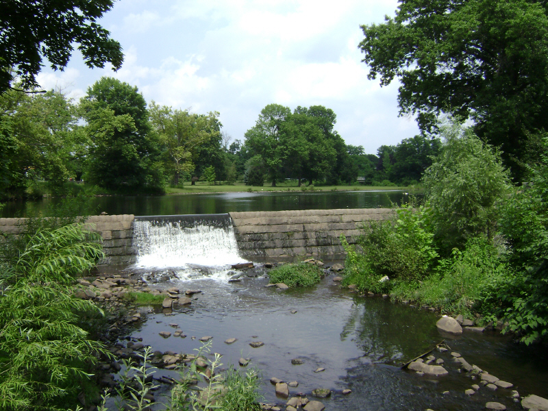
Goffle Brook Park
Monument and historic site · National Register of Historic Places · 1.6 mi
Park in New Jersey, United States
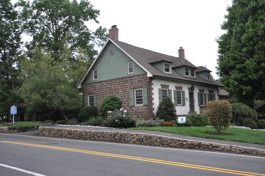
John C. Stagg House
Monument and historic site · National Register of Historic Places · 3.4 mi
Historic house in New Jersey, United States

John W. Ferguson House
Monument and historic site · National Register of Historic Places · 2.5 mi
Historic house in New Jersey, United States


John W. Rea House
Monument and historic site · National Register of Historic Places · 2.0 mi
Historic house in New Jersey, United States
15 more on the map.
Parks, trails and playgrounds13

Garret Mountain Reservation
Park · 2.6 mi
Public park in Passaic County, New Jersey
1 more on the map.
Restaurants and cafes48



The Shepherd & the Knucklehead Pub & Steakhouse
Bar and pub
529 Belmont Avenue, Haledon
Mo-Fr 16:00-01:45; Sa-Su 12:00-01:45

Basilico Italian Kitchen & Brick Oven Pizza
Restaurant · Italian, Pizza · 0.9 mi
Former site of Brother Bruno's Pizza.
140 Paterson-Hamburg Turnpike, Wayne
Biagio's Pizza & Pasta
Restaurant · Italian, Pizza · 1.0 mi
179 Paterson-Hamburg Turnpike, Wayne
Brother Bruno's Pizza, Deli & Bagels
Restaurant · Pizza, Deli, Bagel · 1.0 mi
200 Paterson-Hamburg Turnpike, Wayne
Paesano's Restaurant & Pizzeria
Restaurant · Italian, Pizza, Sandwich, Regional · 1.1 mi
885 Belmont Avenue, North Haledon
Taichi Bubble Tea - Poke Bowl & Ramen
Cafe · Bubble Tea · 1.0 mi
163 Paterson-Hamburg Turnpike, Wayne
36 more on the map.
History
Haledon developed along the northern side of the industrial city of Paterson. It was settled by farmers with colonial Dutch heritage including the Van Riper, Berdan, Banta, Post and Zabriskie families. Prior to the Civil War they were joined by the Roe, Leonhard and Stansfield families, who helped establish St. Mary's Episcopal Church and leading businesses including a general store and the Leonhard Wax Company.
The area became a streetcar suburb of Paterson in the years following the Civil War, with the central area known as Haledon, while the area surrounding the large pond along High Mountain Road was called Oldham. The Paterson and Haledon Horse Rail Road Company, formed in 1871, laid trolley tracks from Paterson along the current-day Belmont Avenue, which were electrified by 1888.
Many of the trolley company's owners were among the founders of the Cedar Cliff Land Company, which bought up large portions of the area, and the street names in the borough reflect these industrialists and businessmen: Morrissee, Hoxey, Van Dyke, John Ryle and Barbour.
From the History section of Haledon, New Jersey on Wikipedia, under CC BY-SA 4.0.
Churches and places of worship37
Cathedral of St. John the Baptist
Church · National Register of Historic Places · 1.9 mi
Temple Beth Tikvah
Place of worship · Reform · 1.5 mi
950 Preakness Avenue, Wayne
Mahatma Gandhi Center & Hindu Temple
Place of worship · 1.1 mi
714 Preakness Avenue, Wayne
Shopping10
Destination Athlete of Bergen, Passaic, & Rockland NY
Shop · 1.3 mi
321 Paterson-Hamburg Turnpike, Wayne
Gas and EV charging3
Schools, colleges and libraries69
Classical Academy Charter School of Clifton
School · 4.7 mi
1255 Main Avenue, Clifton
Clifton Early Learner Academies - Brighton
School · 5.9 mi
290 Brighton Road, Clifton
College Achieve Paterson Charter School
School · 1.6 mi
21 Market Street, Paterson
Healthcare25
Advanced Cardiology Practice
Clinic and pharmacy · 1.2 mi
246 Paterson-Hamburg Turnpike, Wayne
Advanced Pain Therapy
Clinic and pharmacy · 1.5 mi
401 Paterson-Hamburg Turnpike, Wayne
Clean Slate Laser Tattoo Removal
Clinic and pharmacy · 1.2 mi
246 Paterson-Hamburg Turnpike, Wayne
CURA Medical Group
Clinic and pharmacy · 1.5 mi
401 Paterson-Hamburg Turnpike, Wayne
CURA Pain Doctors - Pain Management Center
Clinic and pharmacy · 1.5 mi
401 Paterson-Hamburg Turnpike, Wayne
Elite Surgical Center
Clinic and pharmacy · 1.3 mi
307 Paterson-Hamburg Turnpike, Wayne
Englewood Health Physician Network - HVA Medical Group
Clinic and pharmacy · 1.5 mi
401 Paterson-Hamburg Turnpike, Wayne
High Mountain Health Urgent & Primary Care
Clinic and pharmacy · 1.1 mi
246 Paterson-Hamburg Turnpike, Wayne
Katalyst Performance and Rehabilitation
Clinic and pharmacy · 1.3 mi
321 Paterson-Hamburg Turnpike, Wayne
Map of Haledon
242 places. The map loads OpenStreetMap tiles when you open it.
Climate by month
Monthly table
| Month | High | Low | Rain |
|---|---|---|---|
| Jan | 39°F | 22°F | 3.6 in |
| Feb | 41°F | 23°F | 3.0 in |
| Mar | 50°F | 31°F | 4.2 in |
| Apr | 63°F | 40°F | 4.3 in |
| May | 73°F | 50°F | 4.0 in |
| Jun | 82°F | 60°F | 4.6 in |
| Jul | 86°F | 65°F | 4.6 in |
| Aug | 84°F | 64°F | 4.7 in |
| Sep | 76°F | 56°F | 4.5 in |
| Oct | 65°F | 44°F | 4.2 in |
| Nov | 54°F | 35°F | 3.4 in |
| Dec | 44°F | 27°F | 4.3 in |
U.S. Climate Normals 1991-2020 for Little Falls (4 mi away), rain and snow from Hawthorne 1.0 Sse, NOAA NCEI.
People and cost of living
American Community Survey 5-year estimates, 2020-2024, U.S. Census Bureau. Estimates have margins of error, larger for small towns.
Disaster history
Passaic County has had 20 federal disaster declarations since 2000, most often for hurricanes.
- 2021-09-05: Remnants Of Hurricane Ida (Hurricane)
- 2021-09-02: Remnants Of Hurricane Ida (Hurricane)
- 2020-03-25: Covid-19 Pandemic (Biological)
- 2020-03-13: Covid-19 (Biological)
- 2018-06-08: Severe Winter Storm And Snowstorm (Severe Storm)
- 2012-10-30: Hurricane Sandy (Hurricane)
OpenFEMA disaster declarations summaries.
Getting there and nearby towns
Essex County Airport (CDW) is the nearest airport with scheduled flights listed in OpenStreetMap, 7 miles away.
- William Paterson University of New Jersey 1 mi northwest, about 1 min by car
- Paterson 2 mi southeast, about 3 min by car
- Preakness 2 mi west, about 3 min by car
- Hawthorne 2 mi northeast, about 3 min by car
- Totowa 3 mi southwest, about 5 min by car
- Woodland Park 3 mi south, about 5 min by car
- Fair Lawn 4 mi east, about 6 min by car
- Glen Rock 4 mi northeast, about 6 min by car
- Elmwood Park 4 mi southeast, about 7 min by car
- Ridgewood 5 mi northeast, about 8 min by car
Drive times are estimates from straight-line distance, not routes.
Local news
Headlines from INDB, the NEMICO news database.
Reviews, tips and questions
Loading what members have shared...
Sources and licences
- NCES EDGE (Public domain): public schools
- NOAA NCEI U.S. Climate Normals 1991-2020 (Public domain): climate by month
- OpenFEMA (Public domain): disaster declarations
- OpenStreetMap contributors (ODbL 1.0): places, airports, map data
- U.S. Census Bureau (Public domain): population, income, housing, education, commute
- Wikidata (CC0 1.0): elevation, founding date, time zone, website, landmarks and historic places
- Wikimedia Commons (see each image): photos
- Wikipedia (CC BY-SA 4.0): overview and history text
Photo credits
- Botto House Passaic County, Jared Kofsky/PlaceNJ.com, CC BY-SA 3.0
- Botto House Haledon, Jared Kofsky, CC BY-SA 3.0
- 2018-07-25 14 15 01 View west along Passaic County Route 504 (Haledon Avenue) just west of Passaic County Route 675 (Belmont Avenue) in Haledon, Passaic County, New Jersey, Famartin, CC BY-SA 4.0
- 2018-07-25 12 04 35 View east along Passaic County Route 504 (Pompton Road) just east of Passaic County Route 676 (Alisa Avenue) in Haledon, Passaic County, New Jersey, Famartin, CC BY-SA 4.0
- Camp Veritans entrance, Haledon, NJ, Jan. 2025, Mr. Matté (if there is an issue with this image, contact me using this image's Commons talk page , my Commons user talk page , or my English Wikipedia user talk page ; I'll know about it a lot faster), CC BY-SA 4.0
- 2018-07-25 12 08 10 View east along Passaic County Route 504 (Haledon Avenue) just west of 16th Street on the border of Prospect Park and Haledon in Passaic County, New Jersey, Famartin, CC BY-SA 4.0
- 2018-07-25 13 50 02 View west along Passaic County Route 504 (Haledon Avenue) at 13th Street on the border of Prospect Park and Haledon in Passaic County, New Jersey, Famartin, CC BY-SA 4.0
- 2018-07-25 12 09 34 View east along Passaic County Route 504 (Haledon Avenue) just east of Passaic County Route 662 (Burhans Avenue) on the border of Prospect Park and Paterson in Passaic County, New..., Famartin, CC BY-SA 4.0
- 2018-07-25 13 47 34 View west along Passaic County Route 504 (Haledon Avenue) at Seventh Street on the border of Prospect Park and Paterson in Passaic County, New Jersey, Famartin, CC BY-SA 4.0
- 2018-07-25 12 11 51 View east along Passaic County Route 504 (Haledon Avenue) at Fourth Street in Paterson, Passaic County, New Jersey, Famartin, CC BY-SA 4.0
- West Overlook Avenue eb, North Haledon, NJ (1), Jan. 2025, Mr. Matté (if there is an issue with this image, contact me using this image's Commons talk page , my Commons user talk page , or my English Wikipedia user talk page ; I'll know about it a lot faster), CC BY-SA 4.0
- Overlook Avenue eb, North Haledon, NJ (1), Jan. 2025, Mr. Matté (if there is an issue with this image, contact me using this image's Commons talk page , my Commons user talk page , or my English Wikipedia user talk page ; I'll know about it a lot faster), CC BY-SA 4.0
- North Haledon, NJ Municipal Building, Jan. 2025, Mr. Matté (if there is an issue with this image, contact me using this image's Commons talk page , my Commons user talk page , or my English Wikipedia user talk page ; I'll know about it a lot faster), CC BY-SA 4.0
- 2018-07-25 13 44 52 View west along Passaic County Route 504 (Haledon Avenue) at Holsman Street in Paterson, Passaic County, New Jersey, Famartin, CC BY-SA 4.0
- 2018-07-25 13 44 26 View west along Passaic County Route 504 (Holsman Street) between Main Street and Haledon Avenue in Paterson, Passaic County, New Jersey, Famartin, CC BY-SA 4.0
- 2018-09-12 08 42 48 View north along Passaic County Route 677 (High Mountain Road) at Manchester Avenue in North Haledon, Passaic County, New Jersey, Famartin, CC BY-SA 4.0
- Hinchliffe Stadium July 2023, Oknazevad, CC BY-SA 4.0
- DANFORTH MEMORIAL LIBRARY, PASSAIC COUNTY, NJ, Jerrye & Roy Klotz, MD, CC BY-SA 4.0
- Cathedral of St. John the Baptist - Paterson, New Jersey 02, Farragutful, CC BY-SA 4.0
- Dey Mansion 1, Cmileo88, Public domain
- Arch Street Bridge 20070829-jag9889, Jag9889, CC BY-SA 4.0
- Lambert Castle, Paterson, NJ - looking northwest, Zeete, CC BY-SA 4.0
- PeterGarretsonFarmhouse, KForce at English Wikipedia, CC BY-SA 3.0
- Reinhardt Mills, Lithium6ion, Public domain
- Pietro-betto-house, Dmadeo, CC BY-SA 4.0
- Rea House, Lithium6ion, Public domain
- Paterson City Hall 2008 jeh, Jim.henderson, Public domain
- Straight Street Bridge 20070829-jag9889, Jag9889, CC BY-SA 4.0
- Daniel Thompson and John Ryle Houses, Lithium6ion, Public domain
- Westside Park VanHouten House, Lithium6ion, Public domain
- PUBLIC SCHOOL NUMBER TWO, PATERSON, PASSAIC COUNTY, NJ, Jerrye & Roy Klotz, MD, CC BY-SA 4.0
- Ailsa Farms Hobart Manor, Lithium6ion, Public domain
- Van Houten-Van Allen House, Totowa, NJ, Zeete, CC BY-SA 4.0
- GoffleBrookPark ArnoldsPond, Lithium6ion, Public domain
- WyckoffNJ JohnCStaggHouse, Magicpiano, CC BY-SA 4.0
- PatersonNJ CookeHouse, Cheek Funeral Home, Public domain
- PatersonNJ JohnFergusonHouse, New Jersey Office of Historic Preservation, Public domain
- Kossuth Street School, Lithium6ion, Public domain
- Great Falls of Paterson 2016, FirozAnsari, CC BY-SA 4.0
- Hillery Street Bridge 20090427-jag9889, Jag9889, CC BY-SA 4.0


Page built October 30, 2026. Spotted a mistake? Tell us or suggest a place.