




Hampton Beach, New Hampshire
Hampton Beach is a community of 2,605 people in Rockingham County, New Hampshire.
Why visit Hampton Beach
Townapedia lists 6 museums and landmarks, 11 parks and trails, 41 places to eat, 37 places to stay and 5 attractions in and around town.
Highlights include Explore The Ocean World Oceanarium, Blue Ocean Discovery Center, Benjamin James House and Gov. Meshech Weare House.
July is the warmest month, with average highs of 80°F; January lows average 16°F, and about 65 inches of snow fall in a normal year.
Weather in Hampton Beach
Forecast from the National Weather Service. Full forecast
About Hampton Beach
Hampton Beach is a village district, census-designated place, and beach resort in the town of Hampton, New Hampshire, United States, along the Atlantic Ocean. Its population at the 2020 census was 2,598. Hampton Beach is in Rockingham County, approximately 15 miles (24 km) south of Portsmouth. The community is a popular tourist destination and the busiest beach community in New Hampshire.
From the Wikipedia article Hampton Beach, New Hampshire (this version), under CC BY-SA 4.0.
Things to do5

Explore The Ocean World Oceanarium
Zoo and aquarium
367 Ocean Boulevard, Hampton
May Mo[-1] - 2 days, Mo[-1] - 1 day, Mo[-1] 10:00-17:00; Jun Sa-Su...



Hampton Playhouse
Cinema and theater · 1.1 mi
Former theater in Hampton, New Hampshire, United States
Museums and landmarks6
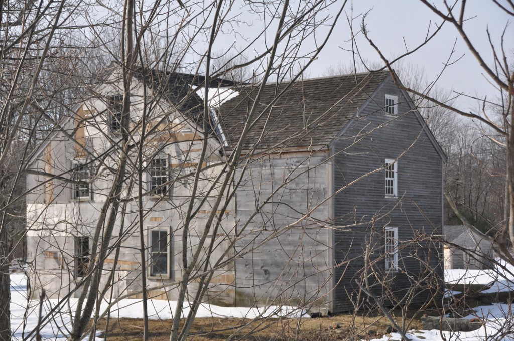
Benjamin James House
Monument and historic site · National Register of Historic Places · 3.3 mi
Hampton, New Hampshire, NRHP-listed
Gov. Meshech Weare House
Monument and historic site · National Register of Historic Places · 2.8 mi
Historic house in New Hampshire, United States
Reuben Lamprey Homestead
Monument and historic site · National Register of Historic Places · 1.2 mi
Historic house in New Hampshire, United States

Al Gauron Fishing & Whale Watching
Monument and historic site · 1.0 mi
1 Ocean Boulevard, Hampton Beach
Parks, trails and playgrounds11
North Hampton State Beach
Park · 3.2 mi
Park in the United States of America




Restaurants and cafes41

The Green Room
Cafe · Breakfast, Smoothie, Coffee Shop · 0.6 mi
142 Ashworth Avenue, Hampton
Mo-Fr 08:00-15:00; Sa-Su 08:00-17:00

Al Gauron Lunchette
Restaurant · Burger · 1.0 mi
1 Ocean Boulevard, Hasmpton Beach
Tasty Pizza
Restaurant · Breakfast, Pizza, Sausage, Seafood · 0.6 mi
71 Ocean Boulevard, Hampton

29 more on the map.
History
The Hampton Beach Village District was established on June 26, 1907, to provide electric power and water to the summer tourist community. In 1923, the village's first fire station was built, after two fires destroyed a large section of the beach settlement in 1919 and 1922. The original fire station was razed and replaced in 2014.
On February 26, 2010, a windstorm-fueled fire burned down all the buildings in a block at Hampton Beach, including the Surf Hotel, Happy Hampton Arcade, and Mrs. Mitchell's Gift Shop. The fire started in the Surf Hotel and was spread to the other buildings by high winds. The cause of this fire is unknown. The area has been rebuilt, with a larger hotel and a new Mrs. Mitchell's.
On July 29, 2023, a single-engine Piper PA-18 crashed off the shore of the beach. Only one person was aboard the aircraft at the time and was not injured.
From the History section of Hampton Beach, New Hampshire on Wikipedia, under CC BY-SA 4.0.
Where to stay37
Churches and places of worship2
Shopping7
Gas and EV charging1
Schools, colleges and libraries9
Map of Hampton Beach
119 places. The map loads OpenStreetMap tiles when you open it.
Climate by month
Monthly table
| Month | High | Low | Rain | Snow |
|---|---|---|---|---|
| Jan | 33°F | 16°F | 3.6 in | 17.1 in |
| Feb | 36°F | 18°F | 3.6 in | 15.8 in |
| Mar | 43°F | 25°F | 4.8 in | 13.9 in |
| Apr | 56°F | 35°F | 4.6 in | 2.3 in |
| May | 66°F | 45°F | 4.0 in | 0.0 in |
| Jun | 75°F | 54°F | 4.6 in | 0.0 in |
| Jul | 80°F | 60°F | 3.9 in | 0.0 in |
| Aug | 79°F | 59°F | 3.7 in | 0.0 in |
| Sep | 72°F | 52°F | 4.1 in | 0.0 in |
| Oct | 60°F | 40°F | 5.0 in | 0.1 in |
| Nov | 48°F | 31°F | 4.1 in | 1.6 in |
| Dec | 38°F | 22°F | 4.9 in | 14.2 in |
U.S. Climate Normals 1991-2020 for Greenland (7 mi away), NOAA NCEI.
People and cost of living
American Community Survey 5-year estimates, 2020-2024, U.S. Census Bureau. Estimates have margins of error, larger for small towns.
Disaster history
Rockingham County has had 26 federal disaster declarations since 2000, most often for severe storms.
- 2024-07-10: Severe Winter Storm And Flooding (Winter Storm)
- 2024-04-19: Severe Storms And Flooding (Severe Storm)
- 2023-09-14: Severe Storms And Flooding (Flood)
- 2020-04-03: Covid-19 Pandemic (Biological)
- 2020-03-13: Covid-19 (Biological)
- 2018-06-08: Severe Winter Storm And Snowstorm (Snowstorm)
OpenFEMA disaster declarations summaries.
Getting there and nearby towns
Portsmouth International Airport (PSM) is the nearest airport with scheduled flights listed in OpenStreetMap, 11 miles away.
- Hampton 2 mi north, about 3 min by car
- Salisbury 6 mi south, about 10 min by car
- Newburyport 8 mi southwest, about 13 min by car
- Exeter 8 mi northwest, about 13 min by car
- Amesbury 8 mi southwest, about 14 min by car
- Portsmouth 10 mi north, about 17 min by car
- Kittery 13 mi north, about 20 min by car
- Rowley 14 mi south, about 22 min by car
- South Eliot 15 mi north, about 25 min by car
- Haverhill 17 mi southwest, about 27 min by car
Drive times are estimates from straight-line distance, not routes.
Local news
Headlines from INDB, the NEMICO news database.
Reviews, tips and questions
Loading what members have shared...
Sources and licences
- NCES EDGE (Public domain): public schools
- NOAA NCEI U.S. Climate Normals 1991-2020 (Public domain): climate by month
- OpenFEMA (Public domain): disaster declarations
- OpenStreetMap contributors (ODbL 1.0): places, airports, map data
- U.S. Census Bureau (Public domain): population, income, housing, education, commute
- Wikidata (CC0 1.0): elevation, founding date, time zone, website, landmarks and historic places
- Wikimedia Commons (see each image): photos
- Wikipedia (CC BY-SA 4.0): overview and history text
Photo credits
- HamptonNH ReubenLampreyHomestead, User:Magicpiano, CC BY-SA 4.0
- HamptonFallsNH GovMeshechWeareHouse, User:Magicpiano, CC BY-SA 4.0
- HamptonNH BenjaminJamesHouse, User:Magicpiano, CC BY-SA 4.0
- Hampton Bridge, Hampton Beach NH, John Phelan, CC BY-SA 3.0
- NorthHamptonNH NorthHamptonStateBeach, User:Magicpiano, CC BY-SA 4.0
Page built October 30, 2026. Spotted a mistake? Tell us or suggest a place.