


Newburyport, Massachusetts
Newburyport is a city of 18,652 people in Essex County, Massachusetts, founded in 1635.
Why visit Newburyport
Townapedia lists 78 museums and landmarks, 83 parks and trails, 48 places to eat, 7 places to stay and 17 attractions in and around town.
Highlights include Newburyport Harbor Front Range Light, Newburyport Harbor Light, Custom House Maritime Museum and Abraham Adams House.
July is the warmest month, with average highs of 83°F; January lows average 17°F, and about 67 inches of snow fall in a normal year.
Weather in Newburyport
Forecast from the National Weather Service. Full forecast
About Newburyport
Newburyport is a coastal city in Essex County, Massachusetts, United States, 35 miles (56 km) northeast of Boston. The population was 18,289 at the 2020 census. A historic seaport with a vibrant tourism industry, Newburyport includes part of Plum Island. The mooring, winter storage, and maintenance of recreational boats, motor and sail, still generate much of the city's income.
From the Wikipedia article Newburyport, Massachusetts (this version), under CC BY-SA 4.0.
Things to do17

Newburyport Harbor Front Range Light
Lighthouse · National Register of Historic Places · 1.1 mi
Lighthouse in Massachusetts, United States

Newburyport Harbor Light
Lighthouse · National Register of Historic Places · 3.4 mi
Lighthouse in Massachusetts, United States

Newburyport Harbor Rear Range Light
Lighthouse · National Register of Historic Places · 1.0 mi
Lighthouse in Massachusetts, United States


Chain Bridge
Bridge · 1.8 mi
Bridge which crosses the Merrimack River, connecting Amesbury and Newburyport, Massachusetts


5 more on the map.
Museums and landmarks78


Abraham Adams House
Monument and historic site · National Register of Historic Places · 4.5 mi
House in Newbury, Massachusetts

Amesbury and Salisbury Mills Village Historic District
Monument and historic site · National Register of Historic Places · 3.9 mi
United States historic place

Amesbury Friends Meeting House
Monument and historic site · National Register of Historic Places · 4.0 mi
Friends Meeting House in Amesbury, Massachusetts

Ann's Diner
Monument and historic site · National Register of Historic Places · 2.3 mi
United States historic place

Benjamin Coker House
Monument and historic site · National Register of Historic Places · 0.9 mi
Historic house in Massachusetts, United States

Briggs Carriage Company
Monument and historic site · National Register of Historic Places · 4.0 mi
Historic buildings in Amesbury, Massachusetts, United States

Brown Square House
Monument and historic site · National Register of Historic Places · 0.6 mi
Historic house in Massachusetts, United States

Cushing House Museum and Garden
Monument and historic site · National Register of Historic Places · 0.9 mi
Historic house in Massachusetts, United States
Dalton House
Monument and historic site · National Register of Historic Places · 0.8 mi
Historic house in Massachusetts, United States

Dodge Building
Monument and historic site · National Register of Historic Places
Building in Massachusetts, United States
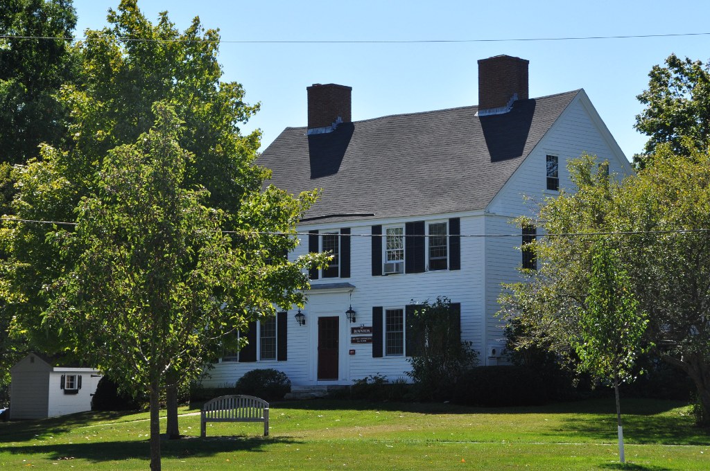


_99)_hdr.jpg)


Hale-Boynton House
Monument and historic site · National Register of Historic Places · 4.3 mi
In Newbury, Massachusetts
66 more on the map.
Parks, trails and playgrounds83




71 more on the map.
Restaurants and cafes48

The Park Lunch
Restaurant · American, Burger, Fish And Chips, Pizza, Sandwich · 0.5 mi
181 Merrimac Street, Newburyport
Mo-Th,Su 11:00-21:00; Fr-Sa 11:00-22:00




36 more on the map.
History
In 1680 Elizabeth Morse was convicted of witchcraft in Newbury. She was confined to her property unless she was escorted by a clergymen until she died in 1690.
On January 28, 1764, the General Court of Massachusetts passed "An act for erecting part of the town of Newbury into a new town by the name of Newburyport." The act begins:Whereas the town of Newbury is very large, and the inhabitants of that part of it who dwell by the water-side there, as it is commonly called, are mostly merchants, traders, and artificers, and the inhabitants of the other parts of the town are chiefly husbandmen; by means whereof many difficulties and disputes have arisen in managing their public affairs – Be it enacted ... That part of the said town of Newbury ... be and hereby are constituted and made a separate and distinct town ....
The act was approved by Governor Francis Bernard on February 4, 1764. The new town was the smallest in Massachusetts, covering an area of 647 acres (2.62 km2), and had a population of 2,800 living in 357 homes. There were three shipyards, no bridges, and several ferries, one of which at the foot of Greenleaf Lane, now State Street, carried the Portsmouth Flying Stage Coach, running between Portsmouth, New Hampshire, and Boston.
From the History section of Newburyport, Massachusetts on Wikipedia, under CC BY-SA 4.0.
Where to stay7
Churches and places of worship12
First Religious Society Church and Parish Hall
Church · National Register of Historic Places · 0.8 mi
Union Congregational Church
Church · National Register of Historic Places · 2.8 mi
Central Congregational Church
Church · United Church Of Christ · 0.6 mi
14 Titcomb Street
Shopping10
Gas and EV charging4
Schools, colleges and libraries30
Healthcare2
Map of Newburyport
250 places. The map loads OpenStreetMap tiles when you open it.
Climate by month
Monthly table
| Month | High | Low | Rain | Snow |
|---|---|---|---|---|
| Jan | 35°F | 17°F | 3.7 in | 17.9 in |
| Feb | 38°F | 19°F | 3.6 in | 17.2 in |
| Mar | 46°F | 26°F | 5.0 in | 14.4 in |
| Apr | 58°F | 36°F | 4.2 in | 2.4 in |
| May | 69°F | 46°F | 3.8 in | 0.0 in |
| Jun | 78°F | 56°F | 4.2 in | 0.0 in |
| Jul | 83°F | 62°F | 3.6 in | 0.0 in |
| Aug | 81°F | 60°F | 3.4 in | 0.0 in |
| Sep | 73°F | 52°F | 4.1 in | 0.0 in |
| Oct | 62°F | 40°F | 4.9 in | 0.4 in |
| Nov | 51°F | 32°F | 3.9 in | 1.8 in |
| Dec | 41°F | 23°F | 4.7 in | 13.0 in |
U.S. Climate Normals 1991-2020 for Groveland (9 mi away), NOAA NCEI.
People and cost of living
American Community Survey 5-year estimates, 2020-2024, U.S. Census Bureau. Estimates have margins of error, larger for small towns.
Disaster history
Essex County has had 26 federal disaster declarations since 2000, most often for severe storms.
- 2023-09-15: Hurricane Lee (Hurricane)
- 2020-03-27: Covid-19 Pandemic (Biological)
- 2020-03-13: Covid-19 (Biological)
- 2018-07-19: Severe Winter Storm And Snowstorm (Snowstorm)
- 2018-06-25: Severe Winter Storm And Flooding (Severe Storm)
- 2015-04-13: Severe Winter Storm, Snowstorm, And Flooding (Severe Storm)
OpenFEMA disaster declarations summaries.
Getting there and nearby towns
Lawrence Municipal Airport (LWM) is the nearest airport with scheduled flights listed in OpenStreetMap, 14 miles away.
- Amesbury 4 mi northwest, about 7 min by car
- Haverhill 10 mi west, about 17 min by car
- Lawrence 16 mi southwest, about 26 min by car
- Methuen 16 mi west, about 25 min by car
- Gloucester 16 mi southeast, about 26 min by car
- Danvers 17 mi south, about 27 min by car
- Beverly 18 mi south, about 29 min by car
- Lynnfield 21 mi south, about 33 min by car
- Marblehead 22 mi south, about 36 min by car
- Lynn 24 mi south, about 38 min by car
Drive times are estimates from straight-line distance, not routes.
Local news
Headlines from INDB, the NEMICO news database.
Reviews, tips and questions
Loading what members have shared...
Sources and licences
- NCES EDGE (Public domain): public schools
- NOAA NCEI U.S. Climate Normals 1991-2020 (Public domain): climate by month
- OpenFEMA (Public domain): disaster declarations
- OpenStreetMap contributors (ODbL 1.0): places, airports, map data
- U.S. Census Bureau (Public domain): population, income, housing, education, commute
- Wikidata (CC0 1.0): elevation, founding date, time zone, website, landmarks and historic places
- Wikimedia Commons (see each image): photos
- Wikipedia (CC BY-SA 4.0): overview and history text
Photo credits
- Newburyport, Nutmegger, Public domain
- Newburyport High School, Fletcher6, CC BY-SA 3.0
- Bridge, Clipper City Rail Trail, Newburyport MA, John Phelan, CC BY-SA 4.0
- Newburyport railroad bridge, Newburyport MA, John Phelan, CC BY 4.0
- Newburyport railroad bridge detail, Newburyport MA, John Phelan, CC BY 4.0
- Clipper City Rail Trail, Newburyport MA, John Phelan, CC BY-SA 4.0
- George Washington statue by John Quincy Adams Ward, Newburyport, Massachusetts (cropped), Jvandelay, CC BY-SA 4.0
- George Washington statue, Newburyport, Massachusetts, Jvandelay, CC BY-SA 4.0
- NewburyportMA DaltonHouse, Magicpiano, CC BY-SA 3.0
- Byron's Court - Newburyport, Hirolovesswords, CC BY-SA 4.0
- Tom Rush at the Firehouse Newburyport crop, John Eckman from Newburyport, MA, United States, CC BY-SA 2.0
- Tom Rush at the Firehouse, Newburyport, John Eckman from Newburyport, MA, United States, CC BY-SA 2.0
- State Street from High Street, Newburyport - 1912 postcard, Unknown author Unknown author, Public domain
- State Street, Newburyport - 1910 postcard, Unknown author Unknown author, Public domain
- Market Square, Newburyport, September 2021, Fletcher, CC BY 4.0
- 2011 Newburyport Massachusetts USA 5656798910, openroads.com, CC BY 2.0
- 2011 Newburyport Massachusetts USA, openroads.com, CC BY 2.0
- Newbury Port MA Old South Church PHS697, Unknown author Unknown author, Public domain
- AmesburyMA BriggsCarriageCompany, Magicpiano, CC BY-SA 4.0
- NewburyMA HaleBoyntonHouse, Magicpiano, CC BY-SA 3.0
- US Customhouse, Newburyport MA, John Phelan, CC BY 3.0
- First Religious Society Church, Newburyport MA, John Phelan, CC BY 3.0
- The Millyard, Amesbury MA, John Phelan, CC BY 3.0
- NewburyportMA RearRangeLight1, Magicpiano, CC BY-SA 3.0
- Spencer-Peirce-Little Farm (front) - Newbury, Massachusetts, Daderot at en.wikipedia, CC BY-SA 3.0
- Newburyport Harbor Front Range Light, May 2012, Newburyport MA, John Phelan, CC BY-SA 3.0
- AmesburyMA UnionCongregationalChurch, Magicpiano, CC BY-SA 3.0
- US Post Office Newburyport Main, MA, John Phelan, CC BY 3.0
- Pat's Diner, Formerly Ann's Diner, Salisbury MA, John Phelan, CC BY 3.0
- Looking south across the pond on the Upper Green, Newbury MA, John Phelan, CC BY 3.0
- Market Square, Newburyport MA, John Phelan, CC BY 3.0
- WestNewburyMA TimothyMorseHouse, Magicpiano, CC BY-SA 3.0
- AmesburyMA WalkerBodyCompanyFactory 2, Magicpiano, CC BY-SA 3.0
- Dodge Building, Newburyport MA, John Phelan, CC BY 3.0
- Cushing House Museum and Garden - Newburyport, Massachusetts, Daderot at en.wikipedia, CC BY-SA 3.0
- Abraham adams house 040812 (100) 101) 99) hdr, Wayne Marshall Chase, CC BY-SA 4.0
- Macy-Colby House (front) - Amesbury, Massachusetts, Daderot at en.wikipedia, CC BY-SA 3.0
- Brown Square House, Newburyport MA, John Phelan, CC BY 3.0
- NewburyportMA BenjaminCokerHouse, Magicpiano, CC BY-SA 3.0
- WestNewburyMA RevJohnTuftsHouse, Magicpiano, CC BY-SA 3.0


Page built October 30, 2026. Spotted a mistake? Tell us or suggest a place.