
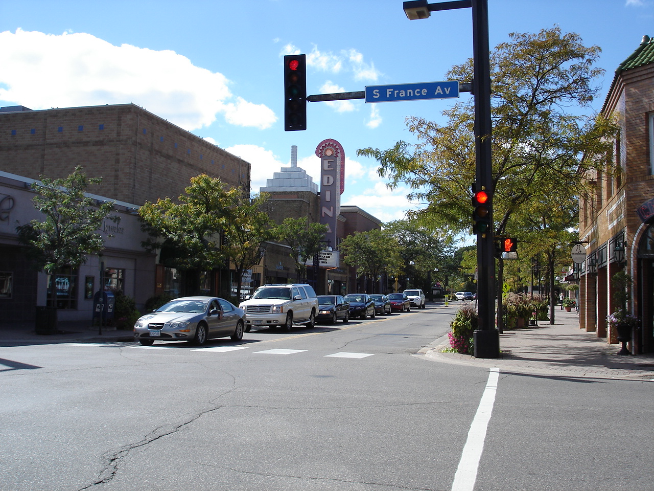


Edina, Minnesota
Edina is a city of 53,262 people in Hennepin County, Minnesota, founded in December 18, 1888.
Why visit Edina
Townapedia lists 45 museums and landmarks, 105 parks and trails, 233 places to eat, 17 places to stay and 17 attractions in and around town.
Highlights include Bridge No. 90646, Interlachen Bridge, Floyd B. Olson House and Minnehaha Grange Hall.
July is the warmest month, with average highs of 83°F; January lows average 9°F, and about 51 inches of snow fall in a normal year.
Weather in Edina
Forecast from the National Weather Service. Full forecast
About Edina
Edina (locally ee-DY-nə, ih-DY-nə) is a city in Hennepin County, Minnesota, United States and a first-ring suburb of Minneapolis. The population was 53,494 at the 2020 census, making it the 18th most populous city in Minnesota.
From the Wikipedia article Edina, Minnesota (this version), under CC BY-SA 4.0.
Things to do17

Bridge No. 90646
Bridge · National Register of Historic Places · 1.9 mi
Road bridge over Minnehaha Creek in Edina, Minnesota
Interlachen Bridge
Bridge · National Register of Historic Places · 3.7 mi
Bridge in Minneapolis, Minnesota, United States of America




Bethany Global University
School · 2.2 mi
Bloomington, Minnesota, United States
Bryant-Lake Bowl
Cinema and theater · 5.2 mi
Bowling alley, restaurant, bar, and theatre in Minnesota

Cedar Lake East Beach
Beach · 5.2 mi
Beach in Minneapolis, Minnesota, United States
Minnesota Life College
School · 3.2 mi
Postsecondary education program for adults with Autism
Northwestern Health Sciences University
School · 3.7 mi
Bloomington, Minnesota
Rasmussen University
School · 2.5 mi
Private university in the United States
5 more on the map.
Museums and landmarks45

Floyd B. Olson House
Monument and historic site · National Register of Historic Places · 3.2 mi
Historic house in Minnesota, United States
1914 West 49th Street, Minneapolis

Minnehaha Grange Hall
Monument and historic site · National Register of Historic Places · 1.4 mi
Building in Edina, Minnesota, United States
Th 09:00-12:00; Sa 10:00-12:00


Queen Avenue Bridge
Bridge · National Register of Historic Places · 3.3 mi
Bridge in Minneapolis, Minnesota
Arthur and Edith Lee House
Monument and historic site · National Register of Historic Places · 5.1 mi
Historic house in Minnesota, United States
Buzza Company Building
Monument and historic site · National Register of Historic Places · 5.2 mi
Building in Minneapolis, Minnesota, United States
Cahill School
Monument and historic site · National Register of Historic Places · 1.4 mi
School building in Edina, United States of America
Calhoun Beach Club
Monument and historic site · National Register of Historic Places · 4.6 mi
Historic building in Minnesota, United States of America
Charles and Grace Parker House
Monument and historic site · National Register of Historic Places · 3.8 mi
Historic house in Minneapolis, Minnesota
Chicago, Milwaukee, St. Paul and Pacific Depot
Monument and historic site · National Register of Historic Places · 3.2 mi
Railway station in St. Louis Park, the United States of America
Country Club District
Monument and historic site · National Register of Historic Places · 2.0 mi
Listed on the NRHP in Minnesota
Dr. Oscar Owre House
Monument and historic site · National Register of Historic Places · 5.3 mi
Historic house in Minneapolis, Minnesota
Frieda and Henry J. Neils House
Monument and historic site · National Register of Historic Places · 5.1 mi
Historic house in Minnesota, United States
33 more on the map.
Parks, trails and playgrounds105

Centennial Lakes Park
Park · 2.4 mi
Park in Edina, Minnesota, United States
Lyndale Park
Park · 4.0 mi
City park in Minneapolis, Minnesota, United States


93 more on the map.
Restaurants and cafes233

Red Cow 50th & France
Diner · American · 2.2 mi
Providing a sophisticated twist on the classic neighborhood tavern, Red Cow celebrates finely crafted eats and drinks with a focus on...
3624 West 50th Street, Minneapolis
Tu-Th 11:00-22:00; Fr 11:00-23:00; Sa 10:00-23:00; Su 10:00-22:00

Starbucks
Cafe · Coffee Shop · 1.4 mi
5121 Gus Young Lane, Vernon Shops
Mo-Fr 05:30-20:00; Sa,Su 06:00-19:30

Blaze Pizza
Restaurant · Pizza · 3.4 mi
8126 Minnesota State Highway 7, Saint Louis Park
Mo-Su 11:00-22:00
Caribou Coffee
Cafe · Coffee Shop · 3.4 mi
8208 Minnesota State Highway 7, Saint Louis Park
Mo-Fr 06:30-18:00; Sa,Su 07:00-18:00
Cocina del Barrio
Restaurant · Mexican · 2.0 mi
5036 France Avenue South
Mo-Th,Su 11:00-21:00; Fr-Sa 11:00-23:00
Coconut Thai
Restaurant · Thai · 2.1 mi
3948 West 50th Street, Edina
Mo-Sa 11:00-21:00; Su 16:00-20:00
D'Amico & Sons
Restaurant · Italian · 2.0 mi
3948 West 50th Street, Edina
Su-We 11:00-20:00; Th-Sa 11:00-21:00

General Sports Bar
Bar and pub · American · 2.1 mi
5034 France Avenue South
Mo-Th 08:00-23:00; Fr 08:00-01:00; Sa 09:00-01:00; Su 09:00-23:00
Great Wall Chinese Restaurant
Restaurant · Chinese · 2.6 mi
4515 France Avenue South, Edina
Su-Th 11:00-21:30; Fr,Sa 11:00-22:00
Haven Asian Eatery
Restaurant · Lao, Thai · 2.9 mi
6407 City West Parkway
Mo-Sa 11:00-20:30; Su 12:00-20:00
221 more on the map.
Where to stay17
Best Western Bloomington Edina - Minneapolis
Motel and hotel · 2.7 mi
4201 American Boulevard West, Bloomington
DoubleTree by Hilton Hotel Bloomington - Minneapolis South
Motel and hotel · 2.0 mi
7800 Normandale Boulevard, Bloomington
Renaissance Minneapolis Bloomington Hotel
Motel and hotel · 2.4 mi
5500 American Boulevard West, Bloomington
Churches and places of worship45
Church of the Incarnation
Church · National Register of Historic Places · 4.8 mi
Saint Stephen Lutheran Church
Church · Evangelical Lutheran · 3.1 mi
8400 France Avenue South, Bloomington
Lake Harriet United Methodist Church
Church · Methodist · 2.3 mi
4901 Chowen Avenue South, Minneapolis
Shopping62
Gas and EV charging25
Schools, colleges and libraries67
Linden Hills Library
Library · National Register of Historic Places · 3.2 mi
2900 West 43rd Street, Minneapolis
Healthcare35
Park Nicollet Specialty Center at Methodist Hospital
Clinic and pharmacy · 2.7 mi
3931 Louisiana Avenue South
Map of Edina
250 places. The map loads OpenStreetMap tiles when you open it.
Climate by month
Monthly table
| Month | High | Low | Rain | Snow |
|---|---|---|---|---|
| Jan | 24°F | 9°F | 0.9 in | 11.0 in |
| Feb | 28°F | 13°F | 0.9 in | 9.5 in |
| Mar | 42°F | 25°F | 1.7 in | 8.2 in |
| Apr | 57°F | 38°F | 2.9 in | 3.5 in |
| May | 69°F | 50°F | 3.9 in | 0.0 in |
| Jun | 79°F | 60°F | 4.6 in | 0.0 in |
| Jul | 83°F | 65°F | 4.1 in | 0.0 in |
| Aug | 81°F | 63°F | 4.3 in | 0.0 in |
| Sep | 73°F | 54°F | 3.0 in | 0.0 in |
| Oct | 58°F | 41°F | 2.6 in | 0.8 in |
| Nov | 42°F | 28°F | 1.6 in | 6.8 in |
| Dec | 29°F | 15°F | 1.2 in | 11.4 in |
U.S. Climate Normals 1991-2020 for Minneapolis/St Paul Ap Gsn Hcn 72658 (6 mi away), NOAA NCEI.
People and cost of living
American Community Survey 5-year estimates, 2020-2024, U.S. Census Bureau. Estimates have margins of error, larger for small towns.
Disaster history
Hennepin County has had 10 federal disaster declarations since 2000, most often for floods.
- 2020-04-07: Covid-19 Pandemic (Biological)
- 2020-03-13: Covid-19 (Biological)
- 2016-11-02: Severe Storms And Flooding (Flood)
- 2014-07-21: Severe Storms, Straight-Line Winds, Flooding, Landslides, And Mudslides (Flood)
- 2013-07-25: Severe Storms, Straight-Line Winds, And Flooding (Severe Storm)
- 2011-06-07: Severe Storms And Tornadoes (Severe Storm)
OpenFEMA disaster declarations summaries.
Getting there and nearby towns
Flying Cloud Airport (FCM) is the nearest airport with scheduled flights listed in OpenStreetMap, 7 miles away.
- Bloomington 5 mi southeast, about 8 min by car
- Eden Prairie 6 mi southwest, about 9 min by car
- Minneapolis 7 mi northeast, about 11 min by car
- Burnsville 10 mi southeast, about 15 min by car
- Crystal 10 mi north, about 16 min by car
- Eagan 11 mi southeast, about 18 min by car
- Chanhassen 11 mi west, about 17 min by car
- Brooklyn Center 12 mi north, about 20 min by car
- St. Paul 13 mi east, about 21 min by car
- Apple Valley 13 mi southeast, about 21 min by car
Drive times are estimates from straight-line distance, not routes.
Local news
Headlines from INDB, the NEMICO news database.
Reviews, tips and questions
Loading what members have shared...
Sources and licences
- NCES EDGE (Public domain): public schools
- NOAA NCEI U.S. Climate Normals 1991-2020 (Public domain): climate by month
- OpenFEMA (Public domain): disaster declarations
- OpenStreetMap contributors (ODbL 1.0): places, airports, map data
- U.S. Census Bureau (Public domain): population, income, housing, education, commute
- Wikidata (CC0 1.0): elevation, founding date, time zone, website, landmarks and historic places
- Wikimedia Commons (see each image): photos
- Wikipedia (CC BY-SA 4.0): overview and history text
Photo credits
- 50thandFrance, Gephart at English Wikipedia, CC BY-SA 3.0
- Flock Safety License Plate Reader in Edina, Minnesota (55558698287), Tony Webster, CC BY 4.0
- CP H21, Edina, chief_huddleston, CC BY 2.0
- Edina Library, McGhiever, CC BY-SA 4.0
- Edina K-9 Memorial - Statue, Cfeast, CC BY-SA 4.0
- Edina K-9 Memorial - Diesel, Cfeast, CC BY-SA 4.0
- Edina K-9 Memorial - Blade, Cfeast, CC BY-SA 4.0
- Edina K-9 Memorial - Kodiak, Cfeast, CC BY-SA 4.0
- Edina K-9 Memorial - Jet, Cfeast, CC BY-SA 4.0
- Edina, MN City Hall Front Bike Rack, Cfeast, CC BY-SA 4.0
- Edina City Hall Public Charger 1, Cfeast, CC BY-SA 4.0
- Edina City Hall Public Charger 2, Cfeast, CC BY-SA 4.0
- Edina City Hall Public Charger 3, Cfeast, CC BY-SA 4.0
- Edina City Hall, Widgetkid, CC BY-SA 4.0
- Edina City Hall Public Charger 4, Cfeast, CC BY-SA 4.0
- Train on Dan Patch Line in Edina, Minnesota, Peterk17700, CC BY-SA 3.0
- Wild flowers - Edina, Minnesota, Christian Collins, CC BY-SA 4.0
- Linden Hills Branch Library, Teemu008, CC BY-SA 2.0
- Queen Ave Bridge, McGhiever, CC BY-SA 4.0
- Floyd B. Olson House 2, Elkman, CC BY-SA 4.0
- Vulgichneumon brevicinctor 4955342, Mathew, CC BY 4.0
- Pelecinobaccha costata - iNaturalist 315009612, Rose Zappa, CC BY 4.0
- Thaumatomyia glabra 148172370, Mathew Zappa, CC BY 4.0
- Thaumatomyia glabra 148172317, Mathew Zappa, CC BY 4.0
- Ypsolopha dentella 111995947, Mathew, CC BY 4.0
- Nomada superba, Mathew* Zappa, CC BY 4.0
- Kasey Lansdale, 2015, PKDASD, CC BY-SA 4.0
- Tuva on globe bank, Dsscod, CC BY-SA 4.0
- Mallard Duck, Chaithanya Krishnan, CC BY-SA 3.0
- Fragrant chamomile (Unsplash), chaithanya krishnan chaithanya_krishnan, CC0
- PXL 20211107 222955341, Dackdotcom, CC BY-SA 4.0
- Ingebretsens Bird String, John2690-john2690, CC BY-SA 4.0
- Minnehaha Grange Hall, McGhiever, CC BY-SA 4.0
- Cahill School, McGhiever, CC BY-SA 4.0
- Minnehaha Grange 4, Elkman, CC BY-SA 3.0
- Cahill School 3, Elkman, CC BY-SA 3.0
- France & 58th Station SB Eline Construction, Maxorca, CC BY-SA 4.0
- Merrill Lynch entrance (34687803734), Sean Hayford Oleary, CC BY 2.0
- Bank of America Southdale (34687807744), Sean Hayford Oleary, CC BY 2.0
- Bridge 90646 West View 01, Elkman, CC BY-SA 3.0


Page built October 30, 2026. Spotted a mistake? Tell us or suggest a place.