
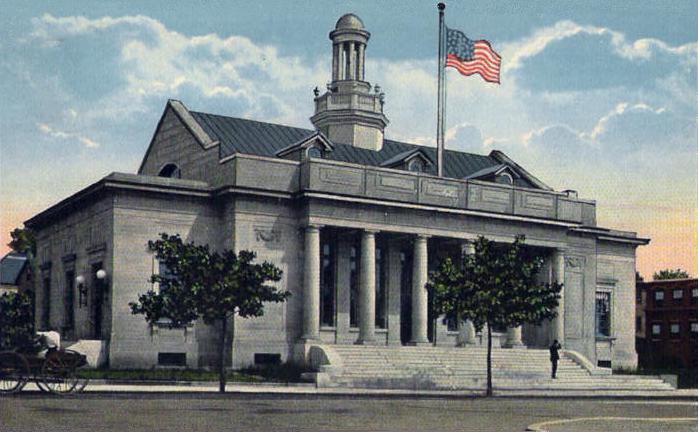


Beverly, Massachusetts
Beverly is a city of 42,665 people in Essex County, Massachusetts, founded in 1626.
Why visit Beverly
Townapedia lists 136 museums and landmarks, 134 parks and trails, 98 places to eat, 8 places to stay and 22 attractions in and around town.
Highlights include Cabot Theatre, Derby Wharf Light, Fort Sewall and Bakers Island Light.
July is the warmest month, with average highs of 80°F; January lows average 18°F, and about 51 inches of snow fall in a normal year.
Weather in Beverly
Forecast from the National Weather Service. Full forecast
About Beverly
Beverly is a city in Essex County, Massachusetts, United States, and a suburb of Boston. The population was 42,670 at the time of the 2020 United States census. A resort, residential, and manufacturing community on the Massachusetts North Shore, Beverly includes Ryal Side, North Beverly, Centerville, Cove, Montserrat, Beverly Farms and Prides Crossing. Beverly is a rival of Marblehead for the title of "birthplace of the U.S.
From the Wikipedia article Beverly, Massachusetts (this version), under CC BY-SA 4.0.
Things to do22

Cabot Theatre
Cinema and theater · 1.8 mi
Nonprofit performing arts venue located at 286 Cabot Street in Beverly, Massachusetts. Originally opened in 1920
286 Cabot Street, Beverly

Derby Wharf Light
Lighthouse · 3.4 mi
One of four lighthouses used to navigate Salem Sound, the Derby Wharf Light Station is the wharf's only original surviving structure.

10 more on the map.
Museums and landmarks136

Fort Sewall
Monument and historic site · National Register of Historic Places · 3.3 mi
Fort in Massachusetts

Bakers Island Light
Monument and historic site · National Register of Historic Places · 3.3 mi
Lighthouse in Essex County, Massachusetts, United States

Derby Waterfront District
Monument and historic site · National Register of Historic Places · 3.3 mi
Historic district in Massachusetts, United States
Fish Flake Hill Historic District
Monument and historic site · National Register of Historic Places · 2.0 mi
Historic district in Massachusetts, United States
Greenlawn Cemetery
Monument and historic site · National Register of Historic Places · 3.4 mi
Cemetery in Salem, Massachusetts

Abbot Hall
Monument and historic site · National Register of Historic Places · 3.8 mi
United States historic place

Bessie Monroe House
Monument and historic site · National Register of Historic Places · 3.4 mi
Historic house in Massachusetts, United States

Beverly Depot
Monument and historic site · National Register of Historic Places · 2.2 mi
Railway station in Beverly, Massachusetts

Bridge Street Neck Historic District
Monument and historic site · National Register of Historic Places · 2.9 mi
Historic district in Massachusetts, United States
Brown House
Monument and historic site · National Register of Historic Places · 4.1 mi
Historic house in Hamilton, Massachusetts, USA
Capt. John Thorndike House
Monument and historic site · National Register of Historic Places · 1.7 mi
Historic house in Massachusetts, United States
Captain Robert Haskell House
Monument and historic site · National Register of Historic Places · 1.4 mi
House in Beverly, Massachusetts
124 more on the map.
Parks, trails and playgrounds134


Salem Maritime National Historical Park
Park · National Register of Historic Places · 3.3 mi
U.S. National Historical Park in Salem, Massachusetts
160 Derby Street, Salem

Lynch Park
Park · 1.1 mi
Please check website for bathhouse and parking hours.
55 Ober Street, Beverly
Mo-Su 06:00-22:00

Derby Wharf
Park · 3.4 mi
Begun in 1762 and completed in 1806, it extends 2,045 feet into the Salem Harbor. At one time, it was home to nearly twenty structures,...
Derby Street, Salem



122 more on the map.
Restaurants and cafes98

The Cotton Mill Cafe
Cafe · Sandwich, Ice Cream, Greek · 1.8 mi
Relaxing Cafe with Healthy Options and Great Ice Cream
480 Rantoul Street, Beverly
Mo 07:00-20:00, We-Th 07:00-20:00, Fr-Su 07:00-21:00

Anchor Pub and Grill
Restaurant · Seafood, Pizza, Italian, Sandwich, Burger · 2.3 mi
20 Cabot Street, Beverly
Mo-Su 08:00-01:00
Beverly House of Pizza
Restaurant · Pizza · 2.3 mi
24 Cabot Street, Beverly
Mo-Sa 10:00-21:00, Su closed
Coffee Time
Cafe · Coffee Shop, Donut, Pastry, Sandwich, Pizza, Cake · 3.0 mi
96 Bridge Street, Salem
05:00-23:00
Essex's NY Pizza & Deli
Restaurant · Pizza · 3.4 mi
2 East India Square Mall, Salem
Mo-Tu 11:00-20:30; We-Sa 11:00-21:00; Su 11:30-19:30
Jaho Coffee Roaster & Wine Bar
Cafe · Coffee Shop · 3.3 mi
197 Derby Street, Salem
Mo-Fr 07:00-23:00; Sa 07:30-23:00; Su 07:30-22:00
Kakawa Chocolate House
Cafe · Chocolate, Ice Cream, Coffee Shop · 3.4 mi
173 Essex Street, Salem
Th-Su 11:00-18:00
Kokeshi & Bambolina
Restaurant · Pizza, Ramen · 3.5 mi
288 Derby Street, Salem
Mo-Th 11:30-20:30; Fr 11:30-21:30; Sa 11:00-21:30; Su 11:00-20:30
Maitland Farm
Restaurant · American, Regional · 3.0 mi
84 Derby Street, Salem
We-Th 11:30-16:00; Fr-Sa 11:30-20:30; Su 11:30-16:00
86 more on the map.
History
Native Americans inhabited what would become northeastern Massachusetts for thousands of years before the European colonization of the Americas. At the time of European contact in the early 1600s, the area that would become Beverly was between an important Naumkeag settlement in present-day Salem and Agawam settlements on Cape Ann, with probable indigenous settlement sites at the mouth of the Bass River. During the early contact period, virgin soil epidemics ravaged native populations, reducing the indigenous population within the present boundaries of Beverly from an estimated 200 to less than 50 if there were any survivors.
English colonists, under Roger Conant's leadership, first colonized the area in 1626 as part of the Massachusetts Bay Colony. Initially part of Salem, Beverly would be set off and officially incorporated in 1668, when it was named after Beverley, the county town of the East Riding of Yorkshire, England. Surviving from the settlement's early history is the John Balch House, built, according to dendrochronological testing performed in 2006, about 1679.
From the History section of Beverly, Massachusetts on Wikipedia, under CC BY-SA 4.0.
Where to stay8
The Salem Waterfront Hotel & Suites
Motel and hotel · 3.4 mi
223;225;231 Derby Street
Churches and places of worship19
Immaculate Conception Church
Church · Roman Catholic · 3.3 mi
15 Hawthorne Boulevard
St. Peter's Episcopal Church
Church · Anglican · 3.4 mi
24 Saint Peter Street, Salem
Shopping45
Gas and EV charging5
Schools, colleges and libraries89
Healthcare2
Map of Beverly
250 places. The map loads OpenStreetMap tiles when you open it.
Climate by month
Monthly table
| Month | High | Low | Rain | Snow |
|---|---|---|---|---|
| Jan | 37°F | 18°F | 3.7 in | 16.0 in |
| Feb | 39°F | 18°F | 3.6 in | 16.4 in |
| Mar | 45°F | 25°F | 4.6 in | 7.6 in |
| Apr | 57°F | 34°F | 4.2 in | 1.4 in |
| May | 66°F | 44°F | 3.5 in | 0.0 in |
| Jun | 75°F | 54°F | 4.0 in | 0.0 in |
| Jul | 80°F | 60°F | 3.4 in | 0.0 in |
| Aug | 79°F | 58°F | 3.4 in | 0.0 in |
| Sep | 72°F | 51°F | 3.8 in | 0.0 in |
| Oct | 61°F | 40°F | 5.0 in | 0.3 in |
| Nov | 51°F | 31°F | 4.0 in | 0.9 in |
| Dec | 42°F | 24°F | 4.8 in | 8.8 in |
U.S. Climate Normals 1991-2020 for Beverly (2 mi away), NOAA NCEI.
People and cost of living
American Community Survey 5-year estimates, 2020-2024, U.S. Census Bureau. Estimates have margins of error, larger for small towns.
Disaster history
Essex County has had 26 federal disaster declarations since 2000, most often for severe storms.
- 2023-09-15: Hurricane Lee (Hurricane)
- 2020-03-27: Covid-19 Pandemic (Biological)
- 2020-03-13: Covid-19 (Biological)
- 2018-07-19: Severe Winter Storm And Snowstorm (Snowstorm)
- 2018-06-25: Severe Winter Storm And Flooding (Severe Storm)
- 2015-04-13: Severe Winter Storm, Snowstorm, And Flooding (Severe Storm)
OpenFEMA disaster declarations summaries.
Getting there and nearby towns
Beverly Municipal Airport (BVY) is the nearest airport with scheduled flights listed in OpenStreetMap, 4 miles away.
- Lynn 8 mi southwest, about 13 min by car
- Boston 18 mi southwest, about 28 min by car
- Cambridge 19 mi southwest, about 30 min by car
- Arlington 19 mi southwest, about 30 min by car
- Amesbury 21 mi north, about 34 min by car
- Quincy 22 mi south, about 36 min by car
- Lowell 25 mi west, about 40 min by car
- Abington 31 mi south, about 50 min by car
- Brockton 34 mi south, about 55 min by car
- Manchester 42 mi northwest, about 1 h 15 min by car
Drive times are estimates from straight-line distance, not routes.
Local news
Headlines from INDB, the NEMICO news database.
Reviews, tips and questions
Loading what members have shared...
Sources and licences
- NCES EDGE (Public domain): public schools
- NOAA NCEI U.S. Climate Normals 1991-2020 (Public domain): climate by month
- OpenFEMA (Public domain): disaster declarations
- OpenStreetMap contributors (ODbL 1.0): places, airports, map data
- U.S. Census Bureau (Public domain): population, income, housing, education, commute
- Wikidata (CC0 1.0): elevation, founding date, time zone, website, landmarks and historic places
- Wikimedia Commons (see each image): photos
- Wikipedia (CC BY-SA 4.0): overview and history text
Photo credits
- Beverly Main Post Office, Beverly, MA, Unknown author Unknown author, Public domain
- Derby House, Fletcher6, CC BY-SA 3.0
- Fort Sewall Stockade, Fletcher6, CC BY-SA 3.0
- Salem Greenlawn Cemetery 3, Magicpiano, CC BY-SA 3.0
- Bakers island light, Arwcheek ( talk ), Public domain
- BeverlyMA FrontStreet, User:Magicpiano, CC BY-SA 4.0
- Hawkes House Salem MA NPS, National Park Service, Public domain
- John Glover House, Fletcher6, CC BY-SA 3.0
- Nathaniel Bowditch House - Salem, Massachusetts, Daderot at en.wikipedia, CC BY-SA 3.0
- Jeremiah Lee Mansion - Marblehead, MA, Daderot at English Wikipedia, CC BY-SA 3.0
- BeverlyMA PeterWoodburyHouse, Magicpiano, CC BY-SA 3.0
- BeverlyMA SamuelCorningHouse, Magicpiano, CC BY-SA 3.0
- PeabodyMA MooreHillHouse, User:Magicpiano, CC BY-SA 4.0
- BeverlyMA OliverWendellHolmesHouse, Magicpiano, CC BY-SA 3.0
- BeverlyMA ExerciseConantHouse, User:Magicpiano, CC BY-SA 4.0
- Gen. Gideon Foster House, Peabody MA, John Phelan, CC BY 3.0
- Larch Farm, Wenham MA, John Phelan, CC BY 3.0
- Claflin-Richards House - Wenham, MA - front view, Daderot., CC BY-SA 3.0
- MarbleheadMA HarrisFarm, User:Magicpiano, CC BY-SA 4.0
- James Friend House, Fletcher6, CC BY-SA 3.0
- PeabodyMA CivicCenterHD, User:Magicpiano, CC BY-SA 4.0
- Manchester First Parish Church, Fletcher6, CC BY-SA 3.0
- Wenham Town Hall, Fletcher6, CC BY-SA 3.0
- Hospital Point from Beverly Harbor, User:jakers3200, CC BY-SA 3.0
- Hamilton Hall (Salem), Fletcher6, CC BY-SA 3.0
- John Peabody House, Fletcher6, CC BY-SA 3.0
- George Peabody House, Fletcher6, CC BY-SA 3.0
- Fort Pickering 7, Michelle A Leppert, CC BY-SA 3.0
- Salem YMCA, Fletcher6, CC BY-SA 3.0
- WenhamMA OldFarm, User:Magicpiano, CC BY-SA 4.0
- Historic Marblehead, Marcbela (Marc N. Belanger), Public domain
- Sutton House, Peabody MA, John Phelan, CC BY 3.0
- Peabody City Hall, MA, John Phelan, CC BY 3.0
- Peabody Institute Library of Danvers, Fletcher6, CC BY-SA 3.0
- Beverly Depot (MBTA station), Fletcher6, CC BY-SA 3.0
- Bessie Monroe House, Fletcher6, CC BY-SA 3.0
- First Universalist Church, Salem MA, John Phelan, CC BY 3.0
- Hazadiah Smith House, Fletcher6, CC BY-SA 3.0
- Fowler House, Fletcher6, CC BY-SA 3.0
- SalemMA BridgeStreet, User:Magicpiano, CC BY-SA 4.0


Page built October 30, 2026. Spotted a mistake? Tell us or suggest a place.