
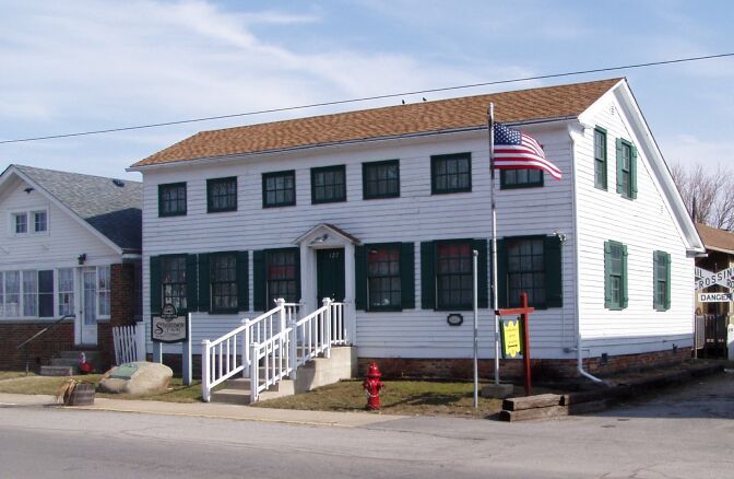


Hebron, Indiana
Hebron is a town of 3,976 people in Porter County, Indiana, founded in 1849.
Why visit Hebron
Townapedia lists 3 museums and landmarks, 1 park or trail and 8 places to eat in and around town.
Highlights include Eli Sigler House and Clinton D. Gilson Barn.
Weather in Hebron
Forecast from the National Weather Service. Full forecast
About Hebron
Hebron is a town in Boone Township, Porter County, Indiana, United States. The population was 3,755 as of the 2020 census.
From the Wikipedia article Hebron, Indiana (this version), under CC BY-SA 4.0.
Museums and landmarks3

Eli Sigler House
Monument and historic site · National Register of Historic Places · 0.5 mi
Historic house in Indiana, United States
Clinton D. Gilson Barn
Monument and historic site · National Register of Historic Places · 2.1 mi

Parks, trails and playgrounds1

Restaurants and cafes8

First Brew Coffee Company
Cafe · Coffee Shop · 0.4 mi
800 Country Square Plaza, Hebron
Mo-Sa 07:00-12:00

Bronko's Pizza
Restaurant · Pizza · 0.4 mi
725 North Main Street, Hebron
Mo-Th 16:00-21:30; Fr 15:00-22:00; Sa 11:00-22:00; 11:00-20:00

Pav's Grill
Diner · American · 0.4 mi
642 North Main Street, Hebron
Su-Th 10:30-20:00; Fr-Sa 10:30-21:00
Tres Amigos
Restaurant · Mexican · 0.5 mi
816 Country Square Plaza, Hebron
Mo-Sa 11:00-21:00; Su 11:00-20:00

Subway
Fast food · Sandwich
615 North Main Street, Hebron
Mo-Su 10:00-20:00
Churches and places of worship3



History
The first settler to Hebron was Judge Jesse Johnson (1st Judge of the Porter County Probate Court. The area of Hebron was an open prairie interspersed with small groves of trees. The prairie was about 2.5 miles (4.0 km) long by 0.75 miles (1.21 km) wide. About 0.5 miles (0.80 km) south was the Potawatomi village of Hauakiki. Locally the village was called "Indian Town."
The area chosen for settlement was referred to as "The Corners" as this was where two roads crossed. Hebron was laid out in 1841. The first homes were of log construction. In 1849, Mr. McCune built the "Tavern" as the first frame structure. The tavern continued in use as a tavern until 1936. In 1838, a Rev. Hannan organized the Bethlehem Church of Associate Reform Presbyterians. Later the church changed its name from "Bethlehem" to "Hebron." In 1845, Rev. Blain of the Hebron Church of Associate Reform Presbyterians petitioned for a post office named after his church. The post office was established that year and the town got its name.
From the History section of Hebron, Indiana on Wikipedia, under CC BY-SA 4.0.
Gas and EV charging2
Schools, colleges and libraries9
Healthcare2
Map of Hebron
28 places. The map loads OpenStreetMap tiles when you open it.
People and cost of living
American Community Survey 5-year estimates, 2020-2024, U.S. Census Bureau. Estimates have margins of error, larger for small towns.
Disaster history
Porter County has had 12 federal disaster declarations since 2000, most often for floods.
- 2026-08-25: Severe Storms, Straight-Line Winds, Tornadoes, And Flooding (Flood)
- 2026-08-15: Severe Storms, Straight-Line Winds, Tornadoes, And Flooding (Flood)
- 2026-01-24: Severe Winter Storm (Winter Storm)
- 2020-04-03: Covid-19 Pandemic (Biological)
- 2020-03-13: Covid-19 (Biological)
- 2018-05-04: Severe Storms And Flooding (Flood)
OpenFEMA disaster declarations summaries.
Getting there and nearby towns
Porter County Regional Airport (VPZ) is the nearest airport with scheduled flights listed in OpenStreetMap, 14 miles away.
- Crown Point 9 mi northwest, about 15 min by car
- DeMotte 9 mi south, about 14 min by car
- Aberdeen 9 mi northeast, about 15 min by car
- Lake Dalecarlia 10 mi west, about 16 min by car
- Merrillville 12 mi northwest, about 19 min by car
- Lowell 12 mi west, about 19 min by car
- Valparaiso 13 mi northeast, about 21 min by car
- Cedar Lake 13 mi west, about 21 min by car
- Hobart 14 mi north, about 22 min by car
- St. John 16 mi northwest, about 26 min by car
Drive times are estimates from straight-line distance, not routes.
Local news
Headlines from INDB, the NEMICO news database.
Reviews, tips and questions
Loading what members have shared...
Sources and licences
- NCES EDGE (Public domain): public schools
- OpenFEMA (Public domain): disaster declarations
- OpenStreetMap contributors (ODbL 1.0): places, airports, map data
- U.S. Census Bureau (Public domain): population, income, housing, education, commute
- Wikidata (CC0 1.0): elevation, founding date, time zone, website, landmarks and historic places
- Wikimedia Commons (see each image): photos
- Wikipedia (CC BY-SA 4.0): overview and history text
Photo credits
- Hebron Indiana Stagecoach Inn 03, Chris Light ( talk ), CC BY-SA 3.0
- Hebron, Indiana (7981668775), Ken Lund from Reno, Nevada, USA, CC BY-SA 2.0
- Hebron High School, ONUnicorn, CC BY-SA 4.0
- Clinton Gilson Barn P7240026, Chris Light at en.wikipedia, CC BY-SA 3.0
- Memorial 2018-10-05 074, Chris Light, CC BY-SA 4.0
- Eli Sigler House, Nyttend, Public domain
Page built October 30, 2026. Spotted a mistake? Tell us or suggest a place.