
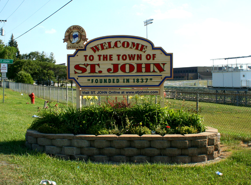


St. John, Indiana
St. John is a town of 22,567 people in Lake County, Indiana, founded in 1837.
Why visit St. John
Townapedia lists 2 museums and landmarks, 25 parks and trails, 10 places to eat, 2 places to stay and 2 attractions in and around town.
Highlights include Hyles–Anderson College, Sauzer's Kiddieland, Francis P. Keilman House and Meyer's Castle.
Weather in St. John
Forecast from the National Weather Service. Full forecast
About St. John
St. John or Saint John is a town in Lake County, Indiana, United States. St. John is located in St. John Township, Hanover Township, and Center Township. It is a southeastern suburb of Chicago. St.
From the Wikipedia article St. John, Indiana (this version), under CC BY-SA 4.0.
Things to do2

Hyles–Anderson College
School · 3.7 mi
Baptist college in Indiana, U.S.

Sauzer's Kiddieland
Monument and historic site · 3.5 mi
Former amusement park in Schererville, Indiana, United States
Museums and landmarks2
Francis P. Keilman House
Monument and historic site · National Register of Historic Places · 0.7 mi
Historic house in Indiana, United States


Meyer's Castle
Monument and historic site · National Register of Historic Places · 3.8 mi
Building in Indiana, United States
Parks, trails and playgrounds25

Cedar Creek Family Golf Center
Golf course · 2.0 mi
10483 West 109th Avenue, Cedar Lake


13 more on the map.
Restaurants and cafes10

Pepino's Italian Restaurant
Restaurant · Italian · 2.6 mi
2410 Ontario Street, Schererville
Su, Tu-Th 11:00-20:00; Fr-Sa 11:00-21:00


History
The St. John post office was established in 1846. The community took its name from Saint Johns Church. The Church was the first church in Lake County and was founded by German immigrant John Hack.
St. John is home to the Shrine of Christ's Passion, opened in 2008. An interactive display of the Passion of Christ, it contains 40 life-size statues depicting the time from the Agony in the Garden all the way to the Resurrection. It has attracted visitors from all 50 US states and more than 40 countries.
The Francis P. Keilman House was listed in the National Register of Historic Places in 2013.
From the History section of St. John, Indiana on Wikipedia, under CC BY-SA 4.0.
Where to stay2
Churches and places of worship9
Saint George Greek Orthodox Church
Church · Greek Orthodox · 2.6 mi
528 West 77th Avenue, Schererville
St. John the Evangelist Parish
Church · Roman Catholic · 1.3 mi
10701 Olcott Avenue, St. John
Community United Reformed Church
Church · United Reformed · 1.7 mi
8405 Alexander Street, Schererville
Cornerstone Protestant Reformed Church
Church · Protestant · 2.1 mi
13251 West 109th Avenue, Dyer
Shopping4
Gas and EV charging6
Schools, colleges and libraries31
Illiana Christian High School
School · 2.7 mi
10904 Calumet Avenue, Dyer
Healthcare1
Map of St. John
92 places. The map loads OpenStreetMap tiles when you open it.
People and cost of living
American Community Survey 5-year estimates, 2020-2024, U.S. Census Bureau. Estimates have margins of error, larger for small towns.
Disaster history
Lake County has had 19 federal disaster declarations since 2000, most often for severe storms.
- 2026-08-25: Severe Storms, Straight-Line Winds, Tornadoes, And Flooding (Flood)
- 2026-08-15: Severe Storms, Straight-Line Winds, Tornadoes, And Flooding (Flood)
- 2026-01-24: Severe Winter Storm (Winter Storm)
- 2023-04-15: Severe Storms, Straight-Line Winds, And Tornadoes (Severe Storm)
- 2020-04-03: Covid-19 Pandemic (Biological)
- 2020-03-13: Covid-19 (Biological)
OpenFEMA disaster declarations summaries.
Getting there and nearby towns
Gary/Chicago International Airport (GYY) is the nearest airport with scheduled flights listed in OpenStreetMap, 12 miles away.
- Dyer 4 mi northwest, about 7 min by car
- Cedar Lake 5 mi south, about 8 min by car
- Griffith 6 mi north, about 10 min by car
- Crown Point 7 mi east, about 11 min by car
- Highland 7 mi north, about 12 min by car
- Munster 8 mi north, about 12 min by car
- Merrillville 8 mi east, about 13 min by car
- Lansing 9 mi northwest, about 15 min by car
- Chicago Heights 10 mi northwest, about 16 min by car
- Hobart 11 mi northeast, about 18 min by car
Drive times are estimates from straight-line distance, not routes.
Local news
Headlines from INDB, the NEMICO news database.
Reviews, tips and questions
Loading what members have shared...
Sources and licences
- NCES EDGE (Public domain): public schools
- OpenFEMA (Public domain): disaster declarations
- OpenStreetMap contributors (ODbL 1.0): places, airports, map data
- U.S. Census Bureau (Public domain): population, income, housing, education, commute
- Wikidata (CC0 1.0): elevation, founding date, time zone, website, landmarks and historic places
- Wikimedia Commons (see each image): photos
- Wikipedia (CC BY-SA 4.0): overview and history text
Photo credits
- StJohnIN, JoeyBLS ( talk ), Public domain
- Joseph Ernest Meyer House through the trees, Nyttend, Public domain
- Francis P. Keilman House, Nyttend, Public domain
- Our Lady of the New Millenium - panoramio, hakkun, CC BY-SA 3.0
- Hypericum swinkianum, cassi saari, CC BY-SA 4.0
Page built October 30, 2026. Spotted a mistake? Tell us or suggest a place.