
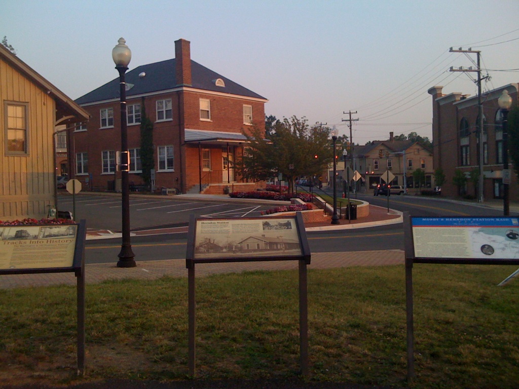


Herndon, Virginia
Herndon is a town of 24,672 people in Fairfax County, Virginia, founded in 1858.
Why visit Herndon
Townapedia lists 12 museums and landmarks, 34 parks and trails, 216 places to eat, 18 places to stay and 7 attractions in and around town.
Highlights include AMC Worldgate 9, Lake Fairfax Park, Herndon Depot Museum and Herndon Historic District.
July is the warmest month, with average highs of 88°F; January lows average 25°F, and about 21 inches of snow fall in a normal year.
Weather in Herndon
Forecast from the National Weather Service. Full forecast
About Herndon
Herndon is a town in Fairfax County, Virginia, United States. Located in Northern Virginia, it is part of the Washington, D.C. metropolitan area. In 2020, the population at the census was 24,655, which makes it the largest of three incorporated towns in the county.
From the Wikipedia article Herndon, Virginia (this version), under CC BY-SA 4.0.
Things to do7


Lake Fairfax Park
Monument and historic site · 3.7 mi
Park in Reston, Fairfax County, Virginia
LOOK Cinemas
Cinema and theater · 1.7 mi
11940 Market Street, Reston
Mo-Fr 14:30-24:00; Sa-Su 11:30-24:00
NextStop Theatre
Cinema and theater · 1.2 mi
269 Sunset Park Drive, Herndon
NextStop Theatre Backstage
Cinema and theater · 1.2 mi
267 Sunset Park Drive, Herndon
Museums and landmarks12

Herndon Depot Museum
Museum · National Register of Historic Places
Railway station in Herndon, the United States of America
717 Lynn Street
Su 12:00-15:00; Dec 15-Dec 31 off; Jan-Apr off

Herndon Historic District
Monument and historic site · National Register of Historic Places
Historic district in Virginia, United States
A. Smith Bowman Distillery
Monument and historic site · National Register of Historic Places · 2.1 mi
Whisky distillery in Fairfax County, Virginia
Bloomfield
Monument and historic site · National Register of Historic Places · 3.1 mi
Historic home located in Fairfax County, Virginia, United States


Dranesville Tavern
Monument and historic site · National Register of Historic Places · 2.9 mi
Historic commercial building in Virginia, United States
Floris Historic District
Monument and historic site · National Register of Historic Places · 2.5 mi
Historic district in Virginia, United States
Lake Anne Village Center Historic District
Monument and historic site · National Register of Historic Places · 2.5 mi
Historic district in Virginia, United States
Merrybrook
Monument and historic site · National Register of Historic Places · 1.5 mi
Historic house in Virginia, United States
U.S. Geological Survey National Center
Monument and historic site · National Register of Historic Places · 1.8 mi
Government building in Fairfax County, Virginia, United States
Vestal's Gap Road and Lanesville Historic District
Monument and historic site · National Register of Historic Places · 3.4 mi
Historic district in Virginia, United States
Parks, trails and playgrounds34

Frying Pan Farm Park
Park · 2.7 mi
Park in Virginia, United States of America, United States of America
Runnymede Park
Park · 1.1 mi
Herndon’s 58-acre nature park provides passive recreational opportunities, and features a native plant garden with over 100 different...

22 more on the map.
Restaurants and cafes216

Bombay Velvet
Restaurant · Indian · 1.7 mi
Bombay Velvet, the first fine dining Indian restaurant from Northern Virginia chef and restaurateur Rajiv Chopra, is getting ready for...
12100 Sunset Hills Road, Reston
Mo-Fr 10:30-22:00
Corsica
Restaurant · Corsican · 1.7 mi
Wine bar with Corsican food
11950 Democracy Drive, Reston
Su-Th 16:00-24:00; Fr-Sa 14:00-01:00


Bagel Cafe
Cafe · Bagel · 0.8 mi
300 Elden Street, Herndon
Su-Sa 06:30-15:00; closed "Christmas "; closed "Thanksgiving "

Baskin-Robbins
Ice cream · Ice Cream · 2.1 mi
1446 North Point Village Center, Reston
Mo-Th 11:00-21:00; Fr 11:00-22:00; Sa 10:30-22:00; Su 11:00-21:30
Cafe Rio
Restaurant · Mexican · 0.7 mi
348;454 Elden Street, Herndon
Mo-Th 10:30-21:00; Fr,Sa 10:30-22:00; Su 11:00-21:00
California Tortilla
Restaurant · Mexican · 2.1 mi
1470 North Point Village Center, Reston
Mo-Sa 10:30-22:00; Su 11:00-21:00
Charcoal Kabob
Restaurant · Afghan · 0.7 mi
394 Elden Street, Herndon
Mo-Fr 11:00-20:00, Sa-Su 12:00-20:00
204 more on the map.
History
The early settlement was named Herndon in 1858, after Commander William Lewis Herndon, an American naval explorer and author of Exploration of the Valley of the Amazon. Commander Herndon captained the ill-fated steamer SS Central America, going down with his ship while helping to save over 150 of its passengers and crew. In the 1870s, many Northern soldiers and their families came to settle in the area, taking advantage of moderate climate and low land prices.
Originally part of the rural surroundings of the Washington, D.C. area, the town of Herndon developed into a hub of dairy farming and vacationing for area residents, aided by its presence along the Alexandria, Loudoun and Hampshire Railroad, later renamed the Washington and Old Dominion (W&OD) Railroad. When the railroad was converted into a hike-and-bike trail, Herndon capitalized on history and small-town feel (in a major metropolitan region) by converting its train station into a museum and visitors center and by relocating a Norfolk Southern Railway caboose to a nearby site and repainting it in W&OD livery.
From the History section of Herndon, Virginia on Wikipedia, under CC BY-SA 4.0.
Where to stay18
Churches and places of worship17
Frying Pan Meetinghouse
Church · National Register of Historic Places · 2.5 mi
The Church of Jesus Christ of Latter-day Saints
Church · Mormon · 1.6 mi
1515 Poplar Grove Drive, Reston
The Church of Jesus Christ of Latter-day Saints
Church · Mormon · 1.9 mi
22066 Circle Drive, Sterling
Shopping30
Gas and EV charging17
Schools, colleges and libraries59
Healthcare11
Map of Herndon
250 places. The map loads OpenStreetMap tiles when you open it.
Climate by month
Monthly table
| Month | High | Low | Rain | Snow |
|---|---|---|---|---|
| Jan | 43°F | 25°F | 2.9 in | 6.9 in |
| Feb | 46°F | 27°F | 2.6 in | 7.0 in |
| Mar | 55°F | 34°F | 3.5 in | 3.9 in |
| Apr | 67°F | 43°F | 3.5 in | 0.1 in |
| May | 75°F | 53°F | 4.7 in | 0.0 in |
| Jun | 83°F | 62°F | 4.3 in | 0.0 in |
| Jul | 88°F | 67°F | 4.2 in | 0.0 in |
| Aug | 86°F | 65°F | 3.5 in | 0.0 in |
| Sep | 79°F | 58°F | 3.9 in | 0.0 in |
| Oct | 68°F | 45°F | 3.6 in | 0.0 in |
| Nov | 56°F | 36°F | 3.1 in | 0.3 in |
| Dec | 46°F | 29°F | 3.3 in | 2.8 in |
U.S. Climate Normals 1991-2020 for Washington Dc Dulles Ap 72403 (5 mi away), NOAA NCEI.
People and cost of living
American Community Survey 5-year estimates, 2020-2024, U.S. Census Bureau. Estimates have margins of error, larger for small towns.
Disaster history
Fairfax County has had 14 federal disaster declarations since 2000, most often for hurricanes.
- 2026-01-23: Severe Winter Storm (Winter Storm)
- 2020-04-02: Covid-19 Pandemic (Biological)
- 2020-03-13: Covid-19 (Biological)
- 2018-09-11: Hurricane Florence (Hurricane)
- 2016-03-07: Severe Winter Storm And Snowstorm (Snowstorm)
- 2012-10-29: Hurricane Sandy (Hurricane)
OpenFEMA disaster declarations summaries.
Getting there and nearby towns
Washington Dulles International Airport (IAD) is the nearest airport with scheduled flights listed in OpenStreetMap, 5 miles away.
- Dranesville 2 mi northeast, about 3 min by car
- Franklin Farm 4 mi south, about 7 min by car
- Cascades 5 mi north, about 9 min by car
- Great Falls 5 mi northeast, about 9 min by car
- Ashburn 6 mi northwest, about 9 min by car
- Chantilly 6 mi southwest, about 10 min by car
- Fair Oaks 7 mi south, about 12 min by car
- Broadlands 8 mi northwest, about 12 min by car
- Brambleton 8 mi west, about 13 min by car
- Centreville 9 mi south, about 15 min by car
Drive times are estimates from straight-line distance, not routes.
Local news
Headlines from INDB, the NEMICO news database.
Reviews, tips and questions
Loading what members have shared...
Sources and licences
- NCES EDGE (Public domain): public schools
- NOAA NCEI U.S. Climate Normals 1991-2020 (Public domain): climate by month
- OpenFEMA (Public domain): disaster declarations
- OpenStreetMap contributors (ODbL 1.0): places, airports, map data
- U.S. Census Bureau (Public domain): population, income, housing, education, commute
- Wikidata (CC0 1.0): elevation, founding date, time zone, website, landmarks and historic places
- Wikimedia Commons (see each image): photos
- Wikipedia (CC BY-SA 4.0): overview and history text
Photo credits
- Herndon, VA, Dion Hinchcliffe, CC BY-SA 2.0
- 2020-10-20 14 30 16 Line for early voting along Center Street in Herndon, Fairfax County, Virginia, Famartin, CC BY-SA 4.0
- 2016-10-27 10 50 37 View north along Virginia State Route 228 and east along Virginia State Secondary Route 606 (Elden Street) between Center Street and Spring Street-Station Street in Herndon..., Famartin, CC BY-SA 4.0
- 2020-10-20 14 34 02 Line for early voting along Center Street in Herndon, Fairfax County, Virginia, Famartin, CC BY-SA 4.0
- 2016-10-27 10 50 42 View north along Virginia State Route 228 and east along Virginia State Secondary Route 606 (Elden Street) at Spring Street and Station Street in Herndon, Fairfax County, Virginia, Famartin, CC BY-SA 4.0
- 2016-10-27 10 50 30 View north along Virginia State Route 228 and east along Virginia State Secondary Route 606 (Elden Street) at Center Street in Herndon, Fairfax County, Virginia, Famartin, CC BY-SA 4.0
- Herndon Station decked out for the holidays, tjmills1520, CC BY-SA 2.0
- Herndon Depot2, Cecouchman, CC BY-SA 3.0
- Herndon Depot1, Cecouchman, CC BY-SA 3.0
- Herndon W&ODCaboose, Cecouchman, CC BY-SA 3.0
- Herndon DepotMuseum, Cecouchman, CC BY-SA 3.0
- 2016-10-27 10 39 34 View south along Virginia State Route 228 and west along Virginia State Secondary Route 606 (Elden Street) at Station Street and Spring Street in Herndon, Fairfax County, Virginia, Famartin, CC BY-SA 4.0
- 2018-10-19 10 43 03 View south along Virginia State Route 228 (Elden Street) at Monroe Street in Herndon, Fairfax County, Virginia, Famartin, CC BY-SA 4.0
- 2018-10-19 10 42 52 View north along Virginia State Route 228 (Monroe Street) at Elden Street in Herndon, Fairfax County, Virginia, Famartin, CC BY-SA 4.0
- St. Joseph's Catholic Church (Herndon, VA) in January 2021, Vahurzpu, CC BY-SA 4.0
- 2019-02-26 22 49 34 A large Pizza Hut stuffed crust pizza with mushrooms and pineapple in Herndon, Fairfax County, Virginia, Famartin, CC BY-SA 4.0
- 2019-02-26 22 49 25 A box containing a Pizza Hut stuffed crust pizza with mushrooms and pineapple in Herndon, Fairfax County, Virginia, Famartin, CC BY-SA 4.0
- 2019-02-26 22 50 59 A slice of Pizza Hut stuffed crust pizza with mushrooms and pineapple in Herndon, Fairfax County, Virginia, Famartin, CC BY-SA 4.0
- 2019-02-26 22 50 43 A slice of Pizza Hut stuffed crust pizza with mushrooms and pineapple in Herndon, Fairfax County, Virginia, Famartin, CC BY-SA 4.0
- Vintage Excel Dryer at Bready Park in Herndon VA, Baron Maddock, CC BY 4.0
- 2017-10-10 23 56 27 A slice of chunky chocolate mousse cake at the Amphora Diner in Herndon, Fairfax County, Virginia, Famartin, CC BY-SA 4.0
- 2019-10-24 14 46 59 View south along Virginia State Route 228 Truck (Herndon Parkway) from the Washington and Old Dominion Trail overpass in Herndon, Fairfax County, Virginia, Famartin, CC BY-SA 4.0
- 2019-10-24 14 52 33 View north along Virginia State Route 228 Truck (Herndon Parkway) from the Washington and Old Dominion Trail overpass in Herndon, Fairfax County, Virginia, Famartin, CC BY-SA 4.0
- 2019-02-26 19 46 54 A slice of chunky chocolate mousse cake from the Amphora Diner in Herndon, Fairfax County, Virginia, Famartin, CC BY-SA 4.0
- 2021-01-15 21 06 04 A chocolate milkshake at the Amphora Diner in Herndon, Fairfax County, Virginia, Famartin, CC BY-SA 4.0
- 2022-05-19 22 58 54 A cheeseburger with onion rings at the Amphora Diner in Herndon, Fairfax County, Virginia, Famartin, CC BY-SA 4.0
- 2022-05-19 22 16 20 A serving of mozzarella sticks at the Amphora Diner in Herndon, Fairfax County, Virginia, Famartin, CC BY-SA 4.0
- 2020-01-29 16 17 33 A slice of chunky chocolate mousse cake at the Amphora Diner in Herndon, Fairfax County, Virginia, Famartin, CC BY-SA 4.0
- 2022-05-19 22 57 57 A cheeseburger with onion rings at the Amphora Diner in Herndon, Fairfax County, Virginia, Famartin, CC BY-SA 4.0
- 2019-02-26 19 28 44 A serving of Zesty Nachos at the Amphora Diner in Herndon, Fairfax County, Virginia, Famartin, CC BY-SA 4.0
- 2019-02-26 19 28 39 A serving of Zesty Nachos at the Amphora Diner in Herndon, Fairfax County, Virginia, Famartin, CC BY-SA 4.0
- 2020-01-29 16 18 16 A slice of chunky chocolate mousse cake at the Amphora Diner in Herndon, Fairfax County, Virginia, Famartin, CC BY-SA 4.0
- 2022-05-19 23 36 05 A slice of chunky chocolate mousse cake at the Amphora Diner in Herndon, Fairfax County, Virginia, Famartin, CC BY-SA 4.0
- 2019-04-26 00 07 35 A slice of chunky chocolate mousse cake from the Amphora Diner in Herndon, Fairfax County, Virginia, Famartin, CC BY-SA 4.0
- 2019-02-26 19 27 45 A serving of Zesty Nachos at the Amphora Diner in Herndon, Fairfax County, Virginia, Famartin, CC BY-SA 4.0
- 2020-03-15 18 54 20 A serving of mozzarella sticks at the Amphora Diner in Herndon, Fairfax County, Virginia, Famartin, CC BY-SA 4.0
- 2018-12-03 00 59 24 A chunky chocolate mousse cake on display at the Amphora Diner in Herndon, Fairfax County, Virginia, Famartin, CC BY-SA 4.0
- 2018-12-03 00 59 21 A chunky chocolate mousse cake on display at the Amphora Diner in Herndon, Fairfax County, Virginia, Famartin, CC BY-SA 4.0
- HERNDON HISTORIC DISTRICT, JERRYE & ROY KLOTZ MD, CC BY-SA 3.0
- Dranesville Tavern, David D'Agostino, CC BY-SA 3.0


Page built October 30, 2026. Spotted a mistake? Tell us or suggest a place.