


Homestead Base, Florida
Homestead Base is a community of 1,125 people in Miami-Dade County, Florida.
Why visit Homestead Base
Townapedia lists 1 museum or landmark, 1 park or trail and 3 places to eat in and around town.
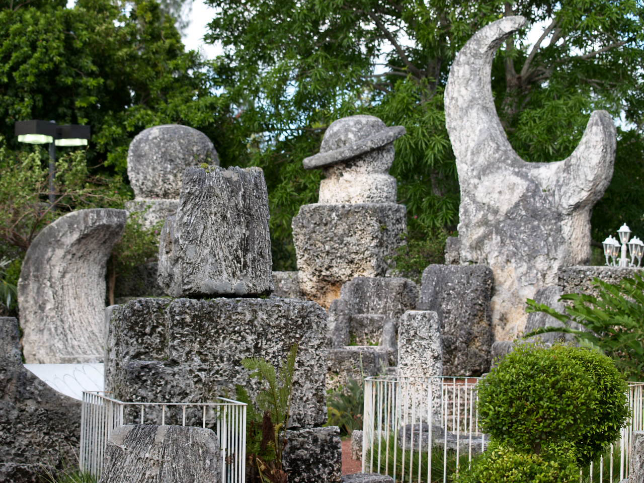
Highlights include Coral Castle.
August is the warmest month, with average highs of 90°F; January lows average 55°F.
Weather in Homestead Base
Forecast from the National Weather Service. Full forecast
About Homestead Base
Homestead Base is a census-designated place (CDP) in Miami-Dade County, Florida, United States. The CDP comprises the extent of Homestead Air Reserve Base plus some surrounding land. It is part of the Miami metropolitan area of South Florida. The population was 999 at the 2020 census.
From the Wikipedia article Homestead Base, Florida (this version), under CC BY-SA 4.0.
Museums and landmarks1
Coral Castle
Monument and historic site · National Register of Historic Places · 3.5 mi
Visitor attraction in Leisure City, Florida, USA
Parks, trails and playgrounds1

Restaurants and cafes3

Taco Bell
Fast food · Tex-Mex · 1.5 mi
13610 Southwest 288th Street, Homestead
Mo-We 08:00-03:00; Th 08:00-04:00; Fr-Sa 08:00-05:00; Su 08:00-03:00
Shopping2

Gas and EV charging4
Schools, colleges and libraries42
Air Base K-8 Center For International Education
School · 1.9 mi
12829 Sw 272Nd St, Homestead
Arthur And Polly Mays Conservatory of The Arts
School · 5.3 mi
11700 Sw 216Th St, Goulds
Chapman Partnership Early Childhood Center South
School · 1.2 mi
1501 Ne 2Nd Ave, Miami
Coral Reef Montessori Academy Charter School
School · 5.6 mi
10853 Sw 216Th St, Cutler Bay
Dr. William A. Chapman Elementary School
School · 2.5 mi
27190 Sw 140Th Ave, Homestead
Everglades Preparatory Academy High School
School · 3.6 mi
2251 E Mowry Dr, Homestead
Gateway Environmental K-8 Learning Center
School · 4.3 mi
955 Se 18Th Ave, Homestead
Map of Homestead Base
53 places. The map loads OpenStreetMap tiles when you open it.
Climate by month
Monthly table
| Month | High | Low | Rain | Snow |
|---|---|---|---|---|
| Jan | 76°F | 55°F | 2.0 in | 0.0 in |
| Feb | 78°F | 57°F | 2.3 in | 0.0 in |
| Mar | 80°F | 59°F | 2.3 in | 0.0 in |
| Apr | 84°F | 63°F | 3.4 in | 0.0 in |
| May | 86°F | 68°F | 5.6 in | 0.0 in |
| Jun | 89°F | 72°F | 10.1 in | 0.0 in |
| Jul | 90°F | 72°F | 7.8 in | 0.0 in |
| Aug | 90°F | 73°F | 10.2 in | 0.0 in |
| Sep | 89°F | 72°F | 10.1 in | 0.0 in |
| Oct | 86°F | 69°F | 7.6 in | 0.0 in |
| Nov | 81°F | 63°F | 2.9 in | 0.0 in |
| Dec | 78°F | 58°F | 2.3 in | 0.0 in |
U.S. Climate Normals 1991-2020 for Perrine 4W Hcn (7 mi away), NOAA NCEI.
People and cost of living
American Community Survey 5-year estimates, 2020-2024, U.S. Census Bureau. Estimates have margins of error, larger for small towns.
Disaster history
Miami-Dade County has had 27 federal disaster declarations since 2000, most often for hurricanes.
- 2024-10-11: Hurricane Milton (Hurricane)
- 2024-10-07: Hurricane Milton (Hurricane)
- 2022-12-13: Hurricane Nicole (Hurricane)
- 2022-11-08: Tropical Storm Nicole (Tropical Storm)
- 2022-09-29: Hurricane Ian (Hurricane)
- 2022-09-24: Tropical Storm Ian (Hurricane)
OpenFEMA disaster declarations summaries.
Getting there and nearby towns
Homestead Air Reserve Base (HST) is the nearest airport with scheduled flights listed in OpenStreetMap, 0 miles away.
- Naranja 3 mi northwest, about 4 min by car
- Leisure City 3 mi west, about 5 min by car
- Princeton 4 mi north, about 6 min by car
- Homestead 4 mi southwest, about 6 min by car
- Goulds 5 mi north, about 8 min by car
- Florida City 6 mi southwest, about 9 min by car
- South Miami Heights 7 mi north, about 11 min by car
- Cutler Bay 7 mi northeast, about 11 min by car
- West Perrine 8 mi north, about 13 min by car
- Richmond West 9 mi north, about 14 min by car
Drive times are estimates from straight-line distance, not routes.
Local news
Headlines from INDB, the NEMICO news database.
Reviews, tips and questions
Loading what members have shared...
Sources and licences
- NCES EDGE (Public domain): public schools
- NOAA NCEI U.S. Climate Normals 1991-2020 (Public domain): climate by month
- OpenFEMA (Public domain): disaster declarations
- OpenStreetMap contributors (ODbL 1.0): places, airports, map data
- U.S. Census Bureau (Public domain): population, income, housing, education, commute
- Wikidata (CC0 1.0): elevation, founding date, time zone, website, landmarks and historic places
- Wikimedia Commons (see each image): photos
- Wikipedia (CC BY-SA 4.0): overview and history text
Photo credits
- Coral Castle 1, Christina Rutz, CC BY 2.0
- Hurricane Hunters Mission Into Tropical Storm Elsa, Hurricane Hunters, Public domain
- 190903-H-PW680-004, CBP Photography, Public domain
- 190903-H-PW680-003, CBP Photography, Public domain
- 190903-H-PW680-005, CBP Photography, Public domain
- 190901-H-PW680-003, CBP Photography, Public domain
- 190901-H-PW680-002, CBP Photography, Public domain
- HOMESTEAD AIRBASE - panoramio, Ivan Curra, CC BY-SA 3.0
- BASE AEREA DE HOMESTEAD - panoramio, Ivan Curra, CC BY-SA 3.0
- 190903-H-PW680-001, CBP Photography, Public domain
- ISS065-E-3479 - View of Earth, Earth Science and Remote Sensing Unit , Lyndon B. Johnson Space Center, Public domain
- ISS065-E-4081 - View of Earth, Earth Science and Remote Sensing Unit , Lyndon B. Johnson Space Center, Public domain
- ISS065-E-88307 - View of Earth, Earth Science and Remote Sensing Unit , Lyndon B. Johnson Space Center, Public domain
- ISS065-E-88308 - View of Earth, Earth Science and Remote Sensing Unit , Lyndon B. Johnson Space Center, Public domain
- ISS065-E-4080 - View of Earth, Earth Science and Remote Sensing Unit , Lyndon B. Johnson Space Center, Public domain
- ISS027-E-34668 - View of Earth, Earth Science and Remote Sensing Unit , Lyndon B. Johnson Space Center, Public domain
- ISS065-E-3478 - View of Earth, Earth Science and Remote Sensing Unit , Lyndon B. Johnson Space Center, Public domain
- ISS027-E-33296 - View of Earth, Earth Science and Remote Sensing Unit , Lyndon B. Johnson Space Center, Public domain
- ISS065-E-4079 - View of Earth, Earth Science and Remote Sensing Unit , Lyndon B. Johnson Space Center, Public domain
- ISS065-E-3782 - View of Earth, Earth Science and Remote Sensing Unit , Lyndon B. Johnson Space Center, Public domain
- ISS027-E-33297 - View of Earth, Earth Science and Remote Sensing Unit , Lyndon B. Johnson Space Center, Public domain
- ISS065-E-3480 - View of Earth, Earth Science and Remote Sensing Unit , Lyndon B. Johnson Space Center, Public domain
- ISS048-E-17135 - View of Earth, Earth Science and Remote Sensing Unit , Lyndon B. Johnson Space Center, Public domain
- ISS030-E-11873 - View of Earth, Earth Science and Remote Sensing Unit , Lyndon B. Johnson Space Center, Public domain
- ISS065-E-4082 - View of Earth, Earth Science and Remote Sensing Unit , Lyndon B. Johnson Space Center, Public domain
- ISS065-E-4083 - View of Earth, Earth Science and Remote Sensing Unit , Lyndon B. Johnson Space Center, Public domain
- ISS038-E-56763 - View of Earth, Earth Science and Remote Sensing Unit , Lyndon B. Johnson Space Center, Public domain
- ISS065-E-4078 - View of Earth, Earth Science and Remote Sensing Unit , Lyndon B. Johnson Space Center, Public domain
- Stephanie Berman with Clinton Tile, OSTFlorida, CC BY-SA 3.0
- Carrfour Verde Gardens GB, OSTFlorida, CC BY-SA 3.0
- Edoardo Leone cycling at the 2025 Draft-Legal National Championships, Johnson524, CC0
- 2025 Draft-Legal National Championships finish, Johnson524, CC0
- Humberto Jenner finish at the 2025 Draft-Legal National Championships, Johnson524, CC0
- Mark Romano finish at the 2025 Draft-Legal National Championships, Johnson524, CC0
- Edoardo Leone finish at the 2025 Draft-Legal National Championships, Johnson524, CC0


Page built October 30, 2026. Spotted a mistake? Tell us or suggest a place.